Skip to content
Menu
Backcountry Fever
  • Projects
    • Adirondack 46ers
    • Colorado 14ers
    • Seven Summits
      • Climb Aconcagua via the 360° Traverse | Full Guide
    • Wasatch 7
    • Wasatch 11ers
  • Highpoints
  • Experience
  • My Never-Ending List
  • Contact
Backcountry Fever
← ‘Tis the season for Mt. Hood
Solo Summit of Shasta →

Sightseeing on South Sister

Posted on June 12, 2023August 20, 2024 by Backcountry Fever

Time to head down into Central Oregon for some sightseeing on South Sister.  This was the second stop in our tour of the Pacific Northwest.  I had never been to this area before but was interested in seeing what there was to see through a first-hand experience.  Spending the weekend here would also serve as a good “in-between” for what my specific plans were: Mt. Hood on one side, Mt. Shasta on the other.

I scoped out the starting point for this hike the day before, already aware it would involve a lot of snow right from the start.  In fact, you couldn’t even get to the official trailhead.  Everyone was parking alongside the road across from Devil’s Lake.
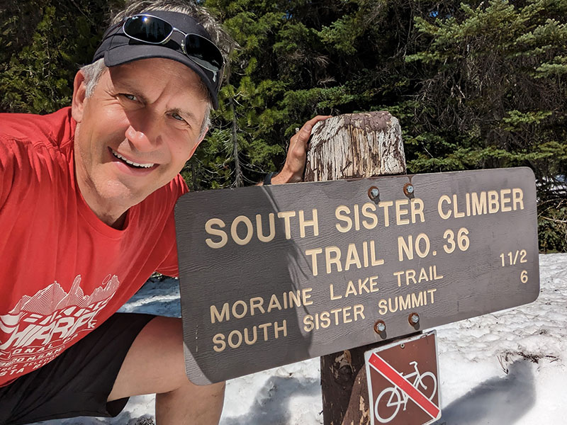
Early Morning Start

No need for an alpine start since the anticipation for “mountaineering” today wouldn’t be much.  5am at the trailhead was good enough!  Snowshoes, ice axe and crampons were loaded in our packs, but we weren’t sure we’d even need them.

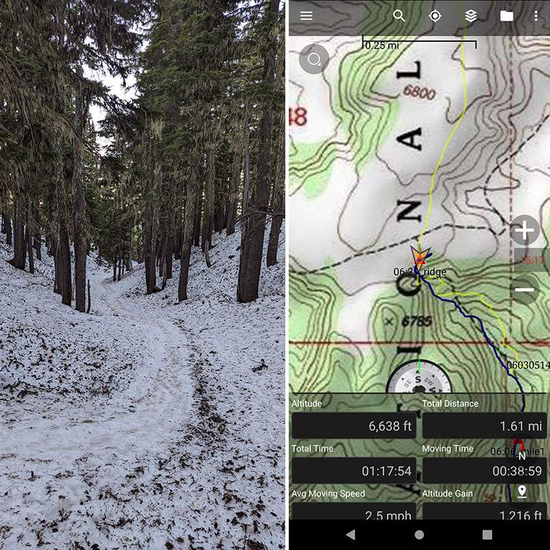
The first mile and a half climbs up through a canyon between Kaleentan Butte and Devil’s Hill.  It was very easy to follow the dirty track through the pines.

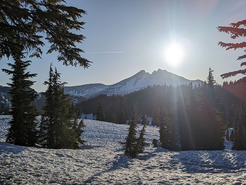
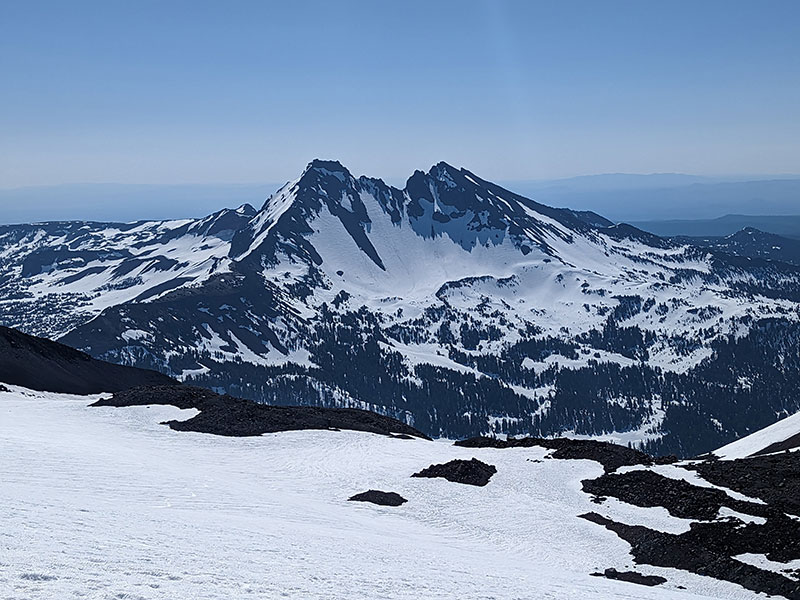
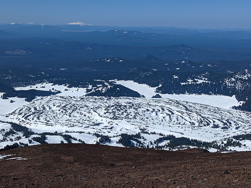
When you reach the plateau at the top of this canyon, you get your first glimpse of Broken Top.

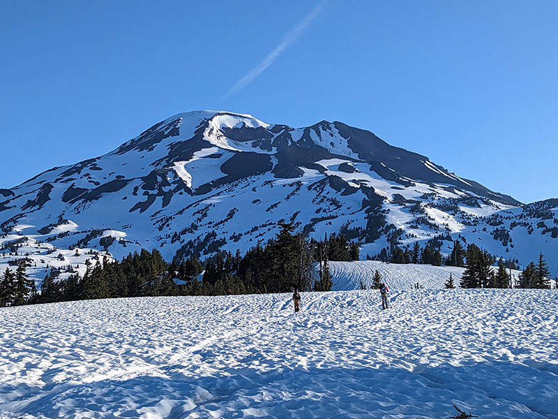
A little further on to the plateau and your destination comes into clear view… although we had no idea how the route would get us there on this first-time approach.

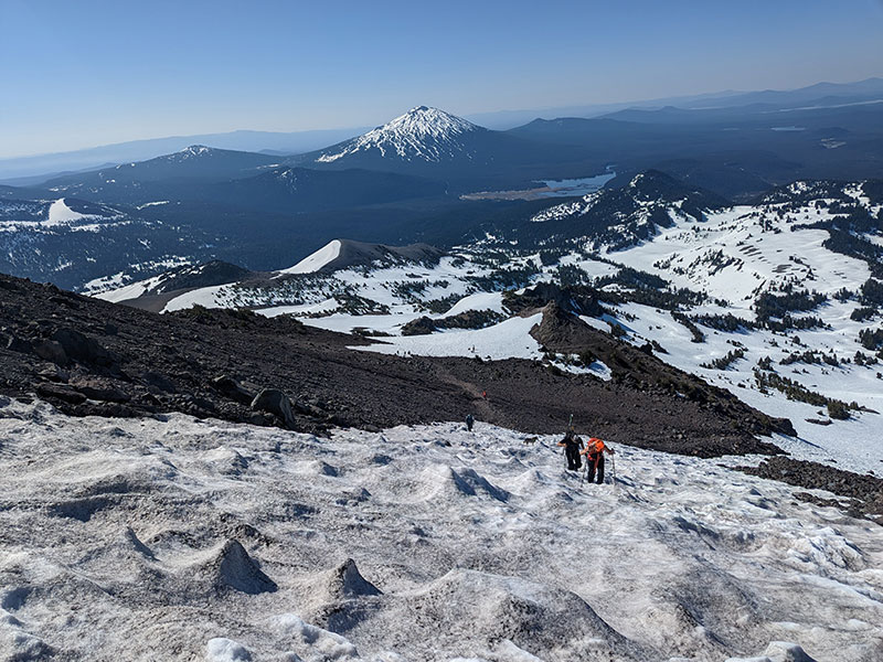
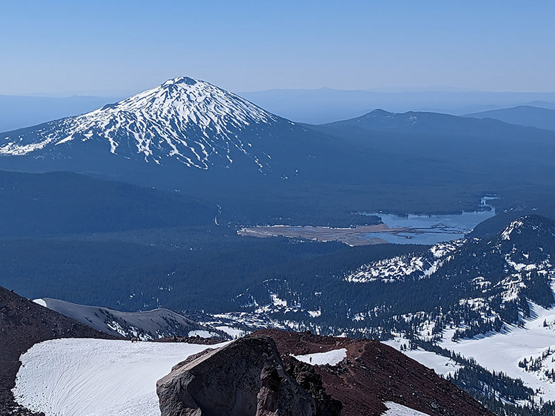
The views across the plateau in the opposite direction were equally amazing.  There you can see Mt. Bachelor off in the distance.

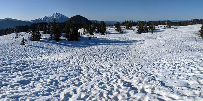
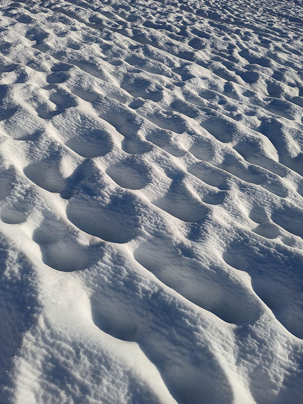
All the snow runnels and sun cups along this stretch was something spectacular to see too!

So was the view of Rock Mesa… a field of lava rock that looked more like a giant cow pie!

Keep Climbing

The climb steadily continues up…

…to a saddle that overlooks Lewis Tarn and the Lewis Glacier.  We could have stayed on the snow and followed along the top of this glacier.

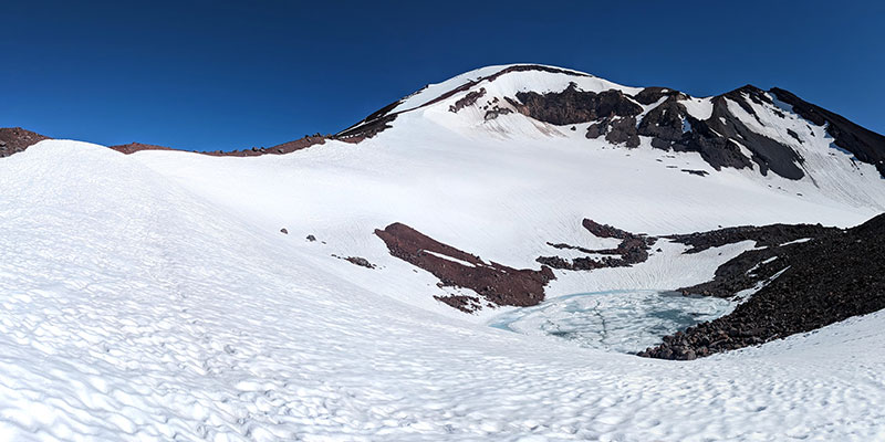
However, we chose the rocky ridge path instead since that just seemed easier.

The views just keep getting better the higher you go.

Mt. Bachelor again with Sparks Lake to the west.

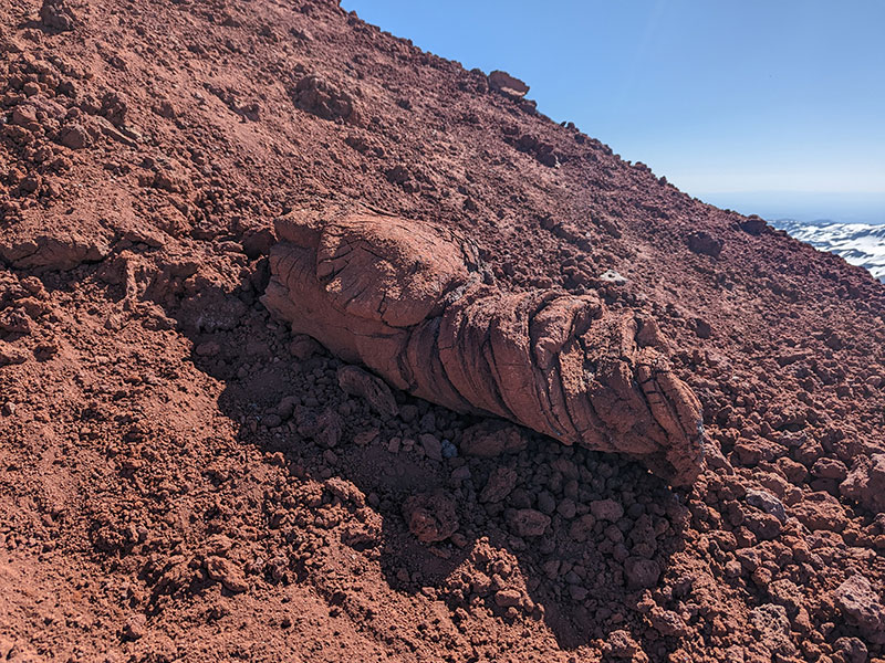
Cow pie or a bowl of pudding?

If I were to guess, I’d say this is a petrified dinosaur turd!

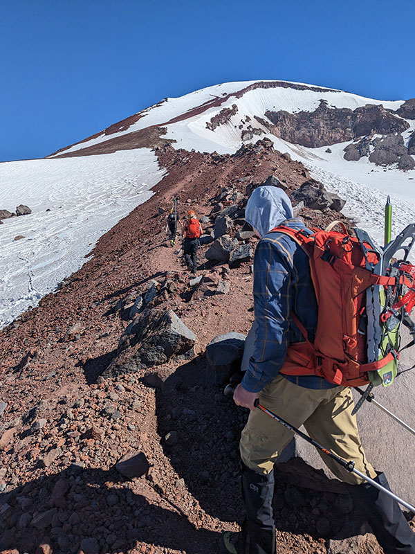
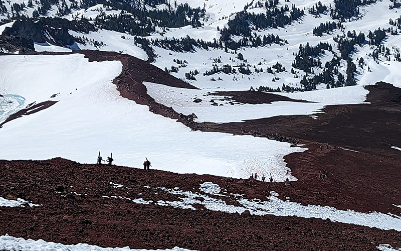
Looking back at the barren ridge we just ascended, there was a slue of skiers coming up behind us.

Summit Push

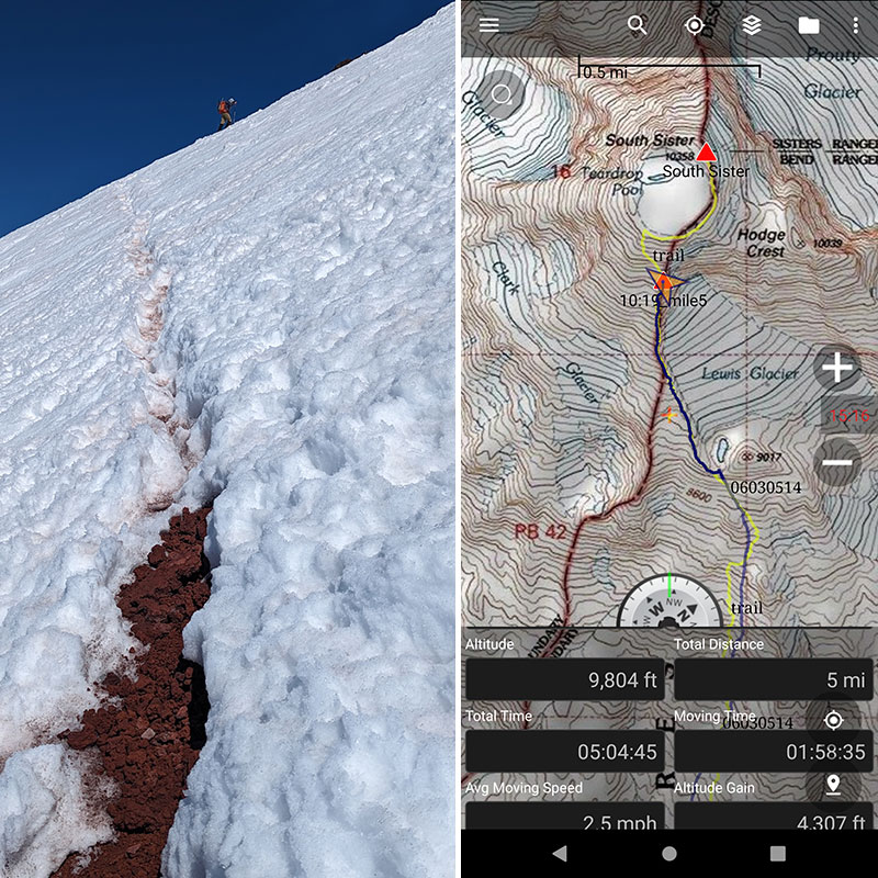
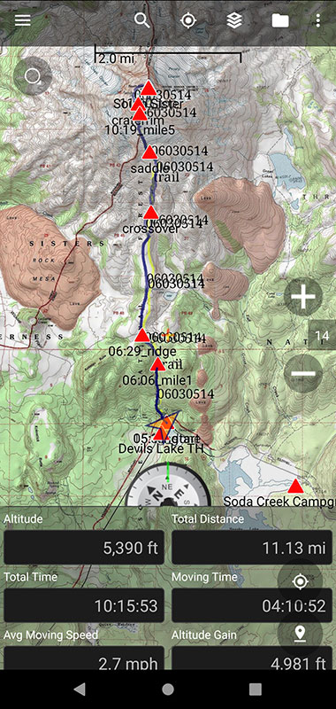
The summer trail hangs a left at the 5-mile mark.  We had climbed 4,300 feet of elevation in 5 hours by this point and were back on snow for the rest of the way.

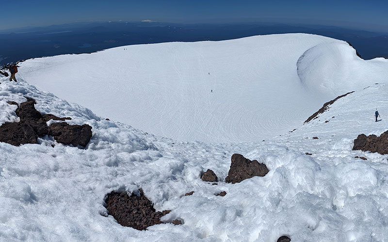
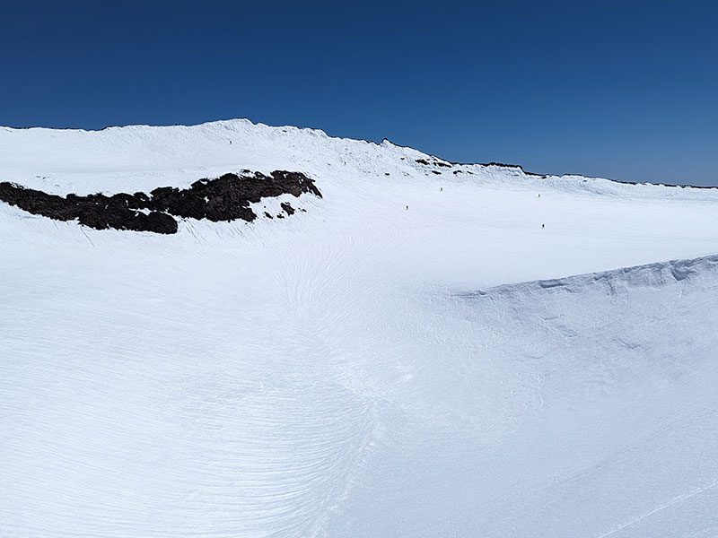
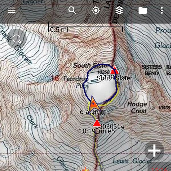
A few minutes later and we were on the crater rim!

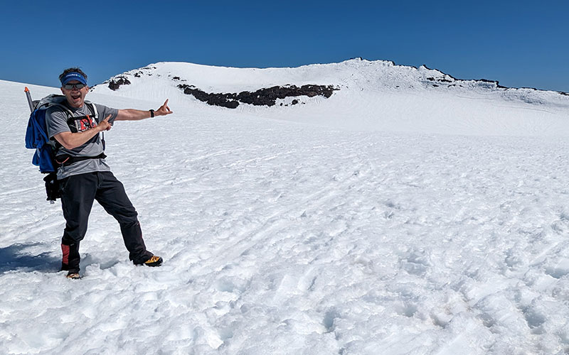
Some people walked across the crater to the summit, but I wanted to traverse along the rim.  At the time, I didn’t know I would ultimately walk the entire perimeter.

Jim and I made it to the top in under 6 hours.  We were 5.5 miles in and 4,800 feet up from from where we had started today.

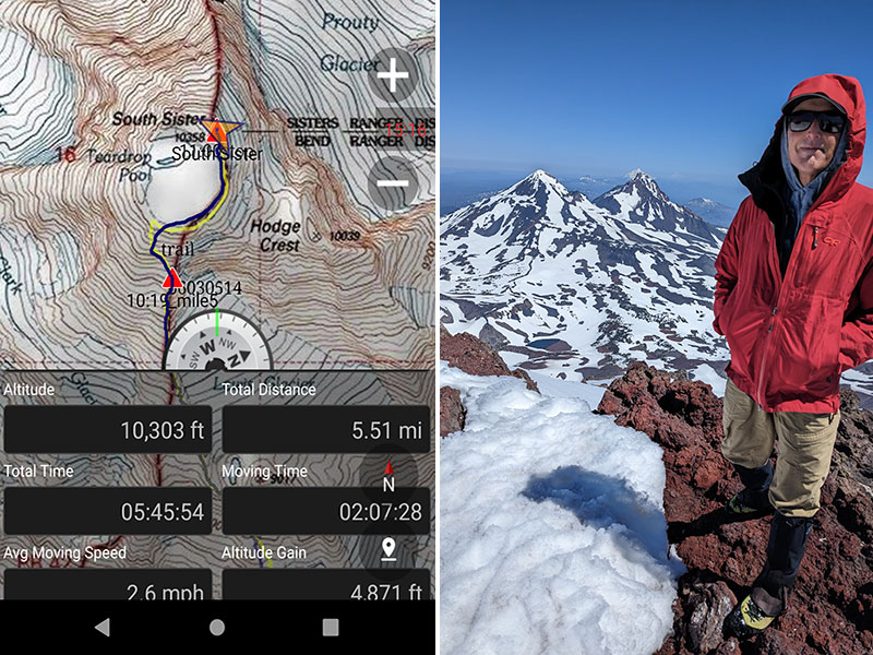
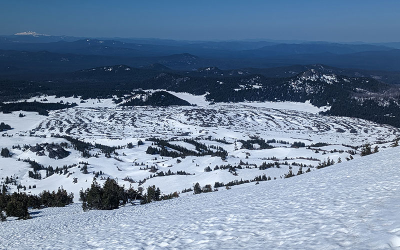
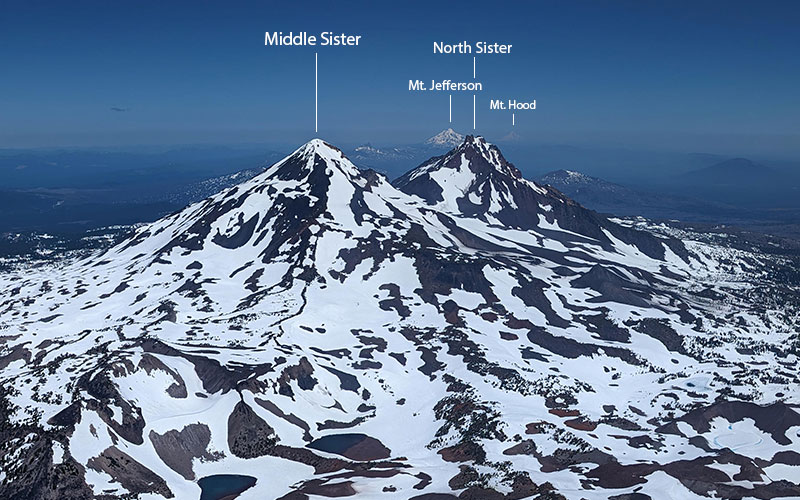
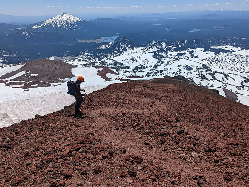
The views to the north are stunning.  You can see all the way to Mt. Hood, the peak we just stood on three days earlier.

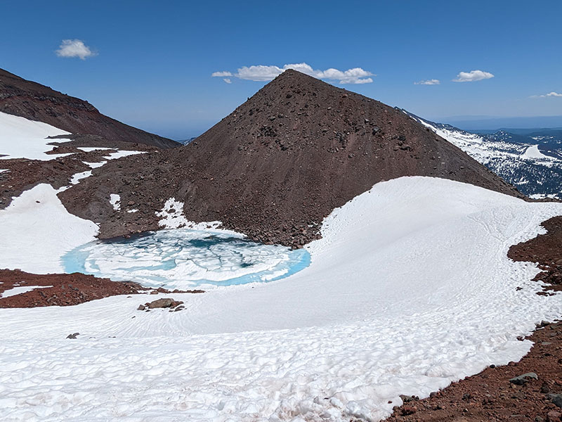
From the summit of South Sister, I started wandering along the rim to the west.  No one else wanted to follow, but I found good snow the whole way around.  This shot was taken from above Teardrop Pool.

If you’ve done the standard route to Mt. Whitney, you know about the 99 switchbacks.  This section reminded me of that, except there were a thousand mini ones here!

Back at the saddle above Lewis Tarn.

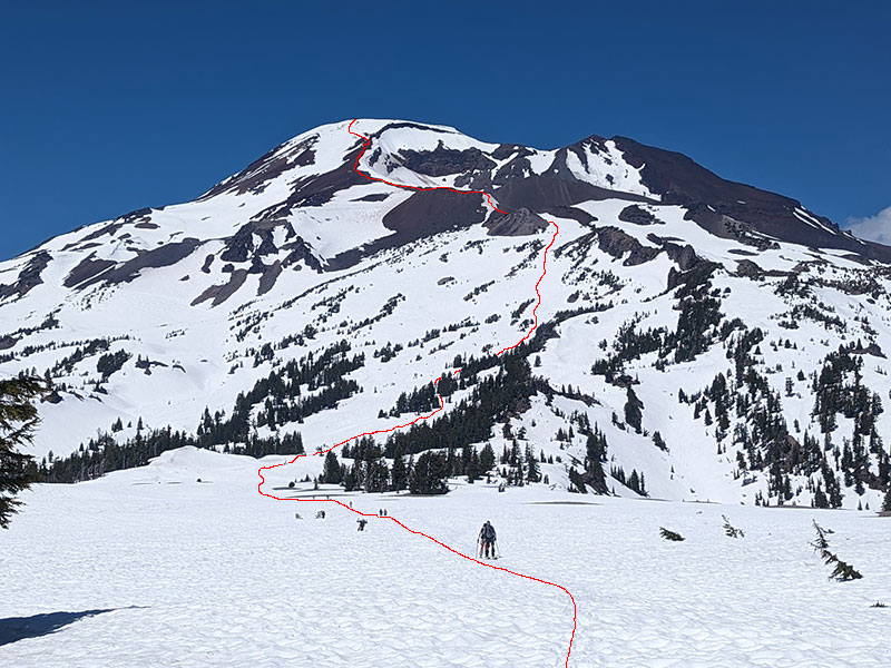
Except for a few good glissade runs down mid-mountain, the rest of the descent was uneventful.  The lower part just felt like another long slog through soft slush.   However, looking back at the mountain now, I saw exactly how the route goes up the side of this volcano.

Final stats for the day: 11 miles and 4,981 feel in just over 10 hours.

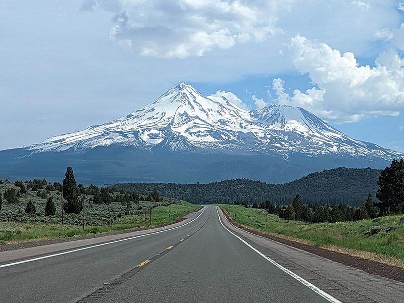
Next stop: Mt. Shasta

← ‘Tis the season for Mt. Hood
Solo Summit of Shasta →

Leave a Reply Cancel reply

Your email address will not be published. Required fields are marked *

On this day last year—February 18—my team and I reached the summit of Aconcagua, the tallest peak in Argentina and the highest mountain in the Western Hemisphere at 22,837 feet.

I’ve enjoyed looking back on that expedition by rereading my day-by-day trip report from our climb.

👉 Link in bio: an 18-part guide covering the entire climb, plus pre-trip planning tips and post-expedition things to see and do around Mendoza.

Whether this is your first high-altitude objective or you’re adding Aconcagua to your mountaineering résumé, the guide will help you see why I chose the 360° Traverse, how to plan for your expedition, and what to expect each day on the mountain.

#aconcagua #aconcagua360 #aconcaguaexpedition #highaltitudemountaineering #mountaineering

30 3
Open post by backcountryfever with ID 18055701743428917
On this day last year—February 18—my team and I reached the summit of Aconcagua, the tallest peak in Argentina and the highest mountain in the Western Hemisphere at 22,837 feet.

I’ve enjoyed looking back on that expedition by rereading my day-by-day trip report from our climb.

👉 Link in bio: an 18-part guide covering the entire climb, plus pre-trip planning tips and post-expedition things to see and do around Mendoza.

Whether this is your first high-altitude objective or you’re adding Aconcagua to your mountaineering résumé, the guide will help you see why I chose the 360° Traverse, how to plan for your expedition, and what to expect each day on the mountain.

#aconcagua #aconcagua360 #aconcaguaexpedition #highaltitudemountaineering #mountaineering

Winter is my favorite season, and cold weather camping is one of my favorite winter activities.

#coldweathercamping #wintercamping #tenting #lovewinter #lovecamping

18 0
Open post by backcountryfever with ID 18088708565160118
Winter is my favorite season, and cold weather camping is one of my favorite winter activities.

#coldweathercamping #wintercamping #tenting #lovewinter #lovecamping

Scoping out snow levels for my annual winter campout this weekend. Yep, there`s enough to still make it fun!

#wintercamping #coldweathercamping #winterhike #sunset #weekendwarrior

18 2
Open post by backcountryfever with ID 18093303244798082
Scoping out snow levels for my annual winter campout this weekend.  Yep, there's enough to still make it fun!

#wintercamping #coldweathercamping #winterhike #sunset #weekendwarrior

Speaking of my multi-millioner friends (see link in the bio), I got to hike with them last weekend.

I had my mind set on doing a Grandeur Peak Yo-Yo for my first hike of the year. Thankfully, @gwhatco and @andeethatch were OK with slowing down for the day.

Not sure what I was thinking though, my thighs were so sore for the next two days. Hockey sure doesn`t use those same muscles like I thought it did.

Recovery definitely called for a few infrared sauna sessions afterwards!

#grandeurpeak #yoyo #doublesummit #legday #goatworthy

35 0
Open post by backcountryfever with ID 18093050872988089
Speaking of my multi-millioner friends (see link in the bio), I got to hike with them last weekend.

I had my mind set on doing a Grandeur Peak Yo-Yo for my first hike of the year. Thankfully, @gwhatco and @andeethatch were OK with slowing down for the day.

Not sure what I was thinking though, my thighs were so sore for the next two days. Hockey sure doesn't use those same muscles like I thought it did. 

Recovery definitely called for a few infrared sauna sessions afterwards!

#grandeurpeak #yoyo #doublesummit #legday #goatworthy

Yeah, you read that right — 5,000,000 vertical feet. That’s a million feet of vert every year for five straight years. Who does that? Well… these two average hikers from Utah have been stacking numbers like this since 2021 — quietly, but well beyond “average”.

The numbers speak for themselves. Get a summary and breakdown by month from the link in the bio ☝️

Think about that: we’re talking about an average of 50 miles and 20,000 feet of gain every single week.

It’s hard to wrap my head around that level of commitment. What they’re doing every month is roughly what I log in a year, all while holding down full-time jobs. That’s one serious fitness program.

In talking with Andee about what comes next, they took the week off after Christmas, then jumped right into the new year on a local favorite—Mount Olympus—with plans to log another million in 2026.

#goatworthy #biggoals #millionverticalfeet #hikerlife #hikemoreworryless

23 5
Open post by backcountryfever with ID 17966367422867268
Yeah, you read that right — 5,000,000 vertical feet.  That’s a million feet of vert every year for five straight years.  Who does that?  Well… these two average hikers from Utah have been stacking numbers like this since 2021 — quietly, but well beyond “average”. 

The numbers speak for themselves.  Get a summary and breakdown by month from the link in the bio ☝️

Think about that: we’re talking about an average of 50 miles and 20,000 feet of gain every single week.

It’s hard to wrap my head around that level of commitment.  What they’re doing every month is roughly what I log in a year, all while holding down full-time jobs.  That’s one serious fitness program.

In talking with Andee about what comes next, they took the week off after Christmas, then jumped right into the new year on a local favorite—Mount Olympus—with plans to log another million in 2026.

#goatworthy #biggoals #millionverticalfeet #hikerlife #hikemoreworryless

With the encouragement from my youngest daughter, I bought a small fleet of kid carriers to get these youngsters started early! We`ve enjoyed a few days out in this unseasonably warm November, but still need to get them ALL out together. Fun times ahead for sure!!

#osprey #ospreypacks #hikingwithkids #familyfun #getemstartedearly

21 1
Open post by backcountryfever with ID 18064990223634047
With the encouragement from my youngest daughter, I bought a small fleet of kid carriers to get these youngsters started early!  We've enjoyed a few days out in this unseasonably warm November, but still need to get them ALL out together.  Fun times ahead for sure!!

#osprey #ospreypacks #hikingwithkids #familyfun #getemstartedearly

My first time up Mt. Ogden unintentionally turned into a full-on-loop-de-doo: up Beus, down Malan`s.

Beus Canyon was pretty boring above treeline, so I decided not to head back the way I came. After tagging the summit, I figured Malan`s would be way more interesting — and it sure was!

Malan`s Basin is surprisingly sketch up high, through a steep and narrow gully, then hard to follow in the middle where an already faint trail disappeared under leaves. I lost the trail a few times and had to backtrack a bit to find my way.

Finally, the Bonneville Shoreline Trail came in clutch once again, making this a nice long loop-de-doo.

Mt. Ogden Loop-de-doo mileage breakdown 👇
- Beus Canyon trailhead to summit, 6 miles
- Mt. Ogden to Malan`s Peak, 3 miles
- Malan`s Peak to Bonneville Shoreline Trail, 3 miles
- BST across and back to Beus trailhead, 3 miles

For a total of 15 miles and 5,300 feet of elevation gain.

#mtogden #mountogden #ogdenpeak #beuscanyon #beuscanyontrail #malansbasin #malanspeak #bonnevilleshorelinetrail #bonnevilleshoreline #bst #loophike #loopdedoo #wasatchfront #hikeogden #fallhike #fallhikingfallhiking

24 0
Open post by backcountryfever with ID 17906240730272550
My first time up Mt. Ogden unintentionally turned into a full-on-loop-de-doo: up Beus, down Malan's. 

Beus Canyon was pretty boring above treeline, so I decided not to head back the way I came. After tagging the summit, I figured Malan's would be way more interesting — and it sure was!

Malan's Basin is surprisingly sketch up high, through a steep and narrow gully, then hard to follow in the middle where an already faint trail disappeared under leaves.  I lost the trail a few times and had to backtrack a bit to find my way.

Finally, the Bonneville Shoreline Trail came in clutch once again, making this a nice long loop-de-doo.

Mt. Ogden Loop-de-doo mileage breakdown 👇
- Beus Canyon trailhead to summit, 6 miles
- Mt. Ogden to Malan's Peak, 3 miles
- Malan's Peak to Bonneville Shoreline Trail, 3 miles
- BST across and back to Beus trailhead, 3 miles

For a total of 15 miles and 5,300 feet of elevation gain.

#mtogden #mountogden #ogdenpeak #beuscanyon #beuscanyontrail #malansbasin #malanspeak #bonnevilleshorelinetrail #bonnevilleshoreline #bst #loophike #loopdedoo #wasatchfront #hikeogden #fallhike #fallhikingfallhiking

Awesome views from the top of Y Mountain. Looking north into Rock Canyon, where I started, and across towards the old Squaw Peak, Cascade Mountain, and Mount Timpanogos further off in the distance.

Pretty fun loop hike 👇

- Up 1.8 miles from the Rock Canyon trailhead
- Up 1.8 miles on First Right Fork to Slide Canyon
- Down Slide Canyon Trail .5 miles to Y Mountain Trail
- Up 1 mile to Y Mountain West Peak
- Down .25 and over .25 miles to Y Mountain East Peak
- Down 1 mile back to Slide Canyon Trail
- Down 1.5 miles to Y Trail (top of the BYU Y)
- Down 1 mile to the Y Trail trailhead
- Across 1.75 miles on the Bonneville Shoreline Trail

For a total of 10.75 miles with 4,137 feet of elevation gain.

#ymountain #rockcanyon #rockcanyontrail #firstrightfork #slidecanyon #ytrail #ytrailhead #bst #bonnevilleshorelinetrail #bonnevilleshoreline #connector #loophike #wasatchfront #hikethewasatch #wasatchmountains #wasatch #hike #hikemore

33 1
Open post by backcountryfever with ID 17900152413305912
Awesome views from the top of Y Mountain.  Looking north into Rock Canyon, where I started, and across towards the old Squaw Peak, Cascade Mountain, and Mount Timpanogos further off in the distance. 

Pretty fun loop hike 👇

- Up 1.8 miles from the Rock Canyon trailhead
- Up 1.8 miles on First Right Fork to Slide Canyon
- Down Slide Canyon Trail .5 miles to Y Mountain Trail
- Up 1 mile to Y Mountain West Peak 
- Down .25 and over .25 miles to Y Mountain East Peak
- Down 1 mile back to Slide Canyon Trail
- Down 1.5 miles to Y Trail (top of the BYU Y)
- Down 1 mile to the Y Trail trailhead
- Across 1.75 miles on the Bonneville Shoreline Trail

For a total of 10.75 miles with 4,137 feet of elevation gain.

#ymountain #rockcanyon #rockcanyontrail #firstrightfork #slidecanyon #ytrail #ytrailhead #bst #bonnevilleshorelinetrail #bonnevilleshoreline #connector #loophike #wasatchfront #hikethewasatch #wasatchmountains #wasatch #hike #hikemore

As the seasons change, each quiet mile through these trees feels like an invitation to let go of what was and move toward all that`s yet to come...

#seasonschange #lettinggo #movingon #pressingforward #lookingahead #newbeginnings #natureishealing #healingenergy #goodvibes #autumnvibes #autumnmountains #hiking #hikerlife #mountainlife #mountains

27 0
Open post by backcountryfever with ID 17902202193279047
As the seasons change, each quiet mile through these trees feels like an invitation to let go of what was and move toward all that's yet to come...

#seasonschange #lettinggo #movingon #pressingforward #lookingahead #newbeginnings #natureishealing #healingenergy #goodvibes #autumnvibes #autumnmountains #hiking #hikerlife #mountainlife #mountains
Follow on Instagram

Recent Posts

  • 5 Million Vertical Feet Gained Over 5 Years
  • 2025 Year in Review
  • From Waikīkī to Makapuʻu: A Casual Tour of Honolulu Stops
  • High Hopes for Hiking Hawaii — Hobbled by Hockey
  • It’s Mountaineering Season in Utah!

Recent Comments

  • Michelle Tirhi on Solo Summit of Shasta
  • Matt on How I Would Do Kings Peak in 1 Day
  • Rich Meziere on Bummed Out By A Broken BOA Binding
  • Backcountry Fever on Bummed Out By A Broken BOA Binding
  • Alex Cook on Bummed Out By A Broken BOA Binding

RECOMMENDED READING

Categories

  • 14ers
  • Adventure Plans
  • Avalanche Awareness
  • Backpacking
  • Epic Treks
  • Grand Canyon
  • Health & Wellness
  • International Expeditions
  • Mountaineering
  • Pacific Northwest
  • Peak Bagging
  • Product Feedback
  • Reading References
  • Road Trip
  • Scrambling
  • Season Summary
  • Seven Summits
  • Six-Pack Challenge
  • Snowshoeing
  • Social Media
  • State Highpoints
  • Technology
  • Uinta Mountains
  • Uncategorized
  • Uphill Training
  • Wasatch Front
  • Zion
©2026 Backcountry Fever