DAY 3 – Acclimating at 14K
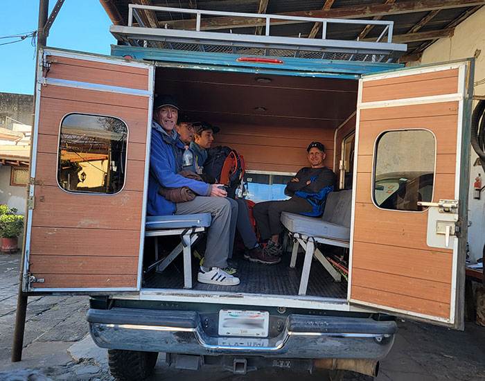
After another fine breakfast from Servimont, we loaded up our gear and got ready for the drive up to Piedra Grande Hut. The road to this basecamp is about 16 miles up from Tlachichuca and took over 2 hours. It’s a rough and rutted route… a typical 4WD road if you’re familiar with logging roads of the Pacific Northwest (for example). Not the kind of road you’d expect to access a “national” park that collects a fee to enter. However, we didn’t need to worry about any of it. Servimont took care of all the transportation while we just sat back and enjoyed the [bumpy] ride!
Our focus was on snapping pictures from the back of our covered carrier.
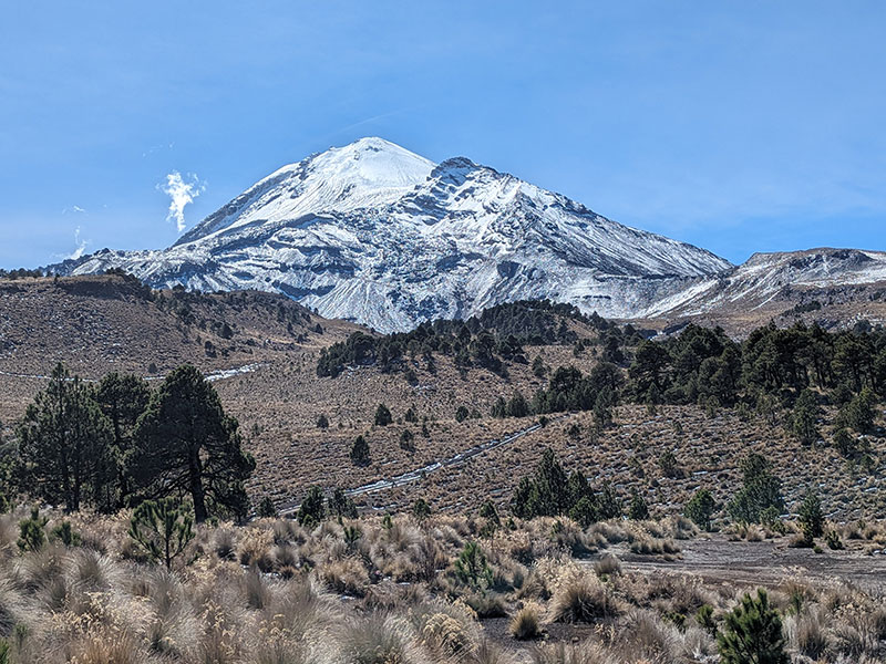
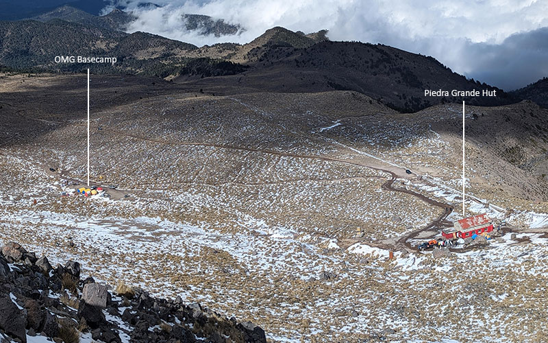
Built in the 1980’s, Refugio Piedra Grande sits at about 14,000′. Thinking about all 14ers in Colorado, it was crazy to see so much more mountain above us.
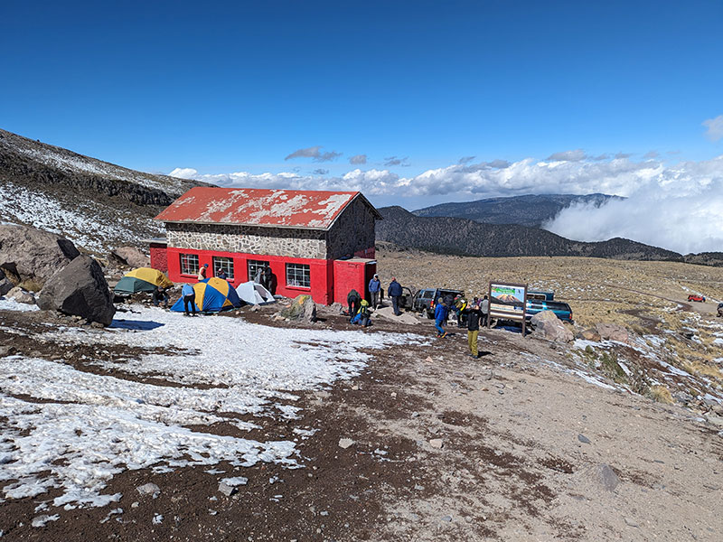
Refugio Piedra Grande
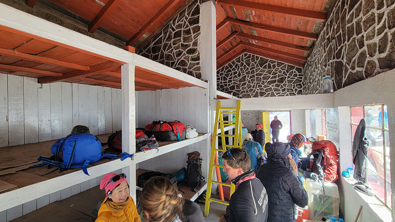
The hut is convenient, but sleeps way too many and is much too noisy. People are constantly in and out all day and night. You really can’t blame them though. Some are getting ready to climb, others are returning. Everyone trying to respect each other’s plans, but realistically just focused on their own.
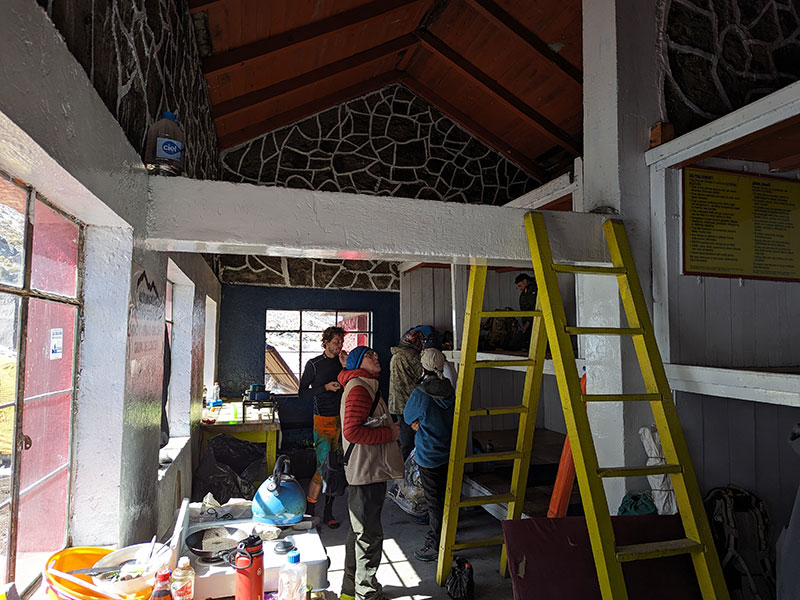
I chose to sleep outside in a tent. Turned out to be one of my best decisions. I really didn’t want to deal with the snoring, farting and crawling over each other all night to go take a leak. A friend from home also told me the hut was dirty and infested with mice. We didn’t find it in either condition. In fact, we were surprised to see not a single mouse despite all the food and crumbs from eating inside.
Let’s go back to the fact that fees are collected to visit this “national” park. What are those funds being spent on if the roads to this facility are terrible and so is their restroom situation.
La Chiquita
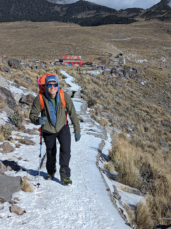
Acclimatization continued with a short hike to a nearby bump called La Chiquita.
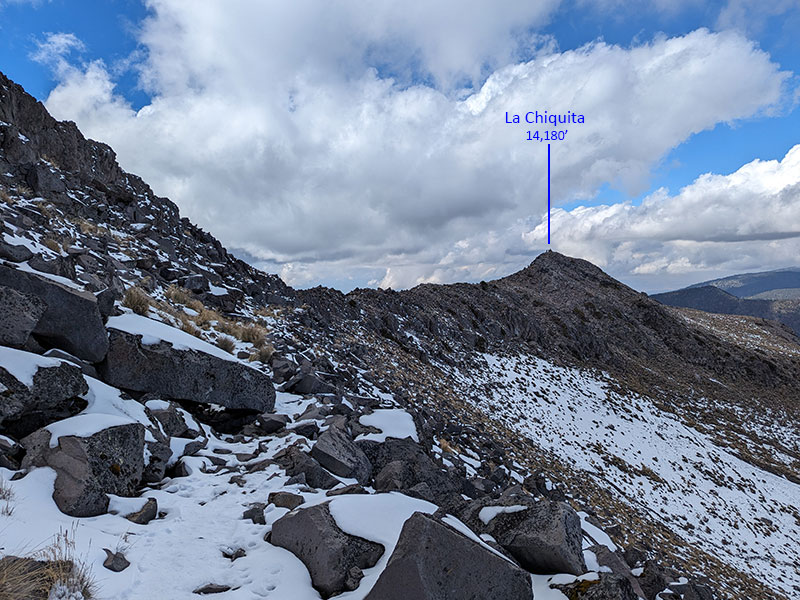
This bump is only two hundred-ish feet above basecamp and less than a mile along the Aqueduct Trail.
San Miguel Zoapan, Tlachichuca and La Malinche (on a clear day) can be seen to the West.
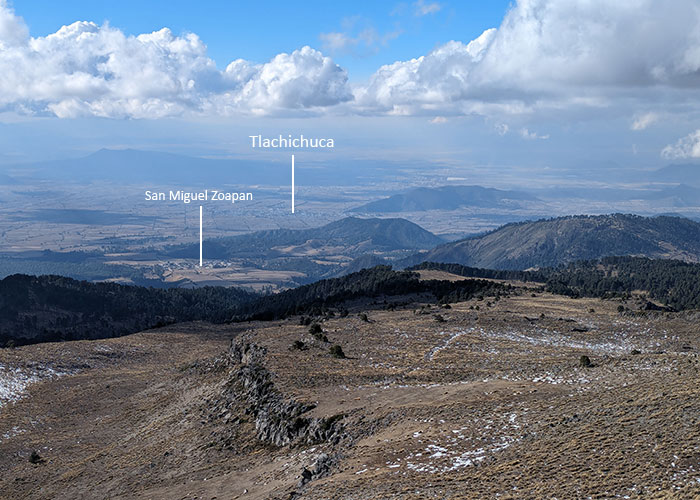
Not much of a view beyond OMG’s basecamp and Piedra Grande to the East.
DAY 4 – Acclimating to 16K
People who attempted to summit on Dec 30th didn’t make it. The wind was whipping around so hard, everyone we spoke with had pulled the plug under such harsh conditions. Many called it brutal.
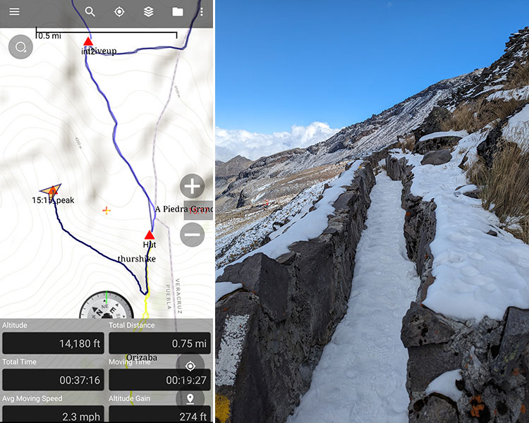
However, the rising sun has a tendency to warm things up and brighten the day. So Eric and I decided to work on our acclimatization and at least check out the Labyrinth.
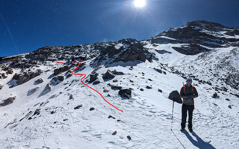
The first part of this main route (Ruta Norte), before the Labyrinth, climbs up through a wide gully.
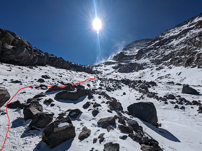
Stay to the left as you continue up the gulley, following along just below this cliff band on your left.
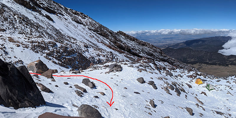
When you reach the end of that band of rocks, you will find yourself now on top of it. The pic below is from that spot now looking back at where we came from. Notice the camp here at about 15,600′.
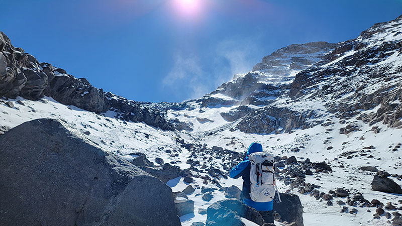
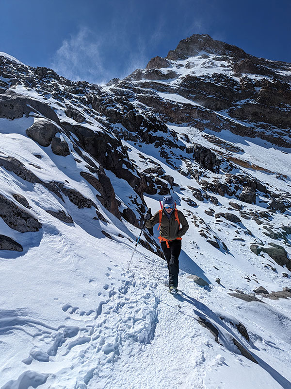
The Labyrinth
This is the entrance to the Labyrinth, a maze of rocks that really wasn’t that hard to navigate through. I believe there’s another route directly up slope behind Eric, but we chose to stay on the standard one since this was our first time.
We were glad to have seen this infamous Labyrinth in the light of day. It made us less concerned about the crux of this route.
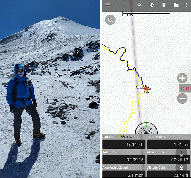
The exit point of the Labyrinth tops out at 16,100′. This is pretty close to the half-way point in altitude, distance and elevation gain to the summit. With it only taking us 2 hours to climb 2,000′ in 1.3 miles, we should have kept going! But not sure how our bodies would feel at 18,000 feet, we decided to stick to the process. Today’s hike was only meant to help acclimatize, not knock it out a day early.
We were back at the hut in time for lunch and then spent the afternoon lounging around. It would be an early night to bed with a summit start at 1 a.m.
