Skip to content
Menu
Backcountry Fever
  • Projects
    • Adirondack 46ers
    • Colorado 14ers
    • Seven Summits
      • Climb Aconcagua via the 360° Traverse | Full Guide
    • Wasatch 7
    • Wasatch 11ers
  • Highpoints
  • Experience
  • My Never-Ending List
  • Contact
Backcountry Fever
← Acclimating for 18,000 Feet
From Citlaltépetl to Iztaccíhuatl →

FELIZ NUEVO AÑO from El Pico de Orizaba

Posted on January 6, 2024October 21, 2025 by Backcountry Fever

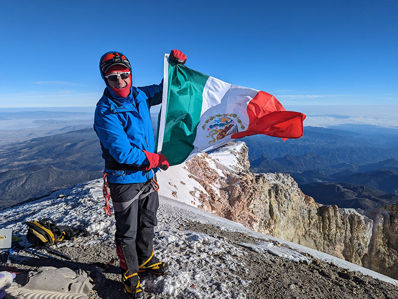
FELIZ NUEVO AÑO from El Pico de Orizaba, the tallest peak in Mexico and the third tallest peak in North America at 18,491 ft (5,636 m).  What a way to start out the New Year!

DAY 5 – Summit Day

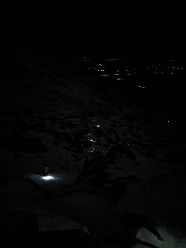
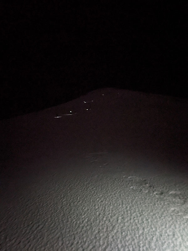
Our summit start began much earlier than necessary.  Our guide insisted we start at 1 a.m. along with everyone else who was there to summit that day.  Why? …more on that later.

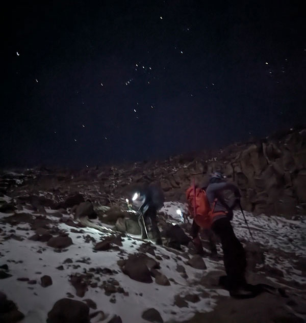
There really wasn’t a lot of picture taking beyond the string of lights below us and another one above.

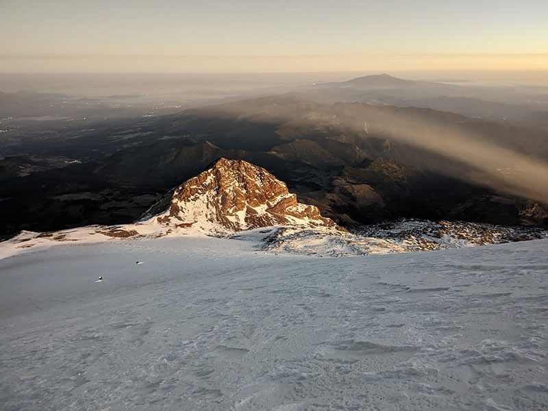
Today was much less windy than the day before but still bitter cold and almost miserable.  Our guide instructed us to walk Pole Pole style (pronounced “po-lay, po-lay”, meaning “slowly, slowly’ in Swahili).  This pace took us an hour longer to reach the top of the Labrinth, the half-way point at 16,100′, where we had hiked yesterday to acclimate.  It was frustrating, but Eric and I were glad we’d gone off on our own the day before to see this maze of rocks in the warmth of the sun.
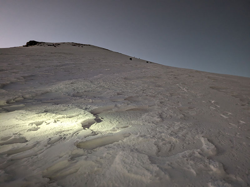
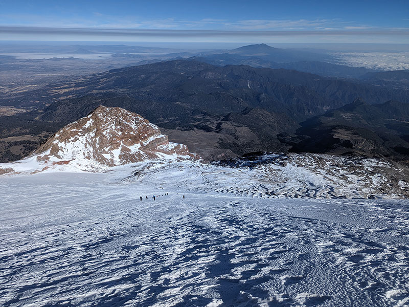
Jamapa Glacier

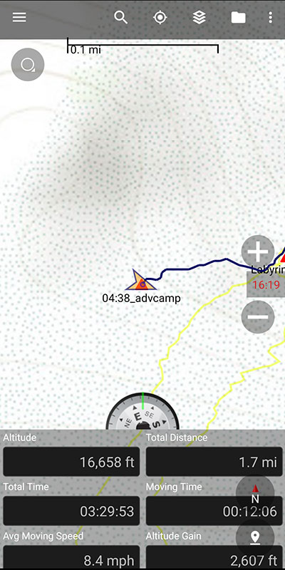
By 4:40 a.m., we reached Advanced Camp at the foot of the Jamapa Glacier.  We had climbed 2,607 feet in 1.7 miles after 3.5 hours of Pole Pole.  It was still dark but could see no one camping here.  We quickly put on crampons, thicker gloves and another layer before continuing on with lots of lamps ahead!

Pictures don’t do it justice, but the sunrise was beautiful as it slowly lit up the horizon.

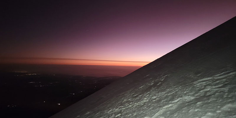
These views are probably the only good reason to start this climb that early.

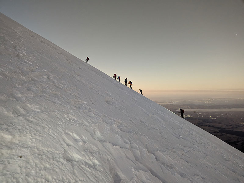
The steepness of the Jamapa Glacier is captured in this shot.  I tried to make sure the camera was perfectly even with the horizon.  That’s about 30 degrees.

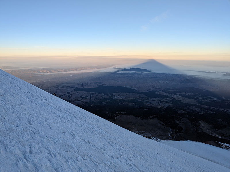
The pyramid shadow of this volcano reminded me of seeing that for the first time on Mount Hood.
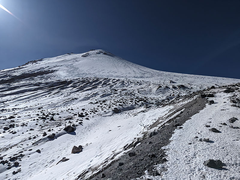
Final Push

The final push was less than a mile but also another 1,800′ of elevation in that short distance.

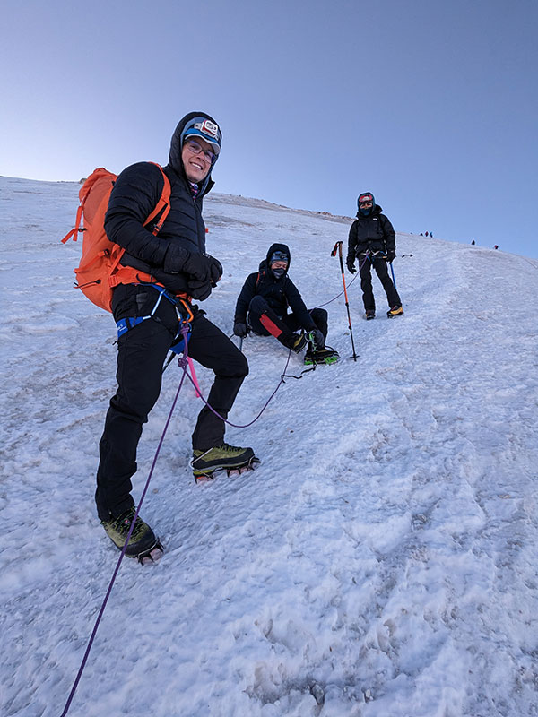
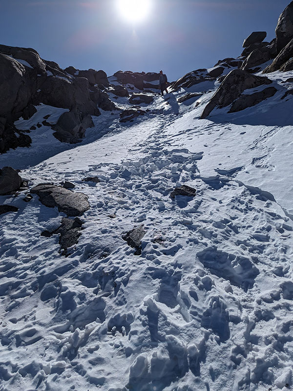
We were roped up but really didn’t need to be.  The snow was hard-packed and icy in places, but minimal crevasse danger to worry about.  The only risk appeared to be slipping on a surface and slope angle that would have been difficult to self-arrest.  Being tied together in conditions like that actually makes me more nervous!  I also don’t remember seeing anyone else tethered together either.

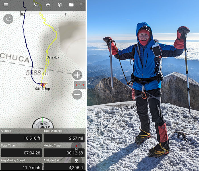
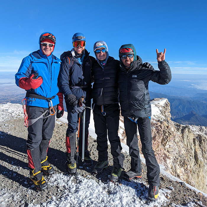
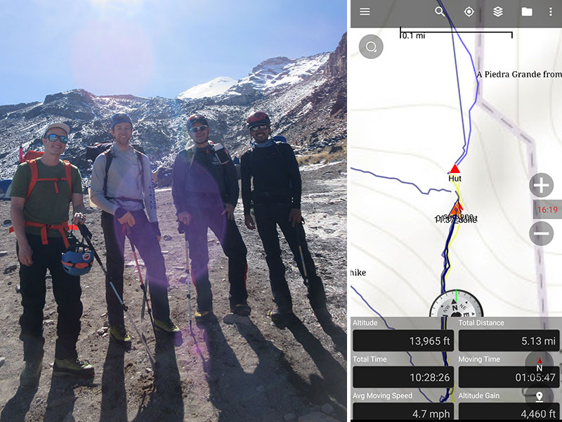
We finally reached the summit a few minutes after 8 a.m., seven hours from when we started.

It was cold and windy at the top.  We barely took the time to snap a few pictures.  I wished we had started later to have spent more time in the light of day and warmth of the sun.  That would have been much more enjoyable.  It’s not like we had to get up there while the surface was still frozen to avoid eminent danger.  I bet it would have been safer to climb that slope after the surface had softened a bit.

I didn’t even notice if you could walk around the rim to get a better view into the crater.
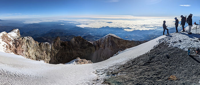
The Descent

Going down was a breeze.  Gravity did all the work!  We also didn’t get roped up for the descent.

We were off the glacier in no time and almost to the top of the Labrinth when we looked back at what we had just accomplished.  We were so stoked!

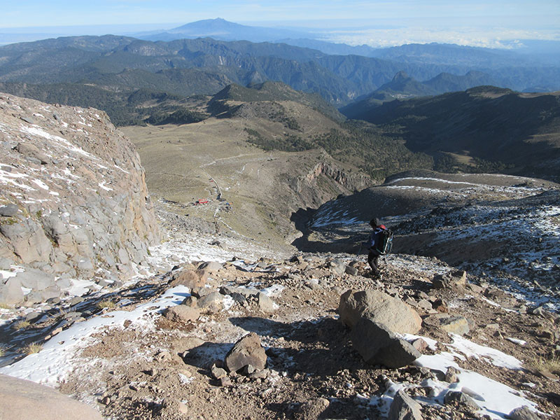
Back into the Labyrinth, we descend through this maze once again.

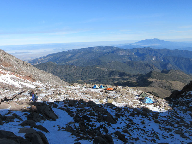
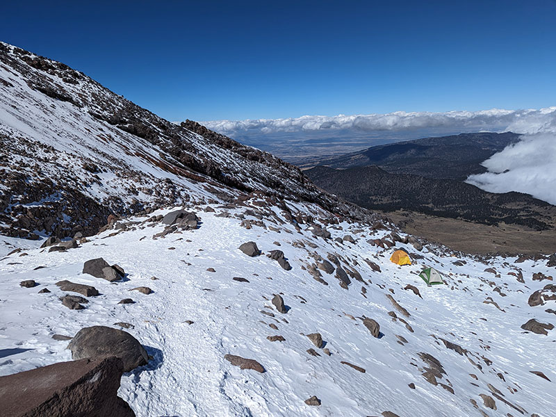
We noticed a few other camps as we made our way back down to Piedra Grande:  Camp1 on a flat spot at 15,000′, another at 15,600′ near the start of the Labyrinth, and Advanced Camp at 16,700′ next to the toe of the glacier.  Even though it was dark when we saw it earlier, Advanced Camp was the largest.

Final stats: 4,460 feet of elevation in 5 miles.  Ten and a half hours from when we started put us in basecamp at 11:37a.  That gave us plenty of time to eat lunch, pack up and drive down to Tlachichuca.

DAY 6 – Rest and Relaxation at Servimont

It was January 1st and we were happy to be back at Servimont.  We got to sleep in, savor another delicious breakfast and enjoy a day of rest and relaxation.  I logged in to work for a few hours from my laptop and then wandered around town.  We replenished our bottled water supply from the same convenience store, tried more street food and made calls home to wish everyone a Happy New Year.

Next up: Izta!

← Acclimating for 18,000 Feet
From Citlaltépetl to Iztaccíhuatl →

Leave a Reply Cancel reply

Your email address will not be published. Required fields are marked *

Winter is my favorite season, and cold weather camping is one of my favorite winter activities.

#coldweathercamping #wintercamping #tenting #lovewinter #lovecamping

2 0
Open post by backcountryfever with ID 18088708565160118
Winter is my favorite season, and cold weather camping is one of my favorite winter activities.

#coldweathercamping #wintercamping #tenting #lovewinter #lovecamping

Scoping out snow levels for my annual winter campout this weekend. Yep, there`s enough to still make it fun!

#wintercamping #coldweathercamping #winterhike #sunset #weekendwarrior

18 2
Open post by backcountryfever with ID 18093303244798082
Scoping out snow levels for my annual winter campout this weekend.  Yep, there's enough to still make it fun!

#wintercamping #coldweathercamping #winterhike #sunset #weekendwarrior

Speaking of my multi-millioner friends (see link in the bio), I got to hike with them last weekend.

I had my mind set on doing a Grandeur Peak Yo-Yo for my first hike of the year. Thankfully, @gwhatco and @andeethatch were OK with slowing down for the day.

Not sure what I was thinking though, my thighs were so sore for the next two days. Hockey sure doesn`t use those same muscles like I thought it did.

Recovery definitely called for a few infrared sauna sessions afterwards!

#grandeurpeak #yoyo #doublesummit #legday #goatworthy

35 0
Open post by backcountryfever with ID 18093050872988089
Speaking of my multi-millioner friends (see link in the bio), I got to hike with them last weekend.

I had my mind set on doing a Grandeur Peak Yo-Yo for my first hike of the year. Thankfully, @gwhatco and @andeethatch were OK with slowing down for the day.

Not sure what I was thinking though, my thighs were so sore for the next two days. Hockey sure doesn't use those same muscles like I thought it did. 

Recovery definitely called for a few infrared sauna sessions afterwards!

#grandeurpeak #yoyo #doublesummit #legday #goatworthy

Yeah, you read that right — 5,000,000 vertical feet. That’s a million feet of vert every year for five straight years. Who does that? Well… these two average hikers from Utah have been stacking numbers like this since 2021 — quietly, but well beyond “average”.

The numbers speak for themselves. Get a summary and breakdown by month from the link in the bio ☝️

Think about that: we’re talking about an average of 50 miles and 20,000 feet of gain every single week.

It’s hard to wrap my head around that level of commitment. What they’re doing every month is roughly what I log in a year, all while holding down full-time jobs. That’s one serious fitness program.

In talking with Andee about what comes next, they took the week off after Christmas, then jumped right into the new year on a local favorite—Mount Olympus—with plans to log another million in 2026.

#goatworthy #biggoals #millionverticalfeet #hikerlife #hikemoreworryless

22 5
Open post by backcountryfever with ID 17966367422867268
Yeah, you read that right — 5,000,000 vertical feet.  That’s a million feet of vert every year for five straight years.  Who does that?  Well… these two average hikers from Utah have been stacking numbers like this since 2021 — quietly, but well beyond “average”. 

The numbers speak for themselves.  Get a summary and breakdown by month from the link in the bio ☝️

Think about that: we’re talking about an average of 50 miles and 20,000 feet of gain every single week.

It’s hard to wrap my head around that level of commitment.  What they’re doing every month is roughly what I log in a year, all while holding down full-time jobs.  That’s one serious fitness program.

In talking with Andee about what comes next, they took the week off after Christmas, then jumped right into the new year on a local favorite—Mount Olympus—with plans to log another million in 2026.

#goatworthy #biggoals #millionverticalfeet #hikerlife #hikemoreworryless

With the encouragement from my youngest daughter, I bought a small fleet of kid carriers to get these youngsters started early! We`ve enjoyed a few days out in this unseasonably warm November, but still need to get them ALL out together. Fun times ahead for sure!!

#osprey #ospreypacks #hikingwithkids #familyfun #getemstartedearly

21 1
Open post by backcountryfever with ID 18064990223634047
With the encouragement from my youngest daughter, I bought a small fleet of kid carriers to get these youngsters started early!  We've enjoyed a few days out in this unseasonably warm November, but still need to get them ALL out together.  Fun times ahead for sure!!

#osprey #ospreypacks #hikingwithkids #familyfun #getemstartedearly

My first time up Mt. Ogden unintentionally turned into a full-on-loop-de-doo: up Beus, down Malan`s.

Beus Canyon was pretty boring above treeline, so I decided not to head back the way I came. After tagging the summit, I figured Malan`s would be way more interesting — and it sure was!

Malan`s Basin is surprisingly sketch up high, through a steep and narrow gully, then hard to follow in the middle where an already faint trail disappeared under leaves. I lost the trail a few times and had to backtrack a bit to find my way.

Finally, the Bonneville Shoreline Trail came in clutch once again, making this a nice long loop-de-doo.

Mt. Ogden Loop-de-doo mileage breakdown 👇
- Beus Canyon trailhead to summit, 6 miles
- Mt. Ogden to Malan`s Peak, 3 miles
- Malan`s Peak to Bonneville Shoreline Trail, 3 miles
- BST across and back to Beus trailhead, 3 miles

For a total of 15 miles and 5,300 feet of elevation gain.

#mtogden #mountogden #ogdenpeak #beuscanyon #beuscanyontrail #malansbasin #malanspeak #bonnevilleshorelinetrail #bonnevilleshoreline #bst #loophike #loopdedoo #wasatchfront #hikeogden #fallhike #fallhikingfallhiking

24 0
Open post by backcountryfever with ID 17906240730272550
My first time up Mt. Ogden unintentionally turned into a full-on-loop-de-doo: up Beus, down Malan's. 

Beus Canyon was pretty boring above treeline, so I decided not to head back the way I came. After tagging the summit, I figured Malan's would be way more interesting — and it sure was!

Malan's Basin is surprisingly sketch up high, through a steep and narrow gully, then hard to follow in the middle where an already faint trail disappeared under leaves.  I lost the trail a few times and had to backtrack a bit to find my way.

Finally, the Bonneville Shoreline Trail came in clutch once again, making this a nice long loop-de-doo.

Mt. Ogden Loop-de-doo mileage breakdown 👇
- Beus Canyon trailhead to summit, 6 miles
- Mt. Ogden to Malan's Peak, 3 miles
- Malan's Peak to Bonneville Shoreline Trail, 3 miles
- BST across and back to Beus trailhead, 3 miles

For a total of 15 miles and 5,300 feet of elevation gain.

#mtogden #mountogden #ogdenpeak #beuscanyon #beuscanyontrail #malansbasin #malanspeak #bonnevilleshorelinetrail #bonnevilleshoreline #bst #loophike #loopdedoo #wasatchfront #hikeogden #fallhike #fallhikingfallhiking

Awesome views from the top of Y Mountain. Looking north into Rock Canyon, where I started, and across towards the old Squaw Peak, Cascade Mountain, and Mount Timpanogos further off in the distance.

Pretty fun loop hike 👇

- Up 1.8 miles from the Rock Canyon trailhead
- Up 1.8 miles on First Right Fork to Slide Canyon
- Down Slide Canyon Trail .5 miles to Y Mountain Trail
- Up 1 mile to Y Mountain West Peak
- Down .25 and over .25 miles to Y Mountain East Peak
- Down 1 mile back to Slide Canyon Trail
- Down 1.5 miles to Y Trail (top of the BYU Y)
- Down 1 mile to the Y Trail trailhead
- Across 1.75 miles on the Bonneville Shoreline Trail

For a total of 10.75 miles with 4,137 feet of elevation gain.

#ymountain #rockcanyon #rockcanyontrail #firstrightfork #slidecanyon #ytrail #ytrailhead #bst #bonnevilleshorelinetrail #bonnevilleshoreline #connector #loophike #wasatchfront #hikethewasatch #wasatchmountains #wasatch #hike #hikemore

33 1
Open post by backcountryfever with ID 17900152413305912
Awesome views from the top of Y Mountain.  Looking north into Rock Canyon, where I started, and across towards the old Squaw Peak, Cascade Mountain, and Mount Timpanogos further off in the distance. 

Pretty fun loop hike 👇

- Up 1.8 miles from the Rock Canyon trailhead
- Up 1.8 miles on First Right Fork to Slide Canyon
- Down Slide Canyon Trail .5 miles to Y Mountain Trail
- Up 1 mile to Y Mountain West Peak 
- Down .25 and over .25 miles to Y Mountain East Peak
- Down 1 mile back to Slide Canyon Trail
- Down 1.5 miles to Y Trail (top of the BYU Y)
- Down 1 mile to the Y Trail trailhead
- Across 1.75 miles on the Bonneville Shoreline Trail

For a total of 10.75 miles with 4,137 feet of elevation gain.

#ymountain #rockcanyon #rockcanyontrail #firstrightfork #slidecanyon #ytrail #ytrailhead #bst #bonnevilleshorelinetrail #bonnevilleshoreline #connector #loophike #wasatchfront #hikethewasatch #wasatchmountains #wasatch #hike #hikemore

As the seasons change, each quiet mile through these trees feels like an invitation to let go of what was and move toward all that`s yet to come...

#seasonschange #lettinggo #movingon #pressingforward #lookingahead #newbeginnings #natureishealing #healingenergy #goodvibes #autumnvibes #autumnmountains #hiking #hikerlife #mountainlife #mountains

27 0
Open post by backcountryfever with ID 17902202193279047
As the seasons change, each quiet mile through these trees feels like an invitation to let go of what was and move toward all that's yet to come...

#seasonschange #lettinggo #movingon #pressingforward #lookingahead #newbeginnings #natureishealing #healingenergy #goodvibes #autumnvibes #autumnmountains #hiking #hikerlife #mountainlife #mountains

Fall colors are fading fast, losing the battle with winter.

#fallcolors #fadingfast #autumn #hikingtrails #hiking #hike #hiker #getreadyforwinter

15 0
Open post by backcountryfever with ID 17913756879229216
Fall colors are fading fast, losing the battle with winter.

#fallcolors #fadingfast #autumn #hikingtrails #hiking #hike #hiker #getreadyforwinter
Follow on Instagram

Recent Posts

  • 5 Million Vertical Feet Gained Over 5 Years
  • 2025 Year in Review
  • From Waikīkī to Makapuʻu: A Casual Tour of Honolulu Stops
  • High Hopes for Hiking Hawaii — Hobbled by Hockey
  • It’s Mountaineering Season in Utah!

Recent Comments

  • Matt on How I Would Do Kings Peak in 1 Day
  • Rich Meziere on Bummed Out By A Broken BOA Binding
  • Backcountry Fever on Bummed Out By A Broken BOA Binding
  • Alex Cook on Bummed Out By A Broken BOA Binding
  • Rick Mandahl on Cold Fusion Couloir to North Timpanogos

RECOMMENDED READING

Categories

  • 14ers
  • Adventure Plans
  • Avalanche Awareness
  • Backpacking
  • Epic Treks
  • Grand Canyon
  • Health & Wellness
  • International Expeditions
  • Mountaineering
  • Pacific Northwest
  • Peak Bagging
  • Product Feedback
  • Reading References
  • Road Trip
  • Scrambling
  • Season Summary
  • Seven Summits
  • Six-Pack Challenge
  • Snowshoeing
  • Social Media
  • State Highpoints
  • Technology
  • Uinta Mountains
  • Uncategorized
  • Uphill Training
  • Wasatch Front
  • Zion
©2026 Backcountry Fever