Skip to content
Menu
Backcountry Fever
  • Projects
    • Adirondack 46ers
    • Colorado 14ers
    • Seven Summits
      • Climb Aconcagua via the 360° Traverse | Full Guide
    • Wasatch 7
    • Wasatch 11ers
  • Highpoints
  • Experience
  • My Never-Ending List
  • Contact
Backcountry Fever
← From Citlaltépetl to Iztaccíhuatl
To Be, Or Not To Be… Guided, That Is →

Traversing Mexico’s Sleeping Beauty

Posted on January 10, 2024October 22, 2025 by Backcountry Fever

DAY 8 – Izta Summit Day

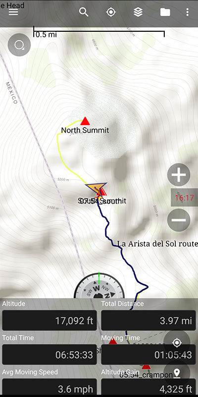
Midnight came quickly as it always does.  Not sure why we had to start that early again and our guides really didn’t have a good answer.  We only had 4,000′ of elevation in 4 miles, very much like a typical day in Utah.  Granted, we were starting from 13,000′ and would climb to 17K but that still didn’t seem to necessitate another 1 a.m. start.  Unfortunately, the only option here was to follow along.  When your group hires a guide, the team loses all decision making ability… which I have very mixed feelings about.

Up by way of La Arista de Sol

Within 15 minutes of hiking La Arista de Sol, the standard route on Izta, we were already passing a large group that started shortly before us.  We would not see them again.
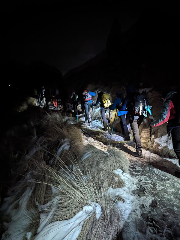
1,000 feet up and a mile in, we reached the 1st saddle in just under an hour.  400 more feet and another third of a mile and we hit the 2nd saddle.   The lights of Mexico City could be seen off in the distance.
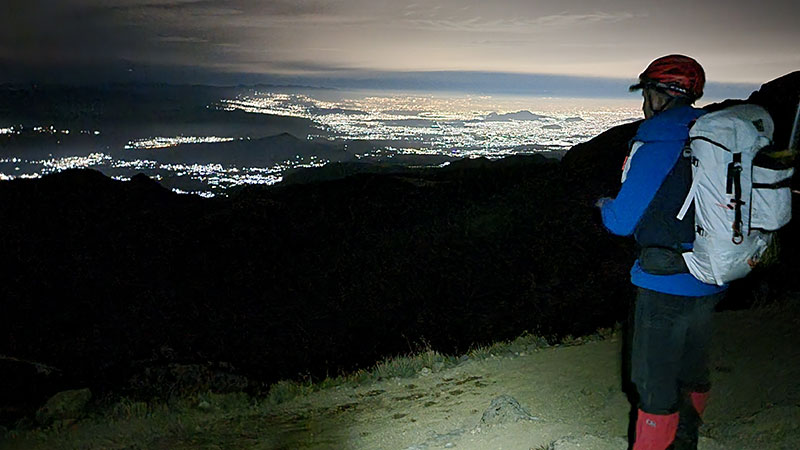
When we got to the 3rd saddle at 14,860′, we had climbed 1,800′ in 1.75 miles.  That elevation and distance took us 2 hours.  It felt like we were making decent progress but slow and steady was the pace.
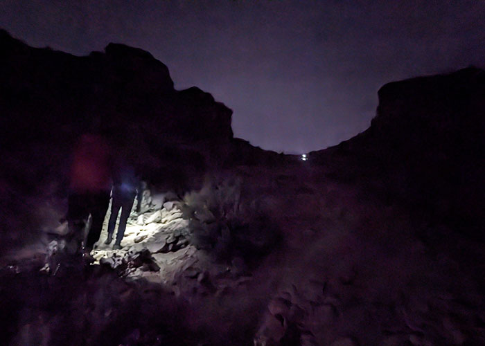
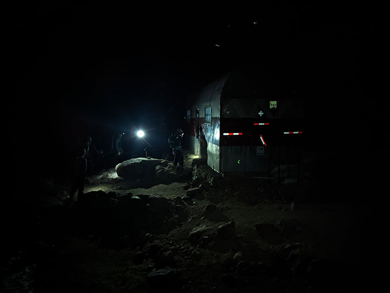
By 4 a.m., we made it to the Grupo de Los Cien shelter at 15,500 feet.  We were 2,500′ up and almost 2.5 miles in after 3 hours of climbing in those cold, dark morning hours.
Not Really The Crux

The slope up from this hut to The Knees is supposed to be the crux of this route.  I would challenge that opinion with what we thought to be a real crux later.  This section of the climb does ascend 1,000′ in a half mile to the First Knee at 16,500′.  So it’s definitely steep, but hardly required use of your hands to make it.  The risk level also didn’t seem high as far as the probability of slipping and falling to your doom.  Maybe that would have felt different with more light, but I doubt it.  I also don’t recall seeing any crosses here either.  Again, this would have been much better to do with more daylight.

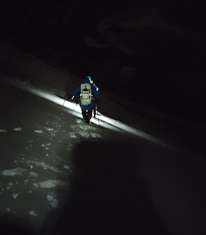
A quarter mile later and another 200′ of elevation, we reached The Belly.  Before dropping down onto that glacier, we stopped to throw on crampons.  It was the first bit of snow we came across all morning.
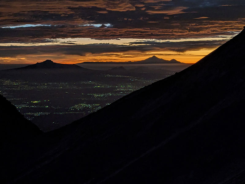
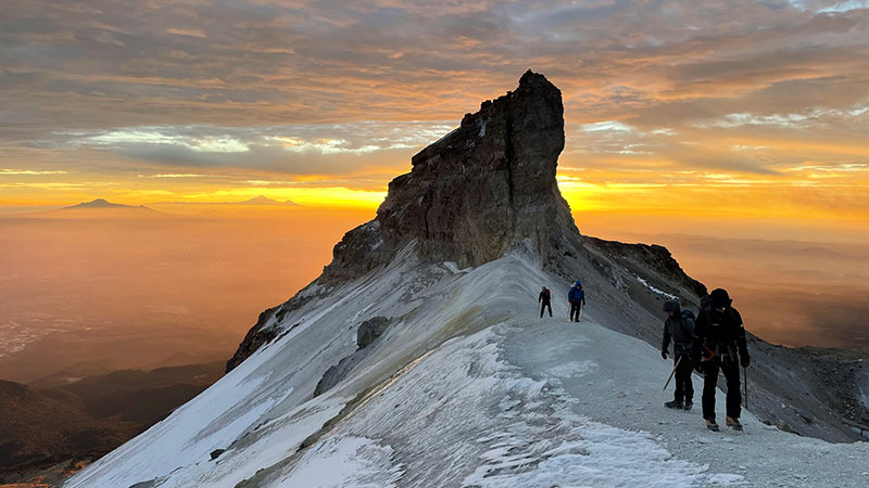
Shortly thereafter, the sunrise from this vantage point was unbelievable.  We were in the right place at the right time to see it light up the sky behind Malinche and Orizaba.  A Van Halen song came to mind!
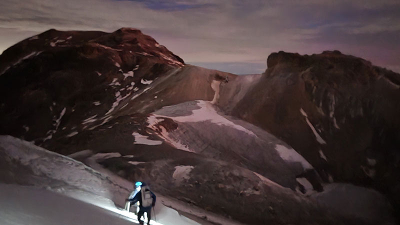
This is also where we came upon the real crux.
The Real Crux

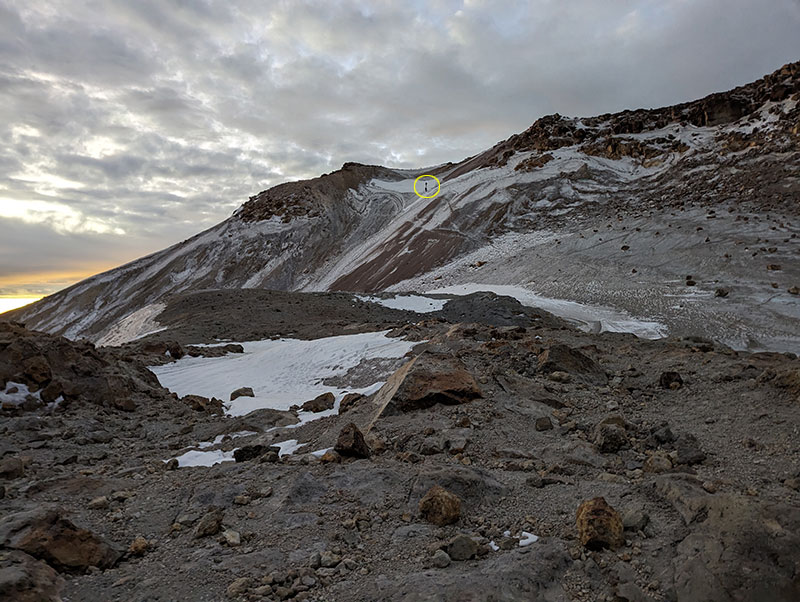
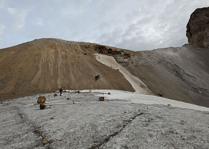
As we were setting up camp the day before, a couple from Seattle had returned from their summit day.  We, of course, asked how it was, anxious to know more about what to expect firsthand.  Both expressed that “The crux wasn’t the crux at all.  The real crux was after that – down the sheet of ice into the belly.”  We concur… the “crux” up to The Knee was nothing!  The real crux, as we traversed it, was definitely this slope the Seattle climbers warned about.  It was solid ice!  Obviously there are no pictures of that white-knuckle experience until after we passed the worst of it seen below.
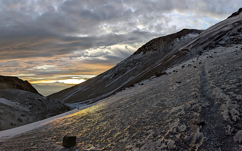
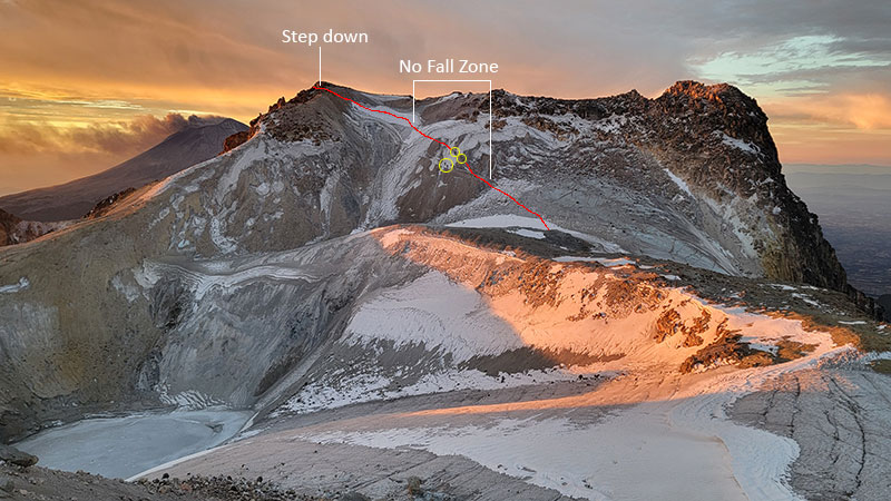
The sketchy part is the upper slope where you can see two others coming down behind us (circled).
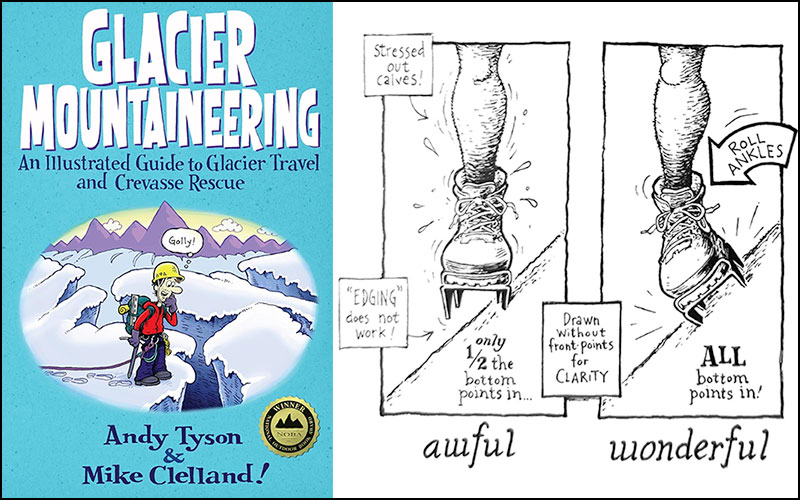
Safe crossing here required careful footwork since an ice axe would have done absolutely nothing!  I had never been on such an extreme surface before and remembered reading about this in Glacier Mountaineering by Andy Tyson & Mike Clelland.  ALL TWELVE POINTS needed to be engaged, 100%!
Our guide told us Glaciar del Vientre has receded much over the years.  Way back whenever, you could cut right across rather than having to go around like we did.
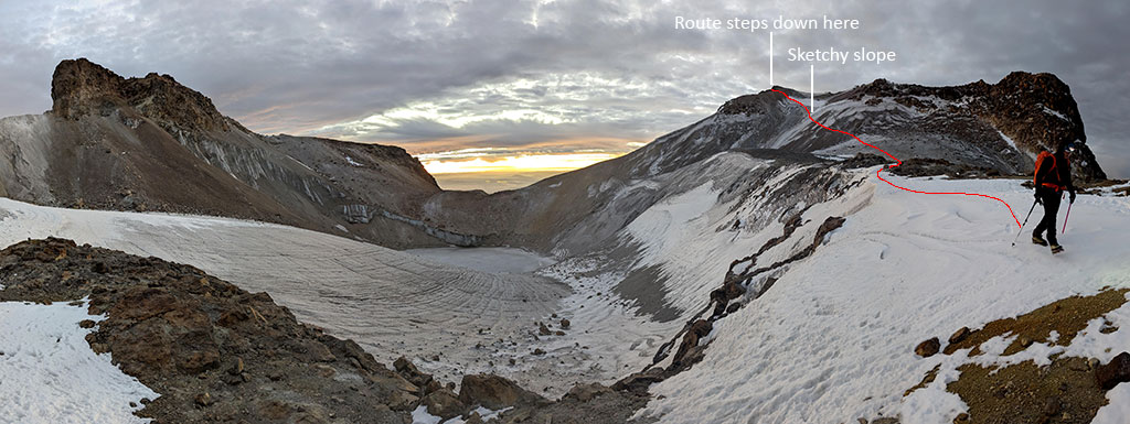
Up and out of The Belly to that ridgeline above.
From there, we looked back at what we later considered a “no fall zone”.  Four more climbers were crossing that area as this pic was taken.  They are circled for further perspective about that being the real crux of the route.  If there was a better way across this section, our guide didn’t lead us there.
A few more shots were taken of this sunrise while the clouds filtered its colors.
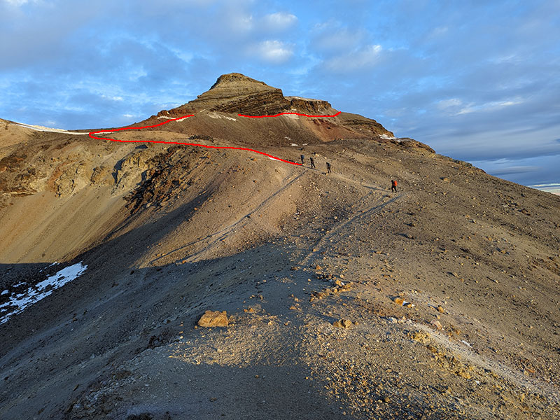
Final Push

The final push is only a half mile more from here to The Breast (“here”, meaning the top of the ridgeline after climbing up out of The Belly, as seen above).  Another 400 feel of elevation is gained in this final stretch pictured behind our guide below.
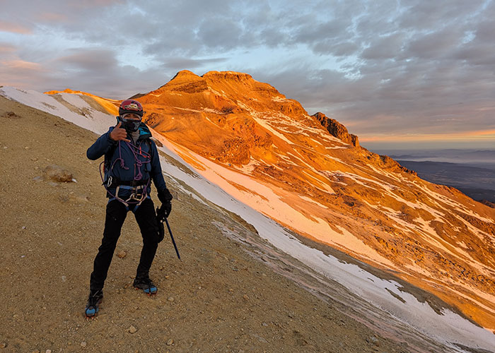
Up and around this bump called Peña Ordoñez according to the CalTopo map I’m referencing… and no, that’s not a nipple of this iztāc (white) cihuātl (woman).
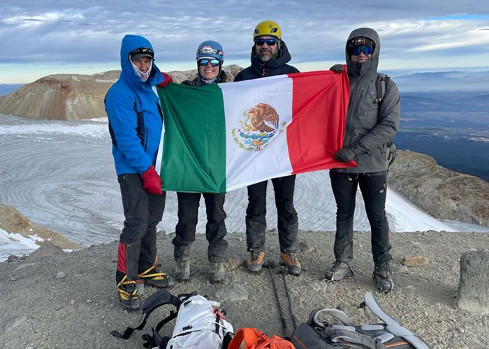
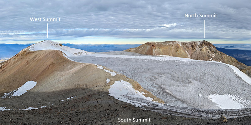
We reached the South Summit a few minutes before 8 o’clock.  That put our summit stats at slightly under 7 hours to climb 4,300 feet in 4 miles.
We did wander over to the West Summit to see The Head of this sleeping beauty.
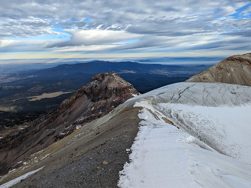
However, there was no desire to cross over and touch the North Summit.  It was cold and windy and we were ready to be done.  We were standing on the highest point, and that was really all that mattered.
Down by way of Ayoloco

Our guide suggested an alternate way down instead of going back the way we came.  It’s called the Ayoloco Trail.  It drops off the ridge to the west just after that bump called Peña Ordoñez on CalTopo.
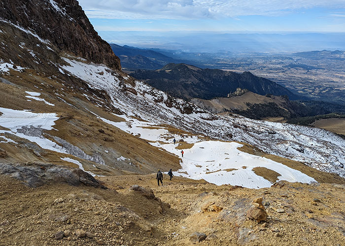
Looking back at what we just started to descend, Peña Ordoñez is that rocky point best seen here.
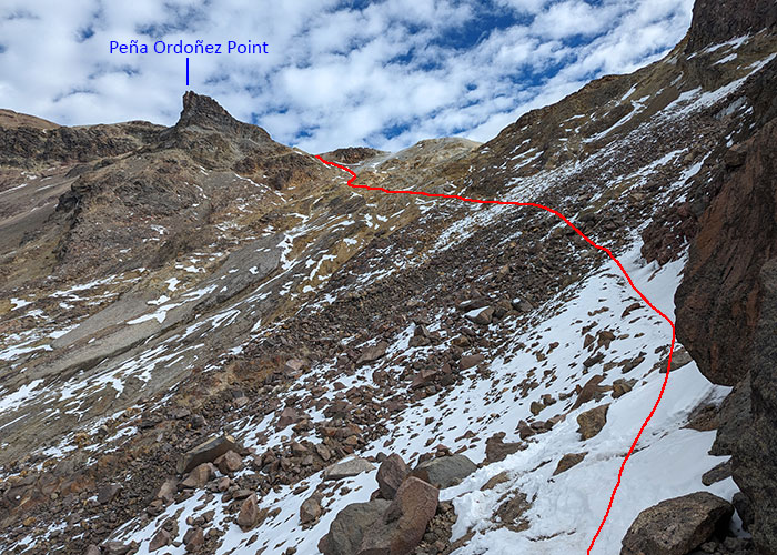
Ayoloco Trail

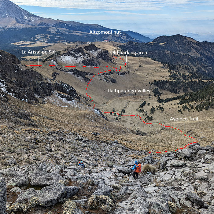
With nothing much left of the Glacier de Ayoloco, the traverse is through large boulders as you cross this field of moraine.  The map does show another shelter in this area called Refugio de Ayoloco, but we didn’t take the time to go look.
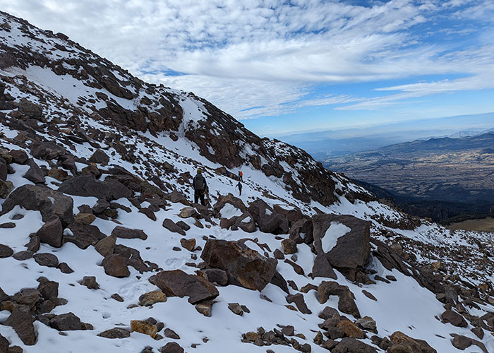
It mellows out the closer you get to the valley floor.
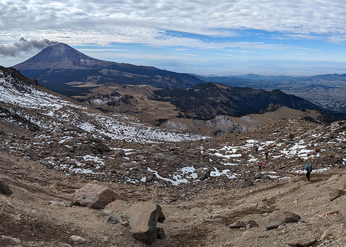
The Ayoloco route is a pretty steady descent for 3.5 miles.  At about a thousand feet per mile, I don’t think it would be too bad going up to the summit this way.
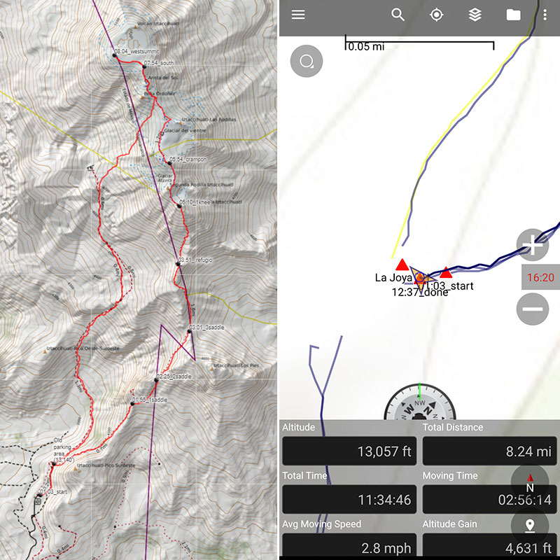
We arrived back at Camp La Joya around 12:30, just in time for lunch.  Final stats for the day were 4,600 feet over 8 miles in 11 and a half hours.  Our GPX track can be downloaded from here.
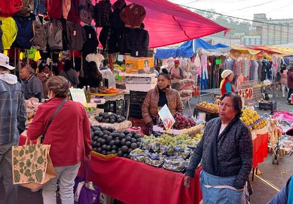
Two hours later, the last member of our group arrived back at camp.  We kinda had to rush her to get changed, packed up and loaded in the van that would take us back to Mexico City.  I started to realize that this might be why guides make you start so early.  They have no idea how long it’s going to take their clients to finish.  I’m sure the Servimont staff expected to leave right after lunch, but instead, had to sit around and wait for a couple more hours.  However, we still were able to make a quick stop in Amecameca to check out their local street market.
We spent our last night back where we started, at the Fiesta Inn near the airport.  Their dinner buffet, a nice hot shower and a comfy bed with a normal pillow made for a really nice ending.

DAY 9 – Return Home

My flight left early that next morning… like 5:45am.  Others were scheduled to leave throughout the day, but I didn’t mind this “alpine start”.  It put me in Houston at 8 and back home by noon.  Reflecting on the week, it was a pretty awesome trip!

← From Citlaltépetl to Iztaccíhuatl
To Be, Or Not To Be… Guided, That Is →

Leave a Reply Cancel reply

Your email address will not be published. Required fields are marked *

Couldn`t have asked for a better day to climb Mount Adams. The conditions today (6/4) were absolutely perfect!

These 6 miles were waaaay different from the last six I did in LA. This 6-mile climb to the summit packed in 6,700 feet of elevation and took 6 hours 45 minutes (one-way).

#mtadams #mountadams #pnw #mountaineering #legday

43 5
Open post by backcountryfever with ID 17988770517003932
Couldn't have asked for a better day to climb Mount Adams. The conditions today (6/4) were absolutely perfect!

These 6 miles were waaaay different from the last six I did in LA. This 6-mile climb to the summit packed in 6,700 feet of elevation and took 6 hours 45 minutes (one-way).

#mtadams #mountadams #pnw #mountaineering #legday

Spent the weekend in California for a wedding and managed to squeeze in a quick hike, L.A.-style.

After reaching Mount Lee behind the Hollywood Sign, I couldn`t resist tagging two other peaks along the Aileen Getty Ridge Trail: Cahuenga Peak, the highest point in Griffith Park, and Burbank Peak, home to the famous Wisdom Tree.

The hike came in at 6 miles with just 1,000 feet of elevation gain and took only 2 hours.

#hollywoodsign #cahuengapeak #burbankpeak #aileengettyridgetrail #hikela

19 0
Open post by backcountryfever with ID 17874758856610450
Spent the weekend in California for a wedding and managed to squeeze in a quick hike, L.A.-style.

After reaching Mount Lee behind the Hollywood Sign, I couldn't resist tagging two other peaks along the Aileen Getty Ridge Trail: Cahuenga Peak, the highest point in Griffith Park, and Burbank Peak, home to the famous Wisdom Tree.

The hike came in at 6 miles with just 1,000 feet of elevation gain and took only 2 hours.

#hollywoodsign #cahuengapeak #burbankpeak #aileengettyridgetrail #hikela

Still chasing snow! Took my brother-in-law on his first-ever mountaineering experience. We went up Temple Couloir, over to Deseret Peak, and then slid down West Twin Couloir. Hard to beat spring days like this.

This was my 6th summit of Deseret Peak.

#deseretpeak #templecouloir #twincouloirs #mountaineering #chasingsnow

46 4
Open post by backcountryfever with ID 17898155133454122
Still chasing snow! Took my brother-in-law on his first-ever mountaineering experience. We went up Temple Couloir, over to Deseret Peak, and then slid down West Twin Couloir.  Hard to beat spring days like this.

This was my 6th summit of Deseret Peak.

#deseretpeak #templecouloir #twincouloirs #mountaineering #chasingsnow

One of my favorite things to do between ski season and hiking season: kicking steps up a steep slope toward some snow-capped summit!

#mountaineering #kickingsteps #steepslope #snowcapped #summitday

33 4
Open post by backcountryfever with ID 17939009859229790
One of my favorite things to do between ski season and hiking season: kicking steps up a steep slope toward some snow-capped summit!

#mountaineering #kickingsteps #steepslope #snowcapped #summitday

Another moderate day of mountaineering up the north slope of Mt. Superior, known as Cardiac Bowl. I`ve only been to this peak once before, from the typical summer trail, so it was way fun to get there from this direction.

#mountsuperior #northslope #cardiacbowl #mountaineering #wasatch11ers

32 0
Open post by backcountryfever with ID 18131016616566455
Another moderate day of mountaineering up the north slope of Mt. Superior, known as Cardiac Bowl.  I've only been to this peak once before, from the typical summer trail, so it was way fun to get there from this direction.

#mountsuperior #northslope #cardiacbowl #mountaineering #wasatch11ers

With such good coverage and a big storm rolling in, I think Alta should stay open for at least another week!

#stillskiing #springskiing #skiutah #skiing #alta

15 0
Open post by backcountryfever with ID 18013199525845115
With such good coverage and a big storm rolling in, I think Alta should stay open for at least another week! 

#stillskiing #springskiing #skiutah #skiing #alta

It`s been a minute since I`ve had anything other than ski boots or hockey skates on my feet this winter. Gotta switch gears before the mountaineering season melts away here in Utah!

#mountaineering #kesslerpeak #westridge #wasatchfront #timetoclimb

📷 @wasatchwidescreen

23 0
Open post by backcountryfever with ID 18073878845639559
It's been a minute since I've had anything other than ski boots or hockey skates on my feet this winter.  Gotta switch gears before the mountaineering season melts away here in Utah!

#mountaineering #kesslerpeak #westridge #wasatchfront #timetoclimb

📷 @wasatchwidescreen

On this day last year—February 18—my team and I reached the summit of Aconcagua, the tallest peak in Argentina and the highest mountain in the Western Hemisphere at 22,837 feet.

I’ve enjoyed looking back on that expedition by rereading my day-by-day trip report from our climb.

👉 Link in bio: an 18-part guide covering the entire climb, plus pre-trip planning tips and post-expedition things to see and do around Mendoza.

Whether this is your first high-altitude objective or you’re adding Aconcagua to your mountaineering résumé, the guide will help you see why I chose the 360° Traverse, how to plan for your expedition, and what to expect each day on the mountain.

#aconcagua #aconcagua360 #aconcaguaexpedition #highaltitudemountaineering #mountaineering

35 2
Open post by backcountryfever with ID 18055701743428917
On this day last year—February 18—my team and I reached the summit of Aconcagua, the tallest peak in Argentina and the highest mountain in the Western Hemisphere at 22,837 feet.

I’ve enjoyed looking back on that expedition by rereading my day-by-day trip report from our climb.

👉 Link in bio: an 18-part guide covering the entire climb, plus pre-trip planning tips and post-expedition things to see and do around Mendoza.

Whether this is your first high-altitude objective or you’re adding Aconcagua to your mountaineering résumé, the guide will help you see why I chose the 360° Traverse, how to plan for your expedition, and what to expect each day on the mountain.

#aconcagua #aconcagua360 #aconcaguaexpedition #highaltitudemountaineering #mountaineering

Winter is my favorite season, and cold weather camping is one of my favorite winter activities.

#coldweathercamping #wintercamping #tenting #lovewinter #lovecamping

19 0
Open post by backcountryfever with ID 18088708565160118
Winter is my favorite season, and cold weather camping is one of my favorite winter activities.

#coldweathercamping #wintercamping #tenting #lovewinter #lovecamping
Follow on Instagram

Recent Posts

  • Adventuring Alone on Adams
  • A Road Trip to Trout Lake
  • The Interview That Made Me Reconsider Hydrogen Water
  • After a Year with the COROS Vertix 2S
  • 5 Million Vertical Feet Gained Over 5 Years

Recent Comments

  • Backcountry Fever on Solo Summit of Shasta
  • Michelle Tirhi on Solo Summit of Shasta
  • Matt on How I Would Do Kings Peak in 1 Day
  • Rich Meziere on Bummed Out By A Broken BOA Binding
  • Backcountry Fever on Bummed Out By A Broken BOA Binding

RECOMMENDED READING

Categories

  • 14ers
  • Adventure Plans
  • Avalanche Awareness
  • Backpacking
  • Epic Treks
  • Grand Canyon
  • Health & Wellness
  • International Expeditions
  • Mountaineering
  • New England
  • Pacific Northwest
  • Peak Bagging
  • Product Feedback
  • Reading References
  • Road Trip
  • Scrambling
  • Season Summary
  • Seven Summits
  • Six-Pack Challenge
  • Snowshoeing
  • Social Media
  • State Highpoints
  • Technology
  • Uinta Mountains
  • Uncategorized
  • Uphill Training
  • Wasatch Front
  • Zion
©2026 Backcountry Fever