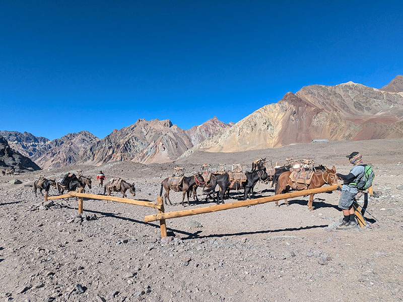
Morning came quickly, and before long we were re-sorting our bags for the 15-mile trek out. Just as our guides had instructed us on Day 2, we returned to the same distribution of gear — for one last time:
- One bag for our high altitude gear, which would be loaded on a mule
- One bag for our every day gear, which was also carried by mule
- One bag as our daypack, that we would carry
The mule train was about to get loaded as we finished that task and began our descent.
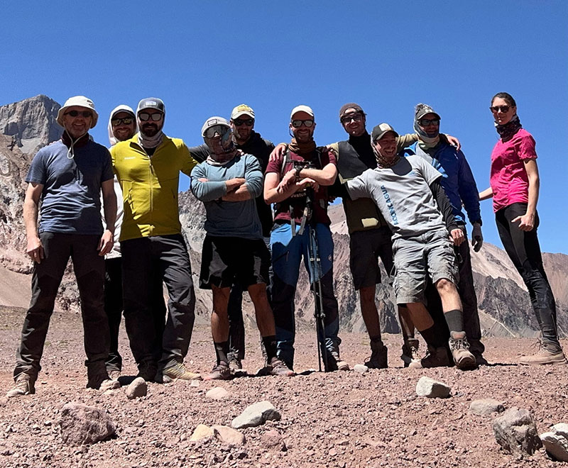
Adiós Aconcagua. Vaya aventura que ha sido!
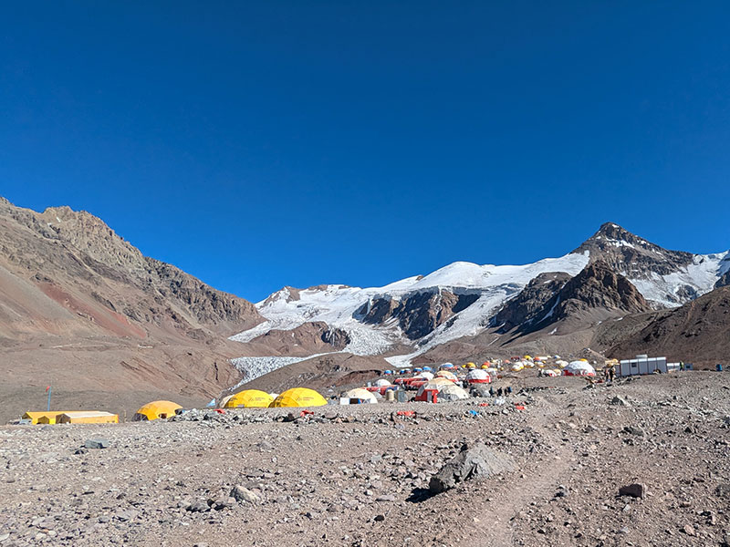
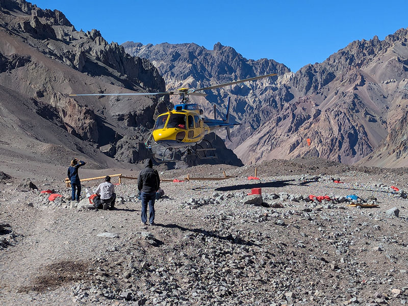
I wouldn’t have minded leaving by air. Seeing these mountains from above would have been incredible.
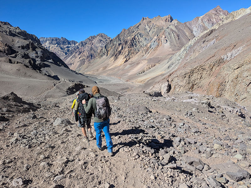
Instead, our exit was a 15-mile walk that we started by 10:30 that morning.
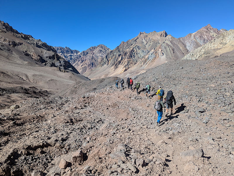
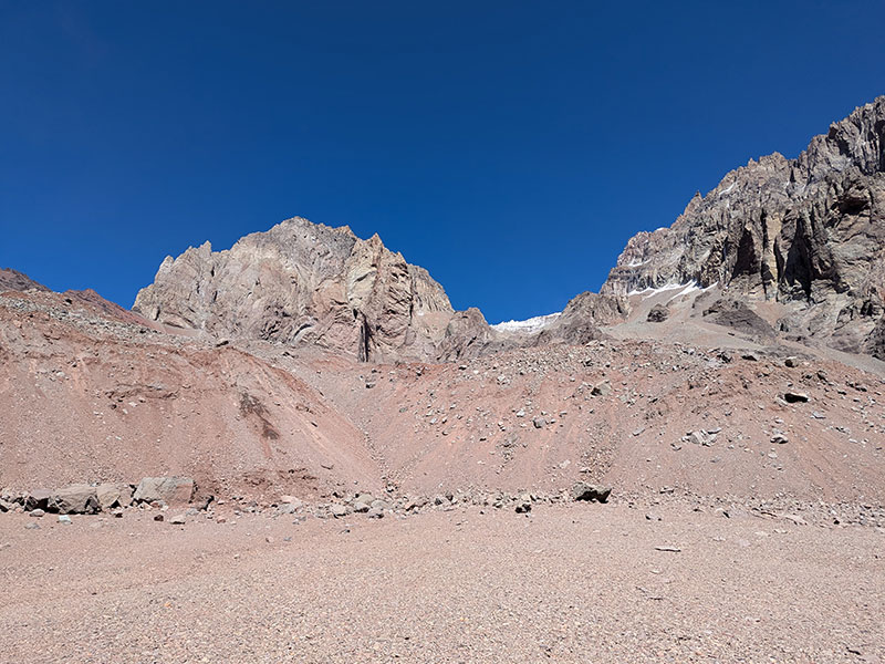
The first mile was the most interesting part of the entire walk out — mainly because we were weaving through fascinating moraine again. It’s hard not to be in awe by how ice carves this terrain. Pictures can’t really do it justice; the sheer magnitude of nature’s creation is so difficult to capture.
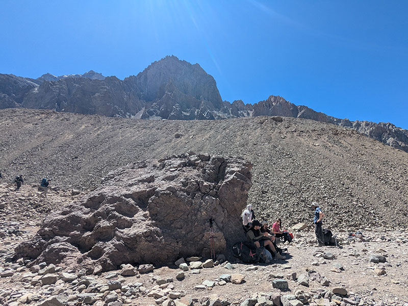
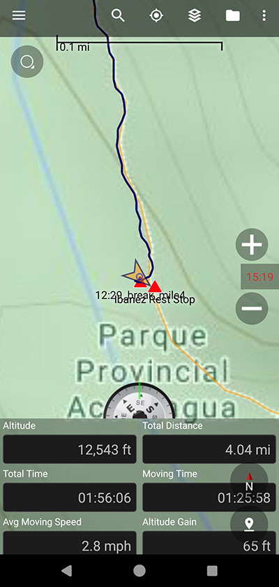
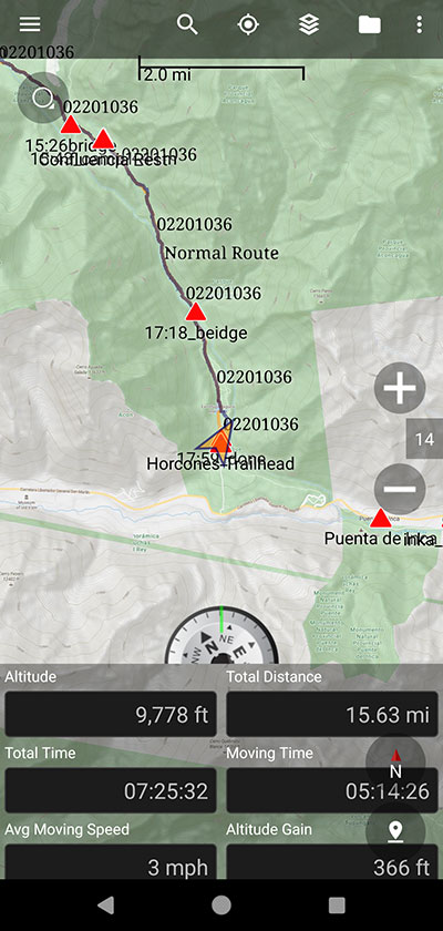
After covering 4 miles in 2 hours, we took our first real break at Piedra Ibáñez at 12:30p. This big rock provided a sliver of shade as the day got warmer. My map also had a waypoint marked for Plaza Francia somewhere along this stretch, but we saw nothing that resembled another camp.
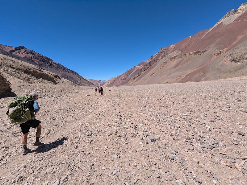
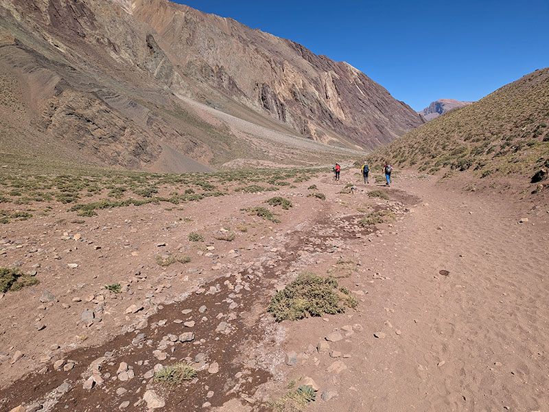
We continued through the dried-up Horcones River bottom and couldn’t help but wonder why people choose to come up this way. It couldn’t be less appealing.
Halfway Point
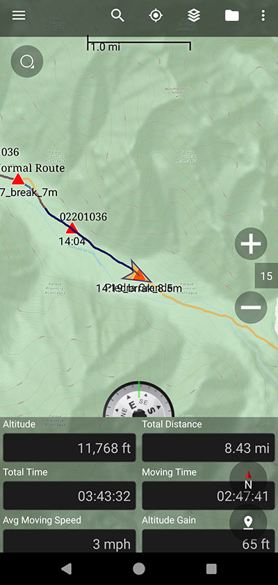
Our next rest stop was taken at another large rock in the middle of this dry riverbed — Piedra Grande. 8.4 miles from Plaza de Mulas, this lone stone marked the spot slightly beyond today’s halfway point.
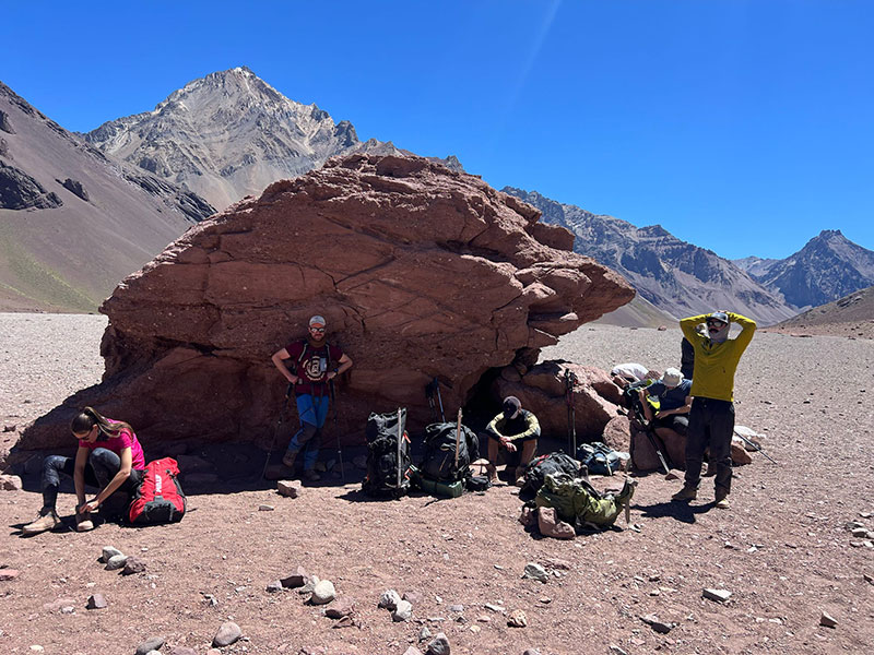
Hot, tired, and hungry, we still managed to pull off an energetic-looking group photo.
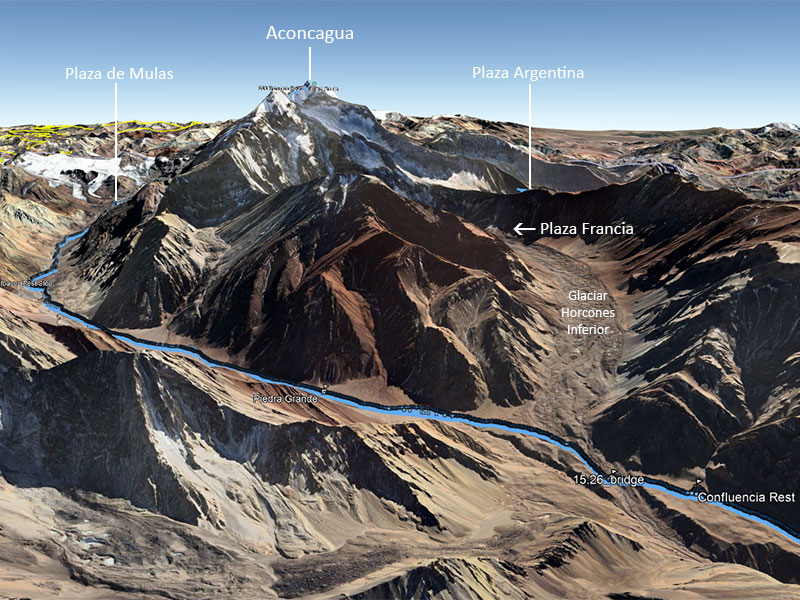
The trek continued through a grassy area, where several braided streams crossed our path. I believe this was runoff from the nearby Horcones Glacier (Inferior), directly south of Aconcagua.
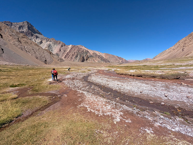
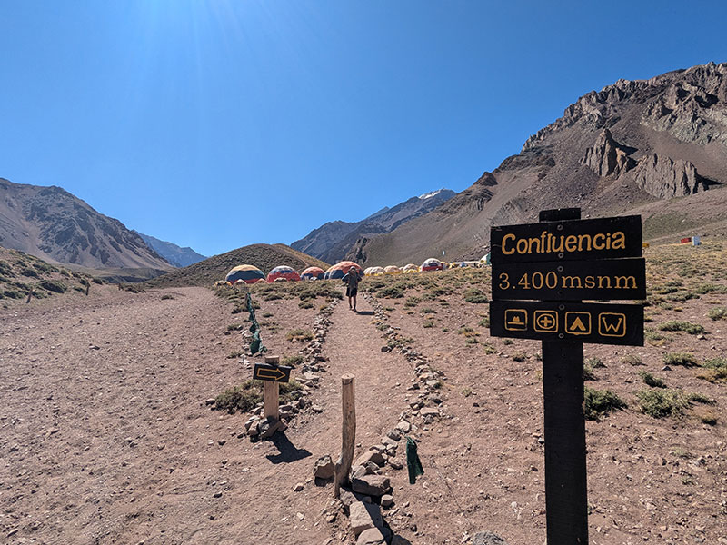
Before long, our next rest stop came into view — the camp at Confluencia.
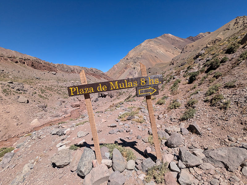
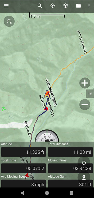
Before crossing the last strand of river from the Glaciar Horcones Inferior, we were glad to be heading in the opposite direction of this sign. 8 hours from here is a long haul up with no other camps between Confluencia and Plaza de Mulas — unless we somehow missed Plaza Francia.
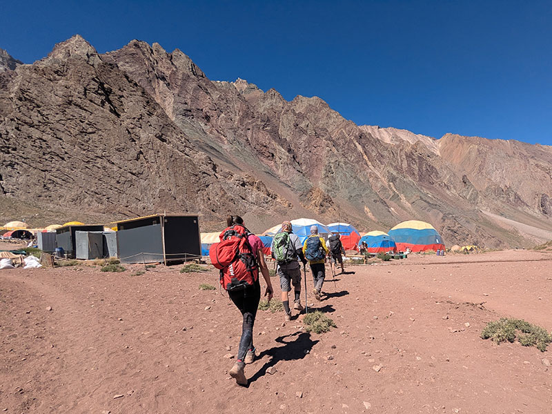
Over the bridge and up the other side, we arrived at Confluencia for refreshments and a late lunch.
Confluencia camp
Confluencia sits at 11,300 feet, 11 miles and 5 hours down from Plaza de Mulas. We reached this camp at 3:45p. With preparations for winter well underway, it felt like an Argentine version of a ghost town.
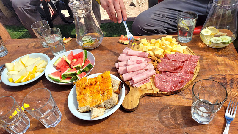
Here we enjoyed a nice break with lite finger foods and cold drinks.
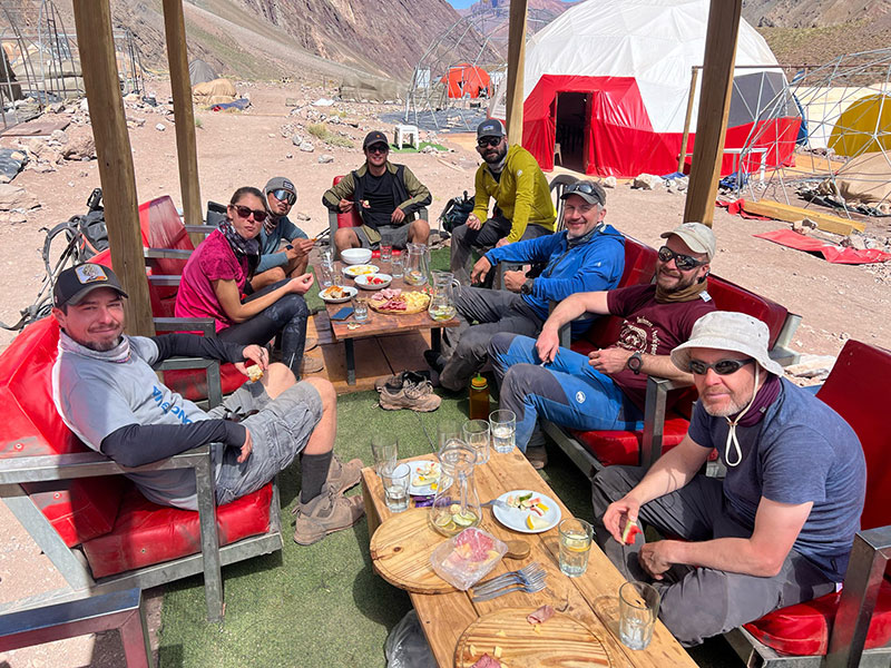
Little did we know this would be our last meal of the day — we wouldn’t reach Mendoza until after 10p.
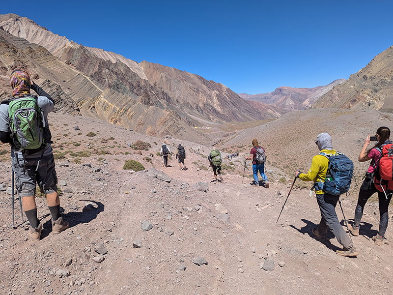
Half an hour later, we were departing from camp, with 4.5 miles still to go.
There was nothing exciting about that final stretch out, and it made me all the more grateful to have chosen the 360° Route as my approach to Aconcagua.
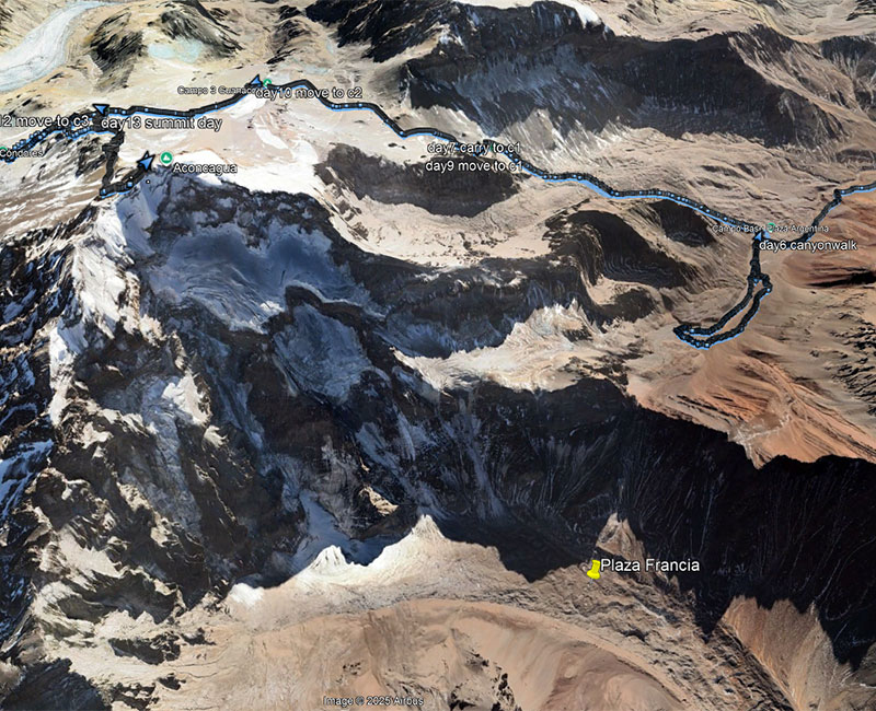
Plaza Francia
I still didn’t know where Plaza Francia was, despite all the indications that it existed. According to this sign near the Horcones trailhead, it’s 5 hours beyond Confluencia — but where exactly?
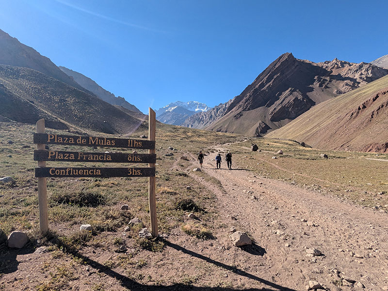
Researching afterwards, I learned that Plaza Francia is an out-and-back side trip right by Confluencia — a popular destination for those not attempting the summit but wanting to see Aconcagua’s massive South Face up close. It also serves as the high camp for climbers tackling that South Face Route. No wonder we never saw it! It’s not even on the trail between Confluencia and Plaza de Mulas, but instead heads up the side canyon from the last bridge we crossed before reaching Confluencia.
The route is classified as a hike, requiring no mountaineering gear — not even crampons. However, if the terrain is anything like the moraine we saw between Plaza Argentina and Camp 1, it’s far from casual. This 6-mile stretch climbs almost 3,000 feet one way! I can see how it might take someone 5 hours from Confluencia, just as the sign above indicates. It would be an all-day excursion.
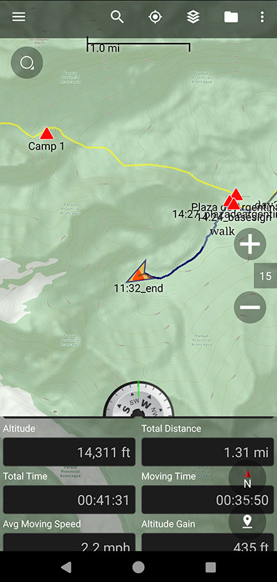
What I didn’t mention earlier — because it didn’t seem relevant at the time — is that I was on the other side of Plaza Francia on Day 6. A few of us were bored from sitting around all day and decided to wander further up Relincho Canyon. It was relatively flat with no plans to do anything significant — just a short stroll. Partway in, the others turned back but I kept going and reached the end at 14,300 feet.
Had I known another camp was on the opposite side of this ridge, I might have been tempted to push a bit further to see if I could look over into the next canyon. But I had no idea what lay ahead for the coming days, so I decided not to risk wasting the energy and wandered back to Base.
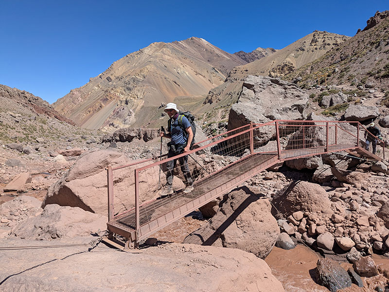
The Final Mile and a Half
Crossing this suspension bridge marked the final mile and a half to the end.
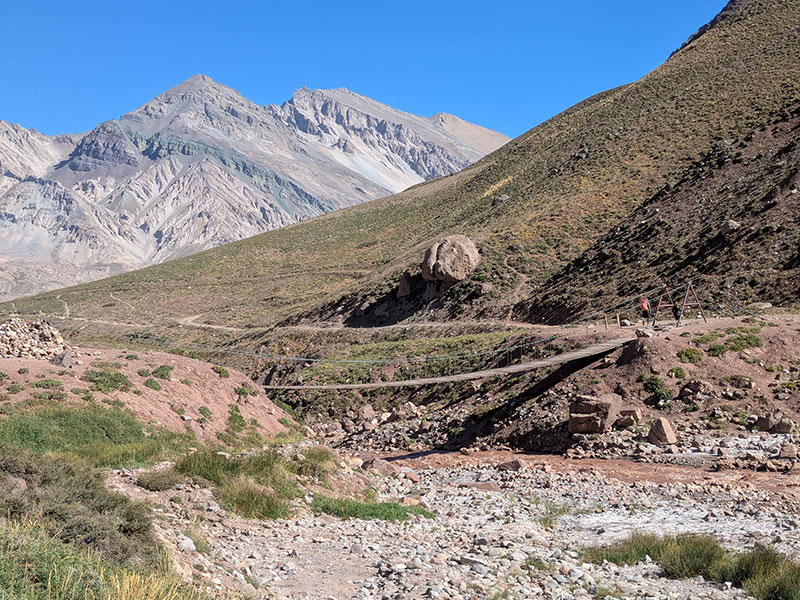
The finish line was in sight — as was the end of this epic expedition.
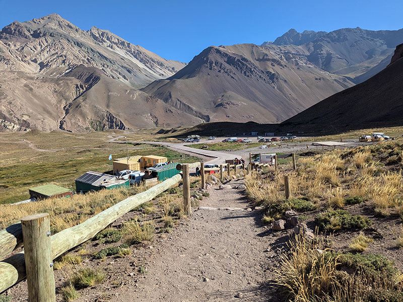
After 15 days, we touched pavement at 6p, wrapping up 15.63 miles and 366 feet of elevation for the day. All that remained was to grab our bags from the mule team and get them loaded onto the shuttle.
The last two days felt a bit rushed, but in the end, getting back to Mendoza was definitely the right call.
Final stats for this expedition:
| EXPEDITION LEG | DISTANCE | ELEVATION GAIN |
| Day 3 – Trek to Pampa de Lenas | 8.18 mi (13.16 km) | 1,739 ft (530 m) |
| Day 4 – Trek to Casa de Piedra | 9.71 mi (15.63 km) | 1,552 ft (473 m) |
| Day 5 – Trek to Plaza Argentina | 7.46 mi (12.01 km) | 3,255 ft (992 m) |
| Day 7 – Carry to Camp 1 (and back) | 4.95 mi (7.97 km) | 2,559 ft (780 m) |
| Day 9 – Move to Camp 1 | 2.55 mi (4.10 km) | 2,592 ft (790 m) |
| Day 10 – Move to Camp 2 | 1.96 mi (3.15 km) | 1,585 ft (483 m) |
| Day 12 – Move to Camp 3 | 1.4 mi (2.25 km) | 1,534 ft (468 m) |
| Day 13 – Summit Day (and back) | 3.96 mi (6.37 km) | 3,075 ft (937 m) |
| Day 14 – Descend to Plaza de Mulas | 3.82 mi (6.15 km) | 2 ft (1 m) |
| Day 15 – Return to Puente de Inca | 15.63 mi (25.15 km) | 366 ft (112 m) |
| TOTAL | 59.62 mi (100.78 km) | 18,259 ft (5,718 m) |
These numbers come pretty close to Inka’s data, despite our group skipping the Carry day to Camp 2.
