Skip to content
Menu
Backcountry Fever
  • Projects
    • Adirondack 46ers
    • Colorado 14ers
    • Seven Summits
      • Climb Aconcagua via the 360° Traverse | Full Guide
    • Wasatch 7
    • Wasatch 11ers
  • Highpoints
  • Experience
  • My Never-Ending List
  • Contact
Backcountry Fever
← Planning for Gannett
Summitting Gannett →

Getting to Gannett

Posted on August 4, 2022August 20, 2024 by Backcountry Fever

Getting to Gannett is legit!  We chose the standard route up from the southwest through Titcomb Basin.  This is the “easiest” way to Wyoming’s tallest peak, which is still pretty tough considering how far in you have to go and how much gear you need to bring.  Here are the overview stats from our trip to illustrate the challenge of this state’s highpoint:

  • Elkhart Park trailhead to Island Lake (camp 1)
    • 12.56 miles, 2,346′ of elevation
  • Island Lake to Titcomb Basin (camp 2)
    • 5.29 miles, 648′ of elevation
  • Titcomb Basin over Bonney Pass to Gannet Peak
    • 4.46 miles, 4,261′ of elevation
  • Gannet Peak back over Bonney to Titcomb Basin
    • 4.48 miles, 1,314′ of elevation
  • Titcomb Basin back to Island Lake
    • 5.26 miles, 247′
  • Island Lake back to Elkhart Park trailhead
    • 12.4 miles, 1,252′

That’s a total of 44.45 miles (round-trip) with over 10,000′ of elevation!  We got it done in 4 days after waiting for favorable snow conditions and having great weather on the day we summitted.  Hopefully the details found here can help you through your own trip preparations and expectations for heading out to Gannett.

DAY 1 – Drive, then Hike Half-way

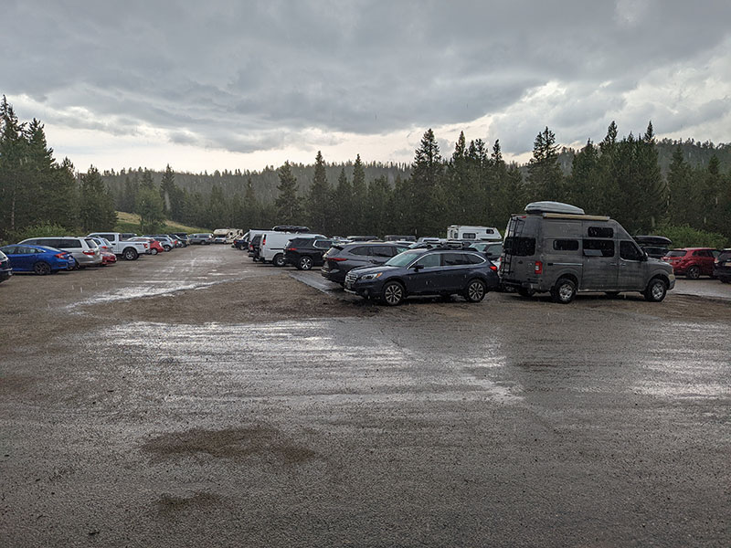
We left Salt Lake around 8a for the 4-hour drive to Pinedale.  The plan for today was to grab lunch in town, swing in to the Great Outdoor Shop for the latest on route conditions and then make it to Seneca Lake, the half-way point to Titcomb, by dinner.

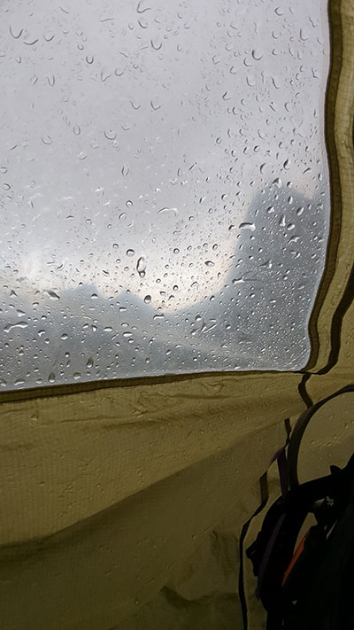
The good weather faded fast and by 2:30p, it started raining as we left the Elkhart Park trailhead.

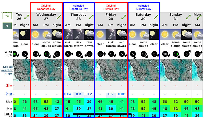
Thunderstorms were in the forecast for this trip and we accounted for bad weather in our planning.  However, it looked like we were off by a day for the good weather window we needed.  So we delayed our start by another day in order to better align with this forecast.

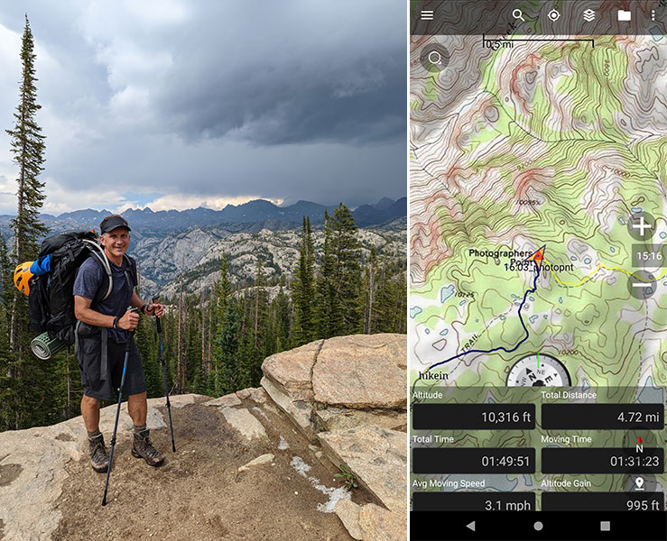
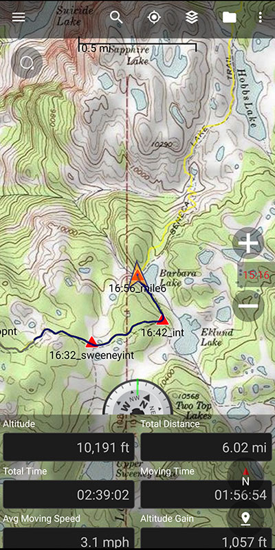
Within 2 hours, we were 5 miles in at Photographers Point where you get your first good view of this rugged range!  We were headed into those stormier clouds off in the distance.

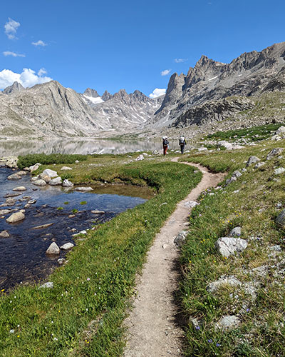
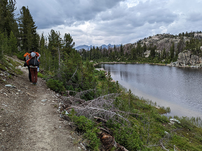
Alpine lake after alpine lake… we filtered some water from Barbara Lake at 6 miles in and hiked along Hobbs Lake at 7 miles (pictured below).

Half-way to Titcomb

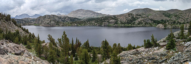
We traveled 9 miles in 4 hours when we got to Seneca Lake.  This is the half-way point to Titcomb Basin.  Our original plan was to stop and camp here but everyone was still  doing well and feeling strong.  We also had plenty of daylight left and knew every mile today would be one less mile tomorrow, so we pressed on.

The rain continued on and off as we hiked past Little Seneca Lake at 10.5 miles.

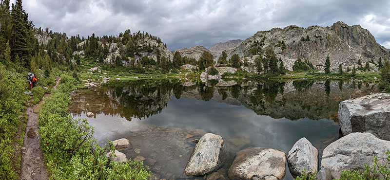
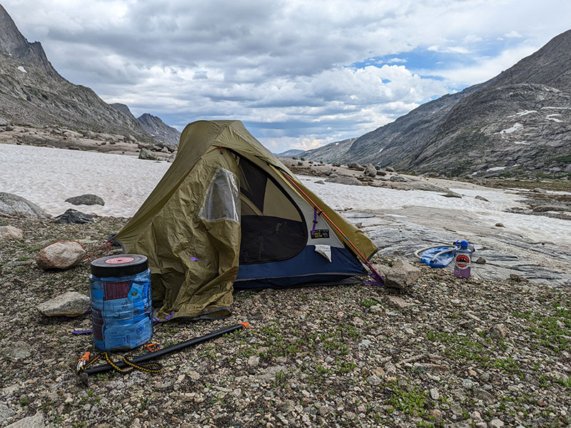
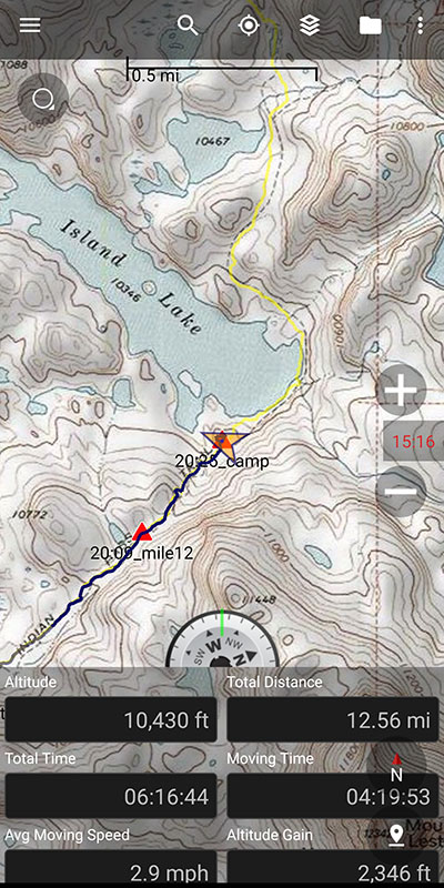
At 12.5 miles in, we reached Island Lake where we stopped and set up camp for our first night.

The mosquitoes were relentless…

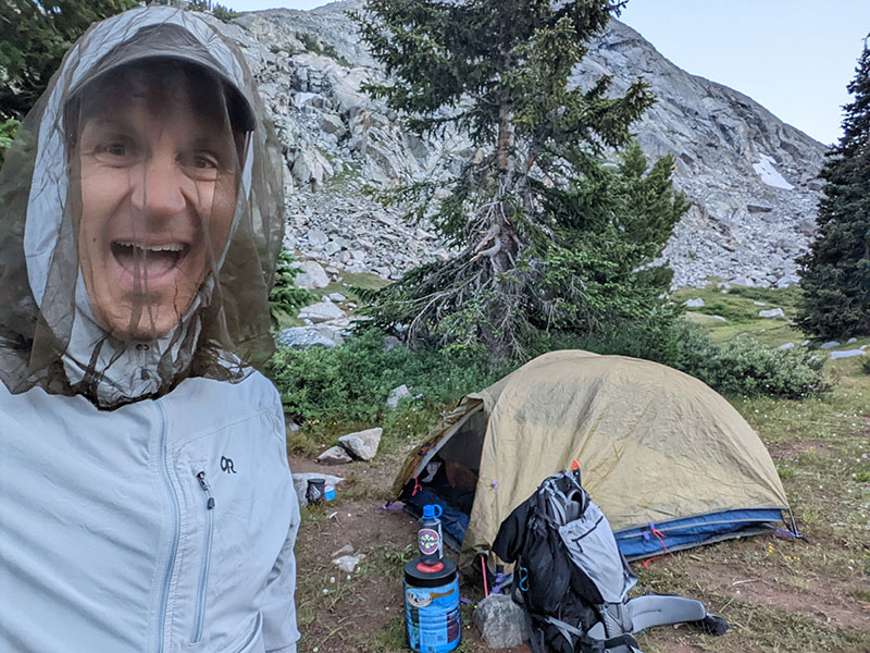
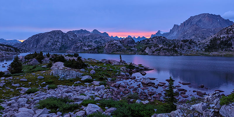
…but the sunset was worth it.

DAY 2 – Rest, Relax and Retire Early

We woke up to a beautiful morning on Day 2 (Friday, 7/29). No one was really expecting that after how much rain we got through the night.

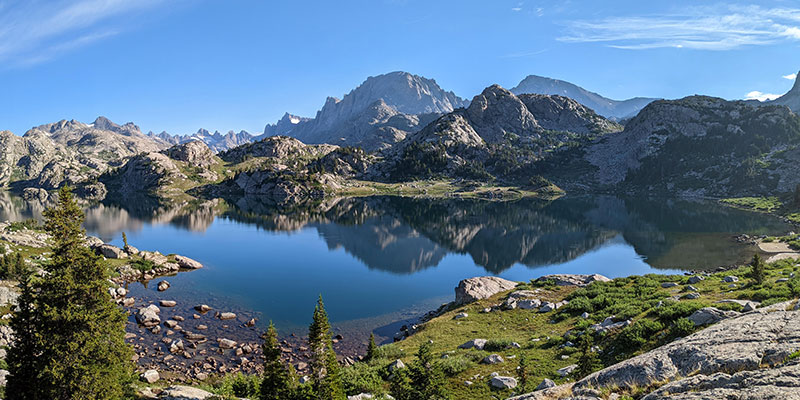
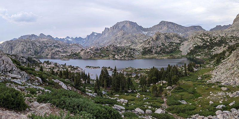
Today would be an easy day.  It involved a leisurely 5-mile walk into Titcomb Basin where we set up our second camp.

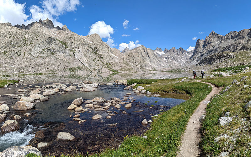
Here we would rest, relax and retire early for our Gannett summit bid that would start in the wee hours of the morning.

By late afternoon, the clouds had rolled in and it started to rain again… a pattern that looked a lot like the day before.  This made us a bit nervous with rumors about unfavorable forecast changes being reported by others in the area.

We discussed a few options and finally settled on getting up around midnight in order to be on the trail by 1am.  Our primary objective was to tag the top and be back down by 2:30p in order to minimize any chance of getting caught in a storm.

← Planning for Gannett
Summitting Gannett →

Leave a Reply Cancel reply

Your email address will not be published. Required fields are marked *

Couldn`t have asked for a better day to climb Mount Adams. The conditions today (6/4) were absolutely perfect!

These 6 miles were waaaay different from the last six I did in LA. This 6-mile climb to the summit packed in 6,700 feet of elevation and took 6 hours 45 minutes (one-way).

#mtadams #mountadams #pnw #mountaineering #legday

38 4
Open post by backcountryfever with ID 17988770517003932
Couldn't have asked for a better day to climb Mount Adams. The conditions today (6/4) were absolutely perfect!

These 6 miles were waaaay different from the last six I did in LA. This 6-mile climb to the summit packed in 6,700 feet of elevation and took 6 hours 45 minutes (one-way).

#mtadams #mountadams #pnw #mountaineering #legday

Spent the weekend in California for a wedding and managed to squeeze in a quick hike, L.A.-style.

After reaching Mount Lee behind the Hollywood Sign, I couldn`t resist tagging two other peaks along the Aileen Getty Ridge Trail: Cahuenga Peak, the highest point in Griffith Park, and Burbank Peak, home to the famous Wisdom Tree.

The hike came in at 6 miles with just 1,000 feet of elevation gain and took only 2 hours.

#hollywoodsign #cahuengapeak #burbankpeak #aileengettyridgetrail #hikela

17 0
Open post by backcountryfever with ID 17874758856610450
Spent the weekend in California for a wedding and managed to squeeze in a quick hike, L.A.-style.

After reaching Mount Lee behind the Hollywood Sign, I couldn't resist tagging two other peaks along the Aileen Getty Ridge Trail: Cahuenga Peak, the highest point in Griffith Park, and Burbank Peak, home to the famous Wisdom Tree.

The hike came in at 6 miles with just 1,000 feet of elevation gain and took only 2 hours.

#hollywoodsign #cahuengapeak #burbankpeak #aileengettyridgetrail #hikela

Still chasing snow! Took my brother-in-law on his first-ever mountaineering experience. We went up Temple Couloir, over to Deseret Peak, and then slid down West Twin Couloir. Hard to beat spring days like this.

This was my 6th summit of Deseret Peak.

#deseretpeak #templecouloir #twincouloirs #mountaineering #chasingsnow

45 4
Open post by backcountryfever with ID 17898155133454122
Still chasing snow! Took my brother-in-law on his first-ever mountaineering experience. We went up Temple Couloir, over to Deseret Peak, and then slid down West Twin Couloir.  Hard to beat spring days like this.

This was my 6th summit of Deseret Peak.

#deseretpeak #templecouloir #twincouloirs #mountaineering #chasingsnow

One of my favorite things to do between ski season and hiking season: kicking steps up a steep slope toward some snow-capped summit!

#mountaineering #kickingsteps #steepslope #snowcapped #summitday

32 4
Open post by backcountryfever with ID 17939009859229790
One of my favorite things to do between ski season and hiking season: kicking steps up a steep slope toward some snow-capped summit!

#mountaineering #kickingsteps #steepslope #snowcapped #summitday

Another moderate day of mountaineering up the north slope of Mt. Superior, known as Cardiac Bowl. I`ve only been to this peak once before, from the typical summer trail, so it was way fun to get there from this direction.

#mountsuperior #northslope #cardiacbowl #mountaineering #wasatch11ers

31 0
Open post by backcountryfever with ID 18131016616566455
Another moderate day of mountaineering up the north slope of Mt. Superior, known as Cardiac Bowl.  I've only been to this peak once before, from the typical summer trail, so it was way fun to get there from this direction.

#mountsuperior #northslope #cardiacbowl #mountaineering #wasatch11ers

With such good coverage and a big storm rolling in, I think Alta should stay open for at least another week!

#stillskiing #springskiing #skiutah #skiing #alta

14 0
Open post by backcountryfever with ID 18013199525845115
With such good coverage and a big storm rolling in, I think Alta should stay open for at least another week! 

#stillskiing #springskiing #skiutah #skiing #alta

It`s been a minute since I`ve had anything other than ski boots or hockey skates on my feet this winter. Gotta switch gears before the mountaineering season melts away here in Utah!

#mountaineering #kesslerpeak #westridge #wasatchfront #timetoclimb

📷 @wasatchwidescreen

23 0
Open post by backcountryfever with ID 18073878845639559
It's been a minute since I've had anything other than ski boots or hockey skates on my feet this winter.  Gotta switch gears before the mountaineering season melts away here in Utah!

#mountaineering #kesslerpeak #westridge #wasatchfront #timetoclimb

📷 @wasatchwidescreen

On this day last year—February 18—my team and I reached the summit of Aconcagua, the tallest peak in Argentina and the highest mountain in the Western Hemisphere at 22,837 feet.

I’ve enjoyed looking back on that expedition by rereading my day-by-day trip report from our climb.

👉 Link in bio: an 18-part guide covering the entire climb, plus pre-trip planning tips and post-expedition things to see and do around Mendoza.

Whether this is your first high-altitude objective or you’re adding Aconcagua to your mountaineering résumé, the guide will help you see why I chose the 360° Traverse, how to plan for your expedition, and what to expect each day on the mountain.

#aconcagua #aconcagua360 #aconcaguaexpedition #highaltitudemountaineering #mountaineering

34 2
Open post by backcountryfever with ID 18055701743428917
On this day last year—February 18—my team and I reached the summit of Aconcagua, the tallest peak in Argentina and the highest mountain in the Western Hemisphere at 22,837 feet.

I’ve enjoyed looking back on that expedition by rereading my day-by-day trip report from our climb.

👉 Link in bio: an 18-part guide covering the entire climb, plus pre-trip planning tips and post-expedition things to see and do around Mendoza.

Whether this is your first high-altitude objective or you’re adding Aconcagua to your mountaineering résumé, the guide will help you see why I chose the 360° Traverse, how to plan for your expedition, and what to expect each day on the mountain.

#aconcagua #aconcagua360 #aconcaguaexpedition #highaltitudemountaineering #mountaineering

Winter is my favorite season, and cold weather camping is one of my favorite winter activities.

#coldweathercamping #wintercamping #tenting #lovewinter #lovecamping

19 0
Open post by backcountryfever with ID 18088708565160118
Winter is my favorite season, and cold weather camping is one of my favorite winter activities.

#coldweathercamping #wintercamping #tenting #lovewinter #lovecamping
Follow on Instagram

Recent Posts

  • The Interview That Made Me Reconsider Hydrogen Water
  • After a Year with the COROS Vertix 2S
  • 5 Million Vertical Feet Gained Over 5 Years
  • 2025 Year in Review
  • From Waikīkī to Makapuʻu: A Casual Tour of Honolulu Stops

Recent Comments

  • Backcountry Fever on Solo Summit of Shasta
  • Michelle Tirhi on Solo Summit of Shasta
  • Matt on How I Would Do Kings Peak in 1 Day
  • Rich Meziere on Bummed Out By A Broken BOA Binding
  • Backcountry Fever on Bummed Out By A Broken BOA Binding

RECOMMENDED READING

Categories

  • 14ers
  • Adventure Plans
  • Avalanche Awareness
  • Backpacking
  • Epic Treks
  • Grand Canyon
  • Health & Wellness
  • International Expeditions
  • Mountaineering
  • Pacific Northwest
  • Peak Bagging
  • Product Feedback
  • Reading References
  • Road Trip
  • Scrambling
  • Season Summary
  • Seven Summits
  • Six-Pack Challenge
  • Snowshoeing
  • Social Media
  • State Highpoints
  • Technology
  • Uinta Mountains
  • Uncategorized
  • Uphill Training
  • Wasatch Front
  • Zion
©2026 Backcountry Fever