Skip to content
Menu
Backcountry Fever
  • Projects
    • Adirondack 46ers
    • Colorado 14ers
    • Seven Summits
      • Climb Aconcagua via the 360° Traverse | Full Guide
    • Wasatch 7
    • Wasatch 11ers
  • Highpoints
  • Experience
  • My Never-Ending List
  • Contact
Backcountry Fever
← Cold Fusion Couloir to North Timpanogos
Denied Mt. Sunflower →

White Baldy from the Kirkham Route

Posted on May 29, 2021December 15, 2025 by Backcountry Fever

Still pretty new to mountaineering, I jumped all over an opportunity to get more crampon experience from a Spring ascent of White Baldy.  This invite also allowed me to knock off another Wasatch 11er, so I was super stoked to do this!  Our adventure started from the Silver Lake Trailhead above Tibble Fork.

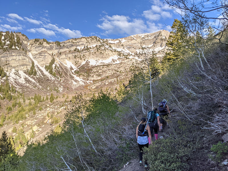
The first 2 miles of this route follows the typical trail up from Silver Lake Flat to Silver Lake.  Easy.

silver fork trail

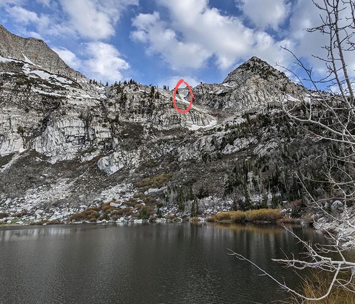
At the time, I was not aware that the route we would take was visible from the banks of Silver Lake.  I later learned this route is known as the “Kirkham Route,” named after Kelly Kirkham, whom I’d just met earlier this month while climbing North Timp from Cold Fusion.

kirkham route

Another half mile up towards Silver Lake Glance is where we hung a left to catch Kirkham’s route.

traverse

It’s pretty clear to see the first “ramp” that continues up this route in the direction of our destination.

up kellys ramp

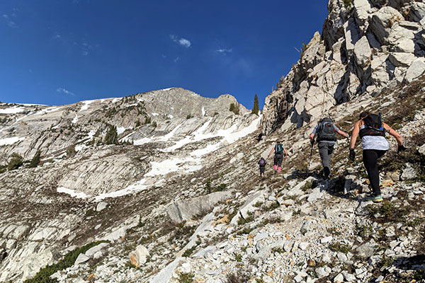
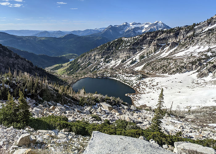
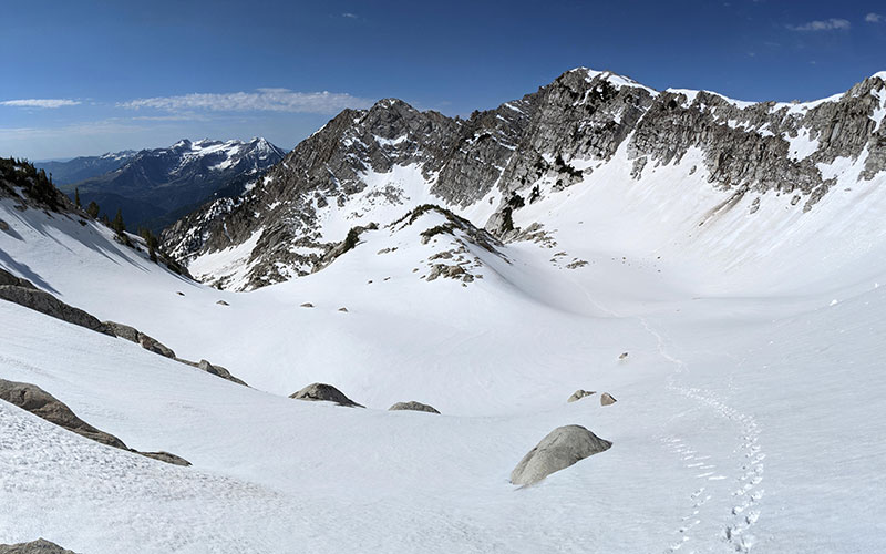
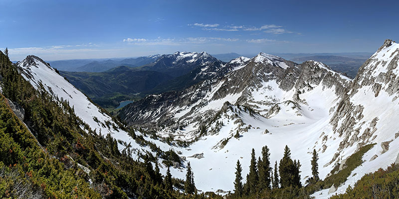
Looking back at where we came from, we are now well above Silver Lake.

above silver lake

Up Kelly’s Ramp

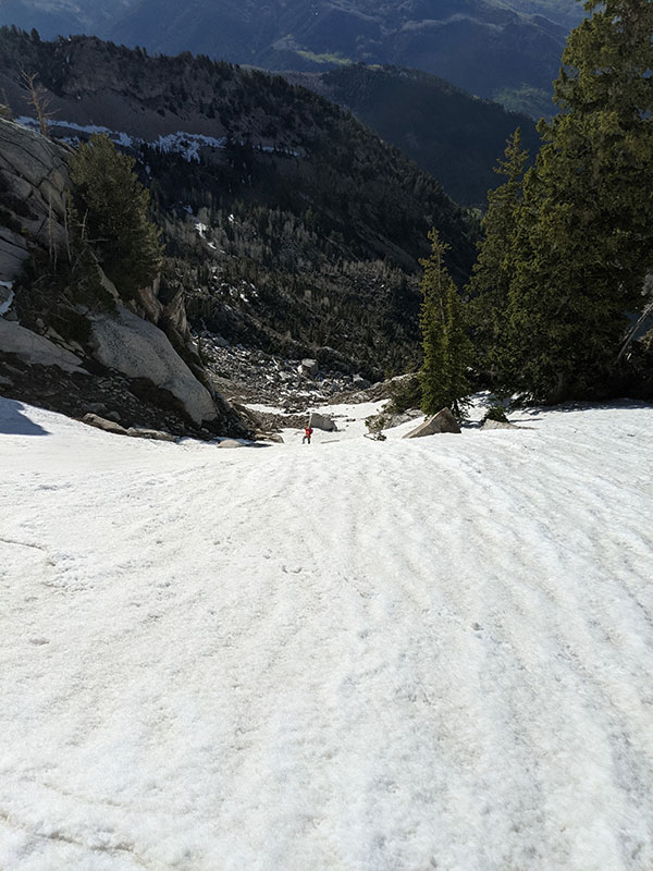
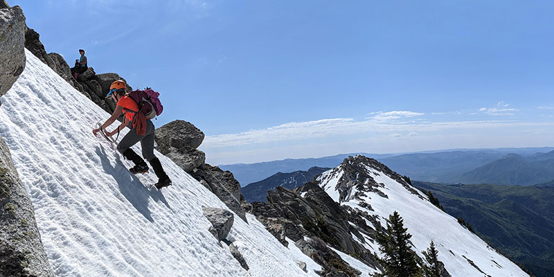
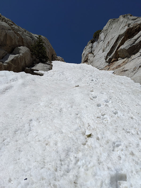
Here is where we donned our crampons and pulled out the ice axe.  Still pretty easy.

up ramp

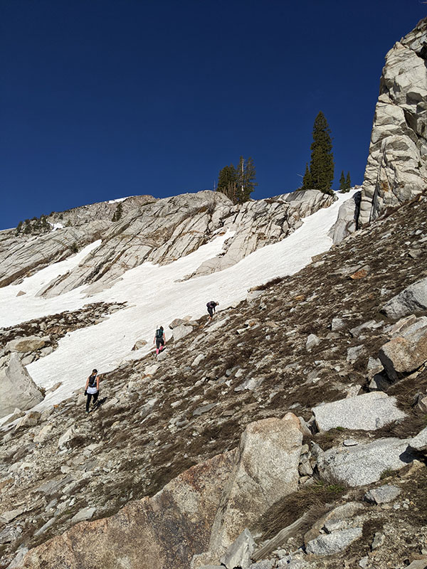
At the top of this short ramp, there are two ways to continue from here.  We stayed to the left.

at top of ramp

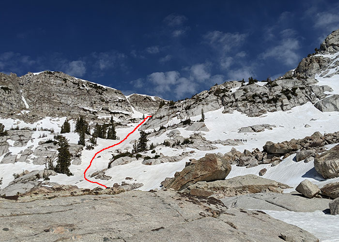
This picture was taken next to that Christmas tree at the top of the red line shown above.

group shot

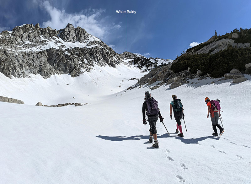
As you round the corner after the Christmas tree, the first sight of today’s objective comes into view.

first view

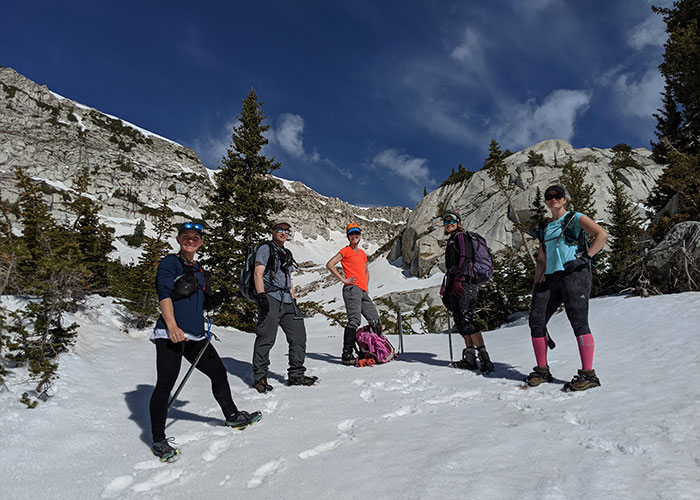
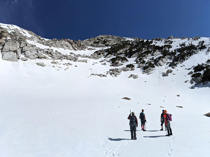
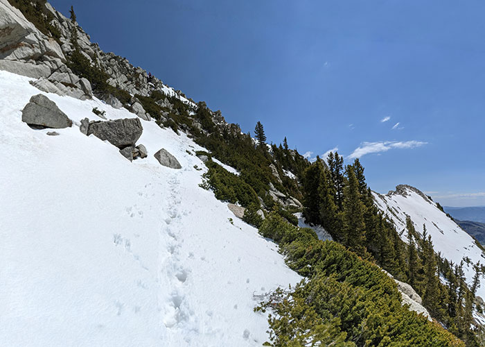
I love being the first and only tracks into an area.

looking back

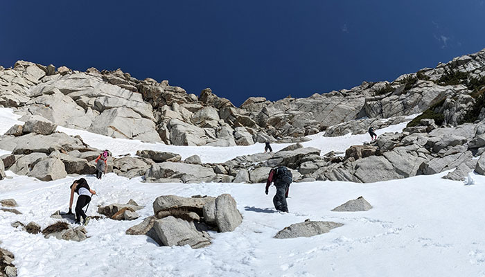
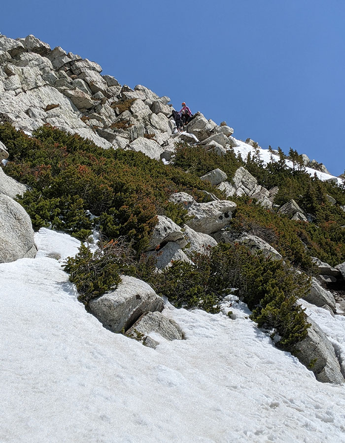
The final stretch to the summit ridge was the only sketchy part.  As a new mountaineer, this was definitely taking baby steps… which is how I believe it should be.

final stretch

That last section was steep and icy in places but still relatively comfortable (for me anyway).

steep stretch

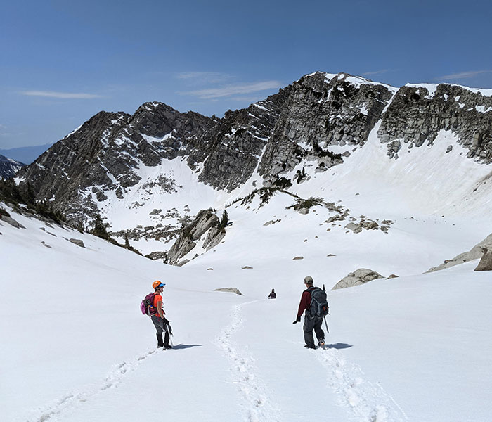
Views on the way up were awesome!

awesome view

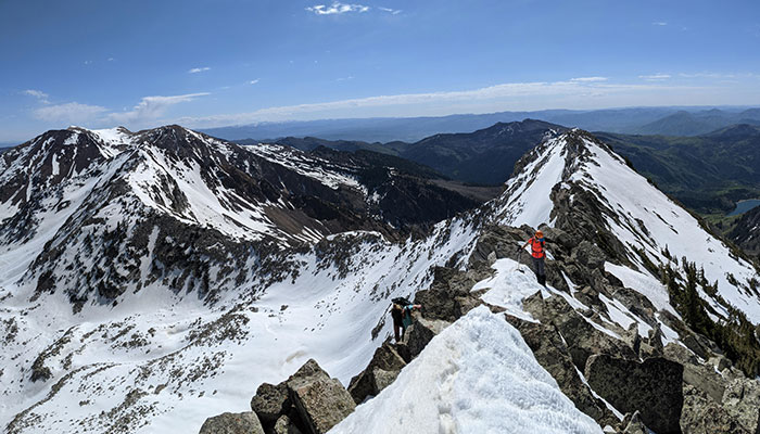
My favorite part was the last push to the summit ridge.

best part

It’s just a short traverse along the ridgeline to the summit from there.

ridgeline

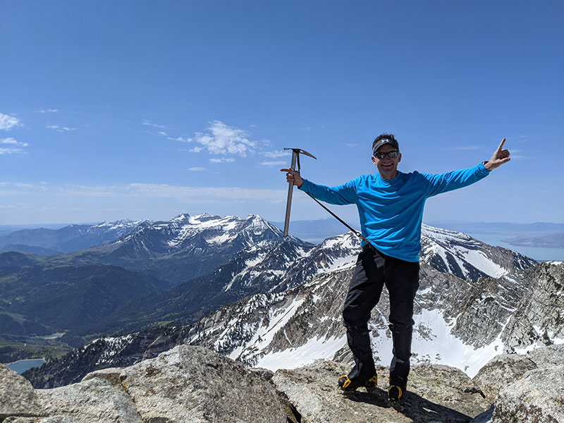
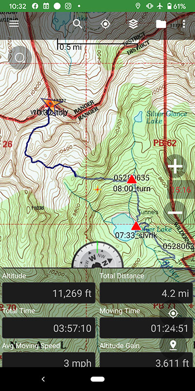
4.2 miles up in 4 hours with 3,600′ of elevation gain.  Lovin’ every minute of it! (name that band)

summit shot

Down and Out

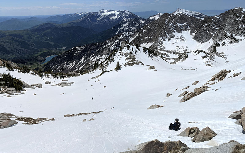
Getting down was a tad tricky.

tricky down

We traversed over a bit to avoid the steeper section we had climbed up.

steep traverse

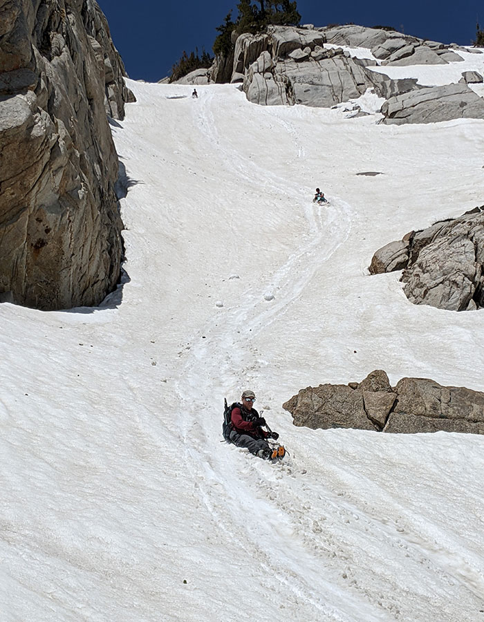
Smooth glissading took place on the lower portion of that slope.

glissading

Such a perfect day for this!

perfect day

More glissading fun for our descent…

more glissading

I found a different ramp on my way down.  It’s just a click south of the one we had taken up.

different ramp down

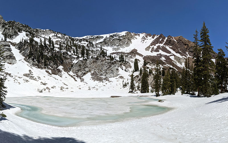
No one wanted this beautiful day to end just yet, so we did a quick detour over to Silver Lake Glance.

silver lake glance

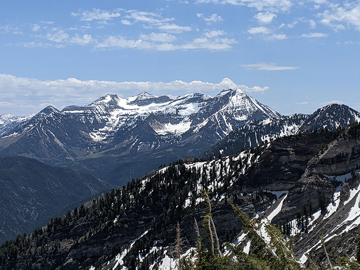
Looking back at Timpanogos, taking note of the route we took up Cold Fusion only a few weeks earlier.

timp view

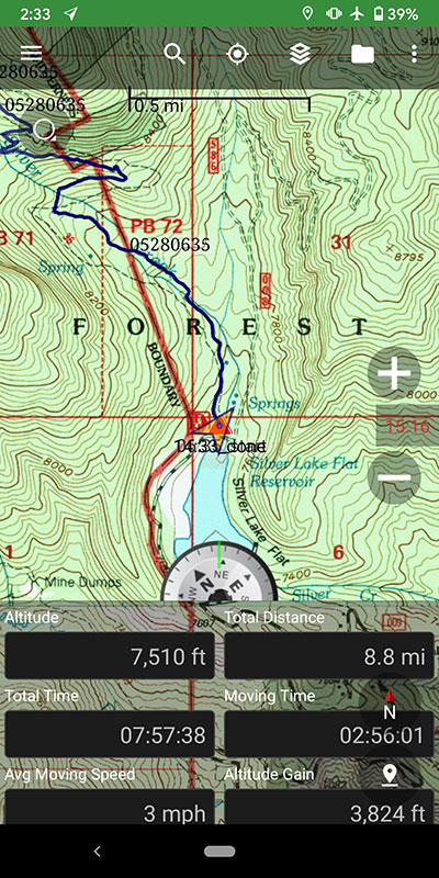
Final stats for the day: 8.8 miles, 3,800 feet, 8 hours.

← Cold Fusion Couloir to North Timpanogos
Denied Mt. Sunflower →

Leave a Reply Cancel reply

Your email address will not be published. Required fields are marked *

My first time up Mt. Ogden unintentionally turned into a full-on-loop-de-doo: up Beus, down Malan`s.

Beus Canyon was pretty boring above treeline, so I decided not to head back the way I came. After tagging the summit, I figured Malan`s would be way more interesting — and it sure was!

Malan`s Basin is surprisingly sketch up high, through a steep and narrow gully, then hard to follow in the middle where an already faint trail disappeared under leaves. I lost the trail a few times and had to backtrack a bit to find my way.

Finally, the Bonneville Shoreline Trail came in clutch once again, making this a nice long loop-de-doo.

Mt. Ogden Loop-de-doo mileage breakdown 👇
- Beus Canyon trailhead to summit, 6 miles
- Mt. Ogden to Malan`s Peak, 3 miles
- Malan`s Peak to Bonneville Shoreline Trail, 3 miles
- BST across and back to Beus trailhead, 3 miles

For a total of 15 miles and 5,300 feet of elevation gain.

#mtogden #mountogden #ogdenpeak #beuscanyon #beuscanyontrail #malansbasin #malanspeak #bonnevilleshorelinetrail #bonnevilleshoreline #bst #loophike #loopdedoo #wasatchfront #hikeogden #fallhike #fallhikingfallhiking

22 0
Open post by backcountryfever with ID 17906240730272550
My first time up Mt. Ogden unintentionally turned into a full-on-loop-de-doo: up Beus, down Malan's. 

Beus Canyon was pretty boring above treeline, so I decided not to head back the way I came. After tagging the summit, I figured Malan's would be way more interesting — and it sure was!

Malan's Basin is surprisingly sketch up high, through a steep and narrow gully, then hard to follow in the middle where an already faint trail disappeared under leaves.  I lost the trail a few times and had to backtrack a bit to find my way.

Finally, the Bonneville Shoreline Trail came in clutch once again, making this a nice long loop-de-doo.

Mt. Ogden Loop-de-doo mileage breakdown 👇
- Beus Canyon trailhead to summit, 6 miles
- Mt. Ogden to Malan's Peak, 3 miles
- Malan's Peak to Bonneville Shoreline Trail, 3 miles
- BST across and back to Beus trailhead, 3 miles

For a total of 15 miles and 5,300 feet of elevation gain.

#mtogden #mountogden #ogdenpeak #beuscanyon #beuscanyontrail #malansbasin #malanspeak #bonnevilleshorelinetrail #bonnevilleshoreline #bst #loophike #loopdedoo #wasatchfront #hikeogden #fallhike #fallhikingfallhiking

Awesome views from the top of Y Mountain. Looking north into Rock Canyon, where I started, and across towards the old Squaw Peak, Cascade Mountain, and Mount Timpanogos further off in the distance.

Pretty fun loop hike 👇

- Up 1.8 miles from the Rock Canyon trailhead
- Up 1.8 miles on First Right Fork to Slide Canyon
- Down Slide Canyon Trail .5 miles to Y Mountain Trail
- Up 1 mile to Y Mountain West Peak
- Down .25 and over .25 miles to Y Mountain East Peak
- Down 1 mile back to Slide Canyon Trail
- Down 1.5 miles to Y Trail (top of the BYU Y)
- Down 1 mile to the Y Trail trailhead
- Across 1.75 miles on the Bonneville Shoreline Trail

For a total of 10.75 miles with 4,137 feet of elevation gain.

#ymountain #rockcanyon #rockcanyontrail #firstrightfork #slidecanyon #ytrail #ytrailhead #bst #bonnevilleshorelinetrail #bonnevilleshoreline #connector #loophike #wasatchfront #hikethewasatch #wasatchmountains #wasatch #hike #hikemore

31 1
Open post by backcountryfever with ID 17900152413305912
Awesome views from the top of Y Mountain.  Looking north into Rock Canyon, where I started, and across towards the old Squaw Peak, Cascade Mountain, and Mount Timpanogos further off in the distance. 

Pretty fun loop hike 👇

- Up 1.8 miles from the Rock Canyon trailhead
- Up 1.8 miles on First Right Fork to Slide Canyon
- Down Slide Canyon Trail .5 miles to Y Mountain Trail
- Up 1 mile to Y Mountain West Peak 
- Down .25 and over .25 miles to Y Mountain East Peak
- Down 1 mile back to Slide Canyon Trail
- Down 1.5 miles to Y Trail (top of the BYU Y)
- Down 1 mile to the Y Trail trailhead
- Across 1.75 miles on the Bonneville Shoreline Trail

For a total of 10.75 miles with 4,137 feet of elevation gain.

#ymountain #rockcanyon #rockcanyontrail #firstrightfork #slidecanyon #ytrail #ytrailhead #bst #bonnevilleshorelinetrail #bonnevilleshoreline #connector #loophike #wasatchfront #hikethewasatch #wasatchmountains #wasatch #hike #hikemore

As the seasons change, each quiet mile through these trees feels like an invitation to let go of what was and move toward all that`s yet to come...

#seasonschange #lettinggo #movingon #pressingforward #lookingahead #newbeginnings #natureishealing #healingenergy #goodvibes #autumnvibes #autumnmountains #hiking #hikerlife #mountainlife #mountains

25 0
Open post by backcountryfever with ID 17902202193279047
As the seasons change, each quiet mile through these trees feels like an invitation to let go of what was and move toward all that's yet to come...

#seasonschange #lettinggo #movingon #pressingforward #lookingahead #newbeginnings #natureishealing #healingenergy #goodvibes #autumnvibes #autumnmountains #hiking #hikerlife #mountainlife #mountains

Fall colors are fading fast, losing the battle with winter.

#fallcolors #fadingfast #autumn #hikingtrails #hiking #hike #hiker #getreadyforwinter

14 0
Open post by backcountryfever with ID 17913756879229216
Fall colors are fading fast, losing the battle with winter.

#fallcolors #fadingfast #autumn #hikingtrails #hiking #hike #hiker #getreadyforwinter

I had high hopes of doing some hiking during a recent trip to O`ahu.  Unfortunately, a lower leg injury from a Summer Hockey League playoff game last month left me hobbling around just enough to make the trip, but not much else.  

This is what I was hoping to explore while spending 10 days on O`ahu for the first time.  I also knew I wouldn`t get to all of them in one trip — especially with other things we wanted to do — so here they are in order of priority:

- Backway for the Stairway to Heaven (Haiku Stairs)
- Three Peaks (Mt. Olomana)
- Reverse Olomana Trail
- Makapu`u Lighthouse Trail
- Koko Crater Stairs
- Koko Crater Rim Trail
- Diamond Head Crater Trail
- Old Pali Highway
- Mt. Ka`ala (tallest peak on O`ahu)
- Pūpūkea to La`ie
 
Maybe next time...

#hikehawaii #hawaiihiking #oahu #stairwaytoheaven #haikustairs #threepeaks #olomana #kokocrater #rimtrail #oldpalihighway #mtkaala #lowerleginjury #musclestrain #tibialisanterior #hockey

24 4
Open post by backcountryfever with ID 18403849120137976
I had high hopes of doing some hiking during a recent trip to O'ahu.  Unfortunately, a lower leg injury from a Summer Hockey League playoff game last month left me hobbling around just enough to make the trip, but not much else.   

This is what I was hoping to explore while spending 10 days on O'ahu for the first time.  I also knew I wouldn't get to all of them in one trip — especially with other things we wanted to do — so here they are in order of priority:

- Backway for the Stairway to Heaven (Haiku Stairs)
- Three Peaks (Mt. Olomana)
- Reverse Olomana Trail
- Makapu'u Lighthouse Trail
- Koko Crater Stairs
- Koko Crater Rim Trail
- Diamond Head Crater Trail
- Old Pali Highway
- Mt. Ka'ala (tallest peak on O'ahu)
- Pūpūkea to La'ie
 
Maybe next time...

#hikehawaii #hawaiihiking #oahu #stairwaytoheaven #haikustairs #threepeaks #olomana #kokocrater #rimtrail #oldpalihighway #mtkaala #lowerleginjury #musclestrain #tibialisanterior #hockey

Six months ago today, I stood on top of the tallest peak in the Americas — Aconcagua, Argentina — and it has taken me that long to finish a series of posts about my epic adventure!

This day-by-day trip report is packed with photos, route descriptions, and insights from my own experience.  You’ll find everything from what to pack, to what the camps are really like, to why I think the 360° Traverse is the ideal choice.

👉 Lnk in bio!

Whether it’s your first high-altitude climb or you’re adding Aconcagua to your mountaineering resume, the 360° Traverse offers one of the most satisfying ways to stand on the highest point in South America.

#aconcagua #climbaconcagua #aconcagua360 #360traverse #highpoint #highpointing #highestpoint #tallestpeak #andes #andesmountains #argentina #sevensummits #7summits #highaltitude #6961 #trekking #mountaineering #inka #inkaexpediciones #expedition #adventure #adventuretime #adventuretravel #adventures #climbhigh #climbhigher #peakbagging #peakbagger

40 4
Open post by backcountryfever with ID 18058499771589212
Six months ago today, I stood on top of the tallest peak in the Americas — Aconcagua, Argentina — and it has taken me that long to finish a series of posts about my epic adventure!

This day-by-day trip report is packed with photos, route descriptions, and insights from my own experience.  You’ll find everything from what to pack, to what the camps are really like, to why I think the 360° Traverse is the ideal choice.

👉 Lnk in bio!

Whether it’s your first high-altitude climb or you’re adding Aconcagua to your mountaineering resume, the 360° Traverse offers one of the most satisfying ways to stand on the highest point in South America.

#aconcagua #climbaconcagua #aconcagua360 #360traverse #highpoint #highpointing #highestpoint #tallestpeak #andes #andesmountains #argentina #sevensummits #7summits  #highaltitude #6961 #trekking #mountaineering #inka #inkaexpediciones #expedition #adventure #adventuretime #adventuretravel #adventures #climbhigh #climbhigher #peakbagging #peakbagger

My 13th time on this summit, but 1st to enjoy some watermelon at the top 🍉 Thanks to Jocelyn, the "Watermelon Girl", who lugged that all the way up and was gracious enough to share it 😁

#mounttimpanogos #mttimpanogos #mounttimp #timpanogos #timp #11er #goatchallenge #hikethewasatch #summitshot #peakbagger #summervibes #watermelon #watermelongirl #goodvibrations

39 3
Open post by backcountryfever with ID 18494366443068269
My 13th time on this summit, but 1st to enjoy some watermelon at the top 🍉 Thanks to Jocelyn, the "Watermelon Girl", who lugged that all the way up and was gracious enough to share it 😁

#mounttimpanogos #mttimpanogos #mounttimp #timpanogos #timp #11er #goatchallenge #hikethewasatch #summitshot #peakbagger #summervibes #watermelon #watermelongirl #goodvibrations

Summit Shack in Sight!

#mounttimpanogos #mttimpanogos #mttimp #timp #wasatchfront #wasatchmountains #11er #summitshack #mountainlife #hikemore #hikerlife

27 0
Open post by backcountryfever with ID 18350512492156368
Summit Shack in Sight!

#mounttimpanogos #mttimpanogos #mttimp #timp #wasatchfront #wasatchmountains #11er #summitshack #mountainlife #hikemore #hikerlife

Veered right a bit of the South saddle (red line) for a more adventurous route up to Timp... but once we got up on the ridge, we saw we could have done an even more interesting way (yellow line) cutting into that cliff band and zigzagging along the shelves as seen in the 4th picture (taken from South Timp).

#mounttimpanogos #mttimpanogos #mttimp #timp #timpanogos #mountaineering

37 1
Open post by backcountryfever with ID 18083925961775519
Veered right a bit of the South saddle (red line) for a more adventurous route up to Timp... but once we got up on the ridge, we saw we could have done an even more interesting way (yellow line) cutting into that cliff band and zigzagging along the shelves as seen in the 4th picture (taken from South Timp).

#mounttimpanogos #mttimpanogos #mttimp #timp #timpanogos #mountaineering
Follow on Instagram

Recent Posts

  • From Waikīkī to Makapuʻu: A Casual Tour of Honolulu Stops
  • High Hopes for Hiking Hawaii — Hobbled by Hockey
  • It’s Mountaineering Season in Utah!
  • Echo Flask Hydrogen Water: Next Level Hydration?
  • Bagging Bierstadt from the Winter Route

Recent Comments

  • Matt on How I Would Do Kings Peak in 1 Day
  • Rich Meziere on Bummed Out By A Broken BOA Binding
  • Backcountry Fever on Bummed Out By A Broken BOA Binding
  • Alex Cook on Bummed Out By A Broken BOA Binding
  • Rick Mandahl on Cold Fusion Couloir to North Timpanogos

RECOMMENDED READING

Categories

  • 14ers
  • Adventure Plans
  • Avalanche Awareness
  • Backpacking
  • Epic Treks
  • Grand Canyon
  • Health & Wellness
  • International Expeditions
  • Mountaineering
  • Pacific Northwest
  • Peak Bagging
  • Product Feedback
  • Reading References
  • Road Trip
  • Scrambling
  • Season Summary
  • Seven Summits
  • Six-Pack Challenge
  • Snowshoeing
  • Social Media
  • State Highpoints
  • Technology
  • Uinta Mountains
  • Uncategorized
  • Uphill Training
  • Wasatch Front
  • Zion
©2025 Backcountry Fever