Skip to content
Menu
Backcountry Fever
  • Projects
    • Adirondack 46ers
    • Colorado 14ers
    • Seven Summits
      • Climb Aconcagua via the 360° Traverse | Full Guide
    • Wasatch 7
    • Wasatch 11ers
  • Highpoints
  • Experience
  • My Never-Ending List
  • Contact
Backcountry Fever
← Mount Whitney: The Approach to Iceberg Lake
The Highpoint Point in Ohio →

Mount Whitney: Summit via the Mountaineer’s Route

Posted on June 24, 2021January 7, 2026 by Backcountry Fever

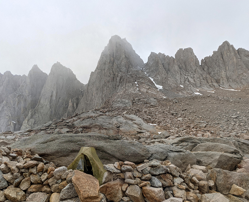
DAY 4: From Standstill to Summit Push

When we got up the next morning, the rain had stopped but the sky had turned gray and moody again.

moody morning

The real concern came from the only other group up there that day — three rock climbers planning to do the East Buttress.  Somehow, they’d gotten word from the ranger station that lightning had sparked a fire overnight and everyone was being ordered off the mountain.  We couldn’t believe it.

Confused, frustrated, and pretty disappointed, we reluctantly began packing up, knowing it would take hours to descend and unsure of what we’d be walking into.  Just then, the other group yelled over and said the rangers wanted us to stay put.  It was safer up here.  That made a lot more sense, given we were well above treeline.  Our next question was, for how long and what should we do while we wait?

Let’s go for it

By the time this all played out, nearly two hours later, the sky had gone blue and the sun was shining brightly.  That made the decision obvious: let’s go for it!  We noticed the other group thought the same.  Disappointment quickly turned to excitement as we realized no one else would be heading up today.

sudden sunshine

Oliver and I quickly reorganized our gear and started our push toward the summit at 9:30a.

ascent start

The sky was messing with us but we continued on.

gray sky again

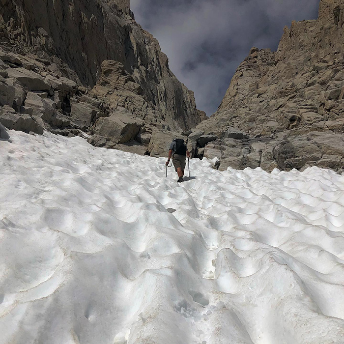
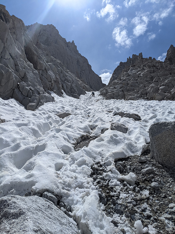
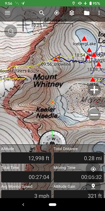
Thirty minutes later, we hit the snow line at 13,000 feet, a quarter mile up from camp.

snowline

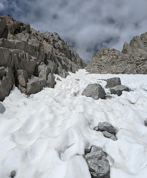
Both of us wished there was more snow in this couloir to give it that true mountaineering experience.

needed more snow

We could hear the climbers above and stayed alert for any falling rock.  They were aware of us too, and caught glimpses of each other now and then.  Before long, they moved ahead and removed the risk.
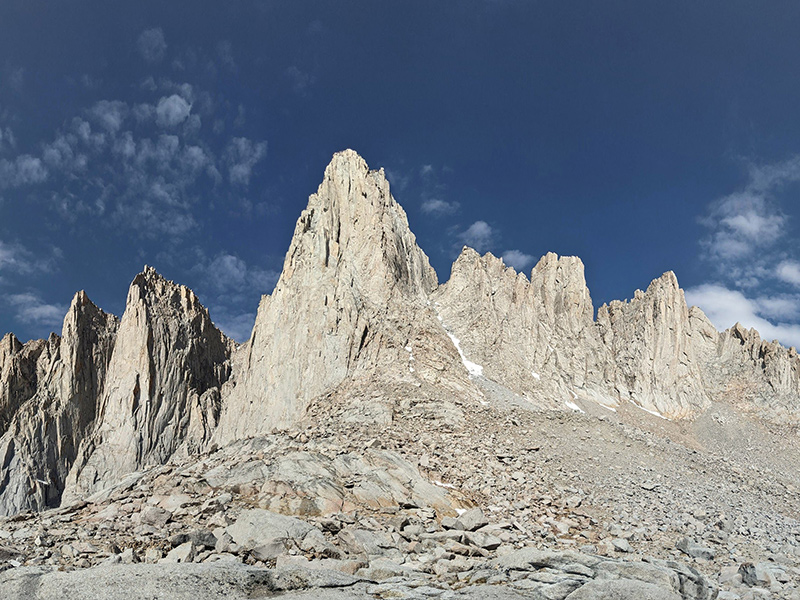
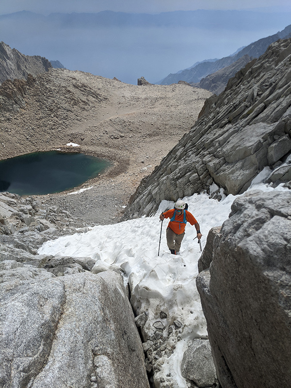
climbers above

The Notch

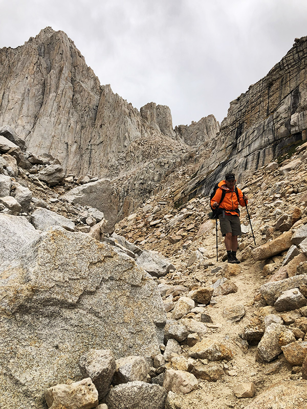
As we approached the Notch, it was obvious the lack of snow meant it wouldn’t be the crux today.

notch eastside

Looking back down the route, it was cool to be here, but definitely wanted it to be more adventurous.

notch looking back

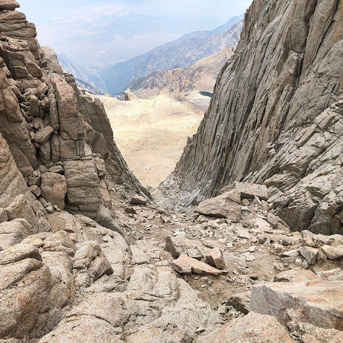
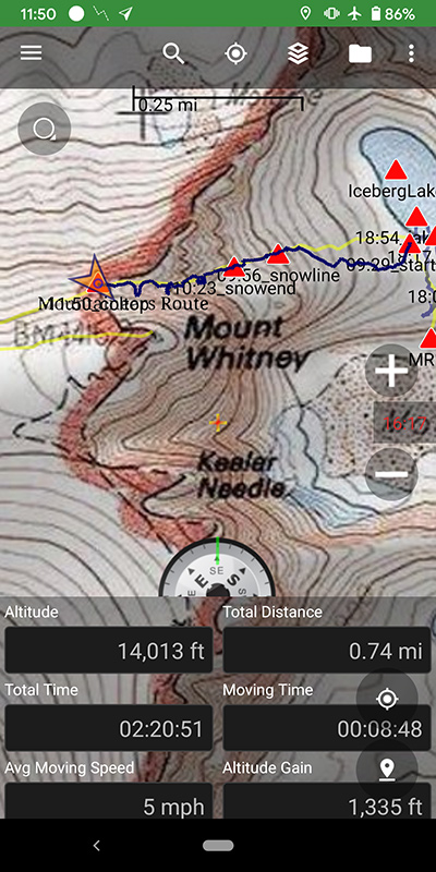
This Notch sits at 14,000 feet, 1,300 feet above our starting point and three-quarters of a mile away.

notch westside

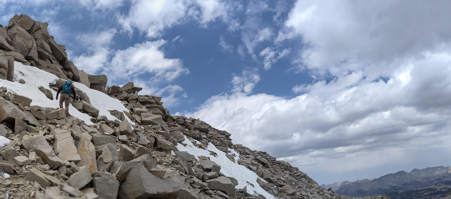
The only part that made me nervous was the traverse across some ice and loose rock immediately after.

traverse after the notch

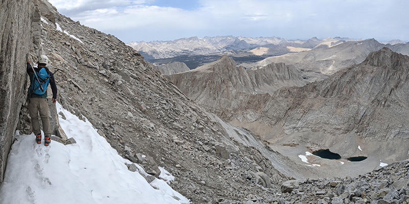
Here’s looking back at that short section.  In harsher conditions, this would definitely be a no-fall zone.
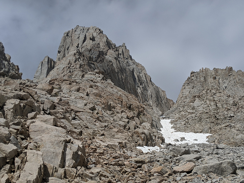
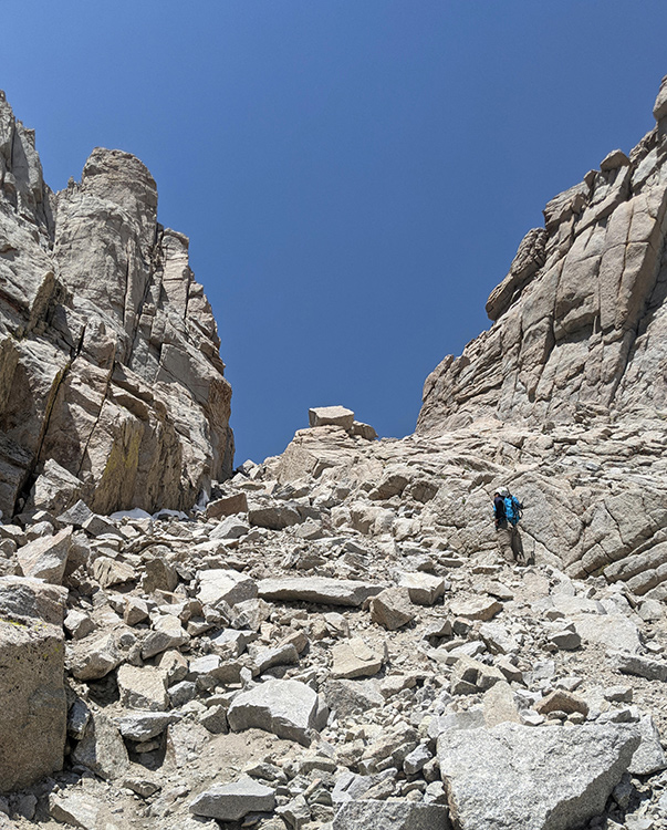
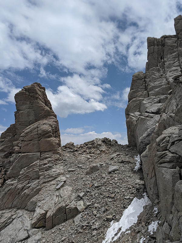
looking back at traverse

The Summit Push

The only thing left was to find the chute to the summit.  Since neither of us knew exactly what to look for, we kept heading west until it felt comfortable to turn uphill.

up to summit

Only after looking at a map later did we realize we were off by a little (the green line was the chute).

summit map overview

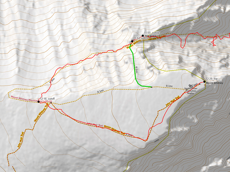
Oh well — we linked up with the John Muir Trail and walked straight to the summit.

muir trail to summit

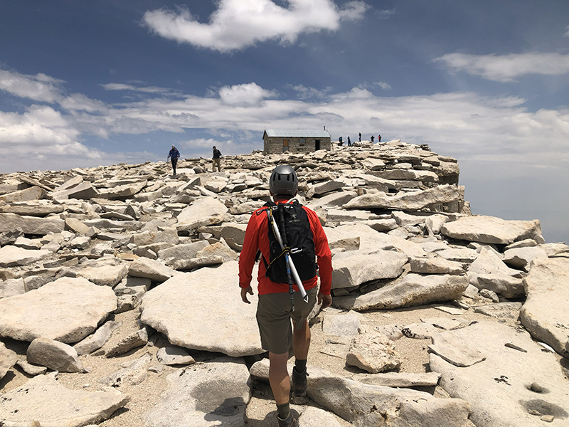
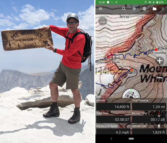
Three hours later, after climbing just over a mile and 1,800 feet, we stood atop the highest point in California as well as the lower 48, both for the second time.  Despite my GPS reading, we were at 14,5.

whitney summit pic

summit selfie

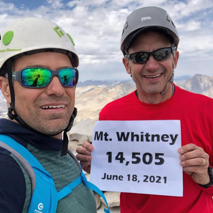
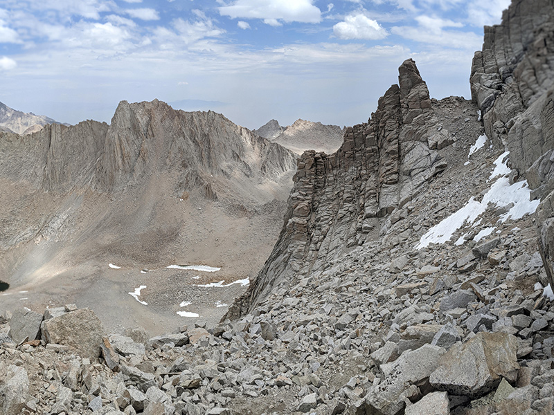
We snapped our summit pics and peered over the edge to our camp down below.

iceberg lake from summit

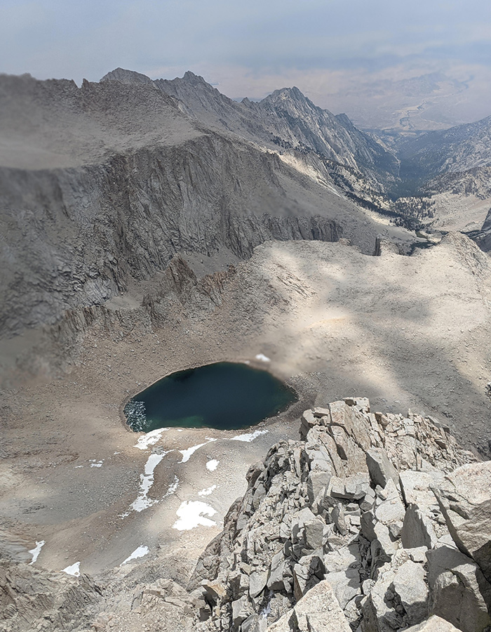
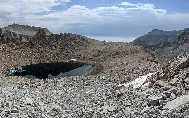
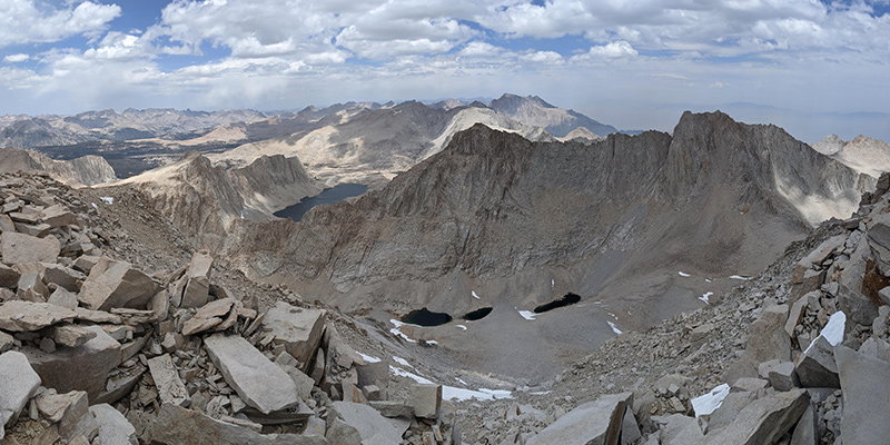
Pinnacle Ridge is still my favorite view from up here.  Last time we came up from the right (south) side of those lakes in the distance, but this time we followed the moraine up the left (north) side.

pinnacle ridge

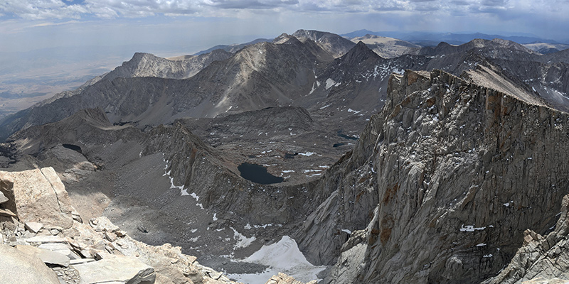
Views to the north towards Wales Lake were equally spectacular.

view towards wales lake

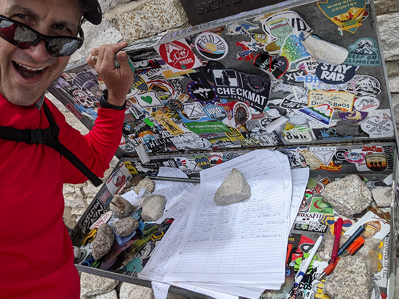
We signed the summit register and started making our way down.

whitney summit register

The Descent

The snow had softened up by then, and post-hole plunge-stepping was unavoidable.

post-holing down

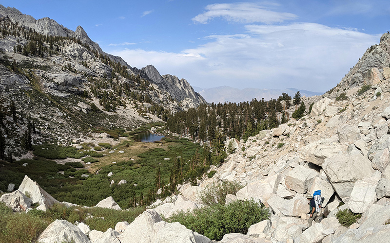
Back at Iceberg Lake, we broke camp and decided to pack out after noticing our neighbors had already left.  This picture is through the moraine below Pinnacle Ridge that I pointed out from the summit.

moraine below pinnacle ridge

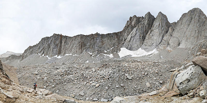
It’s hard to capture how impressive this section really is.

down through moraine looking back

down through moraine looking forward

Not knowing whether fire danger was still an issue, we kept our eyes open and assessed things as we went.  Worst-case scenario, we’d just set up camp again mid-mountain.

descent at mid-mountain

At least we had plenty of water if we ended up staying longer than expected.

natural water slide

Still no signs of danger at Lower Boy Scout Lake.

lower boy scout lake

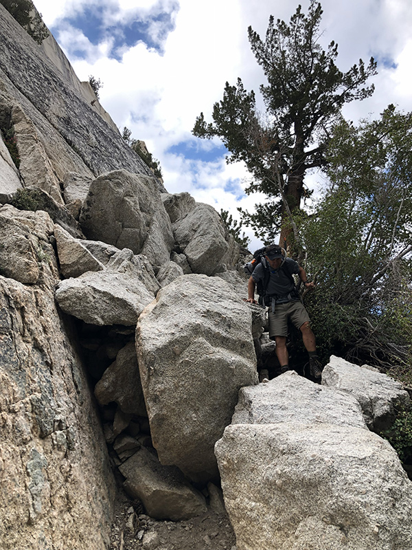
Nothing ablaze at as we approached Ebersbacher Ledges.

approaching ebersbacher ledges

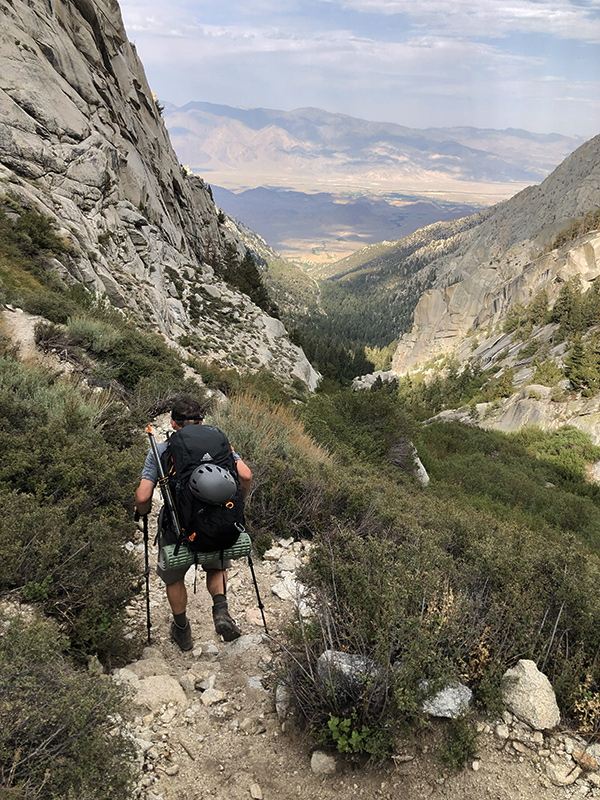
Down off the ledges and about to hit the home stretch.

down off ledges

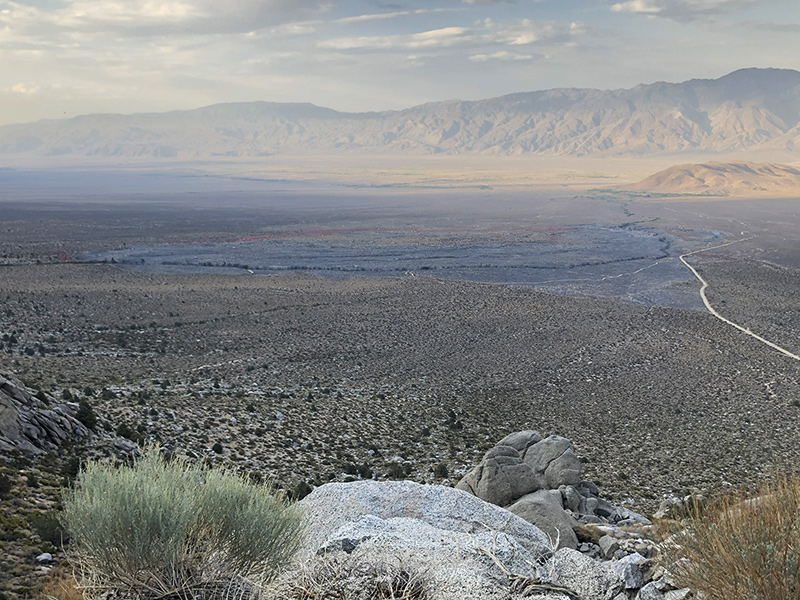
Back at the trailhead, several cars were still parked there, none showing any damage, including ours.  It wasn’t until we drove out that we saw where the fire had been.

whitney fire area

The Forest Service didn’t want anyone heading up the road with this sign flashing “WHITNEY CLOSED”.

road closed sign

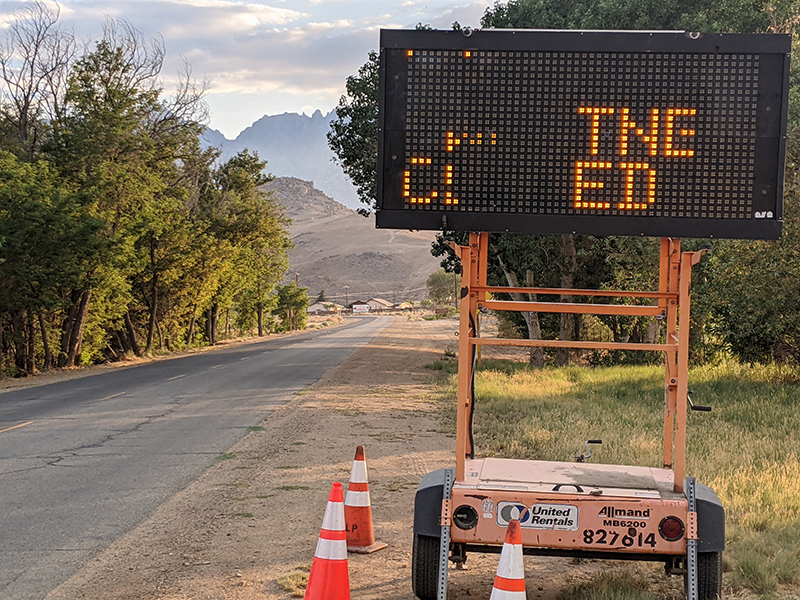
Not sure if anyone proceeded anyway.  Luckily, we missed this unfortunate closure by just one day.

Overall stats for the trip:

LEG DISTANCE (mi) ELEVATION GAIN (ft)
Trailhead to Iceberg Lake 5.18 4,520′
Iceberg Lake to summit 1.24 1,829′
Summit to Iceberg Lake 1.38 59′
Iceberg Lake to trailhead 4.26 127′
TOTAL 12.06 6,535′
← Mount Whitney: The Approach to Iceberg Lake
The Highpoint Point in Ohio →

Leave a Reply Cancel reply

Your email address will not be published. Required fields are marked *

Couldn`t have asked for a better day to climb Mount Adams. The conditions today (6/4) were absolutely perfect!

These 6 miles were waaaay different from the last six I did in LA. This 6-mile climb to the summit packed in 6,700 feet of elevation and took 6 hours 45 minutes (one-way).

#mtadams #mountadams #pnw #mountaineering #legday

40 4
Open post by backcountryfever with ID 17988770517003932
Couldn't have asked for a better day to climb Mount Adams. The conditions today (6/4) were absolutely perfect!

These 6 miles were waaaay different from the last six I did in LA. This 6-mile climb to the summit packed in 6,700 feet of elevation and took 6 hours 45 minutes (one-way).

#mtadams #mountadams #pnw #mountaineering #legday

Spent the weekend in California for a wedding and managed to squeeze in a quick hike, L.A.-style.

After reaching Mount Lee behind the Hollywood Sign, I couldn`t resist tagging two other peaks along the Aileen Getty Ridge Trail: Cahuenga Peak, the highest point in Griffith Park, and Burbank Peak, home to the famous Wisdom Tree.

The hike came in at 6 miles with just 1,000 feet of elevation gain and took only 2 hours.

#hollywoodsign #cahuengapeak #burbankpeak #aileengettyridgetrail #hikela

17 0
Open post by backcountryfever with ID 17874758856610450
Spent the weekend in California for a wedding and managed to squeeze in a quick hike, L.A.-style.

After reaching Mount Lee behind the Hollywood Sign, I couldn't resist tagging two other peaks along the Aileen Getty Ridge Trail: Cahuenga Peak, the highest point in Griffith Park, and Burbank Peak, home to the famous Wisdom Tree.

The hike came in at 6 miles with just 1,000 feet of elevation gain and took only 2 hours.

#hollywoodsign #cahuengapeak #burbankpeak #aileengettyridgetrail #hikela

Still chasing snow! Took my brother-in-law on his first-ever mountaineering experience. We went up Temple Couloir, over to Deseret Peak, and then slid down West Twin Couloir. Hard to beat spring days like this.

This was my 6th summit of Deseret Peak.

#deseretpeak #templecouloir #twincouloirs #mountaineering #chasingsnow

45 4
Open post by backcountryfever with ID 17898155133454122
Still chasing snow! Took my brother-in-law on his first-ever mountaineering experience. We went up Temple Couloir, over to Deseret Peak, and then slid down West Twin Couloir.  Hard to beat spring days like this.

This was my 6th summit of Deseret Peak.

#deseretpeak #templecouloir #twincouloirs #mountaineering #chasingsnow

One of my favorite things to do between ski season and hiking season: kicking steps up a steep slope toward some snow-capped summit!

#mountaineering #kickingsteps #steepslope #snowcapped #summitday

32 4
Open post by backcountryfever with ID 17939009859229790
One of my favorite things to do between ski season and hiking season: kicking steps up a steep slope toward some snow-capped summit!

#mountaineering #kickingsteps #steepslope #snowcapped #summitday

Another moderate day of mountaineering up the north slope of Mt. Superior, known as Cardiac Bowl. I`ve only been to this peak once before, from the typical summer trail, so it was way fun to get there from this direction.

#mountsuperior #northslope #cardiacbowl #mountaineering #wasatch11ers

31 0
Open post by backcountryfever with ID 18131016616566455
Another moderate day of mountaineering up the north slope of Mt. Superior, known as Cardiac Bowl.  I've only been to this peak once before, from the typical summer trail, so it was way fun to get there from this direction.

#mountsuperior #northslope #cardiacbowl #mountaineering #wasatch11ers

With such good coverage and a big storm rolling in, I think Alta should stay open for at least another week!

#stillskiing #springskiing #skiutah #skiing #alta

14 0
Open post by backcountryfever with ID 18013199525845115
With such good coverage and a big storm rolling in, I think Alta should stay open for at least another week! 

#stillskiing #springskiing #skiutah #skiing #alta

It`s been a minute since I`ve had anything other than ski boots or hockey skates on my feet this winter. Gotta switch gears before the mountaineering season melts away here in Utah!

#mountaineering #kesslerpeak #westridge #wasatchfront #timetoclimb

📷 @wasatchwidescreen

23 0
Open post by backcountryfever with ID 18073878845639559
It's been a minute since I've had anything other than ski boots or hockey skates on my feet this winter.  Gotta switch gears before the mountaineering season melts away here in Utah!

#mountaineering #kesslerpeak #westridge #wasatchfront #timetoclimb

📷 @wasatchwidescreen

On this day last year—February 18—my team and I reached the summit of Aconcagua, the tallest peak in Argentina and the highest mountain in the Western Hemisphere at 22,837 feet.

I’ve enjoyed looking back on that expedition by rereading my day-by-day trip report from our climb.

👉 Link in bio: an 18-part guide covering the entire climb, plus pre-trip planning tips and post-expedition things to see and do around Mendoza.

Whether this is your first high-altitude objective or you’re adding Aconcagua to your mountaineering résumé, the guide will help you see why I chose the 360° Traverse, how to plan for your expedition, and what to expect each day on the mountain.

#aconcagua #aconcagua360 #aconcaguaexpedition #highaltitudemountaineering #mountaineering

34 2
Open post by backcountryfever with ID 18055701743428917
On this day last year—February 18—my team and I reached the summit of Aconcagua, the tallest peak in Argentina and the highest mountain in the Western Hemisphere at 22,837 feet.

I’ve enjoyed looking back on that expedition by rereading my day-by-day trip report from our climb.

👉 Link in bio: an 18-part guide covering the entire climb, plus pre-trip planning tips and post-expedition things to see and do around Mendoza.

Whether this is your first high-altitude objective or you’re adding Aconcagua to your mountaineering résumé, the guide will help you see why I chose the 360° Traverse, how to plan for your expedition, and what to expect each day on the mountain.

#aconcagua #aconcagua360 #aconcaguaexpedition #highaltitudemountaineering #mountaineering

Winter is my favorite season, and cold weather camping is one of my favorite winter activities.

#coldweathercamping #wintercamping #tenting #lovewinter #lovecamping

19 0
Open post by backcountryfever with ID 18088708565160118
Winter is my favorite season, and cold weather camping is one of my favorite winter activities.

#coldweathercamping #wintercamping #tenting #lovewinter #lovecamping
Follow on Instagram

Recent Posts

  • The Interview That Made Me Reconsider Hydrogen Water
  • After a Year with the COROS Vertix 2S
  • 5 Million Vertical Feet Gained Over 5 Years
  • 2025 Year in Review
  • From Waikīkī to Makapuʻu: A Casual Tour of Honolulu Stops

Recent Comments

  • Backcountry Fever on Solo Summit of Shasta
  • Michelle Tirhi on Solo Summit of Shasta
  • Matt on How I Would Do Kings Peak in 1 Day
  • Rich Meziere on Bummed Out By A Broken BOA Binding
  • Backcountry Fever on Bummed Out By A Broken BOA Binding

RECOMMENDED READING

Categories

  • 14ers
  • Adventure Plans
  • Avalanche Awareness
  • Backpacking
  • Epic Treks
  • Grand Canyon
  • Health & Wellness
  • International Expeditions
  • Mountaineering
  • Pacific Northwest
  • Peak Bagging
  • Product Feedback
  • Reading References
  • Road Trip
  • Scrambling
  • Season Summary
  • Seven Summits
  • Six-Pack Challenge
  • Snowshoeing
  • Social Media
  • State Highpoints
  • Technology
  • Uinta Mountains
  • Uncategorized
  • Uphill Training
  • Wasatch Front
  • Zion
©2026 Backcountry Fever