Skip to content
Menu
Backcountry Fever
  • Projects
    • Adirondack 46ers
    • Colorado 14ers
    • Seven Summits
      • Climb Aconcagua via the 360° Traverse | Full Guide
    • Wasatch 7
    • Wasatch 11ers
  • Highpoints
  • Experience
  • My Never-Ending List
  • Contact
Backcountry Fever
← The Stars Aligned for Rainier
Mahalo Mauna Kea →

Walking the Planks of Rainier

Posted on August 9, 2023August 20, 2024 by Backcountry Fever

Trying to get any sleep the night before a big summit day is always a challenge.  Am I ready for this?  Did I bring the right boots?  Should I have brought that jacket instead of this one?  It turns out to be a long restless night of going through all the “what ifs” since a lot of decisions are made at home, anticipating the conditions, long before you arrive at the trailhead.

DAY 4 – Summit Day+

We started shortly after 2am with a mixture of stars and headlamps of those on the trail ahead of us.

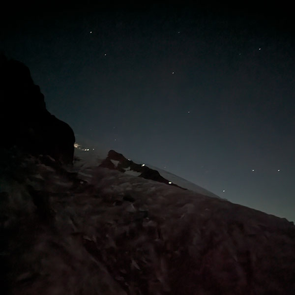
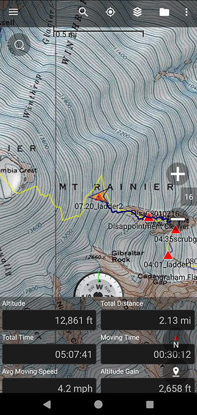
The first half-mile from Camp Muir crosses the Cowlitz Glacier to Cathedral Gap.  Here we removed our crampons to climb up and over Cathedral Clever.  Maybe we shouldn’t have wasted that time taking them off because, as soon as we got to the other side of this gap, the crampons were back for the crossing of Ingraham Glacier.  High camp sits here on Ingraham Flats.  Unfortunately, we really couldn’t see anything at this time of the morning.

Kick Up This Adventure

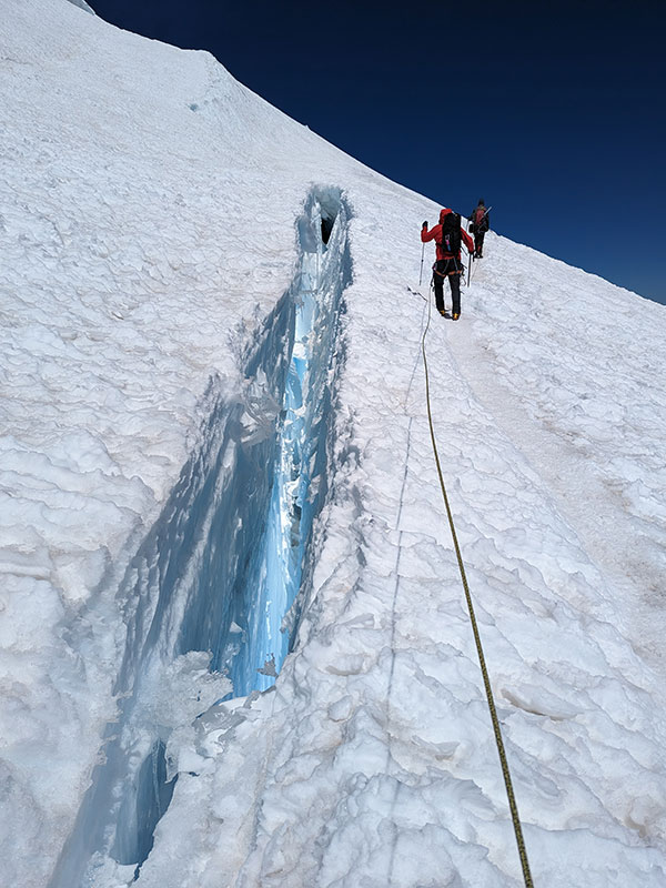
At 4am, we were only a mile in when we came upon our first crevasse!  It was a pretty short span, and not much depth could be seen in the dark, but it definitely kicked up this adventure.

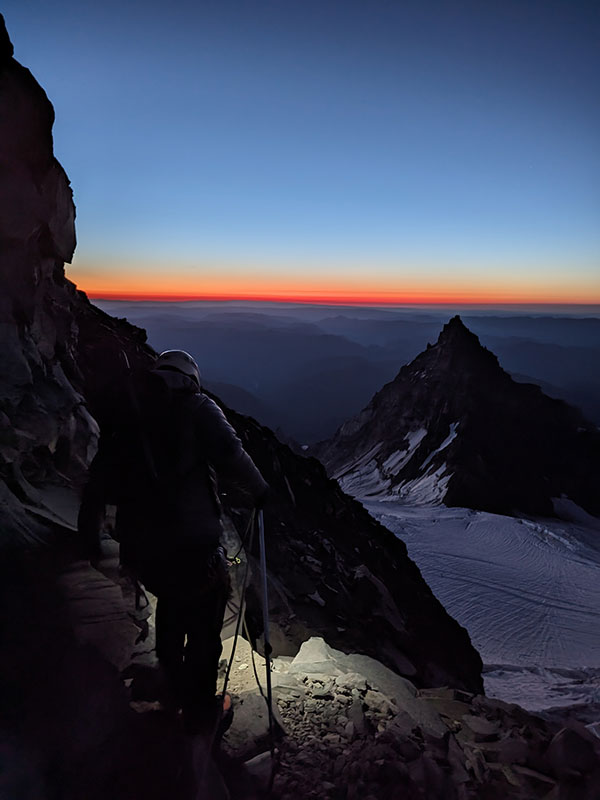
It wasn’t more than a half hour later, less than a half-mile away, where we reached the bergschrund at Disappointment Cleaver.  No one thought to snap a pic here as we had to climb down into this void in order to claw our way over the chunks of ice and up the loose rocks on the other side.  Since it was more dicey than walking across the ladders, I didn’t even think about getting a pic of it on the way back either.

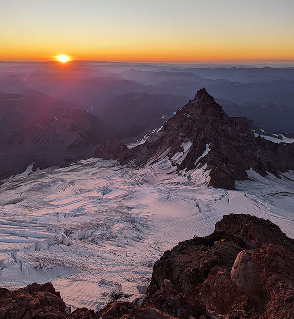
Once across the schrund, we couldn’t have had a better vantage point to watch the sun come up!

The first light on Ingraham Glacier was equally impressive.  If you look close enough, you can see the tents at High Camp on Ingraham Flats.  Also notice Mt. Adams off in the distance.

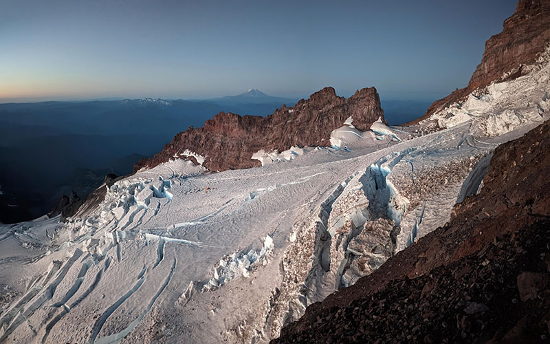
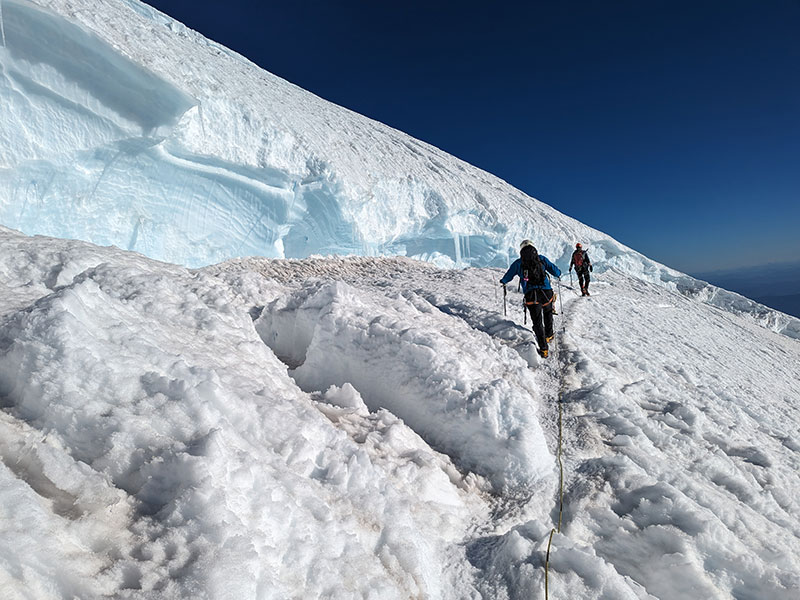
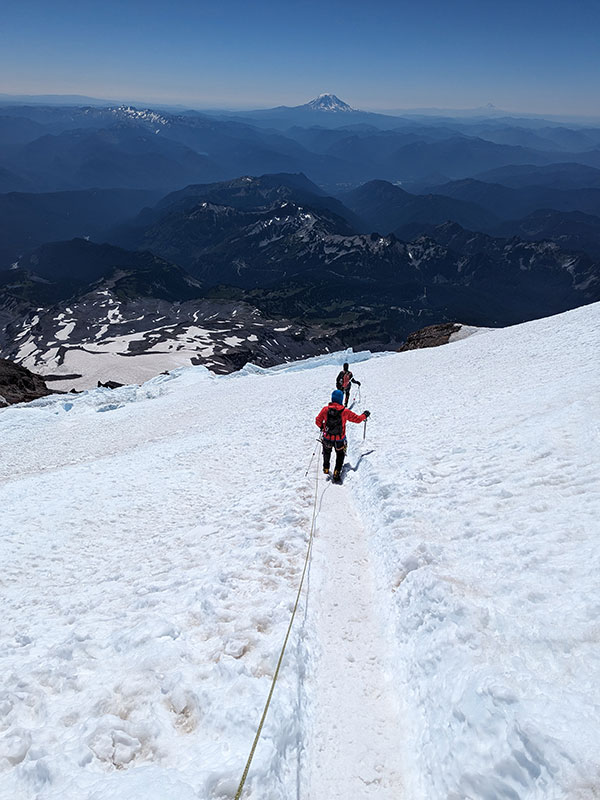
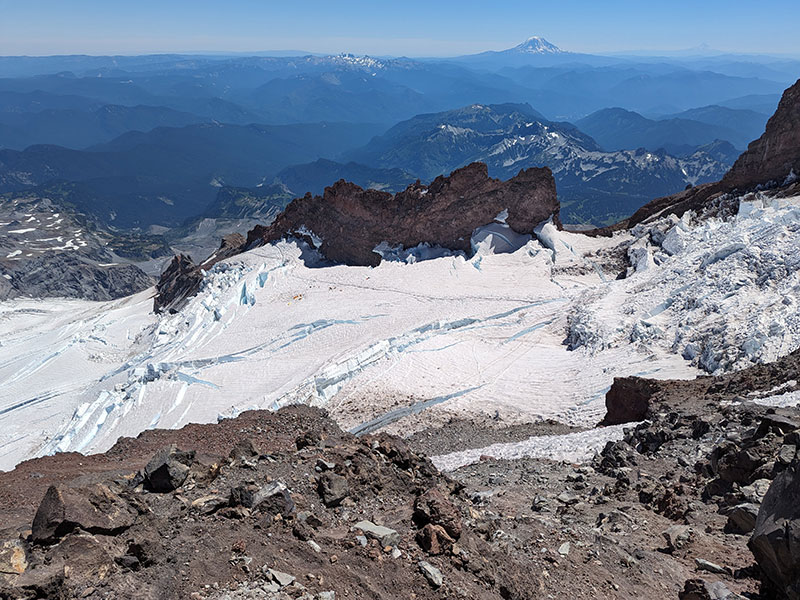
These views were spectacular all morning.  This is looking over the Emmons Glacier and Little Tahoma.

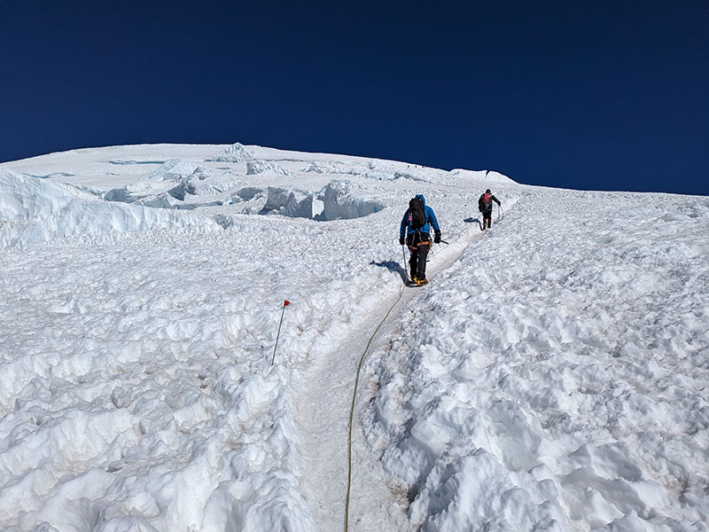
The climb is about 1,000 feet per mile, along a nicely groomed path thanks to all the guided groups that come up here.  There really wasn’t any route finding to do.  That would certainly be a different story in less than ideal weather conditions.
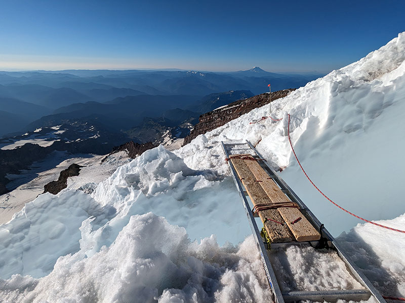
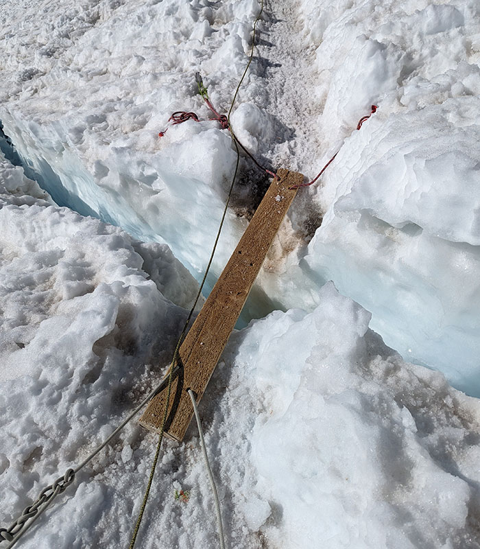
Walking the Planks

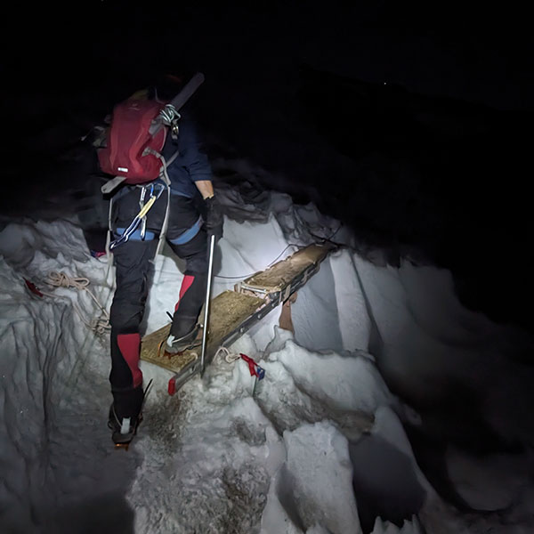
At 2 miles in, we found another ladder over the second crevasse.  Walking the planks was very solid and secure.  You just have to be careful to not trip over your crampons catching the wood.

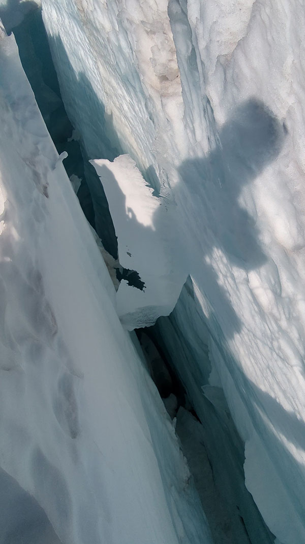
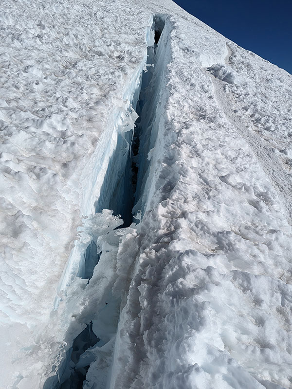
The depths of these cracks is amazing.  Standing there knowing this mountain is constantly on the move is just mindboggling.

Here’s looking back at this second crossing.

At 13,000 feet, the route took a slight detour to the north as a result of some massive separation here just a few weeks ago.

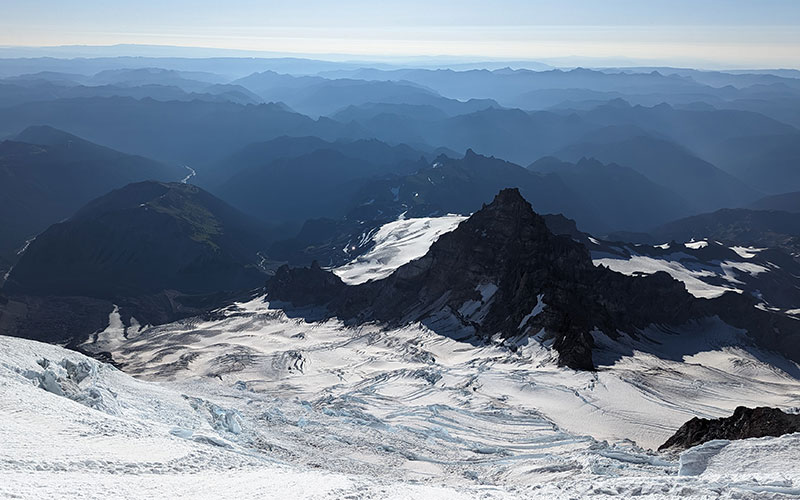
Looking back again toward Emmons Glacier and the miles of mountains making up these Cascades.

A third ladder was set across the end of that ice wall, where the route turns west again towards the summit.  This was only a third of a mile beyond the previous ladder.

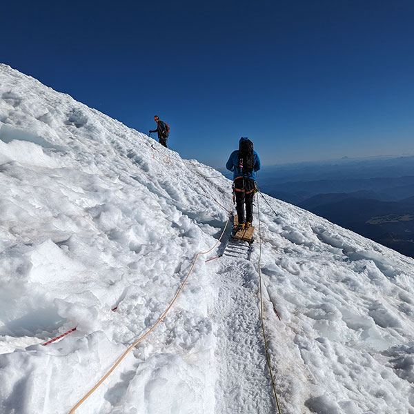
Finally, the last plank we had to walk.

I’d love to know how thick this ice is and what the ground looks like underneath it all.

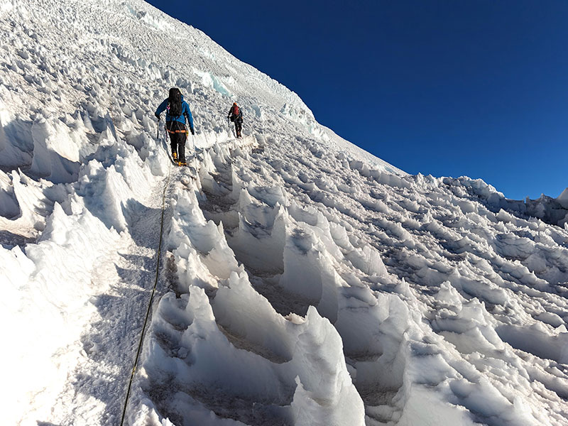
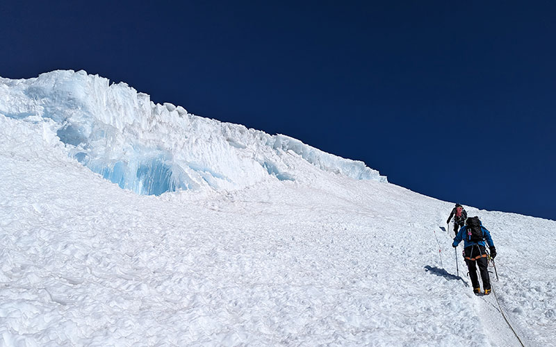
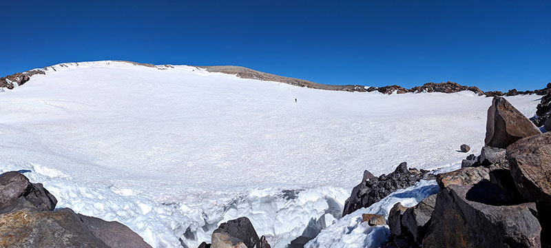
The last 500 feet of elevation zig zags up the eastern slope to the crater rim.

It’s really hard to capture the magnitude of this mountainside.

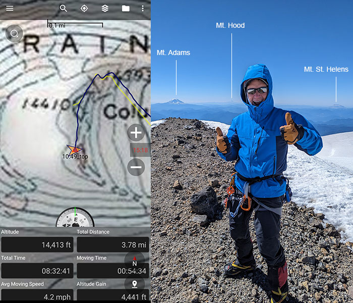
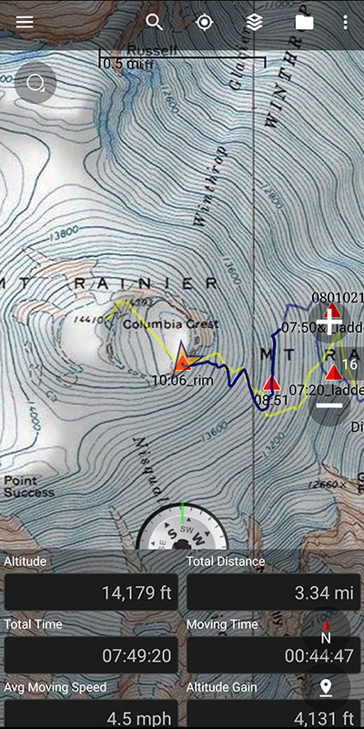
At 10am, we hit the crater rim with a travel time of almost 8 hours.  That felt way too long for only climbing 4,100 feet in 3.34 miles and we still had to cross this crater.   Less than a half mile away, it took us another 30 minutes to reach Rainier’s true summit on the other side.

Summit Success

Standing on top of Washington’s tallest peak put me at #24 of 50… almost half-way to my goal!

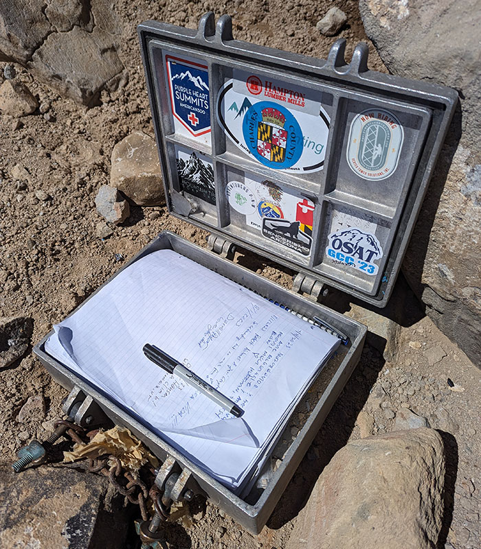
If you are into signing the summit register you will find it below the summit.  It looked just like the one on Baker with the word “Mazamas” on the lid.

The walk down was pretty straight-forward.

Nice Ice Baby

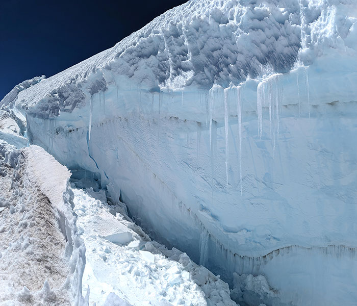
Best pic of the day.  Look at that glacial blue!

Here’s that separation again from a different angle.  This is what blocked the standard way up, causing us to detour around it.

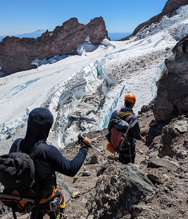
Another view of the Ingram Glacier in the afternoon sun as we descended back to basecamp.

Now back above the bergschrund, we can clearly see what we crossed in the dark earlier that morning.

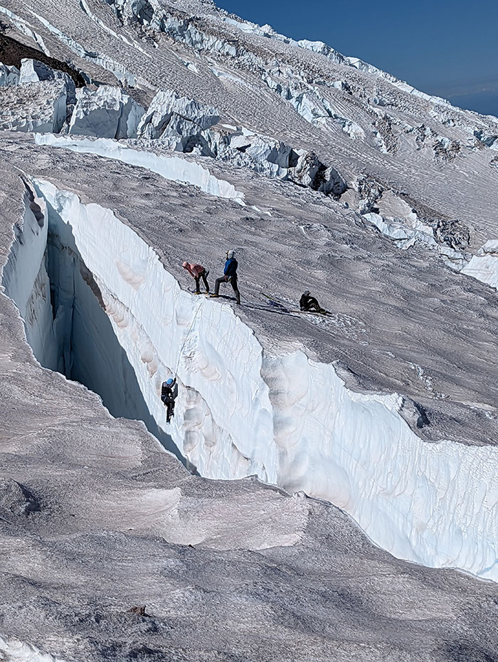
Some people were practicing their crevasse rescue skills, which is critical to know how to do on mountains like this.

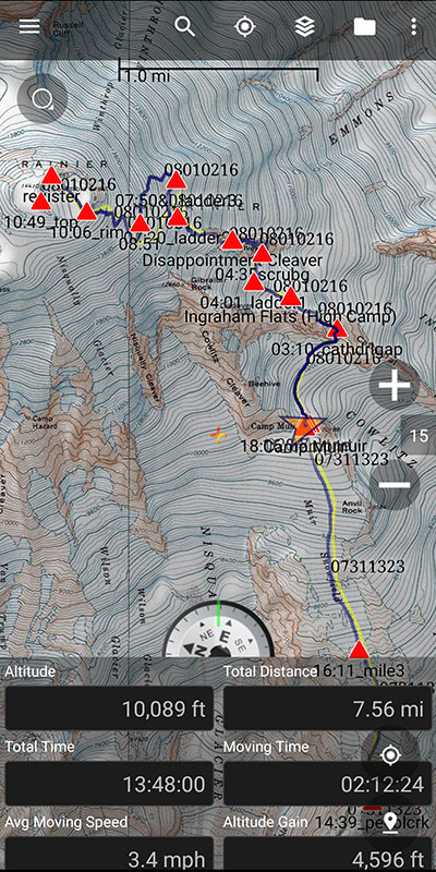
It was 4pm when we walked back into camp on the heels of a fantastic day.  We were so looking forward to dropping our packs, eating some food and grabbing some zzzzzz’s after 14 hours on the mountain.

Unfortunately, that is not what happened!

Awake for 24 Hours

The hut was so freakin’ full, we could barely squeeze through to get inside.  There were people EVERYWHERE!  Inside, outside… it was like a big frat party.  All that was missing was the kegger and a live band.  There was no way we were staying.  I knew we’d get no sleep and was in no mood to try, all crammed in there like sardines.  No thanks.

This unexpected situation gave us instant motivation to gather up the items we had left behind, re-arrange our packs for the long haul out and get on down to the car.  It was a long day… and the day only got longer back at Paradise, trying to find us a place to stay anywhere in Ashford or Packwood.  No one had a vacancy and it was now getting dark.  Remember, we didn’t bring tents.  What a mistake that was.

We decided our only other option was to make the 2-hour drive to Yakima and stay there.  Arriving around midnight, tired and dirty, we immediately flopped into bed.  A shower could wait ’til morning.


← The Stars Aligned for Rainier
Mahalo Mauna Kea →

Leave a Reply Cancel reply

Your email address will not be published. Required fields are marked *

On this day last year—February 18—my team and I reached the summit of Aconcagua, the tallest peak in Argentina and the highest mountain in the Western Hemisphere at 22,837 feet.

I’ve enjoyed looking back on that expedition by rereading my day-by-day trip report from our climb.

👉 Link in bio: an 18-part guide covering the entire climb, plus pre-trip planning tips and post-expedition things to see and do around Mendoza.

Whether this is your first high-altitude objective or you’re adding Aconcagua to your mountaineering résumé, the guide will help you see why I chose the 360° Traverse, how to plan for your expedition, and what to expect each day on the mountain.

#aconcagua #aconcagua360 #aconcaguaexpedition #highaltitudemountaineering #mountaineering

33 3
Open post by backcountryfever with ID 18055701743428917
On this day last year—February 18—my team and I reached the summit of Aconcagua, the tallest peak in Argentina and the highest mountain in the Western Hemisphere at 22,837 feet.

I’ve enjoyed looking back on that expedition by rereading my day-by-day trip report from our climb.

👉 Link in bio: an 18-part guide covering the entire climb, plus pre-trip planning tips and post-expedition things to see and do around Mendoza.

Whether this is your first high-altitude objective or you’re adding Aconcagua to your mountaineering résumé, the guide will help you see why I chose the 360° Traverse, how to plan for your expedition, and what to expect each day on the mountain.

#aconcagua #aconcagua360 #aconcaguaexpedition #highaltitudemountaineering #mountaineering

Winter is my favorite season, and cold weather camping is one of my favorite winter activities.

#coldweathercamping #wintercamping #tenting #lovewinter #lovecamping

19 0
Open post by backcountryfever with ID 18088708565160118
Winter is my favorite season, and cold weather camping is one of my favorite winter activities.

#coldweathercamping #wintercamping #tenting #lovewinter #lovecamping

Scoping out snow levels for my annual winter campout this weekend. Yep, there`s enough to still make it fun!

#wintercamping #coldweathercamping #winterhike #sunset #weekendwarrior

19 2
Open post by backcountryfever with ID 18093303244798082
Scoping out snow levels for my annual winter campout this weekend.  Yep, there's enough to still make it fun!

#wintercamping #coldweathercamping #winterhike #sunset #weekendwarrior

Speaking of my multi-millioner friends (see link in the bio), I got to hike with them last weekend.

I had my mind set on doing a Grandeur Peak Yo-Yo for my first hike of the year. Thankfully, @gwhatco and @andeethatch were OK with slowing down for the day.

Not sure what I was thinking though, my thighs were so sore for the next two days. Hockey sure doesn`t use those same muscles like I thought it did.

Recovery definitely called for a few infrared sauna sessions afterwards!

#grandeurpeak #yoyo #doublesummit #legday #goatworthy

35 0
Open post by backcountryfever with ID 18093050872988089
Speaking of my multi-millioner friends (see link in the bio), I got to hike with them last weekend.

I had my mind set on doing a Grandeur Peak Yo-Yo for my first hike of the year. Thankfully, @gwhatco and @andeethatch were OK with slowing down for the day.

Not sure what I was thinking though, my thighs were so sore for the next two days. Hockey sure doesn't use those same muscles like I thought it did. 

Recovery definitely called for a few infrared sauna sessions afterwards!

#grandeurpeak #yoyo #doublesummit #legday #goatworthy

Yeah, you read that right — 5,000,000 vertical feet. That’s a million feet of vert every year for five straight years. Who does that? Well… these two average hikers from Utah have been stacking numbers like this since 2021 — quietly, but well beyond “average”.

The numbers speak for themselves. Get a summary and breakdown by month from the link in the bio ☝️

Think about that: we’re talking about an average of 50 miles and 20,000 feet of gain every single week.

It’s hard to wrap my head around that level of commitment. What they’re doing every month is roughly what I log in a year, all while holding down full-time jobs. That’s one serious fitness program.

In talking with Andee about what comes next, they took the week off after Christmas, then jumped right into the new year on a local favorite—Mount Olympus—with plans to log another million in 2026.

#goatworthy #biggoals #millionverticalfeet #hikerlife #hikemoreworryless

24 5
Open post by backcountryfever with ID 17966367422867268
Yeah, you read that right — 5,000,000 vertical feet.  That’s a million feet of vert every year for five straight years.  Who does that?  Well… these two average hikers from Utah have been stacking numbers like this since 2021 — quietly, but well beyond “average”. 

The numbers speak for themselves.  Get a summary and breakdown by month from the link in the bio ☝️

Think about that: we’re talking about an average of 50 miles and 20,000 feet of gain every single week.

It’s hard to wrap my head around that level of commitment.  What they’re doing every month is roughly what I log in a year, all while holding down full-time jobs.  That’s one serious fitness program.

In talking with Andee about what comes next, they took the week off after Christmas, then jumped right into the new year on a local favorite—Mount Olympus—with plans to log another million in 2026.

#goatworthy #biggoals #millionverticalfeet #hikerlife #hikemoreworryless

With the encouragement from my youngest daughter, I bought a small fleet of kid carriers to get these youngsters started early! We`ve enjoyed a few days out in this unseasonably warm November, but still need to get them ALL out together. Fun times ahead for sure!!

#osprey #ospreypacks #hikingwithkids #familyfun #getemstartedearly

20 1
Open post by backcountryfever with ID 18064990223634047
With the encouragement from my youngest daughter, I bought a small fleet of kid carriers to get these youngsters started early!  We've enjoyed a few days out in this unseasonably warm November, but still need to get them ALL out together.  Fun times ahead for sure!!

#osprey #ospreypacks #hikingwithkids #familyfun #getemstartedearly

My first time up Mt. Ogden unintentionally turned into a full-on-loop-de-doo: up Beus, down Malan`s.

Beus Canyon was pretty boring above treeline, so I decided not to head back the way I came. After tagging the summit, I figured Malan`s would be way more interesting — and it sure was!

Malan`s Basin is surprisingly sketch up high, through a steep and narrow gully, then hard to follow in the middle where an already faint trail disappeared under leaves. I lost the trail a few times and had to backtrack a bit to find my way.

Finally, the Bonneville Shoreline Trail came in clutch once again, making this a nice long loop-de-doo.

Mt. Ogden Loop-de-doo mileage breakdown 👇
- Beus Canyon trailhead to summit, 6 miles
- Mt. Ogden to Malan`s Peak, 3 miles
- Malan`s Peak to Bonneville Shoreline Trail, 3 miles
- BST across and back to Beus trailhead, 3 miles

For a total of 15 miles and 5,300 feet of elevation gain.

#mtogden #mountogden #ogdenpeak #beuscanyon #beuscanyontrail #malansbasin #malanspeak #bonnevilleshorelinetrail #bonnevilleshoreline #bst #loophike #loopdedoo #wasatchfront #hikeogden #fallhike #fallhikingfallhiking

24 0
Open post by backcountryfever with ID 17906240730272550
My first time up Mt. Ogden unintentionally turned into a full-on-loop-de-doo: up Beus, down Malan's. 

Beus Canyon was pretty boring above treeline, so I decided not to head back the way I came. After tagging the summit, I figured Malan's would be way more interesting — and it sure was!

Malan's Basin is surprisingly sketch up high, through a steep and narrow gully, then hard to follow in the middle where an already faint trail disappeared under leaves.  I lost the trail a few times and had to backtrack a bit to find my way.

Finally, the Bonneville Shoreline Trail came in clutch once again, making this a nice long loop-de-doo.

Mt. Ogden Loop-de-doo mileage breakdown 👇
- Beus Canyon trailhead to summit, 6 miles
- Mt. Ogden to Malan's Peak, 3 miles
- Malan's Peak to Bonneville Shoreline Trail, 3 miles
- BST across and back to Beus trailhead, 3 miles

For a total of 15 miles and 5,300 feet of elevation gain.

#mtogden #mountogden #ogdenpeak #beuscanyon #beuscanyontrail #malansbasin #malanspeak #bonnevilleshorelinetrail #bonnevilleshoreline #bst #loophike #loopdedoo #wasatchfront #hikeogden #fallhike #fallhikingfallhiking

Awesome views from the top of Y Mountain. Looking north into Rock Canyon, where I started, and across towards the old Squaw Peak, Cascade Mountain, and Mount Timpanogos further off in the distance.

Pretty fun loop hike 👇

- Up 1.8 miles from the Rock Canyon trailhead
- Up 1.8 miles on First Right Fork to Slide Canyon
- Down Slide Canyon Trail .5 miles to Y Mountain Trail
- Up 1 mile to Y Mountain West Peak
- Down .25 and over .25 miles to Y Mountain East Peak
- Down 1 mile back to Slide Canyon Trail
- Down 1.5 miles to Y Trail (top of the BYU Y)
- Down 1 mile to the Y Trail trailhead
- Across 1.75 miles on the Bonneville Shoreline Trail

For a total of 10.75 miles with 4,137 feet of elevation gain.

#ymountain #rockcanyon #rockcanyontrail #firstrightfork #slidecanyon #ytrail #ytrailhead #bst #bonnevilleshorelinetrail #bonnevilleshoreline #connector #loophike #wasatchfront #hikethewasatch #wasatchmountains #wasatch #hike #hikemore

32 1
Open post by backcountryfever with ID 17900152413305912
Awesome views from the top of Y Mountain.  Looking north into Rock Canyon, where I started, and across towards the old Squaw Peak, Cascade Mountain, and Mount Timpanogos further off in the distance. 

Pretty fun loop hike 👇

- Up 1.8 miles from the Rock Canyon trailhead
- Up 1.8 miles on First Right Fork to Slide Canyon
- Down Slide Canyon Trail .5 miles to Y Mountain Trail
- Up 1 mile to Y Mountain West Peak 
- Down .25 and over .25 miles to Y Mountain East Peak
- Down 1 mile back to Slide Canyon Trail
- Down 1.5 miles to Y Trail (top of the BYU Y)
- Down 1 mile to the Y Trail trailhead
- Across 1.75 miles on the Bonneville Shoreline Trail

For a total of 10.75 miles with 4,137 feet of elevation gain.

#ymountain #rockcanyon #rockcanyontrail #firstrightfork #slidecanyon #ytrail #ytrailhead #bst #bonnevilleshorelinetrail #bonnevilleshoreline #connector #loophike #wasatchfront #hikethewasatch #wasatchmountains #wasatch #hike #hikemore

As the seasons change, each quiet mile through these trees feels like an invitation to let go of what was and move toward all that`s yet to come...

#seasonschange #lettinggo #movingon #pressingforward #lookingahead #newbeginnings #natureishealing #healingenergy #goodvibes #autumnvibes #autumnmountains #hiking #hikerlife #mountainlife #mountains

27 0
Open post by backcountryfever with ID 17902202193279047
As the seasons change, each quiet mile through these trees feels like an invitation to let go of what was and move toward all that's yet to come...

#seasonschange #lettinggo #movingon #pressingforward #lookingahead #newbeginnings #natureishealing #healingenergy #goodvibes #autumnvibes #autumnmountains #hiking #hikerlife #mountainlife #mountains
Follow on Instagram

Recent Posts

  • 5 Million Vertical Feet Gained Over 5 Years
  • 2025 Year in Review
  • From Waikīkī to Makapuʻu: A Casual Tour of Honolulu Stops
  • High Hopes for Hiking Hawaii — Hobbled by Hockey
  • It’s Mountaineering Season in Utah!

Recent Comments

  • Backcountry Fever on Solo Summit of Shasta
  • Michelle Tirhi on Solo Summit of Shasta
  • Matt on How I Would Do Kings Peak in 1 Day
  • Rich Meziere on Bummed Out By A Broken BOA Binding
  • Backcountry Fever on Bummed Out By A Broken BOA Binding

RECOMMENDED READING

Categories

  • 14ers
  • Adventure Plans
  • Avalanche Awareness
  • Backpacking
  • Epic Treks
  • Grand Canyon
  • Health & Wellness
  • International Expeditions
  • Mountaineering
  • Pacific Northwest
  • Peak Bagging
  • Product Feedback
  • Reading References
  • Road Trip
  • Scrambling
  • Season Summary
  • Seven Summits
  • Six-Pack Challenge
  • Snowshoeing
  • Social Media
  • State Highpoints
  • Technology
  • Uinta Mountains
  • Uncategorized
  • Uphill Training
  • Wasatch Front
  • Zion
©2026 Backcountry Fever