Skip to content
Menu
Backcountry Fever
  • Home Preview
  • Projects
    • Adirondack 46ers
    • Colorado 14ers
    • Seven Summits
      • Climb Aconcagua via the 360° Traverse | Full Guide
    • Wasatch 7
    • Wasatch 11ers
  • Highpoints
  • Experience
  • My Never-Ending List
  • Contact
Backcountry Fever
← The Snow Bridge on Borah Peak
Walking the Planks of Rainier →

The Stars Aligned for Rainier

Posted on August 8, 2023June 20, 2025 by Backcountry Fever

Rainier was the only peak I didn’t have pre-arranged plans for as we rolled into this season of mountaineering.  I knew I really needed to get it done this summer if I were to be more prepared for a run at Denali next summer.  I just wasn’t exactly sure how that was going to happen.

The conversation started not long after I posted my trip report for Hood.  A friend and I were talking about what states we had left in the West (not including Alaska), since both of us are working on all 50 state highpoints.  He still needed Wyoming and Washington while I was only missing Washington and Hawaii.  A few potential dates were thrown on the table for the end of July and we left it at that.

After getting home from Baker on July 8th, I immediately began aligning the stars for Rainier.
DAY 1 – Drive Half-way

If you’ve read any of my other blog posts about traveling to the Pacific Northwest, you know I’m not a fan of doing that drive from Salt Lake in one day.  Luckily, Oliver has a brother that lives just outside Boise who was kind enough to let us crash at his place before and after this trip.  It wasn’t quite half-way, but good enough to break up this lengthy drive.

DAY 2 – Arrive in Packwood

After breakfast, we uncoiled a rope in their backyard to revisit hauling systems and refamiliarize ourselves with the basic knots.  We then stopped at REI in Boise to get a few forgotten items before heading out.  This has become an all-too-familiar pattern for many of our adventures.  I guess it’s a good thing REI has so many locations as that always seems to work out for us.  Today’s seven-hour drive would end at an AirBNB in Packwood, WA.

DAY 3 – Hike to Camp Muir

Day three’s objective was to hike from Paradise to Camp Muir where I had a reservation in the hut for two nights.  We knew it was only about 4 miles to this basecamp, so we took our time getting started.  In other words, we didn’t feel the need to get out in front of a weekend crowd… it was Monday after all.

So we’re in the Ranger Station around noon to grab our permit and he says, “you all brought tents, right?”  We’re like, “Um, no.  We have a reservation in the hut.  Why would we need a tent?”  Apparently they overbook these accommodations and 30 people had already checked in.  Gulp.  No one told us that beforehand!  We decided to take our chances and figure it out when we got up there.  So off we went.

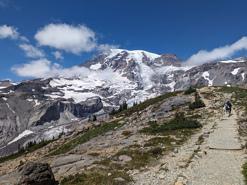
The Skyline Trail starts at Paradise, where lots of tourists hike the foothills of Mt. Rainier National Park.
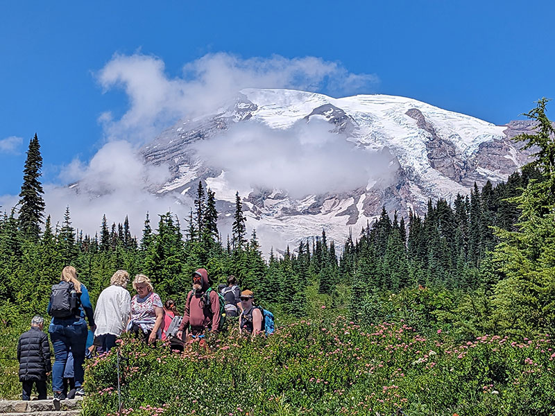
Slowly but surely, the crowd thins out the higher you get.
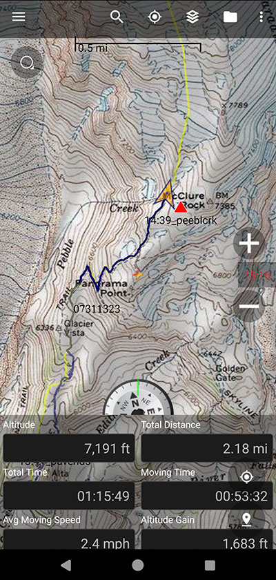
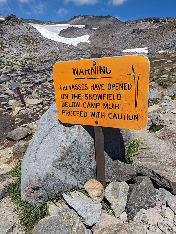
About 2 miles in, you will see this warning sign as you approach Pebble Creek.  This is about where we put on our crampons and traveled on snow for the rest of the way up.
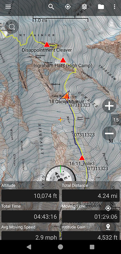
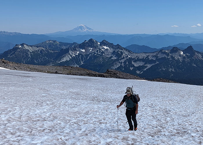
Hiking up the Muir Snowfield is a pretty decent challenge.  You climb about 4,500 feet in 4 miles carrying a pack full of gear.
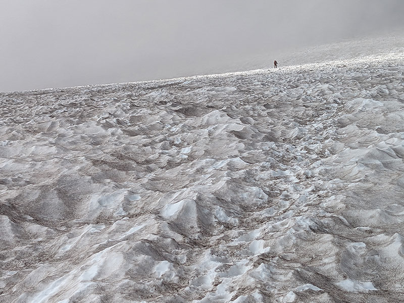
For a brief moment, we walked through a heavy cloud layer.
Then we broke out into the sun for the rest of the time above it.
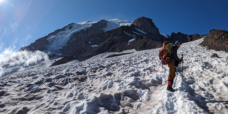
To our surprise, no one… not one single climber, was in the hut when we arrived around 6pm.
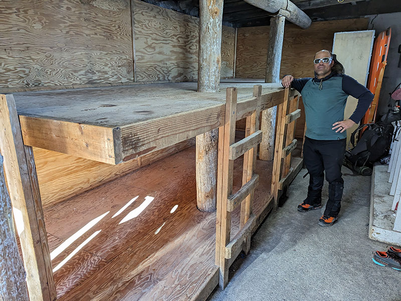
We couldn’t figure out how that could be with 30 people checking in before us?  Were they all made to think there’d be no room at the Inn and brought their tents to set up outside??
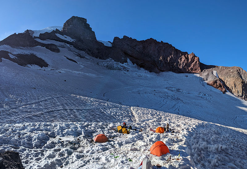
It didn’t matter really.  We sprawled out and enjoyed the first of two nights in the “comfort” of these accommodations without all the commotion of a typical climbing hut scenario.  That would definitely not be the case for our second night here.

Our stats from Paradise to Camp Muir: 4.24 miles with 4,532′ of elevation in 4h 43m.

← The Snow Bridge on Borah Peak
Walking the Planks of Rainier →

Leave a Reply Cancel reply

Your email address will not be published. Required fields are marked *

I really wanted to do the loop, so I took another shot at Kessler, this time from the Relsek Trail. Let me tell ya, 2,000 feet of elevation in that 1-mile stretch from road to ridge is a real thigh-burner! 🥵

I also much rather liked climbing UP the gully to the summit, rather than the thought of going DOWN it (the part I didn`t want to tackle by myself last week).

As always, it felt rewarding to get it done and now I can say I`ve closed the loop on this one! 🥾⛰️

#kesslerpeak #relsektrail #loophike #wasatchmountains #legday

22 1
Open post by backcountryfever with ID 18093421613420388
I really wanted to do the loop, so I took another shot at Kessler, this time from the Relsek Trail.  Let me tell ya, 2,000 feet of elevation in that 1-mile stretch from road to ridge is a real thigh-burner! 🥵

I also much rather liked climbing UP the gully to the summit, rather than the thought of going DOWN it (the part I didn't want to tackle by myself last week).

As always, it felt rewarding to get it done and now I can say I've closed the loop on this one! 🥾⛰️

#kesslerpeak #relsektrail #loophike #wasatchmountains #legday

Today`s sufferfest on Kessler Peak!

I wanted to do the loop, but when I considered the options down off the south ridge, I decided not to try that alone. Same with the mine I saw up there... not sure if that`s the same one I`ve seen others inside a tunnel?

Still a good time after not being out in a while.

#kesslerpeak #kesslerpealtrail #wasatchfront #sufferfest #legday

20 1
Open post by backcountryfever with ID 17960032346983601
Today's sufferfest on Kessler Peak!

I wanted to do the loop, but when I considered the options down off the south ridge, I decided not to try that alone.  Same with the mine I saw up there... not sure if that's the same one I've seen others inside a tunnel? 

Still a good time after not being out in a while.

#kesslerpeak #kesslerpealtrail #wasatchfront #sufferfest #legday

I struck out on Leatherman in 2024, and added that to my list of unfinished business. With the help of some adventurous friends, we dropped it in the bag. The last 2,000 feet was grueling, but so worth it now that we`re done. Thanks Andee, Greg and Dave 👊 I wouldn`t have made it without you!

#leathermanpeak #hikeidaho #lostriverrange #peakbagging #peakbagger

23 0
Open post by backcountryfever with ID 18446485450137775
I struck out on Leatherman in 2024, and added that to my list of unfinished business.  With the help of some adventurous friends, we dropped it in the bag.  The last 2,000 feet was grueling, but so worth it now that we're done. Thanks Andee, Greg and Dave 👊 I wouldn't have made it without you!

#leathermanpeak #hikeidaho #lostriverrange #peakbagging #peakbagger

Couldn`t have asked for a better day to climb Mount Adams. The conditions today (6/4) were absolutely perfect!

These 6 miles were waaaay different from the last six I did in LA. This 6-mile climb to the summit packed in 6,700 feet of elevation and took 6 hours 45 minutes (one-way).

#mtadams #mountadams #pnw #mountaineering #legday

45 4
Open post by backcountryfever with ID 17988770517003932
Couldn't have asked for a better day to climb Mount Adams. The conditions today (6/4) were absolutely perfect!

These 6 miles were waaaay different from the last six I did in LA. This 6-mile climb to the summit packed in 6,700 feet of elevation and took 6 hours 45 minutes (one-way).

#mtadams #mountadams #pnw #mountaineering #legday

Spent the weekend in California for a wedding and managed to squeeze in a quick hike, L.A.-style.

After reaching Mount Lee behind the Hollywood Sign, I couldn`t resist tagging two other peaks along the Aileen Getty Ridge Trail: Cahuenga Peak, the highest point in Griffith Park, and Burbank Peak, home to the famous Wisdom Tree.

The hike came in at 6 miles with just 1,000 feet of elevation gain and took only 2 hours.

#hollywoodsign #cahuengapeak #burbankpeak #aileengettyridgetrail #hikela

19 0
Open post by backcountryfever with ID 17874758856610450
Spent the weekend in California for a wedding and managed to squeeze in a quick hike, L.A.-style.

After reaching Mount Lee behind the Hollywood Sign, I couldn't resist tagging two other peaks along the Aileen Getty Ridge Trail: Cahuenga Peak, the highest point in Griffith Park, and Burbank Peak, home to the famous Wisdom Tree.

The hike came in at 6 miles with just 1,000 feet of elevation gain and took only 2 hours.

#hollywoodsign #cahuengapeak #burbankpeak #aileengettyridgetrail #hikela

Still chasing snow! Took my brother-in-law on his first-ever mountaineering experience. We went up Temple Couloir, over to Deseret Peak, and then slid down West Twin Couloir. Hard to beat spring days like this.

This was my 6th summit of Deseret Peak.

#deseretpeak #templecouloir #twincouloirs #mountaineering #chasingsnow

46 4
Open post by backcountryfever with ID 17898155133454122
Still chasing snow! Took my brother-in-law on his first-ever mountaineering experience. We went up Temple Couloir, over to Deseret Peak, and then slid down West Twin Couloir.  Hard to beat spring days like this.

This was my 6th summit of Deseret Peak.

#deseretpeak #templecouloir #twincouloirs #mountaineering #chasingsnow

One of my favorite things to do between ski season and hiking season: kicking steps up a steep slope toward some snow-capped summit!

#mountaineering #kickingsteps #steepslope #snowcapped #summitday

33 4
Open post by backcountryfever with ID 17939009859229790
One of my favorite things to do between ski season and hiking season: kicking steps up a steep slope toward some snow-capped summit!

#mountaineering #kickingsteps #steepslope #snowcapped #summitday

Another moderate day of mountaineering up the north slope of Mt. Superior, known as Cardiac Bowl. I`ve only been to this peak once before, from the typical summer trail, so it was way fun to get there from this direction.

#mountsuperior #northslope #cardiacbowl #mountaineering #wasatch11ers

32 0
Open post by backcountryfever with ID 18131016616566455
Another moderate day of mountaineering up the north slope of Mt. Superior, known as Cardiac Bowl.  I've only been to this peak once before, from the typical summer trail, so it was way fun to get there from this direction.

#mountsuperior #northslope #cardiacbowl #mountaineering #wasatch11ers

With such good coverage and a big storm rolling in, I think Alta should stay open for at least another week!

#stillskiing #springskiing #skiutah #skiing #alta

15 0
Open post by backcountryfever with ID 18013199525845115
With such good coverage and a big storm rolling in, I think Alta should stay open for at least another week! 

#stillskiing #springskiing #skiutah #skiing #alta
Follow on Instagram

Recent Posts

  • Adventuring Alone on Adams
  • A Road Trip to Trout Lake
  • The Interview That Made Me Reconsider Hydrogen Water
  • After a Year with the COROS Vertix 2S
  • 5 Million Vertical Feet Gained Over 5 Years

Recent Comments

  • Kirsto on How I Would Do Kings Peak in 1 Day
  • Backcountry Fever on Solo Summit of Shasta
  • Michelle Tirhi on Solo Summit of Shasta
  • Matt on How I Would Do Kings Peak in 1 Day
  • Rich Meziere on Bummed Out By A Broken BOA Binding

RECOMMENDED READING

Categories

  • 14ers
  • Adventure Plans
  • Avalanche Awareness
  • Backpacking
  • Epic Treks
  • Grand Canyon
  • Health & Wellness
  • International Expeditions
  • Mountaineering
  • New England
  • Pacific Northwest
  • Peak Bagging
  • Product Feedback
  • Reading References
  • Road Trip
  • Scrambling
  • Season Summary
  • Seven Summits
  • Six-Pack Challenge
  • Snowshoeing
  • Social Media
  • State Highpoints
  • Technology
  • Uinta Mountains
  • Uncategorized
  • Uphill Training
  • Wasatch Front
  • Zion
©2026 Backcountry Fever