Skip to content
Menu
Backcountry Fever
  • Projects
    • Adirondack 46ers
    • Colorado 14ers
    • Seven Summits
      • Climb Aconcagua via the 360° Traverse | Full Guide
    • Wasatch 7
    • Wasatch 11ers
  • Highpoints
  • Experience
  • My Never-Ending List
  • Contact
Backcountry Fever
← Colorado just wasn’t in the cards for me this summer
An Unexpected Trifecta in New Hampshire →

Fall Series starts in the East on Mansfield

Posted on October 14, 2020August 22, 2024 by Backcountry Fever

Since September was a bust with Colorado, my focus turned to the plans I had in the East for October.

This idea began taking shape back in May after COVID shut down the world and killed my EBC trip.  At that time, I thought we would surely be through all this Coronavirus stuff by Fall and wanted to do something big on my list but closer to home in case we still couldn’t travel abroad some 7 months later.

The tallest peaks in the East came to mind.  My chiropractor is from New Hampshire and is always telling me I should try their mountains.  We also have family in that area, so I asked my brother-in-law if he wanted to join me on part of this adventure.  Paul eagerly accepted my invitation but not sure he fully understood what he was signing up for.

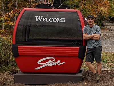
My wife and I flew with our youngest daughter to Vermont and spent a nice weekend with family.  Paul and I then left Monday morning to kick off my COVID Fall Series of State Highpoints on Mt. Mansfield.

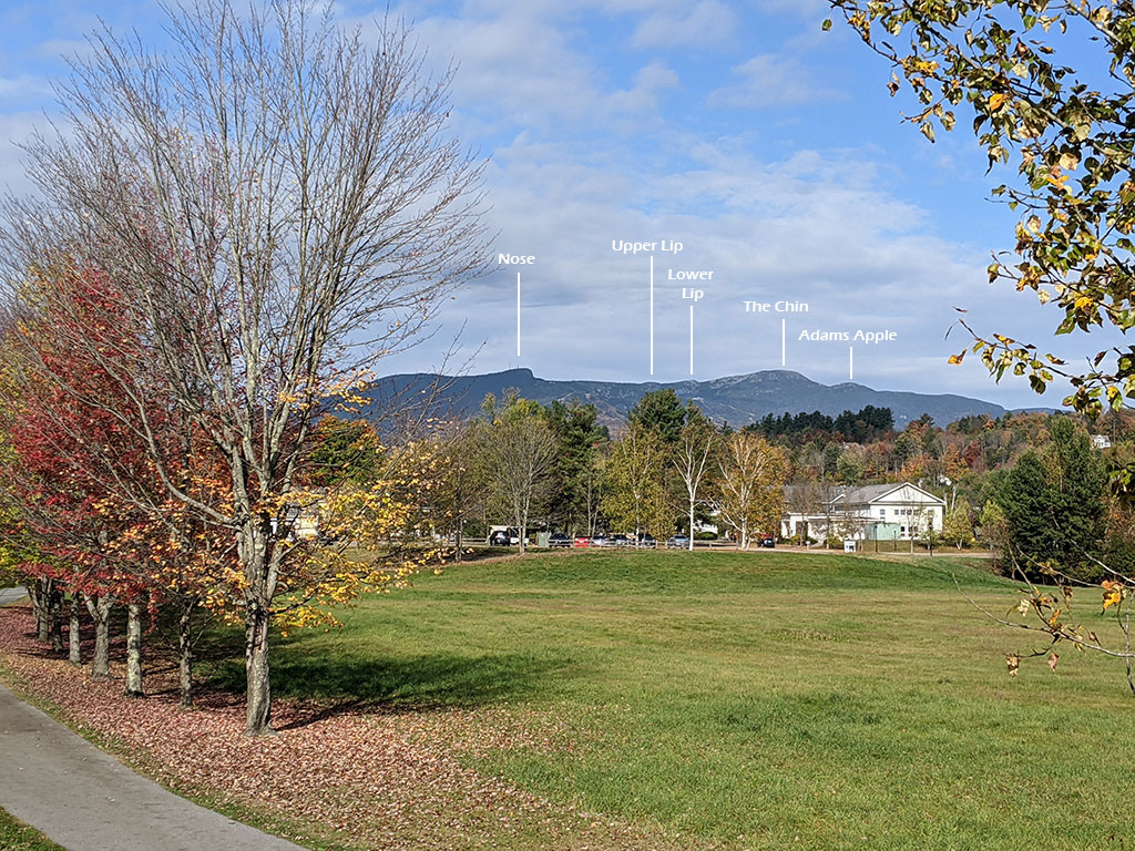
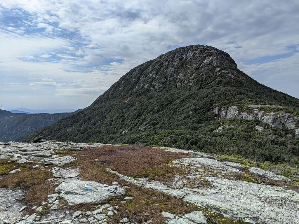
It was a beautiful drive through the hills of Vermont.  The first clear profile of this mountain comes into view along VT-108 on the way up to Stowe Mountain Resort.  It’s not hard to see the resemblance of the facial features that describe this highpoint.

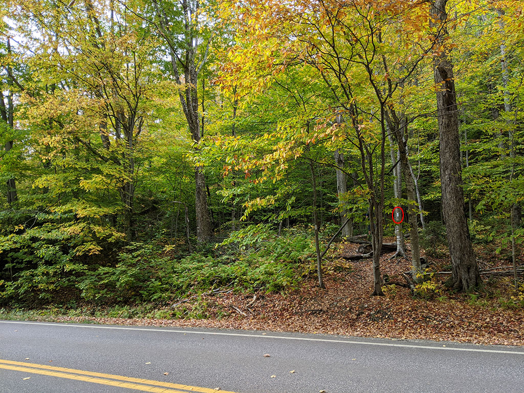
From the trailhead parking at the entrance of Stowe Mountain Resort, you have to walk up the road about a 1/4 mile.  Nothing is marked very well and the only hint of where to start is the white blaze on the inset tree that didn’t catch my eye.  In fact, we walked right past this trail turn and continued looking up the road to find another faint trail start that I had on my GPS as the beginning of Long Trail.  I guess all the leaves on the ground didn’t help either, but some signage would have been nice.
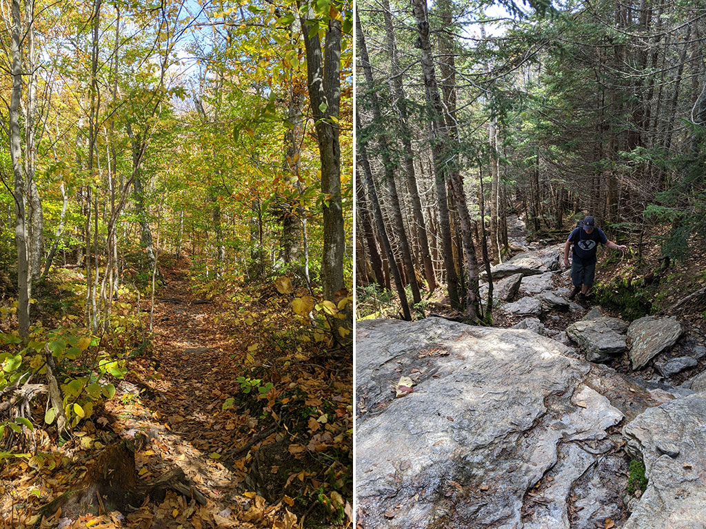
Long Trail

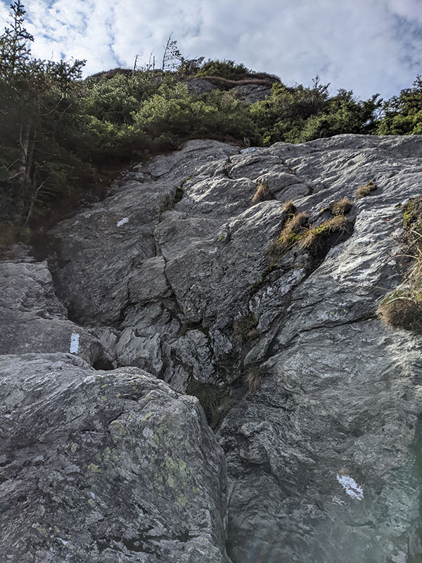
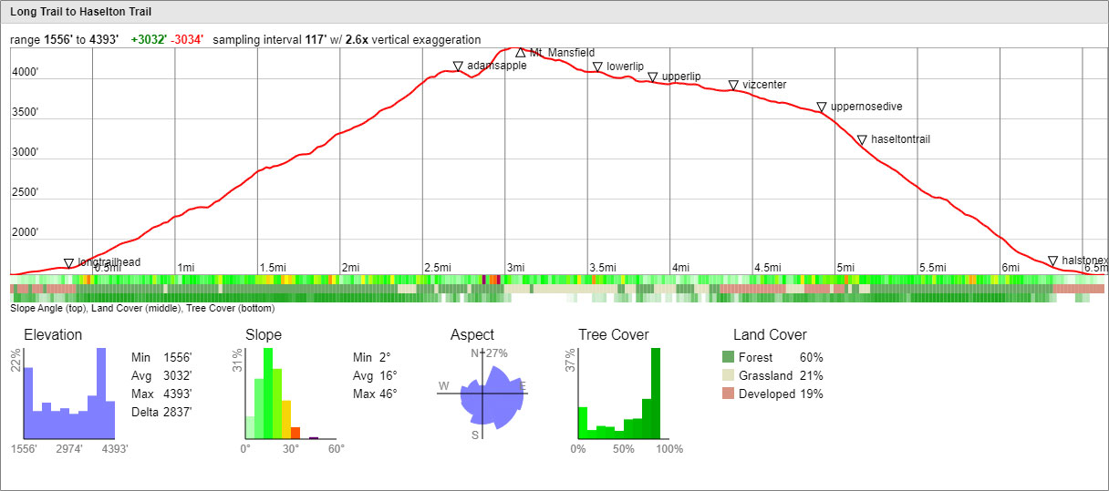
It was great to be here at this time with all the autumn colors yet still nice enough to be hiking in shorts.  The Long Trail is a pretty steady incline with a few sections that was literally climbing a staircase of rock.

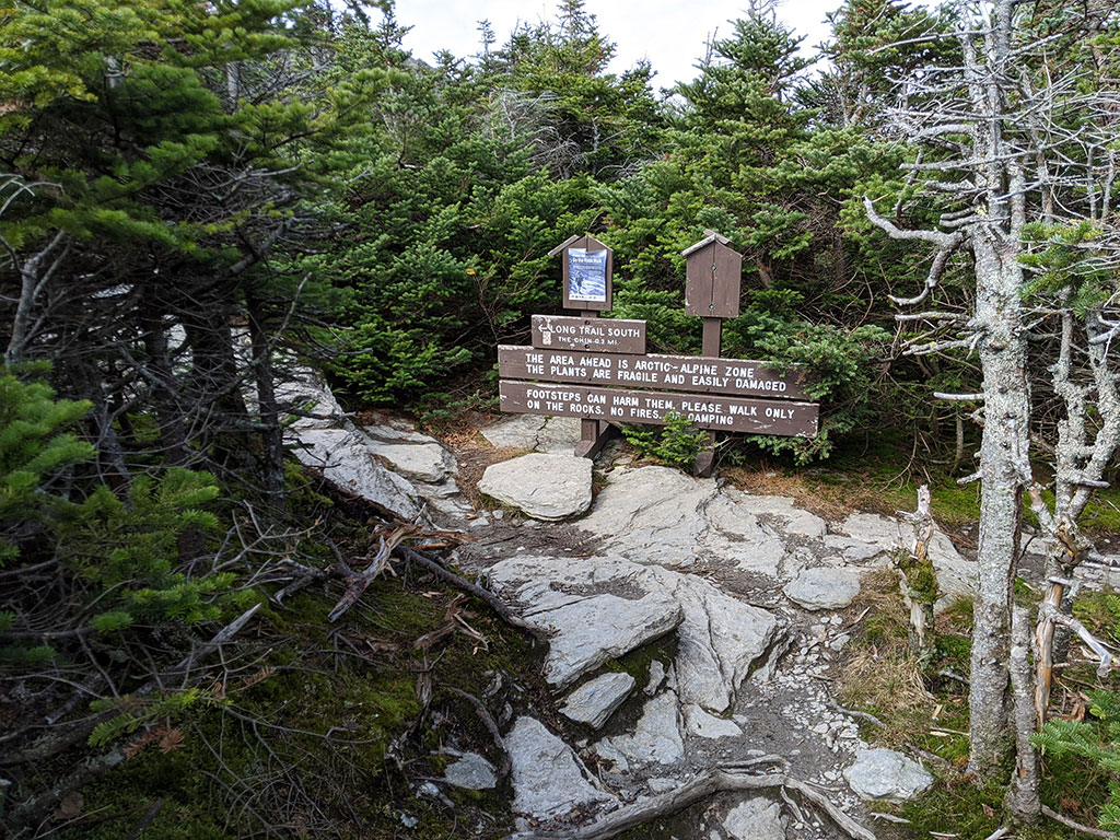
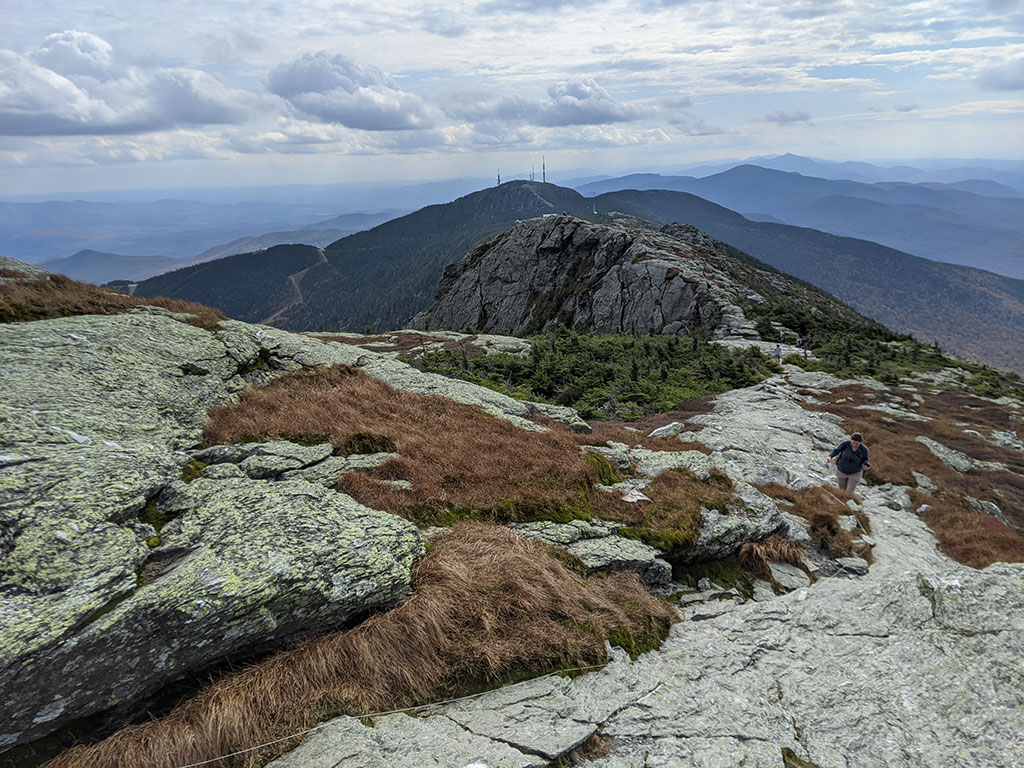
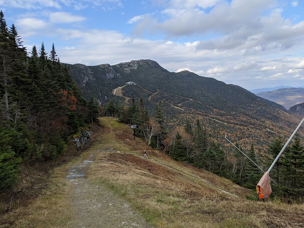
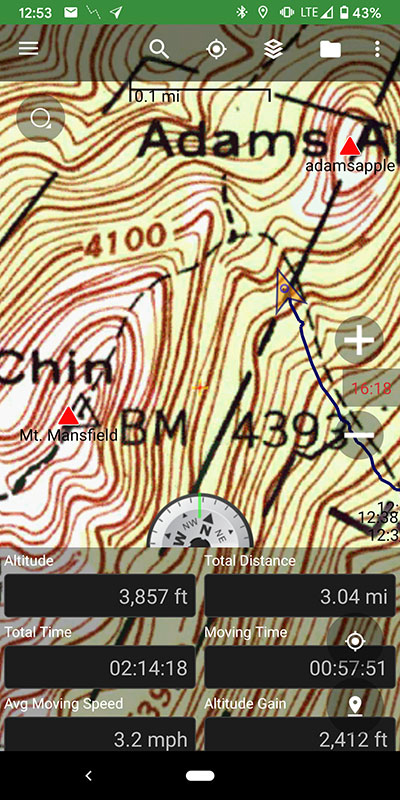
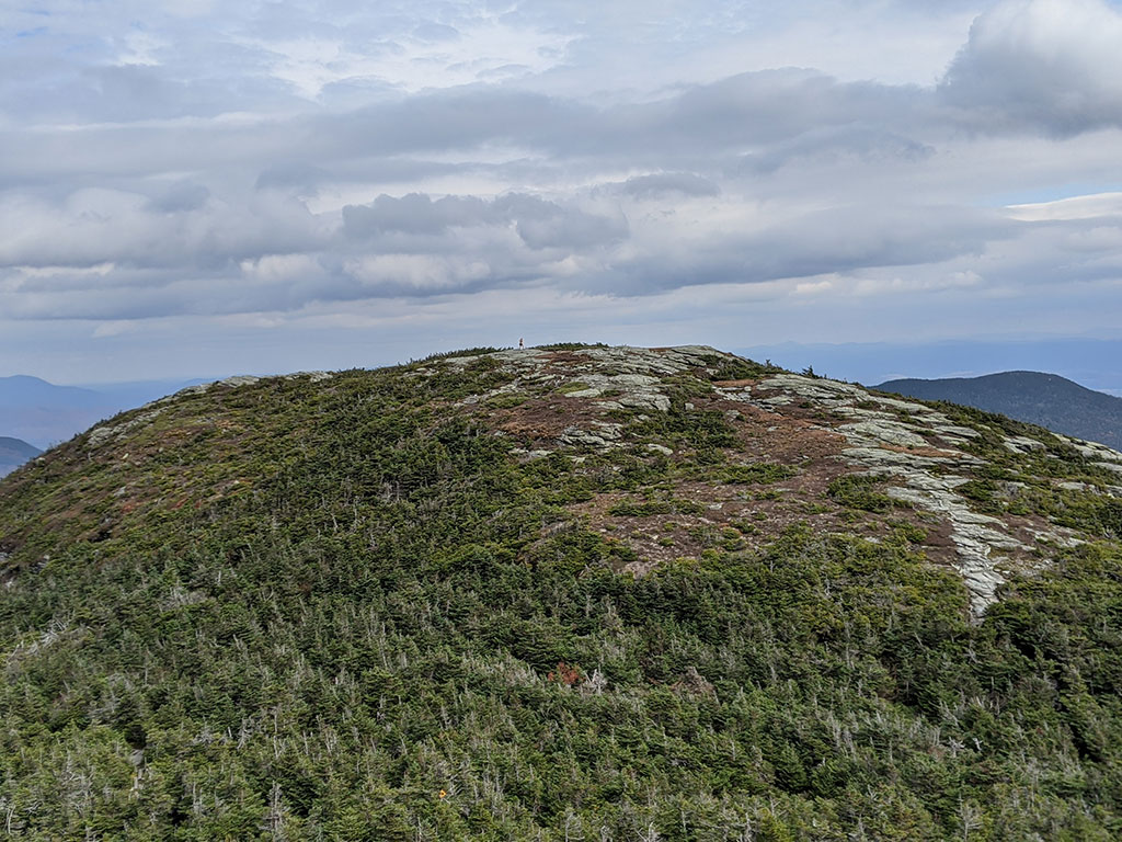
As you approach the treeline about 3 miles up, you reach this intersection.  Following the trail here to the right for 1/4 mile leads to the Adam’s Apple.  Bearing left for 1/3 of a mile takes you to the Chin, which is actual peak/highpoint.

If you hike this route up Long Trail, you might as well take the slight detour to get this great view of Mt. Mansfield from the Adam’s Apple.

Continue following white blazes up the north side of Mt. Mansfield to the top.

There were quite a few people up there for a Monday in early October.  However, most came by car or gondola.
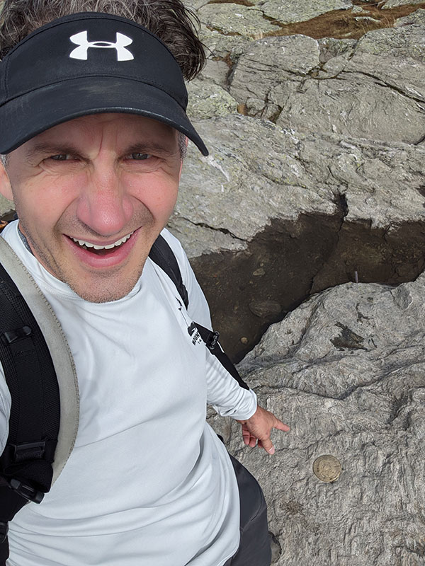
Summit Selfie

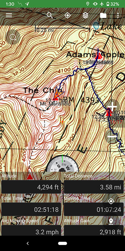
Getting to the top for us was only 3.6 miles and 2,900′ of elevation, but Paul was struggling.  I think he thought this was going to be a walk in the park…

Views from the top were pretty cool and we felt lucky to have decent weather after all the rain that fell the day before.  I was also hoping to see tomorrow’s destination to the East but the clouds had already moved in by the time we got up here.

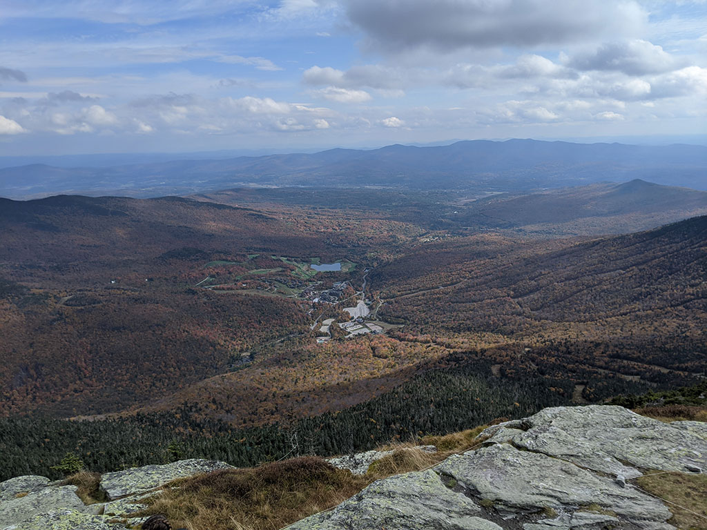
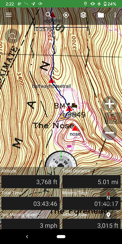
We made this hike a loop by cutting across the top to the Nose (at the radio towers) and then down from there.  The walk across the ridge was about a mile and a half for a total of 5 miles by the time we got to the Nose.

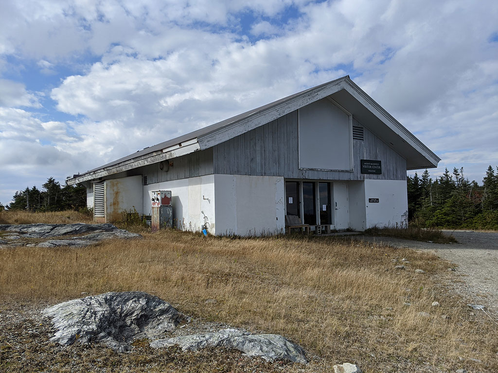
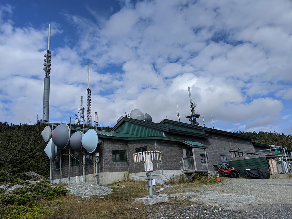
The Visitor’s Center was closed due to COVID, but I’m not sure there was much to see inside anyway.

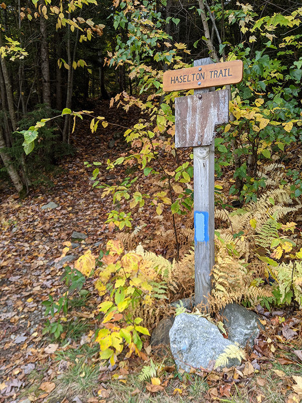
This is where you’re supposed to follow the road down from the parking lot to the Haselton trail.  Again, not a lot of markings to guide the way.

I had a map that said the trail went around the backside of the Nose before dropping off the top.  When we got to the end of the road at the Ron Whitcomb Communication Facility, we found that trail to be closed!
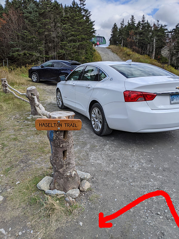
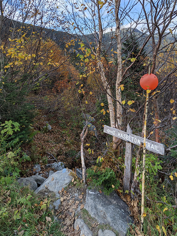
Haselton Trail

We then backtracked that extra 1/2 mile and returned to the Visitors Center to follow the road to another waypoint I had for the Haselton Trail.  It was only another 1/2 mile down that road before we came across this sign near the top of Stowe Mountain’s FourRunner Quad chairlift.

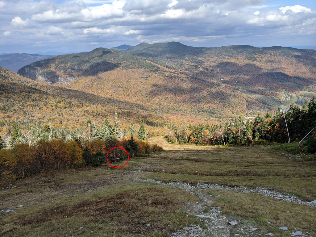
The last leg of this hike drops down Upper Nosedive, a black diamond ski run in the winter.

You are only on this ski slope for about 1/4 mile before the trail enters the woods again.

1.5 miles remains from this point down through the trees and over some rocky terrain.

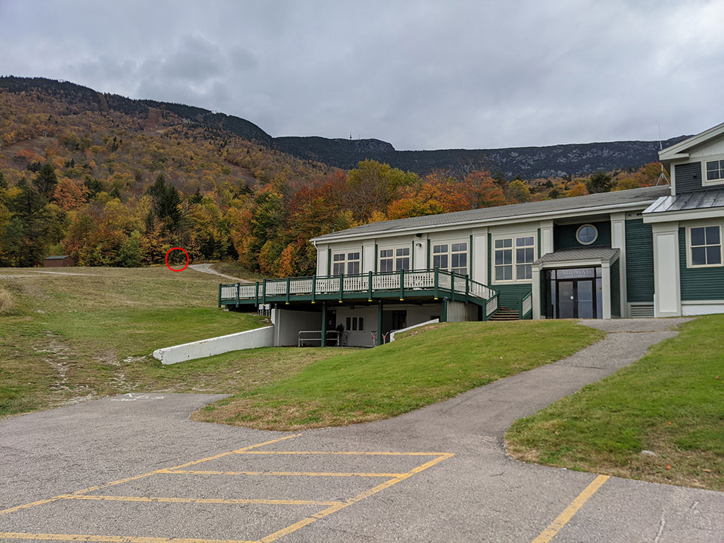
As the Haselton Trail exits the woods, we found ourselves at the Midway Base Lodge not far from the car.


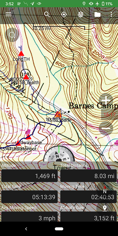
Final stats for the day, after a few mistakes and a bit of minor route finding, was 8 miles and 3,150′ of elevation.  Not a bad warm-up hike for what we will be doing tomorrow!

← Colorado just wasn’t in the cards for me this summer
An Unexpected Trifecta in New Hampshire →

Leave a Reply Cancel reply

Your email address will not be published. Required fields are marked *

Couldn`t have asked for a better day to climb Mount Adams. The conditions today (6/4) were absolutely perfect!

These 6 miles were waaaay different from the last six I did in LA. This 6-mile climb to the summit packed in 6,700 feet of elevation and took 6 hours 45 minutes (one-way).

#mtadams #mountadams #pnw #mountaineering #legday

43 5
Open post by backcountryfever with ID 17988770517003932
Couldn't have asked for a better day to climb Mount Adams. The conditions today (6/4) were absolutely perfect!

These 6 miles were waaaay different from the last six I did in LA. This 6-mile climb to the summit packed in 6,700 feet of elevation and took 6 hours 45 minutes (one-way).

#mtadams #mountadams #pnw #mountaineering #legday

Spent the weekend in California for a wedding and managed to squeeze in a quick hike, L.A.-style.

After reaching Mount Lee behind the Hollywood Sign, I couldn`t resist tagging two other peaks along the Aileen Getty Ridge Trail: Cahuenga Peak, the highest point in Griffith Park, and Burbank Peak, home to the famous Wisdom Tree.

The hike came in at 6 miles with just 1,000 feet of elevation gain and took only 2 hours.

#hollywoodsign #cahuengapeak #burbankpeak #aileengettyridgetrail #hikela

19 0
Open post by backcountryfever with ID 17874758856610450
Spent the weekend in California for a wedding and managed to squeeze in a quick hike, L.A.-style.

After reaching Mount Lee behind the Hollywood Sign, I couldn't resist tagging two other peaks along the Aileen Getty Ridge Trail: Cahuenga Peak, the highest point in Griffith Park, and Burbank Peak, home to the famous Wisdom Tree.

The hike came in at 6 miles with just 1,000 feet of elevation gain and took only 2 hours.

#hollywoodsign #cahuengapeak #burbankpeak #aileengettyridgetrail #hikela

Still chasing snow! Took my brother-in-law on his first-ever mountaineering experience. We went up Temple Couloir, over to Deseret Peak, and then slid down West Twin Couloir. Hard to beat spring days like this.

This was my 6th summit of Deseret Peak.

#deseretpeak #templecouloir #twincouloirs #mountaineering #chasingsnow

46 4
Open post by backcountryfever with ID 17898155133454122
Still chasing snow! Took my brother-in-law on his first-ever mountaineering experience. We went up Temple Couloir, over to Deseret Peak, and then slid down West Twin Couloir.  Hard to beat spring days like this.

This was my 6th summit of Deseret Peak.

#deseretpeak #templecouloir #twincouloirs #mountaineering #chasingsnow

One of my favorite things to do between ski season and hiking season: kicking steps up a steep slope toward some snow-capped summit!

#mountaineering #kickingsteps #steepslope #snowcapped #summitday

33 4
Open post by backcountryfever with ID 17939009859229790
One of my favorite things to do between ski season and hiking season: kicking steps up a steep slope toward some snow-capped summit!

#mountaineering #kickingsteps #steepslope #snowcapped #summitday

Another moderate day of mountaineering up the north slope of Mt. Superior, known as Cardiac Bowl. I`ve only been to this peak once before, from the typical summer trail, so it was way fun to get there from this direction.

#mountsuperior #northslope #cardiacbowl #mountaineering #wasatch11ers

32 0
Open post by backcountryfever with ID 18131016616566455
Another moderate day of mountaineering up the north slope of Mt. Superior, known as Cardiac Bowl.  I've only been to this peak once before, from the typical summer trail, so it was way fun to get there from this direction.

#mountsuperior #northslope #cardiacbowl #mountaineering #wasatch11ers

With such good coverage and a big storm rolling in, I think Alta should stay open for at least another week!

#stillskiing #springskiing #skiutah #skiing #alta

15 0
Open post by backcountryfever with ID 18013199525845115
With such good coverage and a big storm rolling in, I think Alta should stay open for at least another week! 

#stillskiing #springskiing #skiutah #skiing #alta

It`s been a minute since I`ve had anything other than ski boots or hockey skates on my feet this winter. Gotta switch gears before the mountaineering season melts away here in Utah!

#mountaineering #kesslerpeak #westridge #wasatchfront #timetoclimb

📷 @wasatchwidescreen

23 0
Open post by backcountryfever with ID 18073878845639559
It's been a minute since I've had anything other than ski boots or hockey skates on my feet this winter.  Gotta switch gears before the mountaineering season melts away here in Utah!

#mountaineering #kesslerpeak #westridge #wasatchfront #timetoclimb

📷 @wasatchwidescreen

On this day last year—February 18—my team and I reached the summit of Aconcagua, the tallest peak in Argentina and the highest mountain in the Western Hemisphere at 22,837 feet.

I’ve enjoyed looking back on that expedition by rereading my day-by-day trip report from our climb.

👉 Link in bio: an 18-part guide covering the entire climb, plus pre-trip planning tips and post-expedition things to see and do around Mendoza.

Whether this is your first high-altitude objective or you’re adding Aconcagua to your mountaineering résumé, the guide will help you see why I chose the 360° Traverse, how to plan for your expedition, and what to expect each day on the mountain.

#aconcagua #aconcagua360 #aconcaguaexpedition #highaltitudemountaineering #mountaineering

35 2
Open post by backcountryfever with ID 18055701743428917
On this day last year—February 18—my team and I reached the summit of Aconcagua, the tallest peak in Argentina and the highest mountain in the Western Hemisphere at 22,837 feet.

I’ve enjoyed looking back on that expedition by rereading my day-by-day trip report from our climb.

👉 Link in bio: an 18-part guide covering the entire climb, plus pre-trip planning tips and post-expedition things to see and do around Mendoza.

Whether this is your first high-altitude objective or you’re adding Aconcagua to your mountaineering résumé, the guide will help you see why I chose the 360° Traverse, how to plan for your expedition, and what to expect each day on the mountain.

#aconcagua #aconcagua360 #aconcaguaexpedition #highaltitudemountaineering #mountaineering

Winter is my favorite season, and cold weather camping is one of my favorite winter activities.

#coldweathercamping #wintercamping #tenting #lovewinter #lovecamping

19 0
Open post by backcountryfever with ID 18088708565160118
Winter is my favorite season, and cold weather camping is one of my favorite winter activities.

#coldweathercamping #wintercamping #tenting #lovewinter #lovecamping
Follow on Instagram

Recent Posts

  • Adventuring Alone on Adams
  • A Road Trip to Trout Lake
  • The Interview That Made Me Reconsider Hydrogen Water
  • After a Year with the COROS Vertix 2S
  • 5 Million Vertical Feet Gained Over 5 Years

Recent Comments

  • Backcountry Fever on Solo Summit of Shasta
  • Michelle Tirhi on Solo Summit of Shasta
  • Matt on How I Would Do Kings Peak in 1 Day
  • Rich Meziere on Bummed Out By A Broken BOA Binding
  • Backcountry Fever on Bummed Out By A Broken BOA Binding

RECOMMENDED READING

Categories

  • 14ers
  • Adventure Plans
  • Avalanche Awareness
  • Backpacking
  • Epic Treks
  • Grand Canyon
  • Health & Wellness
  • International Expeditions
  • Mountaineering
  • Pacific Northwest
  • Peak Bagging
  • Product Feedback
  • Reading References
  • Road Trip
  • Scrambling
  • Season Summary
  • Seven Summits
  • Six-Pack Challenge
  • Snowshoeing
  • Social Media
  • State Highpoints
  • Technology
  • Uinta Mountains
  • Uncategorized
  • Uphill Training
  • Wasatch Front
  • Zion
©2026 Backcountry Fever