Skip to content
Menu
Backcountry Fever
  • Projects
    • Adirondack 46ers
    • Colorado 14ers
    • Seven Summits
      • Climb Aconcagua via the 360° Traverse | Full Guide
    • Wasatch 7
    • Wasatch 11ers
  • Highpoints
  • Experience
  • My Never-Ending List
  • Contact
Backcountry Fever
← Grand Canyon Double R2R: First Leg, NK to BA
Rolling Hills to Lookout Peak →

Grand Canyon Double R2R: Second Leg, BA to NK

Posted on May 31, 2022July 3, 2025 by Backcountry Fever

Everything was going according to plan as the group enjoyed an evening together on the South rim.  While the majority felt excitement about tomorrow, a few were contemplating their readiness for this Grand Challenge.  This is the opposite kind of hike in every way you can think of.  It reminds me of what the Park Ranger told us the last time we were in the canyon: “what should be down is up, what should be cold is hot and what should be junk food is good”…so true.

As we organized our needs for the morrow and got ready for bed, there was a lot of talk about when and where to start.  Our original itinerary had us catching the first shuttle on the Orange route at 4:30a to be on the South Kaibab Trail by 5.  However, two things played a factor in revisiting that plan: heat reports and shuttle times.

Heat Report for Friday, May 27, through Sunday, May 29, 2022

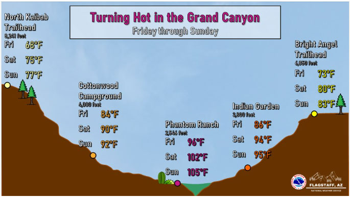
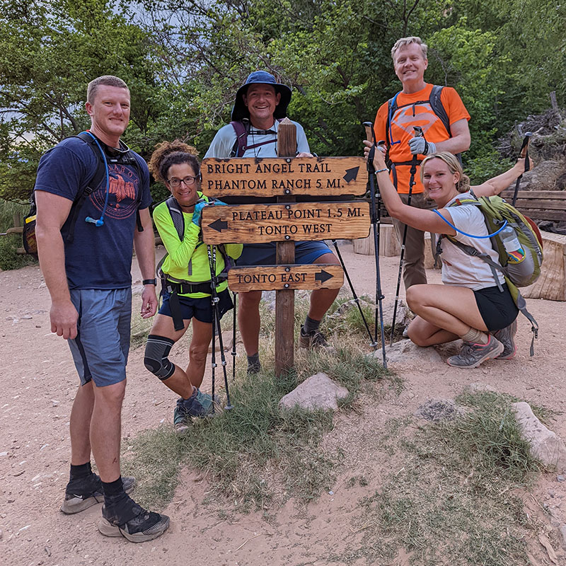
We learned the Orange route schedule had changed for May.  The first shuttle of the day departed at 5a.  Many in the group wanted to start much earlier than that to beat the heat at the bottom.  We thought about getting dropped off at the Visitors Center and walking the extra 2 miles to the SK trailhead… but if we were going to add 2 miles, then why not just keep it simple and start right where we were!  I know the views are better coming down South Kaibab, but we wouldn’t catch the sunrise with a 3:30a start anyway.  So we all agreed to take Bright Angel down since heat avoidance was more important than a sunrise view this time around.

DAY 3: Half Hike, Half Drive

The final count was 7 to hike.  4 were doing their first-ever rim to rim, 1 for his second time across and 2 others to complete a Double R2R back to back. Unfortunately, 4 others had to make the difficult decision to drop out and join the 3 supporting spouses who were driving back around to pick us up.  Their reasons for not hiking were wise given the difficulty and commitment levels involved.  For once our shuttle left to meet us on the opposite rim, there would be no turning back.
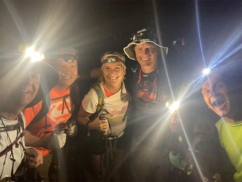
We got this!

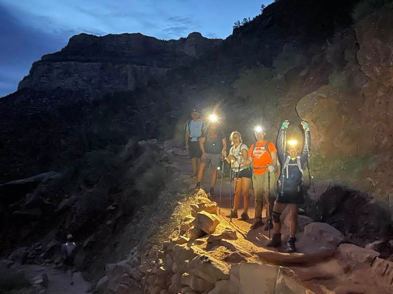
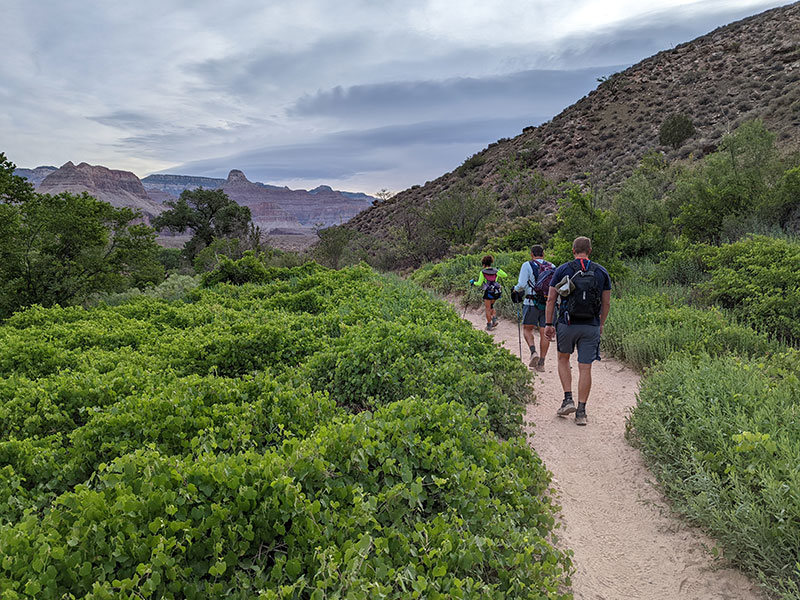
Overcast conditions made for a picturesque sky.

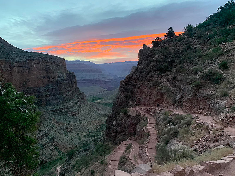
Indian Garden in the morning was nothing like the day before in the heat of the afternoon sun.  I forgot to snap a pic of the thermometer, but I think it was already 80-something at 5:40am.  I also didn’t remember to snap a screenshot of our stats.  Looking back at my GPS tracks, it took us 2 hours to get to this point (4.7 miles from the rim).

Gotta love the greenery around Indian Garden…and it stays this way from Garden Creek flowing through here.

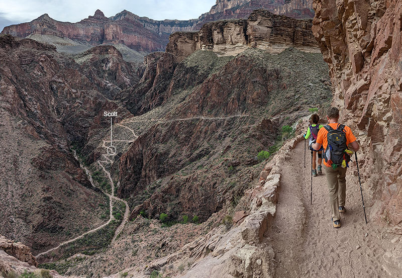
Devil’s Corkscrew was MUCH more fun heading down ? Scott was going strong and quickly pulled ahead here.  No one saw him again after this point.

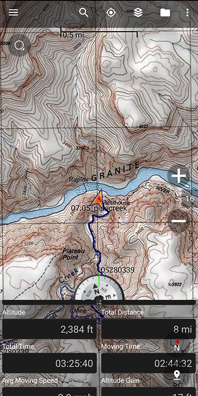
By 7a, I was down at the River Resthouse where rafters pulled off the Colorado at Pipe Creek Beach.  This was 8 miles in and 3.5 hours from when we started.

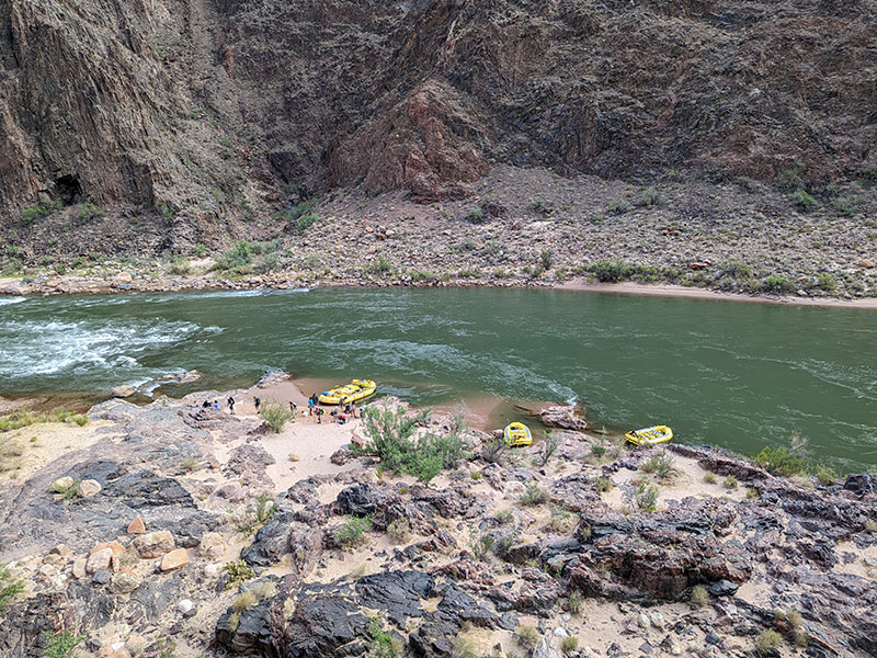
Still wanting  to float this mighty waterway someday, from Lees Ferry to Lake Mead…

Half Way There

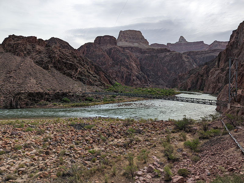
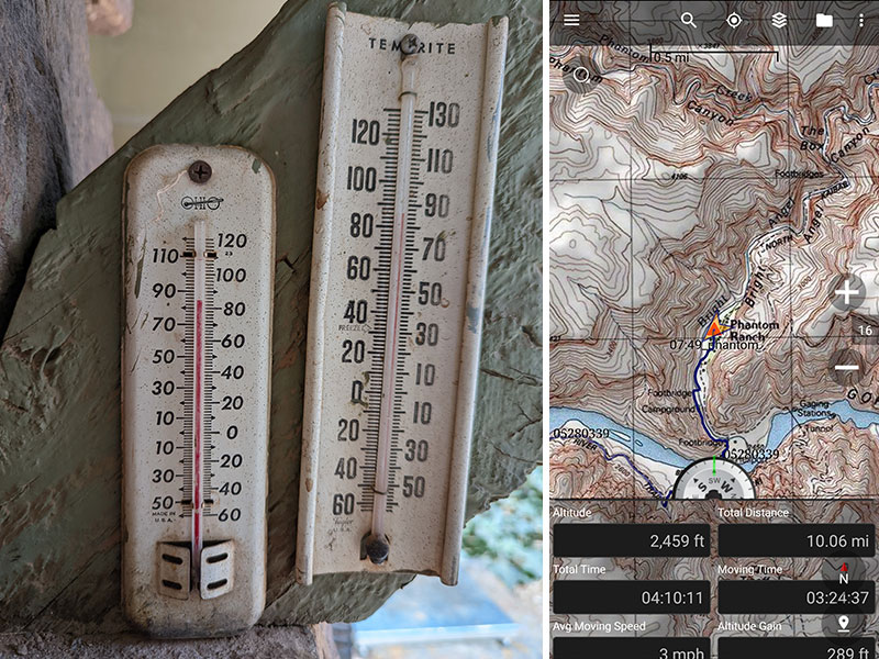
Phantom Ranch was already heating up by 8am.  My GPS tracked 10 miles to this point in a little over 4 hours.  Repeating what I had done the day before, I passed on buying a cold lemonade and drank my electrolytes instead.  I also added some tape to a few new hotspots.

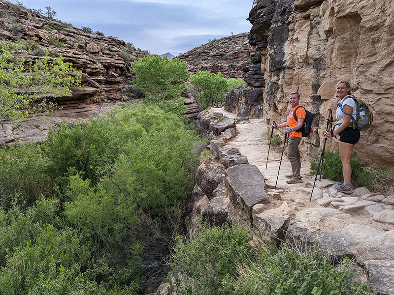
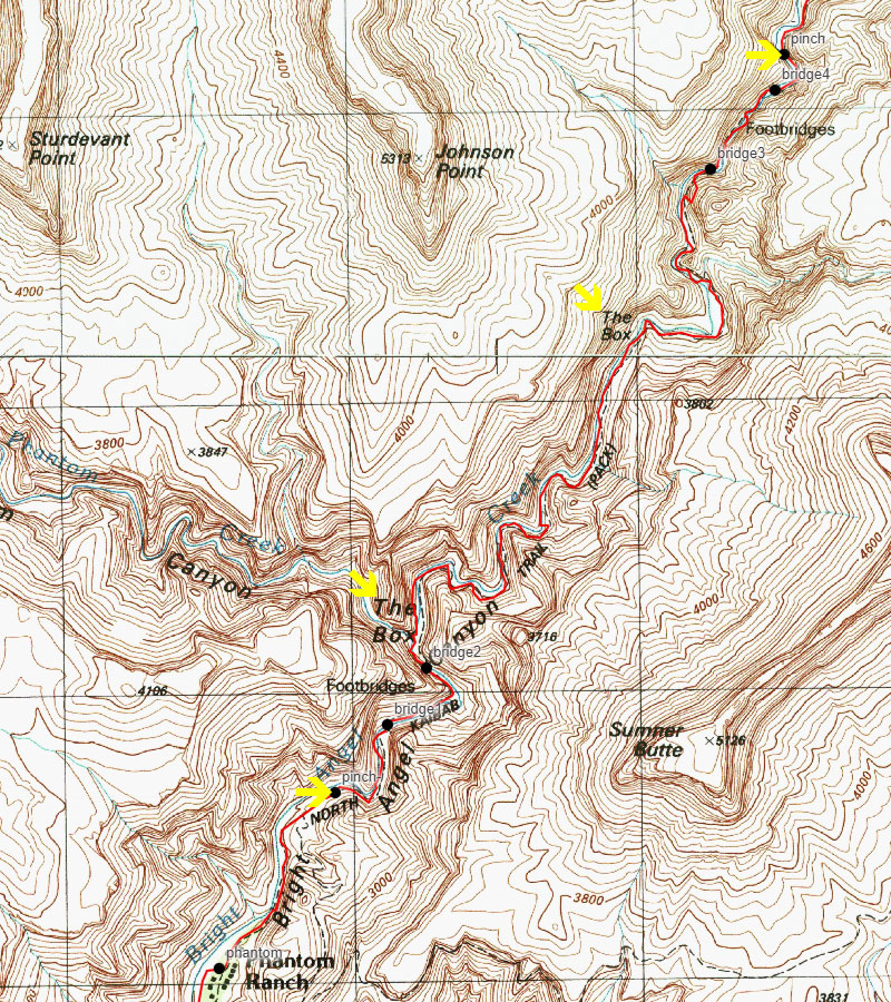
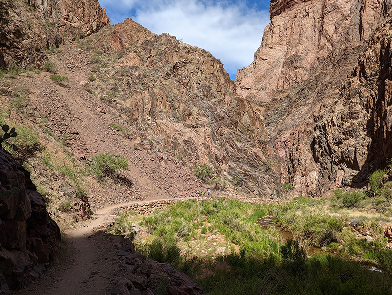
Coming up through “The Box” is always a fun experience.

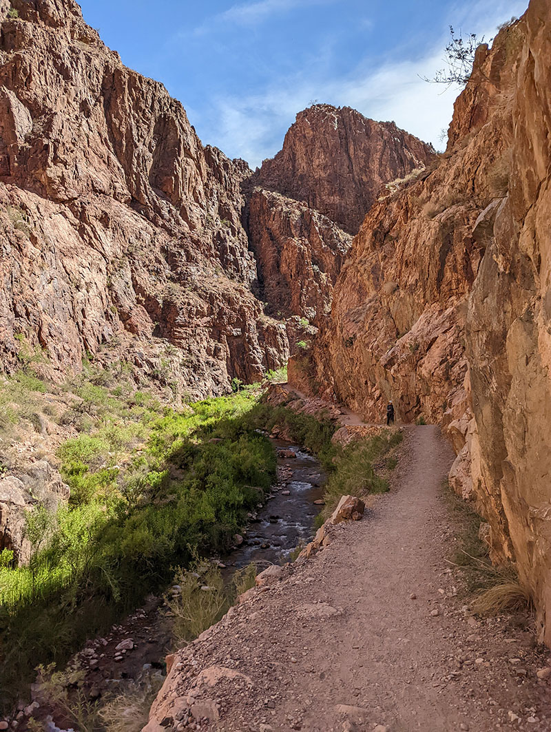
The Box is the 3-4 mile section north of Phantom where that corridor is the narrowest.  I paid special attention during this 5th time through and marked where the canyon walls closed in as indicated by these “pinch points”.

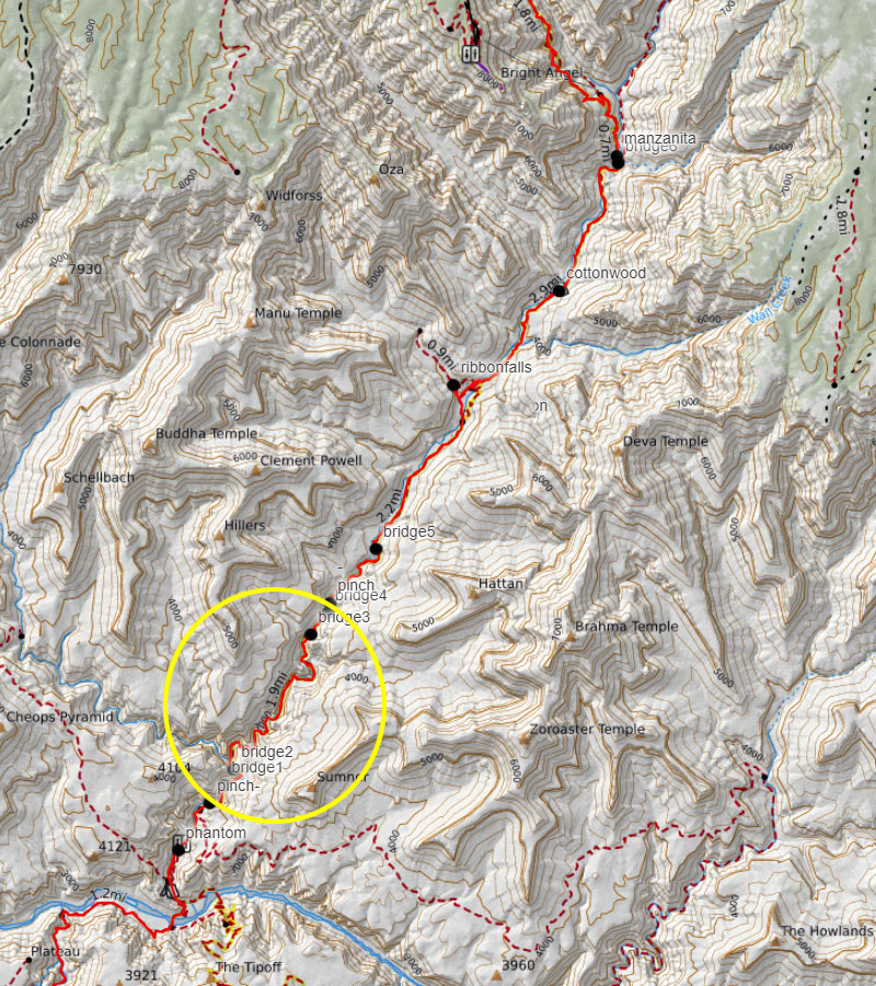
A zoomed out view shows The Box with respect to the distance from Cottonwood and the entire length of that bottom section.

This is such a cool hike (not temperature wise).

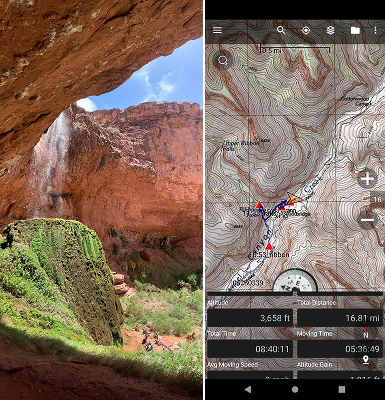
We have always taken a pitstop at Ribbon Falls to grab food and cool off.  I forgot to take a screenshot of our stats again here, but we arrived at 11:30a and 16 miles from the start.  It would be 45 minutes before we would get back on the trail feeling refreshed and ready for the final push.

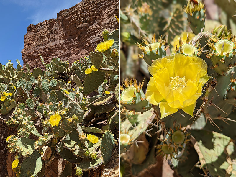
Seeing the cacti along the trail in bloom was a first-time for me.

The End is Near

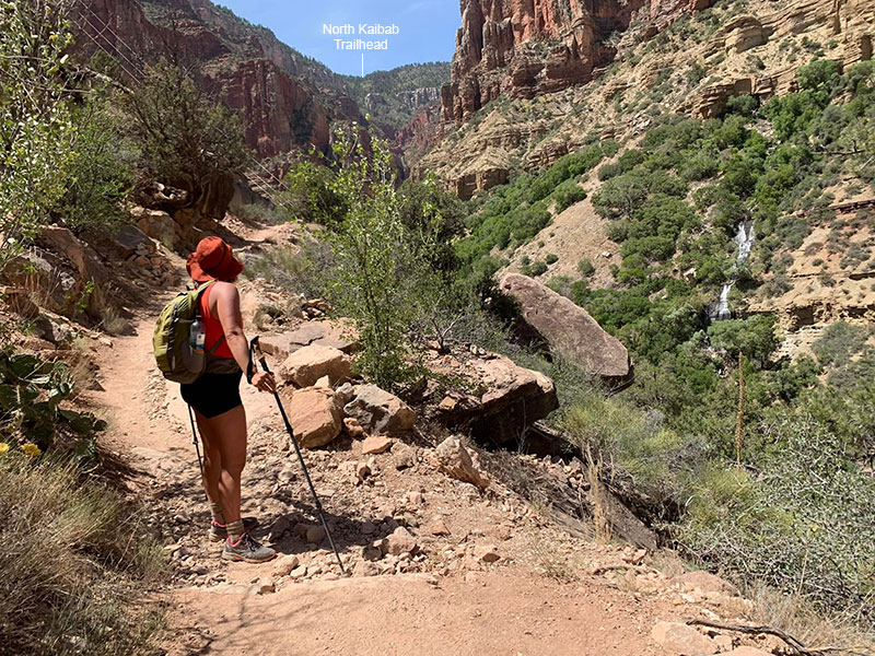
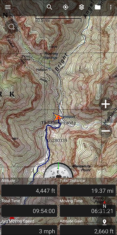
We arrived at Manzanita at 1:30p, 19 miles across and 10 hours in.  This would be our last opportunity to refill water, drench shirts and gear up for the home stretch.  5.5 miles to end…but those would be the hardest of them all!  The words of the Park Ranger ran through my mind: “what should be down is up.”  Yep, 3,600 more feet of up!  It helps when you get to Roaring Springs and the end comes into view.

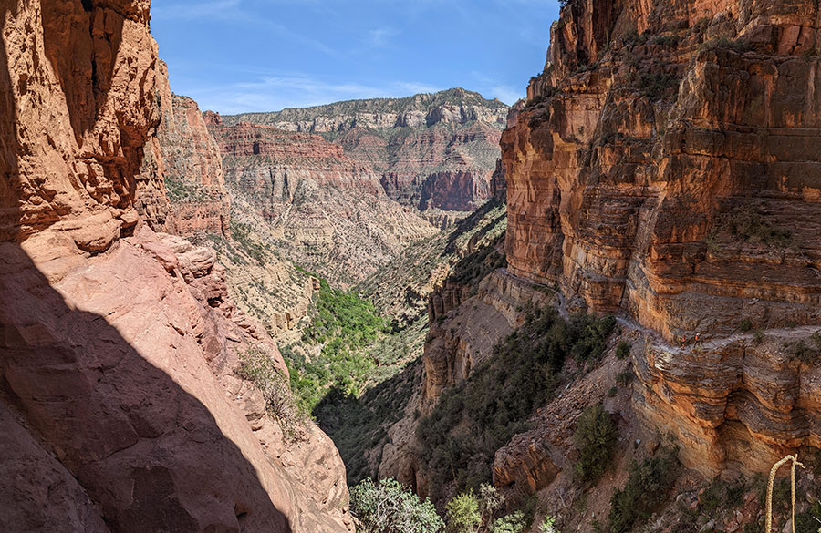
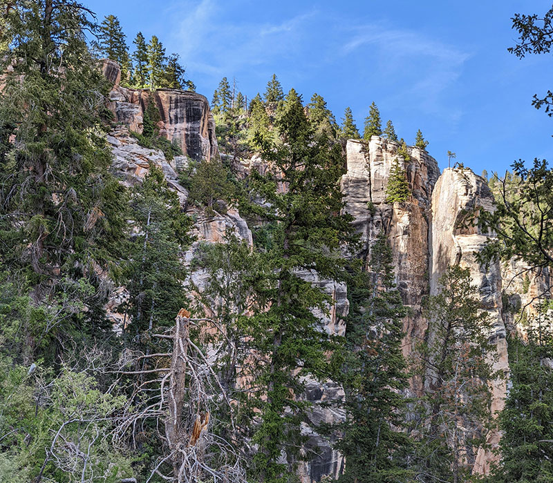
My absolute favorite section of trail is up North Kaibab where it weaves along the steep canyon walls.

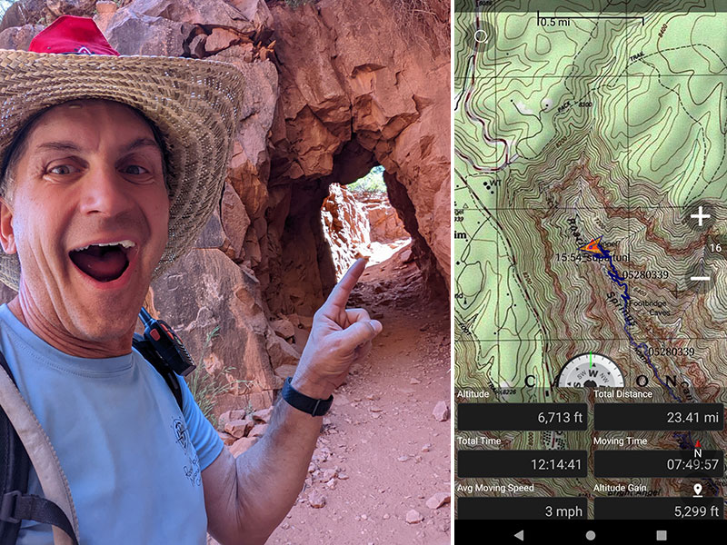
Supai Tunnel means you are very close to the end of a loooong day.  Like, only a mile and a half to go!

The end is up there somewhere.

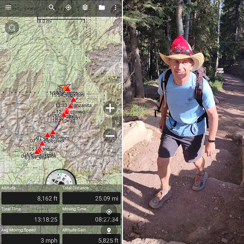
DONE!! 25 more miles with 5,825 feet of elevation, took me 13h and 18m.  My feet were DONE too!

Brandi and Jared came in strong about 45 minutes later.

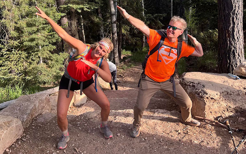
Greg (pictured left) finished at 15 hours exactly!  Steve (pictured right), who just turned 70 earlier that week, also made great time with his Double Rim-to-Rim after starting and hour or so after us.

But it was Scott who blew us all away at 11h 15m – remember, he was nowhere in sight after Devil’s Corkscrew.  Michele, Greg’s wife, also shifted into a high gear at Manzanita and pressed on like a machine.  There was no catching her either!

DAY 4: Return Home

We parted ways after breakfast at Adria’s Restaurant in Kanab with most feeling pretty accomplished from this trip.  Much is learned about oneself from an experience like this… even when you have to call it off for reasons that are yours and yours alone.  But you build strength from the inside out and go after it again if you so choose.  As Jared put it:

“There were lots of miles, lots of elevation loss/gain, lots of heat, lots of hiking, lots of rock and sand AND lots of pure beauty, lots of laughs, lots of encouragement, and lots of incredible memories to remind us that not only can we do hard things but it creates who we want to be.”

← Grand Canyon Double R2R: First Leg, NK to BA
Rolling Hills to Lookout Peak →

Leave a Reply Cancel reply

Your email address will not be published. Required fields are marked *

Couldn`t have asked for a better day to climb Mount Adams. The conditions today (6/4) were absolutely perfect!

These 6 miles were waaaay different from the last six I did in LA. This 6-mile climb to the summit packed in 6,700 feet of elevation and took 6 hours 45 minutes (one-way).

#mtadams #mountadams #pnw #mountaineering #legday

43 5
Open post by backcountryfever with ID 17988770517003932
Couldn't have asked for a better day to climb Mount Adams. The conditions today (6/4) were absolutely perfect!

These 6 miles were waaaay different from the last six I did in LA. This 6-mile climb to the summit packed in 6,700 feet of elevation and took 6 hours 45 minutes (one-way).

#mtadams #mountadams #pnw #mountaineering #legday

Spent the weekend in California for a wedding and managed to squeeze in a quick hike, L.A.-style.

After reaching Mount Lee behind the Hollywood Sign, I couldn`t resist tagging two other peaks along the Aileen Getty Ridge Trail: Cahuenga Peak, the highest point in Griffith Park, and Burbank Peak, home to the famous Wisdom Tree.

The hike came in at 6 miles with just 1,000 feet of elevation gain and took only 2 hours.

#hollywoodsign #cahuengapeak #burbankpeak #aileengettyridgetrail #hikela

19 0
Open post by backcountryfever with ID 17874758856610450
Spent the weekend in California for a wedding and managed to squeeze in a quick hike, L.A.-style.

After reaching Mount Lee behind the Hollywood Sign, I couldn't resist tagging two other peaks along the Aileen Getty Ridge Trail: Cahuenga Peak, the highest point in Griffith Park, and Burbank Peak, home to the famous Wisdom Tree.

The hike came in at 6 miles with just 1,000 feet of elevation gain and took only 2 hours.

#hollywoodsign #cahuengapeak #burbankpeak #aileengettyridgetrail #hikela

Still chasing snow! Took my brother-in-law on his first-ever mountaineering experience. We went up Temple Couloir, over to Deseret Peak, and then slid down West Twin Couloir. Hard to beat spring days like this.

This was my 6th summit of Deseret Peak.

#deseretpeak #templecouloir #twincouloirs #mountaineering #chasingsnow

46 4
Open post by backcountryfever with ID 17898155133454122
Still chasing snow! Took my brother-in-law on his first-ever mountaineering experience. We went up Temple Couloir, over to Deseret Peak, and then slid down West Twin Couloir.  Hard to beat spring days like this.

This was my 6th summit of Deseret Peak.

#deseretpeak #templecouloir #twincouloirs #mountaineering #chasingsnow

One of my favorite things to do between ski season and hiking season: kicking steps up a steep slope toward some snow-capped summit!

#mountaineering #kickingsteps #steepslope #snowcapped #summitday

33 4
Open post by backcountryfever with ID 17939009859229790
One of my favorite things to do between ski season and hiking season: kicking steps up a steep slope toward some snow-capped summit!

#mountaineering #kickingsteps #steepslope #snowcapped #summitday

Another moderate day of mountaineering up the north slope of Mt. Superior, known as Cardiac Bowl. I`ve only been to this peak once before, from the typical summer trail, so it was way fun to get there from this direction.

#mountsuperior #northslope #cardiacbowl #mountaineering #wasatch11ers

32 0
Open post by backcountryfever with ID 18131016616566455
Another moderate day of mountaineering up the north slope of Mt. Superior, known as Cardiac Bowl.  I've only been to this peak once before, from the typical summer trail, so it was way fun to get there from this direction.

#mountsuperior #northslope #cardiacbowl #mountaineering #wasatch11ers

With such good coverage and a big storm rolling in, I think Alta should stay open for at least another week!

#stillskiing #springskiing #skiutah #skiing #alta

15 0
Open post by backcountryfever with ID 18013199525845115
With such good coverage and a big storm rolling in, I think Alta should stay open for at least another week! 

#stillskiing #springskiing #skiutah #skiing #alta

It`s been a minute since I`ve had anything other than ski boots or hockey skates on my feet this winter. Gotta switch gears before the mountaineering season melts away here in Utah!

#mountaineering #kesslerpeak #westridge #wasatchfront #timetoclimb

📷 @wasatchwidescreen

23 0
Open post by backcountryfever with ID 18073878845639559
It's been a minute since I've had anything other than ski boots or hockey skates on my feet this winter.  Gotta switch gears before the mountaineering season melts away here in Utah!

#mountaineering #kesslerpeak #westridge #wasatchfront #timetoclimb

📷 @wasatchwidescreen

On this day last year—February 18—my team and I reached the summit of Aconcagua, the tallest peak in Argentina and the highest mountain in the Western Hemisphere at 22,837 feet.

I’ve enjoyed looking back on that expedition by rereading my day-by-day trip report from our climb.

👉 Link in bio: an 18-part guide covering the entire climb, plus pre-trip planning tips and post-expedition things to see and do around Mendoza.

Whether this is your first high-altitude objective or you’re adding Aconcagua to your mountaineering résumé, the guide will help you see why I chose the 360° Traverse, how to plan for your expedition, and what to expect each day on the mountain.

#aconcagua #aconcagua360 #aconcaguaexpedition #highaltitudemountaineering #mountaineering

35 2
Open post by backcountryfever with ID 18055701743428917
On this day last year—February 18—my team and I reached the summit of Aconcagua, the tallest peak in Argentina and the highest mountain in the Western Hemisphere at 22,837 feet.

I’ve enjoyed looking back on that expedition by rereading my day-by-day trip report from our climb.

👉 Link in bio: an 18-part guide covering the entire climb, plus pre-trip planning tips and post-expedition things to see and do around Mendoza.

Whether this is your first high-altitude objective or you’re adding Aconcagua to your mountaineering résumé, the guide will help you see why I chose the 360° Traverse, how to plan for your expedition, and what to expect each day on the mountain.

#aconcagua #aconcagua360 #aconcaguaexpedition #highaltitudemountaineering #mountaineering

Winter is my favorite season, and cold weather camping is one of my favorite winter activities.

#coldweathercamping #wintercamping #tenting #lovewinter #lovecamping

19 0
Open post by backcountryfever with ID 18088708565160118
Winter is my favorite season, and cold weather camping is one of my favorite winter activities.

#coldweathercamping #wintercamping #tenting #lovewinter #lovecamping
Follow on Instagram

Recent Posts

  • Adventuring Alone on Adams
  • A Road Trip to Trout Lake
  • The Interview That Made Me Reconsider Hydrogen Water
  • After a Year with the COROS Vertix 2S
  • 5 Million Vertical Feet Gained Over 5 Years

Recent Comments

  • Backcountry Fever on Solo Summit of Shasta
  • Michelle Tirhi on Solo Summit of Shasta
  • Matt on How I Would Do Kings Peak in 1 Day
  • Rich Meziere on Bummed Out By A Broken BOA Binding
  • Backcountry Fever on Bummed Out By A Broken BOA Binding

RECOMMENDED READING

Categories

  • 14ers
  • Adventure Plans
  • Avalanche Awareness
  • Backpacking
  • Epic Treks
  • Grand Canyon
  • Health & Wellness
  • International Expeditions
  • Mountaineering
  • Pacific Northwest
  • Peak Bagging
  • Product Feedback
  • Reading References
  • Road Trip
  • Scrambling
  • Season Summary
  • Seven Summits
  • Six-Pack Challenge
  • Snowshoeing
  • Social Media
  • State Highpoints
  • Technology
  • Uinta Mountains
  • Uncategorized
  • Uphill Training
  • Wasatch Front
  • Zion
©2026 Backcountry Fever