Skip to content
Menu
Backcountry Fever
  • Projects
    • Adirondack 46ers
    • Colorado 14ers
    • Seven Summits
      • Climb Aconcagua via the 360° Traverse | Full Guide
    • Wasatch 7
    • Wasatch 11ers
  • Highpoints
  • Experience
  • My Never-Ending List
  • Contact
Backcountry Fever
← Mahalo Mauna Kea
No Sunglasses nor Sunscreen Needed on Sassafras →

Mt. Mitchell Trail to the Top of North Carolina

Posted on September 12, 2023August 20, 2024 by Backcountry Fever

It’s time to hit the east now that I’m done with all the state high points west of the 100th meridian!

After a fun Labor Day weekend in Charlotte, we drove west to Asheville and began my End Of Summer East Coast Highpointing Tour with North Carolina’s Mt. Mitchell.

This summit is accessible by car but I will always opt to hike when a more challenging trail is available.

That said, there are two primary hiking routes to Mt. Mitchell from the south:

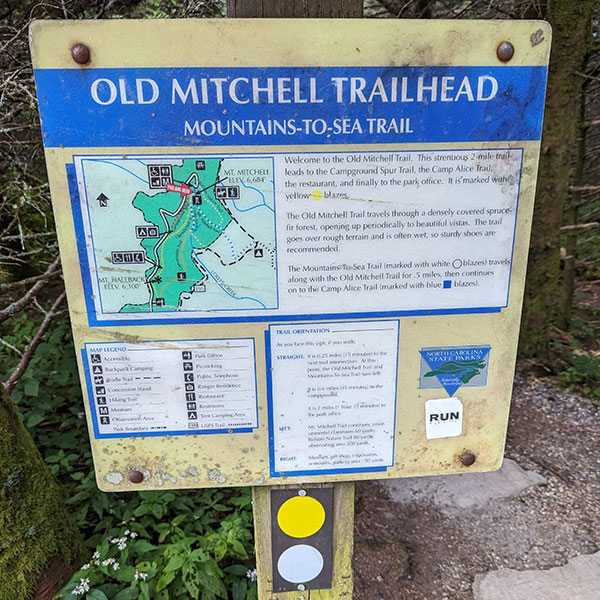
  1. Old Mitchell Trail: 2ish miles and almost 800 feet of elevation (one way) from the Mt. Mitchell Information Center
  2. Mt. Mitchell Trail: 5.5ish miles and over 3,600 feet up (one way) from Black Mountain Campground

I chose the latter since it was longer and harder.

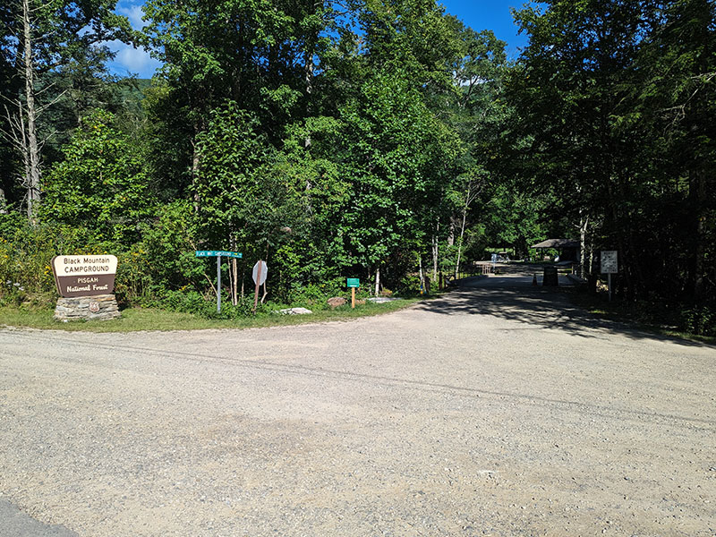
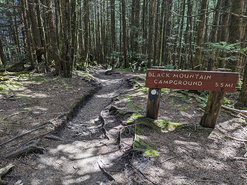
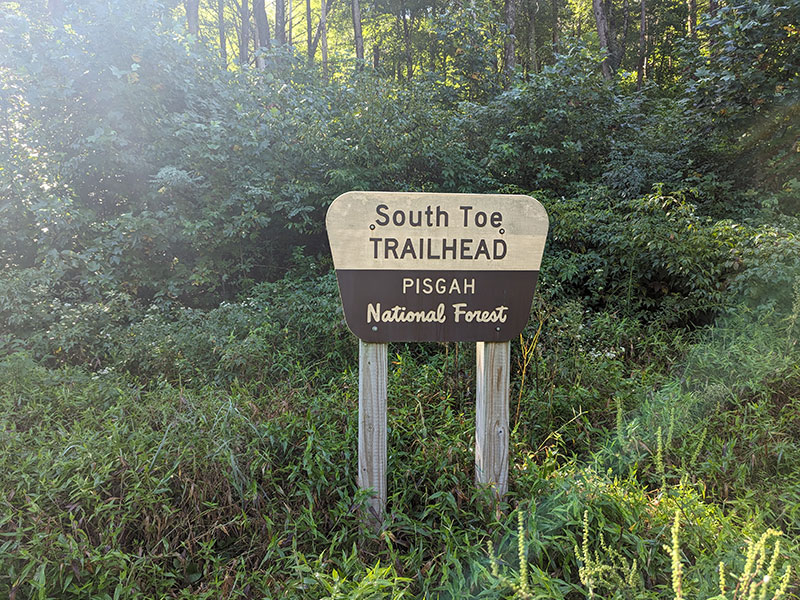
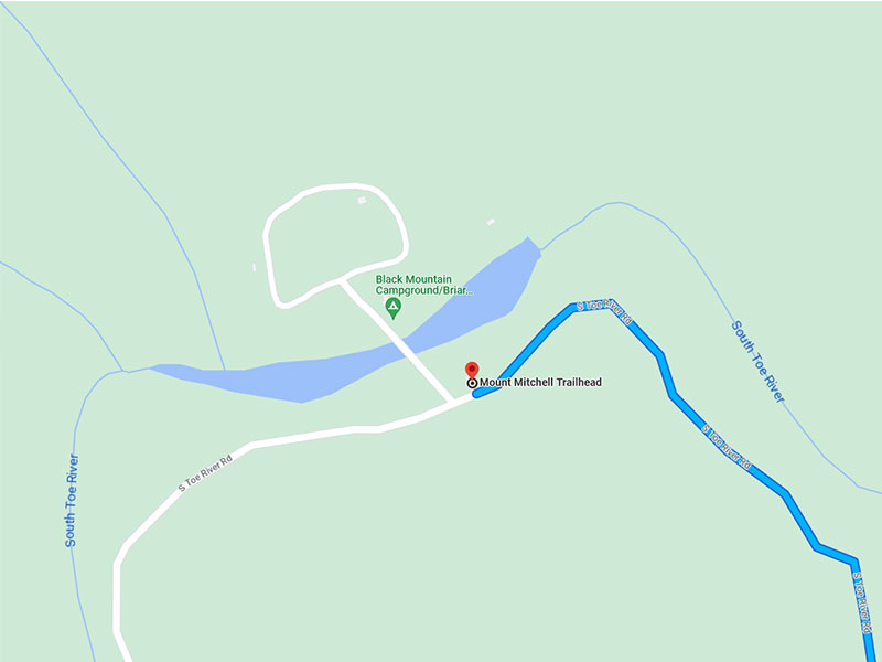
The Mt. Mitchell Trailhead is about an hour north of Interstate 40 from Old Fort (33 miles).  The road is paved and curves through the Pisgah National Forest from Lake Tahoma on up.  The road turns to gravel shortly after you veer left off NC-80 on to S Toe River Road.  At that point, you are about 2 miles from the South Toe Trailhead (Google Maps shows this as the Mt. Mitchell Trailhead).  Either way, it’s right across from Black Mountain Campground where the picture below was taken.  That’s where I parked since it cost to enter the campground by car and South Toe looked like the best place to park anyway.

Mt. Mitchell Trail

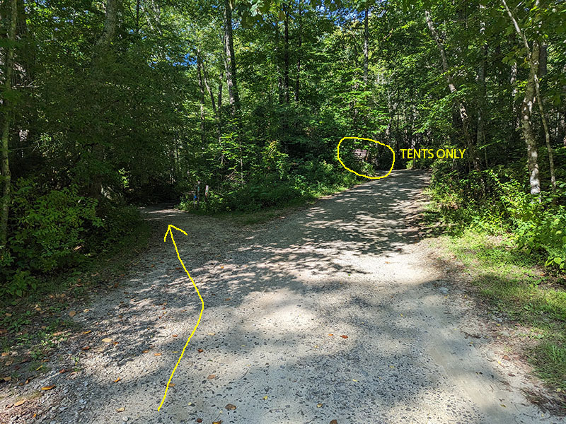
Once across the river and heading into the campground, look left for the start of this trail.  It passes through the Briar Bottom Group Area.  Stay left again just before the sign that says “TENTS ONLY”.

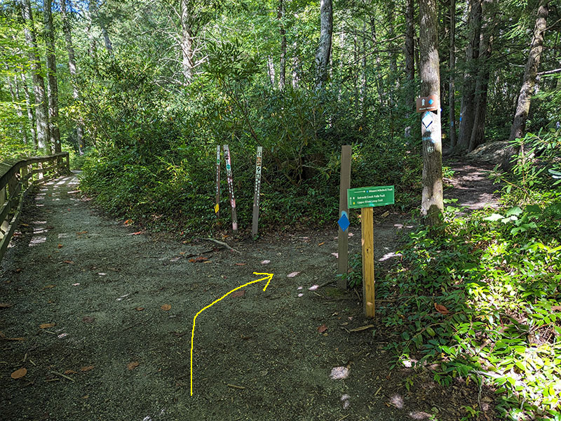
At a quarter mile in, the trail splits again.  Take a right to start your ascent.

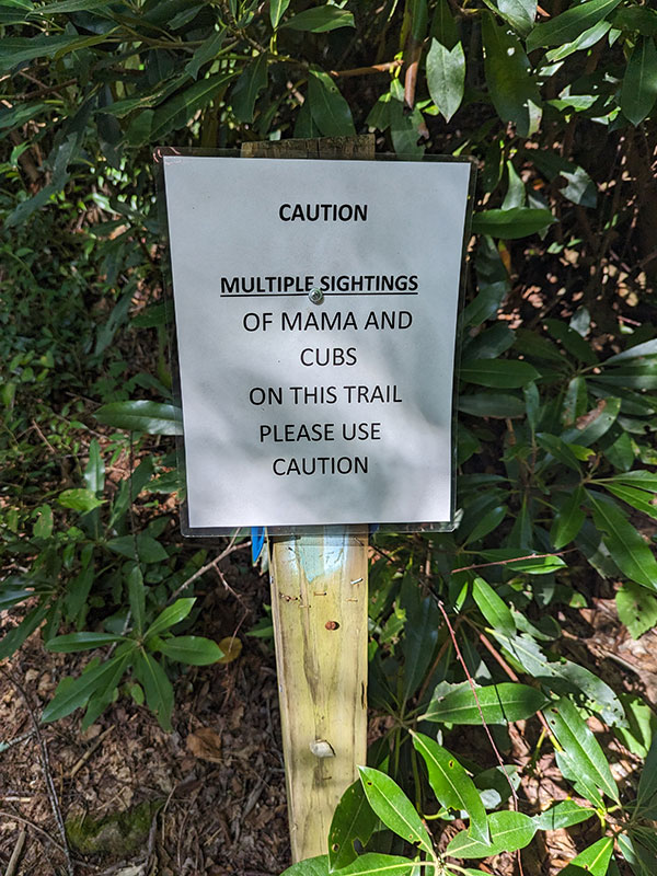
A warning of bears in the area put my senses on high alert.  This was not something I had prepared for, so I picked up a big walking stick that someone had left behind and decided it would be better than nothing.  I also remembered two other cars in the parking lot and hoped we’d all be on the same trail.

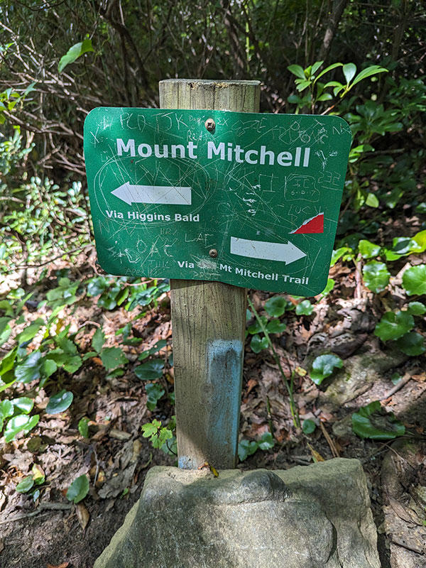
Right before the 2-mile mark, the trail splits once again for two different routes to the summit.  I continued along the “standard” way up but knew I’d have to explore the Higgins route down.

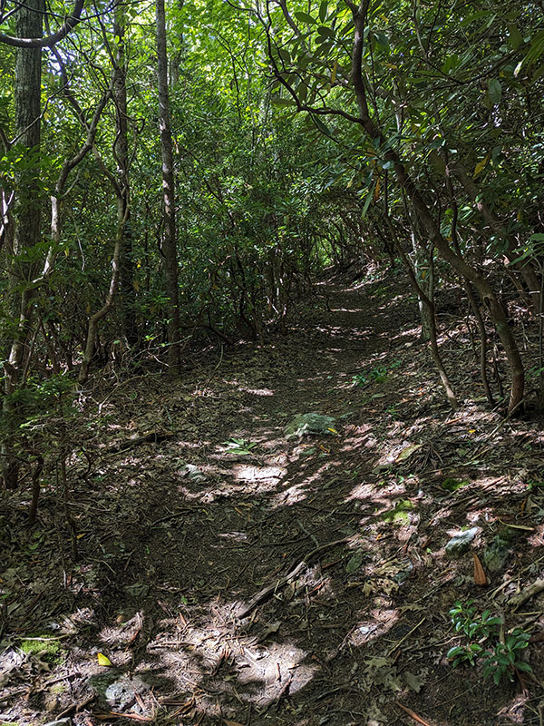
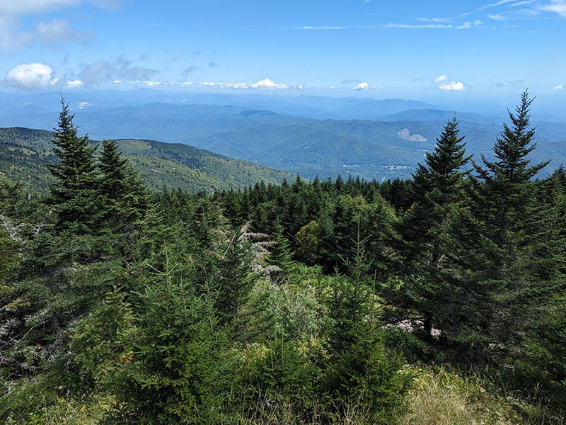
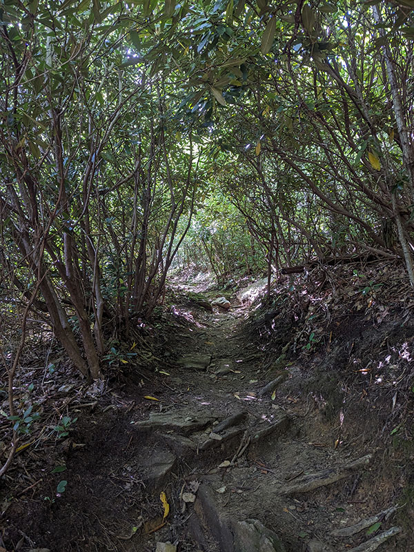
In typical Appalachian-style hiking, the trail was like walking through a tunnel.

There is basically no view of anything other than dense forest under a tall thick canopy.  A few fighter jets blew overhead but there was no way I could see any more than just flickers of black flashing by.
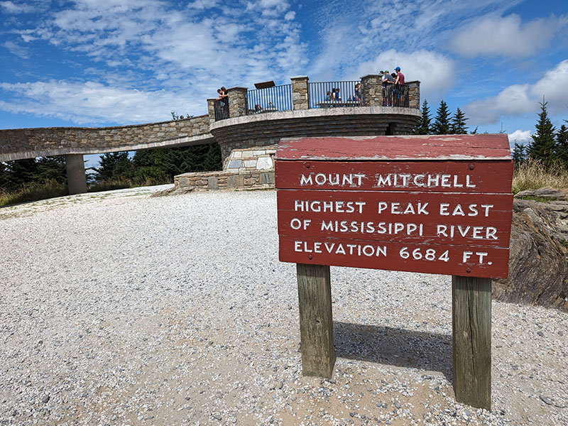
Mt. Mitchell Summit

When I reached the top, it was no wonder why a lookout platform is necessary.

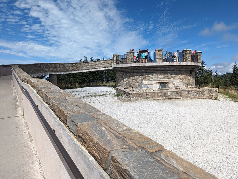
Standing above the treeline is the only way to see anything here.

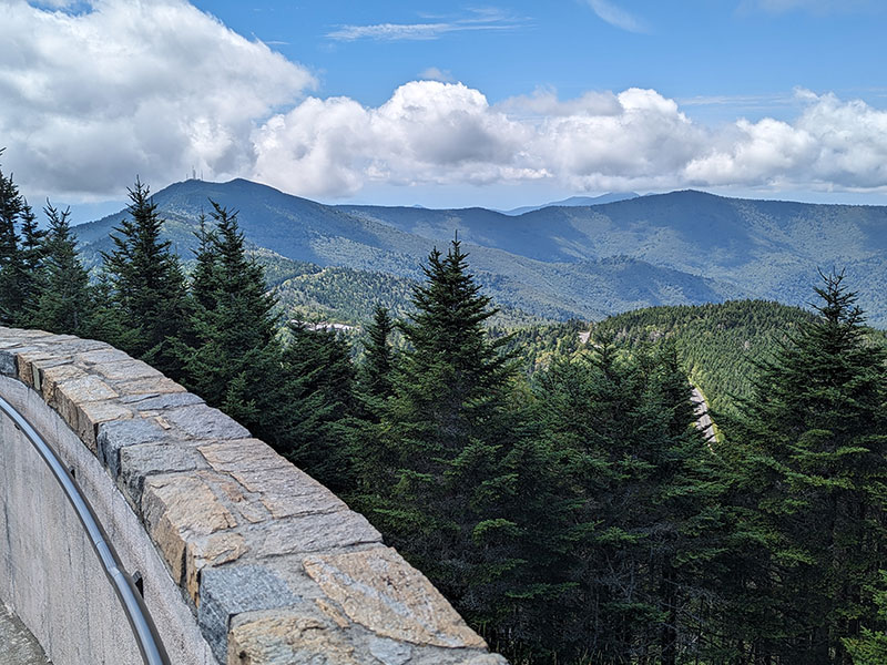
Even then, the view in every direction is deep green mountain slopes for as far as the eye can see!

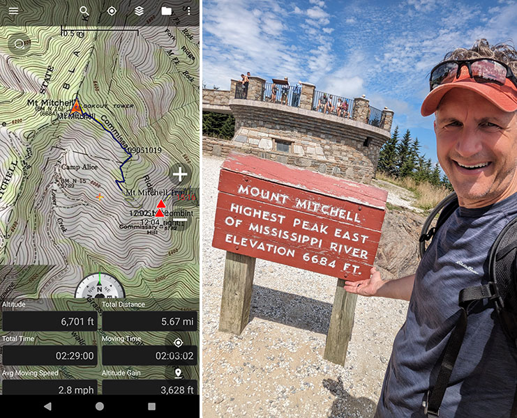
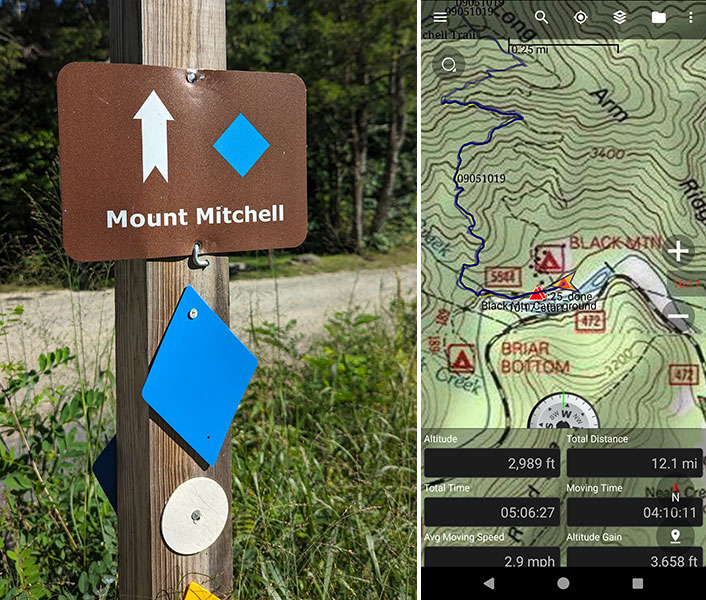
This trail is a good five and a half miles to the top with 3,600 feel of elevation.  That’s a pretty typical day for me but the humid climate of the East also made me soaking wet from it.

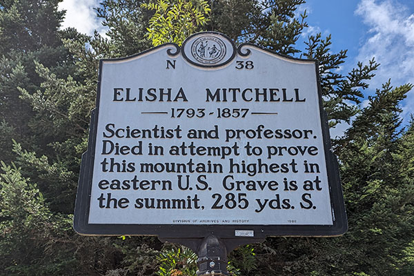
Searching for this grave site was considered, but then thought it likely wouldn’t be all that worthwhile.

I did see the top of Old Mitchell and was happy to have hiked the trail less traveled.

Higgins Bald Return

My return to Black Mountain Campground was quiet and peaceful.  I did come across the hikers that also parked at South Toe, but we had passed by each other much earlier in the day.  They were already headed down when I was only 3 miles in.  So I knew I probably wouldn’t see anyone else again on the trail for the rest of the day… and I didn’t.

I did stick to my idea of going back by way of Higgins Bald.  The trail marker here indicates “most difficult” but didn’t see how that could be possible.  Why would it be tougher from the TOP of this split when no similar mention of this was made on the sign down near the bottom of it??  It didn’t make sense and went for it anyway.

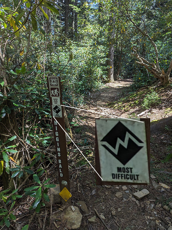
I don’t know why this alternate trail is called Higgins Bald since there is nothing “bald” about it… just more of the same but slightly longer than the main route.

Five hours from the start, I was back at my car.  Final stats for the day: 12 miles and 3,658′ of elevation.

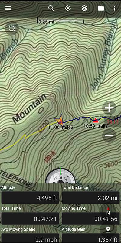
All in all, it was a great afternoon in North Carolina and I enjoyed every minute of it!  Would I do this one again?  Probably not.  Although I might consider what another guy at the top told me he was doing.  He basically drove up for a loop hike along Deep Gap Trail to the north and then back around on the Buncombe Horse Trail (yellow line shown below).

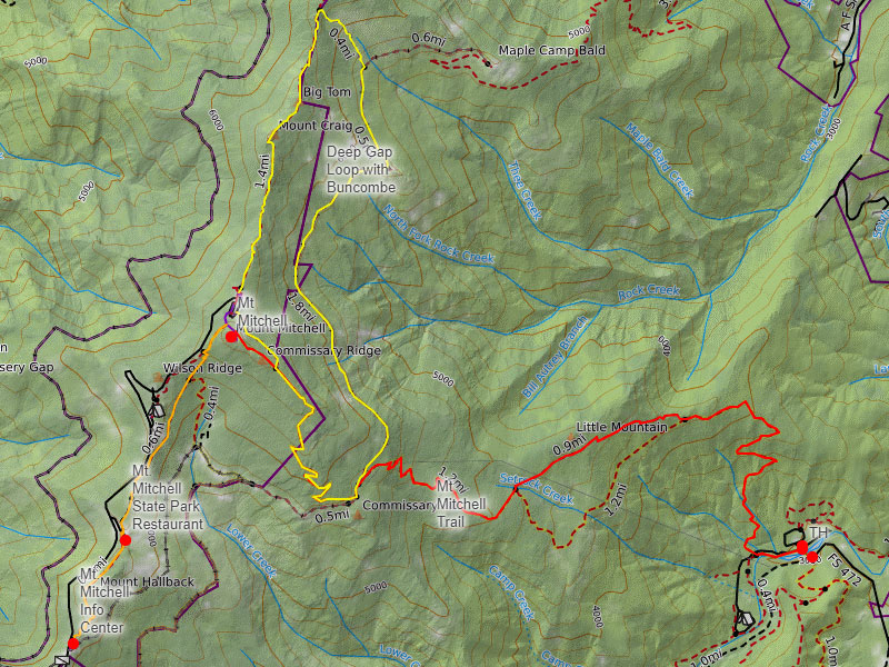
You can view or download any of the tracks mentioned here from this CalTopo link.

Next stop: Sassafras Mountain, South Carolina

← Mahalo Mauna Kea
No Sunglasses nor Sunscreen Needed on Sassafras →

Leave a Reply Cancel reply

Your email address will not be published. Required fields are marked *

Couldn`t have asked for a better day to climb Mount Adams. The conditions today (6/4) were absolutely perfect!

These 6 miles were waaaay different from the last six I did in LA. This 6-mile climb to the summit packed in 6,700 feet of elevation and took 6 hours 45 minutes (one-way).

#mtadams #mountadams #pnw #mountaineering #legday

43 5
Open post by backcountryfever with ID 17988770517003932
Couldn't have asked for a better day to climb Mount Adams. The conditions today (6/4) were absolutely perfect!

These 6 miles were waaaay different from the last six I did in LA. This 6-mile climb to the summit packed in 6,700 feet of elevation and took 6 hours 45 minutes (one-way).

#mtadams #mountadams #pnw #mountaineering #legday

Spent the weekend in California for a wedding and managed to squeeze in a quick hike, L.A.-style.

After reaching Mount Lee behind the Hollywood Sign, I couldn`t resist tagging two other peaks along the Aileen Getty Ridge Trail: Cahuenga Peak, the highest point in Griffith Park, and Burbank Peak, home to the famous Wisdom Tree.

The hike came in at 6 miles with just 1,000 feet of elevation gain and took only 2 hours.

#hollywoodsign #cahuengapeak #burbankpeak #aileengettyridgetrail #hikela

19 0
Open post by backcountryfever with ID 17874758856610450
Spent the weekend in California for a wedding and managed to squeeze in a quick hike, L.A.-style.

After reaching Mount Lee behind the Hollywood Sign, I couldn't resist tagging two other peaks along the Aileen Getty Ridge Trail: Cahuenga Peak, the highest point in Griffith Park, and Burbank Peak, home to the famous Wisdom Tree.

The hike came in at 6 miles with just 1,000 feet of elevation gain and took only 2 hours.

#hollywoodsign #cahuengapeak #burbankpeak #aileengettyridgetrail #hikela

Still chasing snow! Took my brother-in-law on his first-ever mountaineering experience. We went up Temple Couloir, over to Deseret Peak, and then slid down West Twin Couloir. Hard to beat spring days like this.

This was my 6th summit of Deseret Peak.

#deseretpeak #templecouloir #twincouloirs #mountaineering #chasingsnow

46 4
Open post by backcountryfever with ID 17898155133454122
Still chasing snow! Took my brother-in-law on his first-ever mountaineering experience. We went up Temple Couloir, over to Deseret Peak, and then slid down West Twin Couloir.  Hard to beat spring days like this.

This was my 6th summit of Deseret Peak.

#deseretpeak #templecouloir #twincouloirs #mountaineering #chasingsnow

One of my favorite things to do between ski season and hiking season: kicking steps up a steep slope toward some snow-capped summit!

#mountaineering #kickingsteps #steepslope #snowcapped #summitday

33 4
Open post by backcountryfever with ID 17939009859229790
One of my favorite things to do between ski season and hiking season: kicking steps up a steep slope toward some snow-capped summit!

#mountaineering #kickingsteps #steepslope #snowcapped #summitday

Another moderate day of mountaineering up the north slope of Mt. Superior, known as Cardiac Bowl. I`ve only been to this peak once before, from the typical summer trail, so it was way fun to get there from this direction.

#mountsuperior #northslope #cardiacbowl #mountaineering #wasatch11ers

32 0
Open post by backcountryfever with ID 18131016616566455
Another moderate day of mountaineering up the north slope of Mt. Superior, known as Cardiac Bowl.  I've only been to this peak once before, from the typical summer trail, so it was way fun to get there from this direction.

#mountsuperior #northslope #cardiacbowl #mountaineering #wasatch11ers

With such good coverage and a big storm rolling in, I think Alta should stay open for at least another week!

#stillskiing #springskiing #skiutah #skiing #alta

15 0
Open post by backcountryfever with ID 18013199525845115
With such good coverage and a big storm rolling in, I think Alta should stay open for at least another week! 

#stillskiing #springskiing #skiutah #skiing #alta

It`s been a minute since I`ve had anything other than ski boots or hockey skates on my feet this winter. Gotta switch gears before the mountaineering season melts away here in Utah!

#mountaineering #kesslerpeak #westridge #wasatchfront #timetoclimb

📷 @wasatchwidescreen

23 0
Open post by backcountryfever with ID 18073878845639559
It's been a minute since I've had anything other than ski boots or hockey skates on my feet this winter.  Gotta switch gears before the mountaineering season melts away here in Utah!

#mountaineering #kesslerpeak #westridge #wasatchfront #timetoclimb

📷 @wasatchwidescreen

On this day last year—February 18—my team and I reached the summit of Aconcagua, the tallest peak in Argentina and the highest mountain in the Western Hemisphere at 22,837 feet.

I’ve enjoyed looking back on that expedition by rereading my day-by-day trip report from our climb.

👉 Link in bio: an 18-part guide covering the entire climb, plus pre-trip planning tips and post-expedition things to see and do around Mendoza.

Whether this is your first high-altitude objective or you’re adding Aconcagua to your mountaineering résumé, the guide will help you see why I chose the 360° Traverse, how to plan for your expedition, and what to expect each day on the mountain.

#aconcagua #aconcagua360 #aconcaguaexpedition #highaltitudemountaineering #mountaineering

35 2
Open post by backcountryfever with ID 18055701743428917
On this day last year—February 18—my team and I reached the summit of Aconcagua, the tallest peak in Argentina and the highest mountain in the Western Hemisphere at 22,837 feet.

I’ve enjoyed looking back on that expedition by rereading my day-by-day trip report from our climb.

👉 Link in bio: an 18-part guide covering the entire climb, plus pre-trip planning tips and post-expedition things to see and do around Mendoza.

Whether this is your first high-altitude objective or you’re adding Aconcagua to your mountaineering résumé, the guide will help you see why I chose the 360° Traverse, how to plan for your expedition, and what to expect each day on the mountain.

#aconcagua #aconcagua360 #aconcaguaexpedition #highaltitudemountaineering #mountaineering

Winter is my favorite season, and cold weather camping is one of my favorite winter activities.

#coldweathercamping #wintercamping #tenting #lovewinter #lovecamping

19 0
Open post by backcountryfever with ID 18088708565160118
Winter is my favorite season, and cold weather camping is one of my favorite winter activities.

#coldweathercamping #wintercamping #tenting #lovewinter #lovecamping
Follow on Instagram

Recent Posts

  • Adventuring Alone on Adams
  • A Road Trip to Trout Lake
  • The Interview That Made Me Reconsider Hydrogen Water
  • After a Year with the COROS Vertix 2S
  • 5 Million Vertical Feet Gained Over 5 Years

Recent Comments

  • Backcountry Fever on Solo Summit of Shasta
  • Michelle Tirhi on Solo Summit of Shasta
  • Matt on How I Would Do Kings Peak in 1 Day
  • Rich Meziere on Bummed Out By A Broken BOA Binding
  • Backcountry Fever on Bummed Out By A Broken BOA Binding

RECOMMENDED READING

Categories

  • 14ers
  • Adventure Plans
  • Avalanche Awareness
  • Backpacking
  • Epic Treks
  • Grand Canyon
  • Health & Wellness
  • International Expeditions
  • Mountaineering
  • Pacific Northwest
  • Peak Bagging
  • Product Feedback
  • Reading References
  • Road Trip
  • Scrambling
  • Season Summary
  • Seven Summits
  • Six-Pack Challenge
  • Snowshoeing
  • Social Media
  • State Highpoints
  • Technology
  • Uinta Mountains
  • Uncategorized
  • Uphill Training
  • Wasatch Front
  • Zion
©2026 Backcountry Fever