Skip to content
Menu
Backcountry Fever
  • Projects
    • Adirondack 46ers
    • Colorado 14ers
    • Seven Summits
      • Climb Aconcagua via the 360° Traverse | Full Guide
    • Wasatch 7
    • Wasatch 11ers
  • Highpoints
  • Experience
  • My Never-Ending List
  • Contact
Backcountry Fever
← No Sunglasses nor Sunscreen Needed on Sassafras
An Urban Adventure Game with REI →

Brasstown Bald from the Arkaquah Trail

Posted on September 17, 2023December 3, 2024 by Backcountry Fever

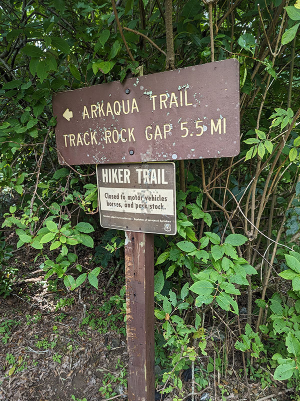
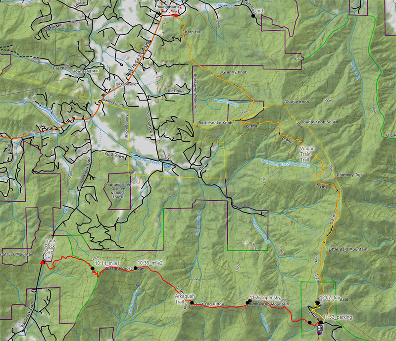
The last stop on my End of Summer East Coast Highpointing Tour is Georgia’s Brasstown Bald.  I chose to summit this state’s highpoint using the Arkaquah Trail from Track Rock Gap, not far off US 76 between Blairsville and Young Harris.

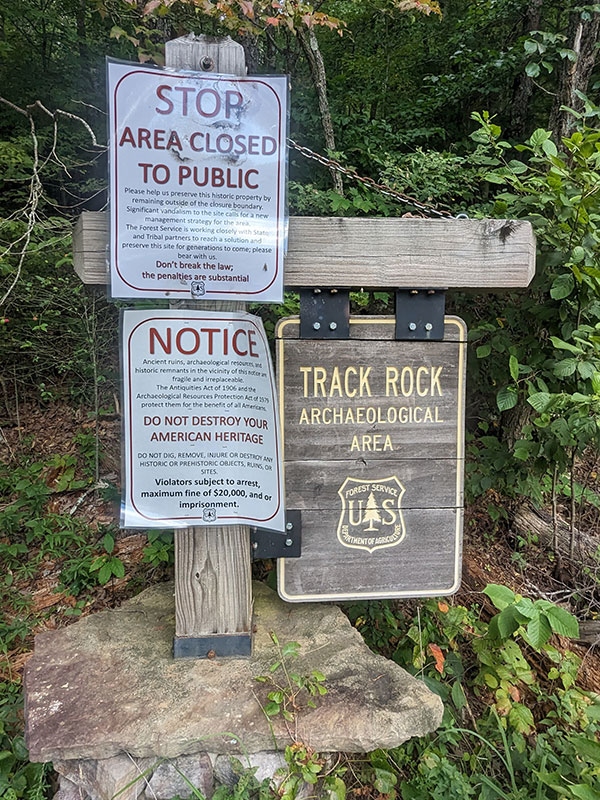
The parking area on the west side of the road is really for the petroglyph site that is temporarily closed to the public.

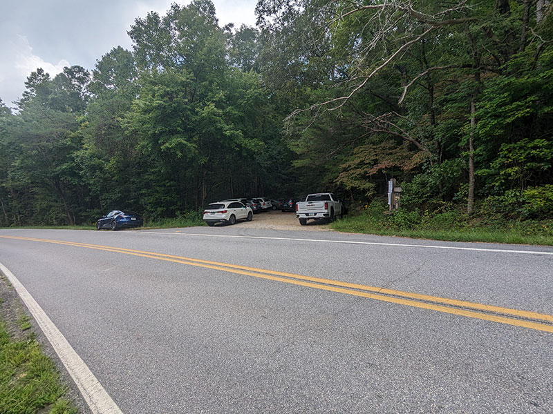
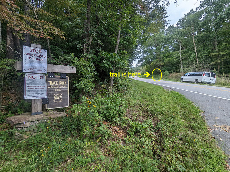
The trail is actually on the east side of the Track Rock Gap Road and slightly to the north of this archaeological area.

Arkaquah Trail

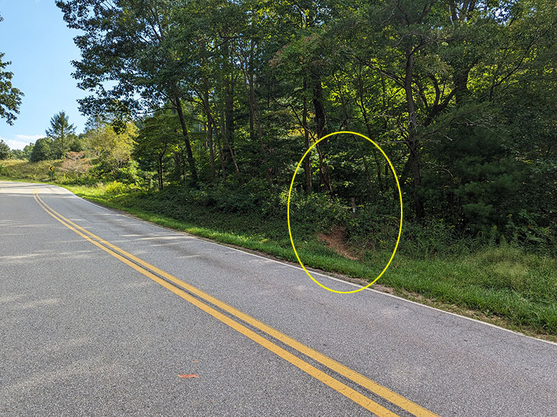
The Arkaquah Trail is barely noticeable along the side of the road.  No trailhead parking, no signage… not even a blaze!  Either way, I anticipated this 5.5-mile route to take around 2.5 hours from here.

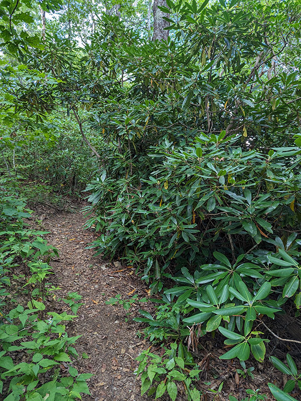
This trail is another Appalachian-style hike through the jungle…

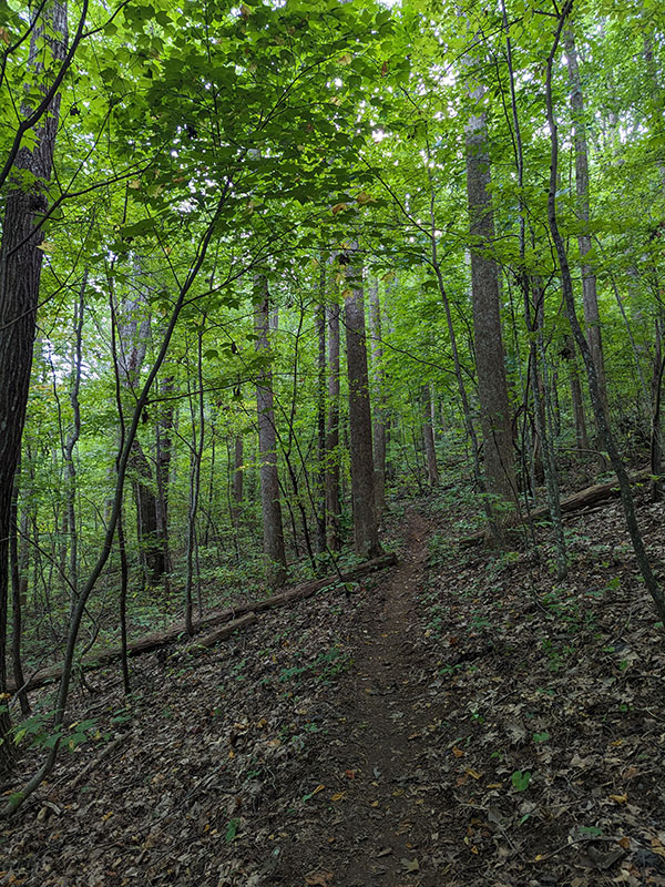
…with a bunch of ups and downs through dense foliage and viny rhododendron shrubs.

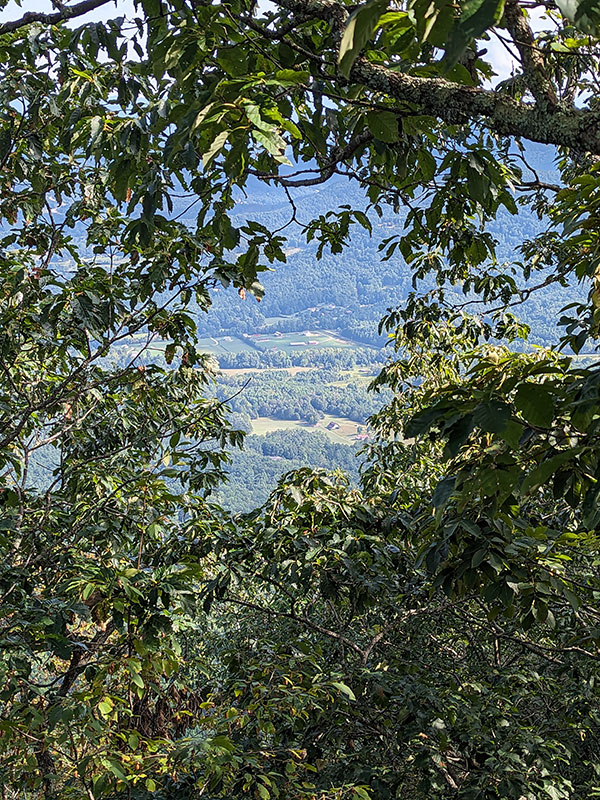
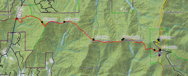
My favorite part was the narrow traverse across Locust Log Ridge.  You can see how far up you are from the peepholes through the trees.

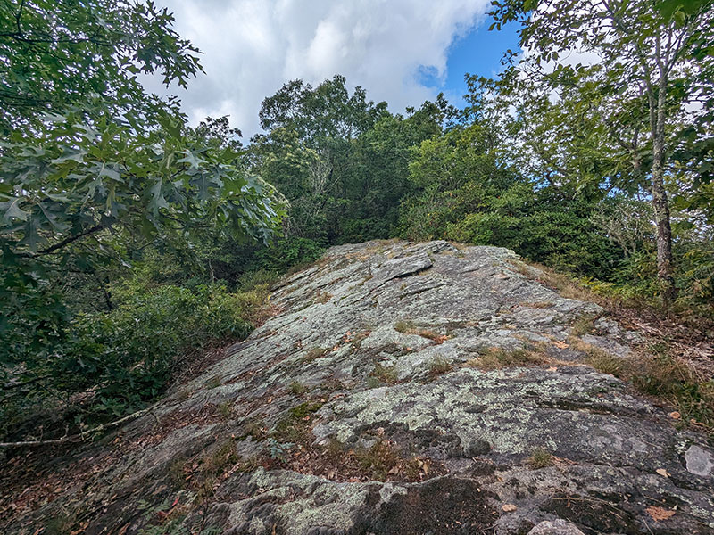
The only open view of the sky you get is the few steps you take across Chimneytop Mountain, 4 miles in.

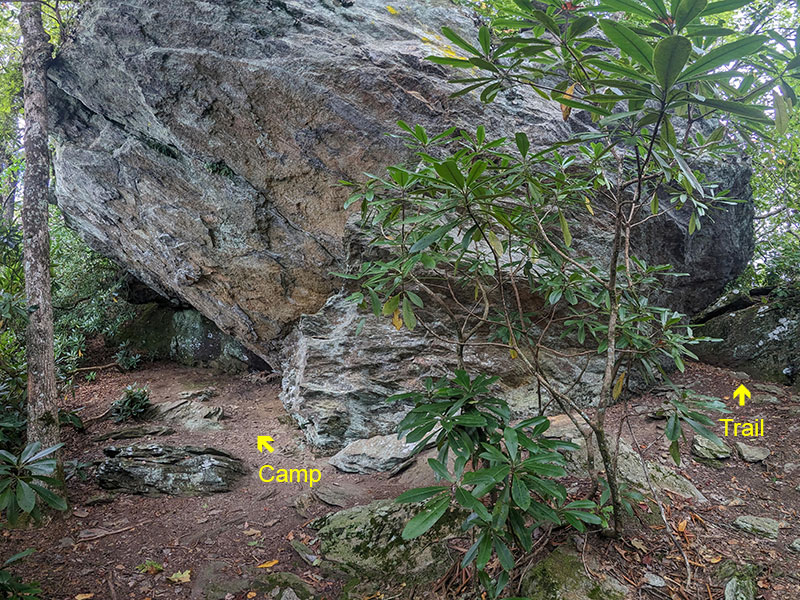
There is one place you might need to stop and look for a continuation of the trail.  It’s where this camp is located by the giant boulder.  I was drawn to the left at first, but the trail actually goes to the right through that crack.

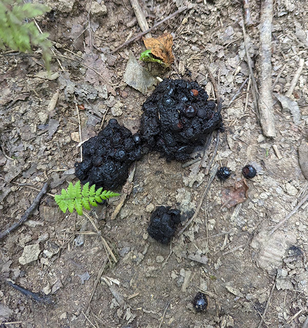
Remember, this is bear country too, as seen by somewhat fresh evidence left behind.

Final Stretch

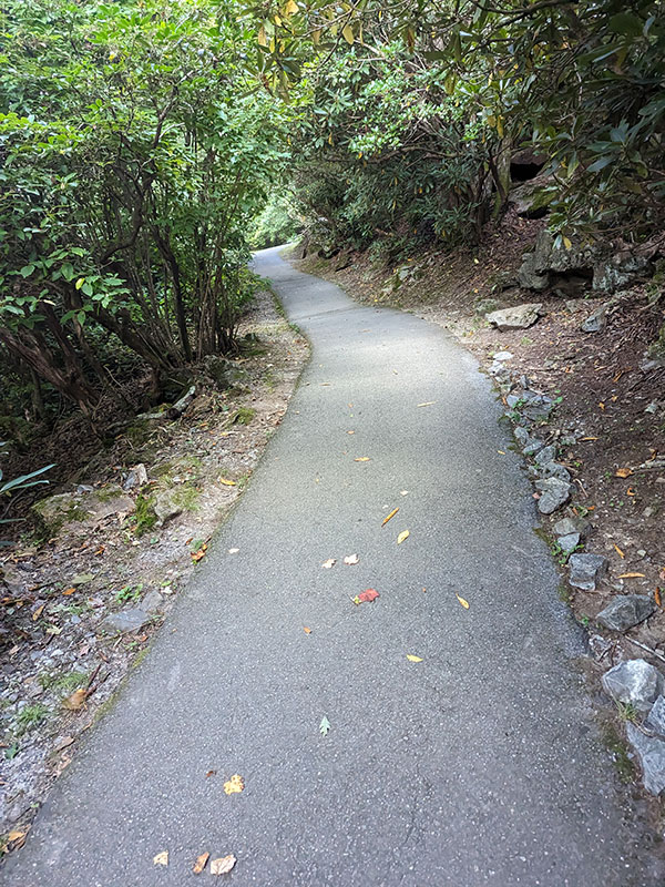
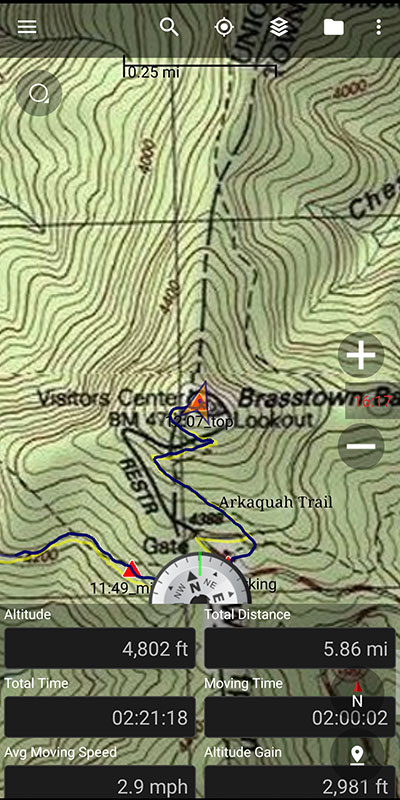
Not far after the 5-mile mark, Arkaquah ends at the Brasstown Bald parking area.  Here you will find a restroom, gift shop and the final stretch to the summit.  That last 1/2 mile is paved but does climb another 400′ of elevation too.

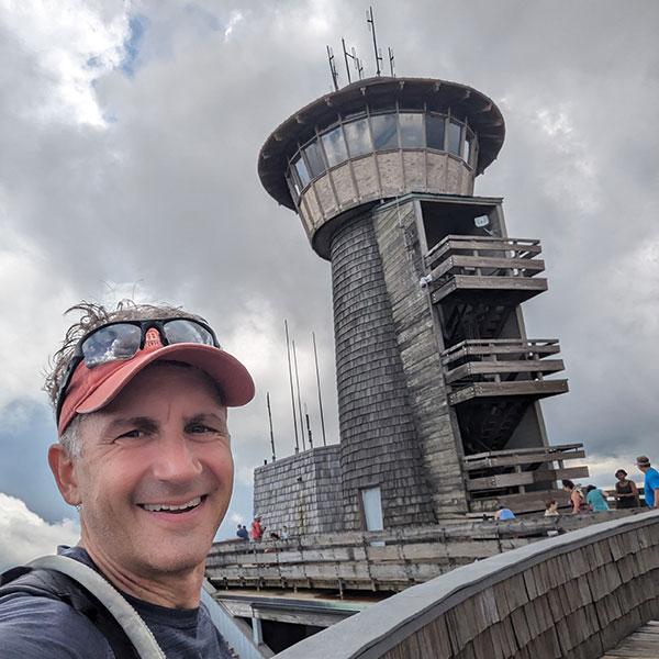
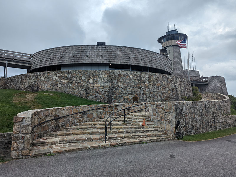
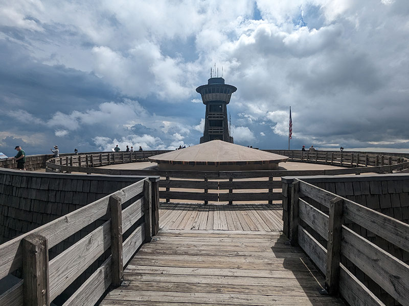
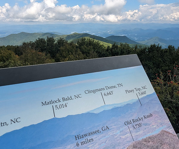
Brasstown’s observation tower was the coolest of the three I visited this week!

1-way stats to the top turned out to be a little over 5.5 miles and just under 3,000 feet of elevation.

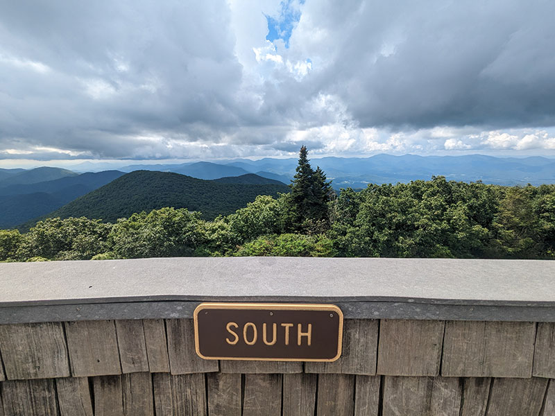
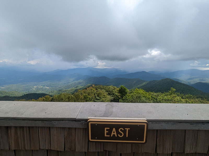
The views were more or less the same as what was seen from Mt. Mitchell and Sassafras Mountain.

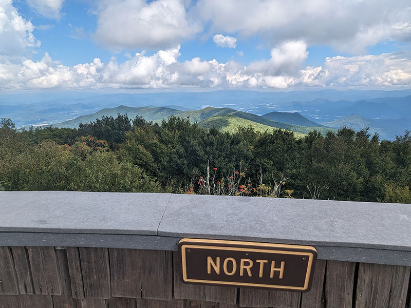
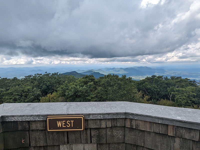
I guess you can see Tennessee’s high point from here, but it all looks the same to me.

Back to Track Rock Gap

I returned the way I came as rain clouds threatened nearby.  I also had a rain jacket stuffed in my pack, but didn’t end up needing it.

Turned out to be another 12-mile day RT with about 3,400 of gain. Not bad for the highest point in Georgia.  Here’s a GPX track of this route if you’re interested.

Wagon Train Trail

As I made my way down off the summit, a Father and son were milling around the Wagon Train Trailhead and asked if I knew anything about it.  Unfortunately, I didn’t… but it did make me wonder.

Where did that trail go?

How long was it?

Could I have taken that trail to somehow make this a loop?  (see orange track below)

The Wagon Train Trail starts in Young Harris.  Recalling that we passed through this town on our way in, I went back to check it out.  Google Maps lead me to Young Harris College and Bald Mountain Road where the paved road skirts along college housing before ending at a gate adjacent to student parking.

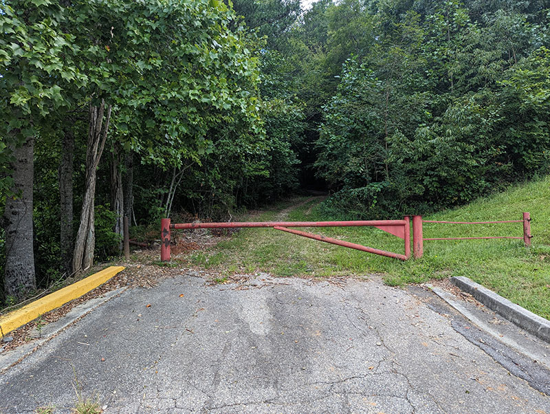
There are no signs here indicating an “historic trailhead” nor anything that resembles trailhead parking.  In fact, student permits are required to park in the lot next to this gate.

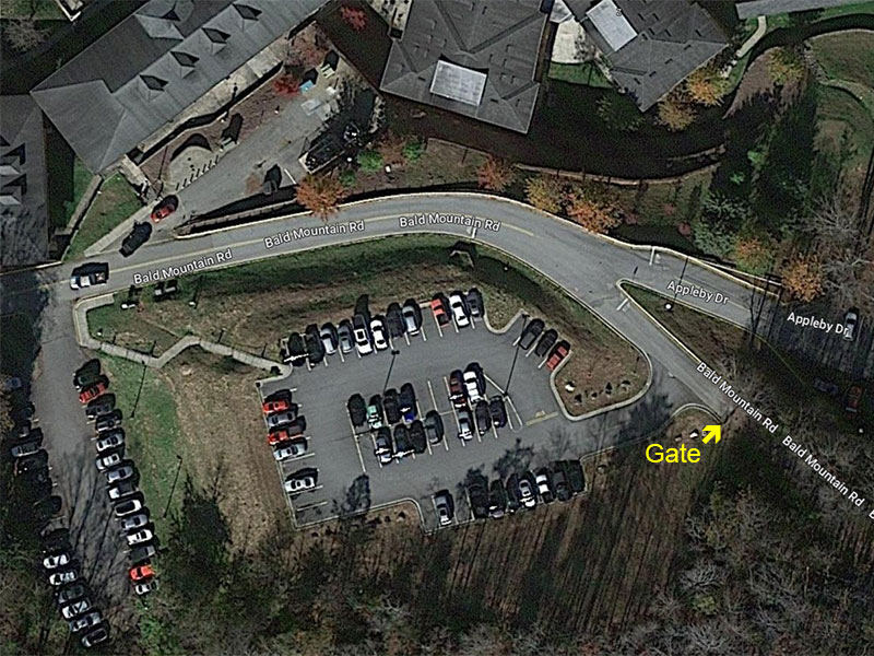
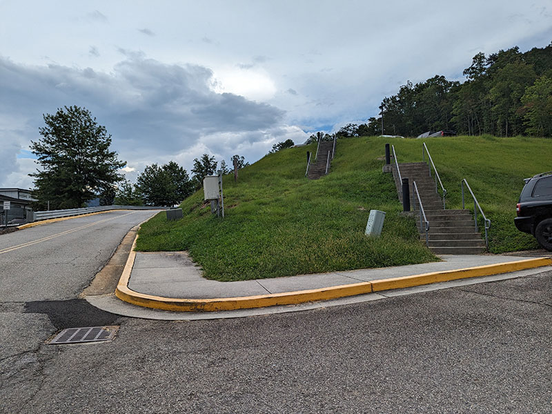
My best guess is that hikers starting here might park across from the Methodist church near the corner of Main and Bald Mountain Road.

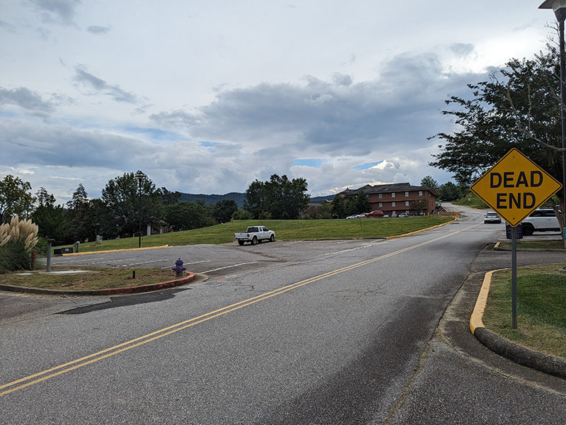
If so, then all you have to do is walk up the road a tenth of a mile to these stairs and cut across the parking lot to begin your hike.  Based on my mapping, the Wagon Train Trail is about 6.5 miles one-way with about 2,500 feet of elevation.

I’d love to know if this trail is active with the kind of history behind this route.

Has anyone taken it or is this used mostly by college students?

Jack’s Knob Trail

Since writing this post, I also noticed another way up from Jack’s Gap.  Jack’s Knob Trail (purple track below) looks to be about 3 miles one-way and less than 2,000 feet of elevation gain.  Trail descriptions mention the dread of 40 switchbacks, but I think that’s what makes it sound interesting!

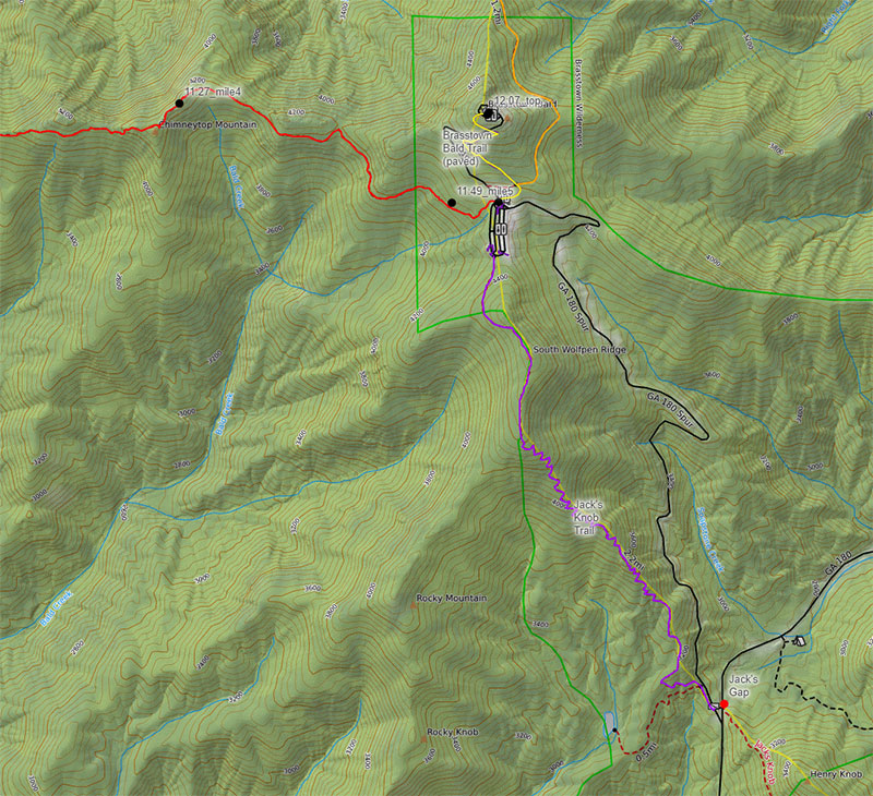
Georgia was my favorite state highpoint of the three I did last week.  If I came back for Brasstown Bald again, my trails of choice would most likely be Jack’s Knob up with Wagon Train down.  I think I’d park the car in Young Harris and catch a 15-mile/30-minute Uber ride to Jack’s Gap and start from there.

← No Sunglasses nor Sunscreen Needed on Sassafras
An Urban Adventure Game with REI →

1 thought on “Brasstown Bald from the Arkaquah Trail”

  1. Foot says:
    October 15, 2024 at 10:55 pm

    Thank you for the information. Very few use the wagon trail anymore. Couple of old timers.

    Reply

Leave a Reply Cancel reply

Your email address will not be published. Required fields are marked *

On this day last year—February 18—my team and I reached the summit of Aconcagua, the tallest peak in Argentina and the highest mountain in the Western Hemisphere at 22,837 feet.

I’ve enjoyed looking back on that expedition by rereading my day-by-day trip report from our climb.

👉 Link in bio: an 18-part guide covering the entire climb, plus pre-trip planning tips and post-expedition things to see and do around Mendoza.

Whether this is your first high-altitude objective or you’re adding Aconcagua to your mountaineering résumé, the guide will help you see why I chose the 360° Traverse, how to plan for your expedition, and what to expect each day on the mountain.

#aconcagua #aconcagua360 #aconcaguaexpedition #highaltitudemountaineering #mountaineering

33 3
Open post by backcountryfever with ID 18055701743428917
On this day last year—February 18—my team and I reached the summit of Aconcagua, the tallest peak in Argentina and the highest mountain in the Western Hemisphere at 22,837 feet.

I’ve enjoyed looking back on that expedition by rereading my day-by-day trip report from our climb.

👉 Link in bio: an 18-part guide covering the entire climb, plus pre-trip planning tips and post-expedition things to see and do around Mendoza.

Whether this is your first high-altitude objective or you’re adding Aconcagua to your mountaineering résumé, the guide will help you see why I chose the 360° Traverse, how to plan for your expedition, and what to expect each day on the mountain.

#aconcagua #aconcagua360 #aconcaguaexpedition #highaltitudemountaineering #mountaineering

Winter is my favorite season, and cold weather camping is one of my favorite winter activities.

#coldweathercamping #wintercamping #tenting #lovewinter #lovecamping

19 0
Open post by backcountryfever with ID 18088708565160118
Winter is my favorite season, and cold weather camping is one of my favorite winter activities.

#coldweathercamping #wintercamping #tenting #lovewinter #lovecamping

Scoping out snow levels for my annual winter campout this weekend. Yep, there`s enough to still make it fun!

#wintercamping #coldweathercamping #winterhike #sunset #weekendwarrior

19 2
Open post by backcountryfever with ID 18093303244798082
Scoping out snow levels for my annual winter campout this weekend.  Yep, there's enough to still make it fun!

#wintercamping #coldweathercamping #winterhike #sunset #weekendwarrior

Speaking of my multi-millioner friends (see link in the bio), I got to hike with them last weekend.

I had my mind set on doing a Grandeur Peak Yo-Yo for my first hike of the year. Thankfully, @gwhatco and @andeethatch were OK with slowing down for the day.

Not sure what I was thinking though, my thighs were so sore for the next two days. Hockey sure doesn`t use those same muscles like I thought it did.

Recovery definitely called for a few infrared sauna sessions afterwards!

#grandeurpeak #yoyo #doublesummit #legday #goatworthy

35 0
Open post by backcountryfever with ID 18093050872988089
Speaking of my multi-millioner friends (see link in the bio), I got to hike with them last weekend.

I had my mind set on doing a Grandeur Peak Yo-Yo for my first hike of the year. Thankfully, @gwhatco and @andeethatch were OK with slowing down for the day.

Not sure what I was thinking though, my thighs were so sore for the next two days. Hockey sure doesn't use those same muscles like I thought it did. 

Recovery definitely called for a few infrared sauna sessions afterwards!

#grandeurpeak #yoyo #doublesummit #legday #goatworthy

Yeah, you read that right — 5,000,000 vertical feet. That’s a million feet of vert every year for five straight years. Who does that? Well… these two average hikers from Utah have been stacking numbers like this since 2021 — quietly, but well beyond “average”.

The numbers speak for themselves. Get a summary and breakdown by month from the link in the bio ☝️

Think about that: we’re talking about an average of 50 miles and 20,000 feet of gain every single week.

It’s hard to wrap my head around that level of commitment. What they’re doing every month is roughly what I log in a year, all while holding down full-time jobs. That’s one serious fitness program.

In talking with Andee about what comes next, they took the week off after Christmas, then jumped right into the new year on a local favorite—Mount Olympus—with plans to log another million in 2026.

#goatworthy #biggoals #millionverticalfeet #hikerlife #hikemoreworryless

24 5
Open post by backcountryfever with ID 17966367422867268
Yeah, you read that right — 5,000,000 vertical feet.  That’s a million feet of vert every year for five straight years.  Who does that?  Well… these two average hikers from Utah have been stacking numbers like this since 2021 — quietly, but well beyond “average”. 

The numbers speak for themselves.  Get a summary and breakdown by month from the link in the bio ☝️

Think about that: we’re talking about an average of 50 miles and 20,000 feet of gain every single week.

It’s hard to wrap my head around that level of commitment.  What they’re doing every month is roughly what I log in a year, all while holding down full-time jobs.  That’s one serious fitness program.

In talking with Andee about what comes next, they took the week off after Christmas, then jumped right into the new year on a local favorite—Mount Olympus—with plans to log another million in 2026.

#goatworthy #biggoals #millionverticalfeet #hikerlife #hikemoreworryless

With the encouragement from my youngest daughter, I bought a small fleet of kid carriers to get these youngsters started early! We`ve enjoyed a few days out in this unseasonably warm November, but still need to get them ALL out together. Fun times ahead for sure!!

#osprey #ospreypacks #hikingwithkids #familyfun #getemstartedearly

20 1
Open post by backcountryfever with ID 18064990223634047
With the encouragement from my youngest daughter, I bought a small fleet of kid carriers to get these youngsters started early!  We've enjoyed a few days out in this unseasonably warm November, but still need to get them ALL out together.  Fun times ahead for sure!!

#osprey #ospreypacks #hikingwithkids #familyfun #getemstartedearly

My first time up Mt. Ogden unintentionally turned into a full-on-loop-de-doo: up Beus, down Malan`s.

Beus Canyon was pretty boring above treeline, so I decided not to head back the way I came. After tagging the summit, I figured Malan`s would be way more interesting — and it sure was!

Malan`s Basin is surprisingly sketch up high, through a steep and narrow gully, then hard to follow in the middle where an already faint trail disappeared under leaves. I lost the trail a few times and had to backtrack a bit to find my way.

Finally, the Bonneville Shoreline Trail came in clutch once again, making this a nice long loop-de-doo.

Mt. Ogden Loop-de-doo mileage breakdown 👇
- Beus Canyon trailhead to summit, 6 miles
- Mt. Ogden to Malan`s Peak, 3 miles
- Malan`s Peak to Bonneville Shoreline Trail, 3 miles
- BST across and back to Beus trailhead, 3 miles

For a total of 15 miles and 5,300 feet of elevation gain.

#mtogden #mountogden #ogdenpeak #beuscanyon #beuscanyontrail #malansbasin #malanspeak #bonnevilleshorelinetrail #bonnevilleshoreline #bst #loophike #loopdedoo #wasatchfront #hikeogden #fallhike #fallhikingfallhiking

24 0
Open post by backcountryfever with ID 17906240730272550
My first time up Mt. Ogden unintentionally turned into a full-on-loop-de-doo: up Beus, down Malan's. 

Beus Canyon was pretty boring above treeline, so I decided not to head back the way I came. After tagging the summit, I figured Malan's would be way more interesting — and it sure was!

Malan's Basin is surprisingly sketch up high, through a steep and narrow gully, then hard to follow in the middle where an already faint trail disappeared under leaves.  I lost the trail a few times and had to backtrack a bit to find my way.

Finally, the Bonneville Shoreline Trail came in clutch once again, making this a nice long loop-de-doo.

Mt. Ogden Loop-de-doo mileage breakdown 👇
- Beus Canyon trailhead to summit, 6 miles
- Mt. Ogden to Malan's Peak, 3 miles
- Malan's Peak to Bonneville Shoreline Trail, 3 miles
- BST across and back to Beus trailhead, 3 miles

For a total of 15 miles and 5,300 feet of elevation gain.

#mtogden #mountogden #ogdenpeak #beuscanyon #beuscanyontrail #malansbasin #malanspeak #bonnevilleshorelinetrail #bonnevilleshoreline #bst #loophike #loopdedoo #wasatchfront #hikeogden #fallhike #fallhikingfallhiking

Awesome views from the top of Y Mountain. Looking north into Rock Canyon, where I started, and across towards the old Squaw Peak, Cascade Mountain, and Mount Timpanogos further off in the distance.

Pretty fun loop hike 👇

- Up 1.8 miles from the Rock Canyon trailhead
- Up 1.8 miles on First Right Fork to Slide Canyon
- Down Slide Canyon Trail .5 miles to Y Mountain Trail
- Up 1 mile to Y Mountain West Peak
- Down .25 and over .25 miles to Y Mountain East Peak
- Down 1 mile back to Slide Canyon Trail
- Down 1.5 miles to Y Trail (top of the BYU Y)
- Down 1 mile to the Y Trail trailhead
- Across 1.75 miles on the Bonneville Shoreline Trail

For a total of 10.75 miles with 4,137 feet of elevation gain.

#ymountain #rockcanyon #rockcanyontrail #firstrightfork #slidecanyon #ytrail #ytrailhead #bst #bonnevilleshorelinetrail #bonnevilleshoreline #connector #loophike #wasatchfront #hikethewasatch #wasatchmountains #wasatch #hike #hikemore

32 1
Open post by backcountryfever with ID 17900152413305912
Awesome views from the top of Y Mountain.  Looking north into Rock Canyon, where I started, and across towards the old Squaw Peak, Cascade Mountain, and Mount Timpanogos further off in the distance. 

Pretty fun loop hike 👇

- Up 1.8 miles from the Rock Canyon trailhead
- Up 1.8 miles on First Right Fork to Slide Canyon
- Down Slide Canyon Trail .5 miles to Y Mountain Trail
- Up 1 mile to Y Mountain West Peak 
- Down .25 and over .25 miles to Y Mountain East Peak
- Down 1 mile back to Slide Canyon Trail
- Down 1.5 miles to Y Trail (top of the BYU Y)
- Down 1 mile to the Y Trail trailhead
- Across 1.75 miles on the Bonneville Shoreline Trail

For a total of 10.75 miles with 4,137 feet of elevation gain.

#ymountain #rockcanyon #rockcanyontrail #firstrightfork #slidecanyon #ytrail #ytrailhead #bst #bonnevilleshorelinetrail #bonnevilleshoreline #connector #loophike #wasatchfront #hikethewasatch #wasatchmountains #wasatch #hike #hikemore

As the seasons change, each quiet mile through these trees feels like an invitation to let go of what was and move toward all that`s yet to come...

#seasonschange #lettinggo #movingon #pressingforward #lookingahead #newbeginnings #natureishealing #healingenergy #goodvibes #autumnvibes #autumnmountains #hiking #hikerlife #mountainlife #mountains

27 0
Open post by backcountryfever with ID 17902202193279047
As the seasons change, each quiet mile through these trees feels like an invitation to let go of what was and move toward all that's yet to come...

#seasonschange #lettinggo #movingon #pressingforward #lookingahead #newbeginnings #natureishealing #healingenergy #goodvibes #autumnvibes #autumnmountains #hiking #hikerlife #mountainlife #mountains
Follow on Instagram

Recent Posts

  • 5 Million Vertical Feet Gained Over 5 Years
  • 2025 Year in Review
  • From Waikīkī to Makapuʻu: A Casual Tour of Honolulu Stops
  • High Hopes for Hiking Hawaii — Hobbled by Hockey
  • It’s Mountaineering Season in Utah!

Recent Comments

  • Backcountry Fever on Solo Summit of Shasta
  • Michelle Tirhi on Solo Summit of Shasta
  • Matt on How I Would Do Kings Peak in 1 Day
  • Rich Meziere on Bummed Out By A Broken BOA Binding
  • Backcountry Fever on Bummed Out By A Broken BOA Binding

RECOMMENDED READING

Categories

  • 14ers
  • Adventure Plans
  • Avalanche Awareness
  • Backpacking
  • Epic Treks
  • Grand Canyon
  • Health & Wellness
  • International Expeditions
  • Mountaineering
  • Pacific Northwest
  • Peak Bagging
  • Product Feedback
  • Reading References
  • Road Trip
  • Scrambling
  • Season Summary
  • Seven Summits
  • Six-Pack Challenge
  • Snowshoeing
  • Social Media
  • State Highpoints
  • Technology
  • Uinta Mountains
  • Uncategorized
  • Uphill Training
  • Wasatch Front
  • Zion
©2026 Backcountry Fever