Skip to content
Menu
Backcountry Fever
  • Projects
    • Adirondack 46ers
    • Colorado 14ers
    • Seven Summits
      • Climb Aconcagua via the 360° Traverse | Full Guide
    • Wasatch 7
    • Wasatch 11ers
  • Highpoints
  • Experience
  • My Never-Ending List
  • Contact
Backcountry Fever
← I tagged Wheeeeeeeler, New Mexico’s tallest peak!
From One Extreme to the Other in the Lower 48 →

Woo hoo, got Elbert too!!

Posted on June 4, 2021December 15, 2025 by Backcountry Fever

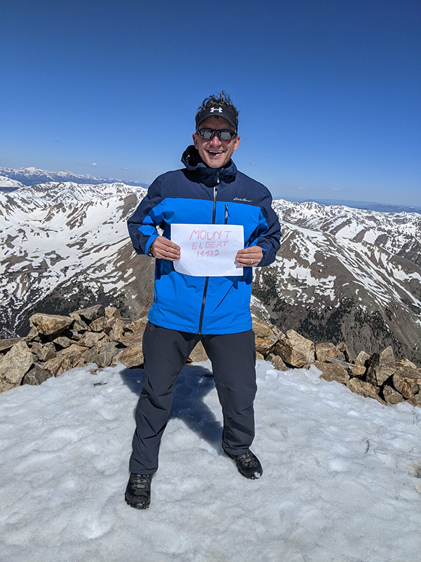
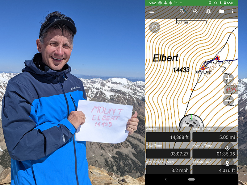
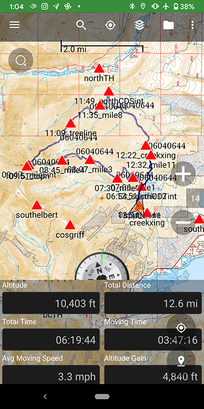
Woo hoo, got Elbert too!! Gorgeous day here in Leadville to touch the top of Colorado (also the 2nd tallest peak in the lower 48).  Went up one way, came down another to make it a loop back to the car.  Blue skies, not much wind, no issues with snow.  Turned out to be a 12.6 mile day with 4,800′ of vert.

elbert summit shot

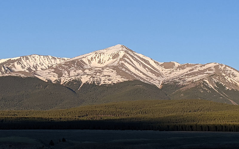
The morning was already shaping up to be awesome as I made my way to Mt. Elbert — stop #3 in this Summer Series of State Highpoints.  Today’s summit challenge was in clear view along Highway 24.

view from road

Southeast Ridge Route Up

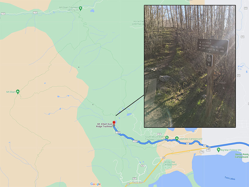
Just like I’d done on Wheeler, I wanted to experience as much of this mountain as possible and thought another big loop would be fun.  The South Elbert Trailhead seemed like the best place to start, especially since I’d been curious about that side of Elbert since last summer.

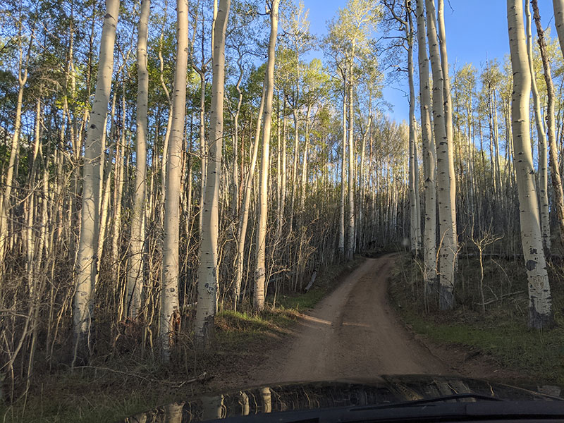
When I reached the lower parking area, conditions looked dry enough to continue the extra mile and a half up 125B — a dirt road that leads to additional parking a little higher on the mountain.

125B dirt road

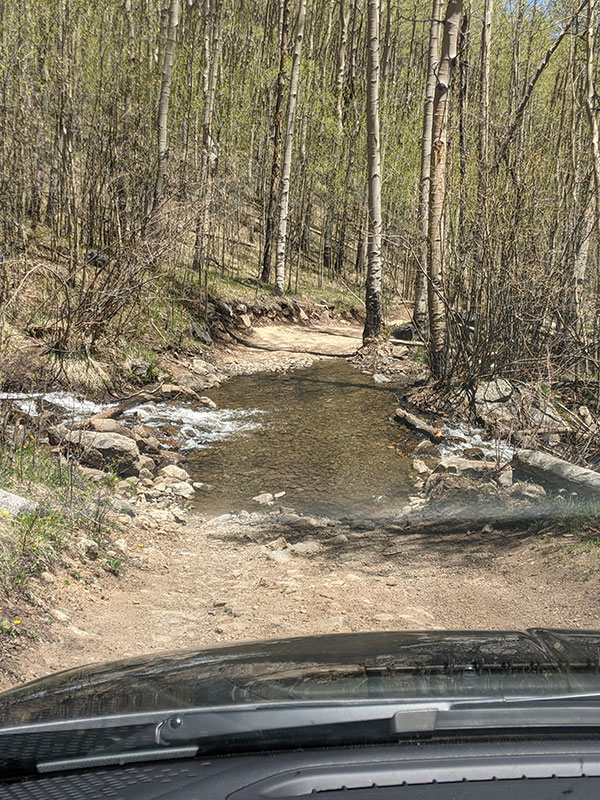
I knew there was a creek crossing on this road and was willing to give it a go in my rented Dodge Journey — despite the memory of Kansas still fresh on my mind.  I completely spaced on taking a picture going in, but here’s what it looked like later that afternoon as I drove out.  It was really no big deal.

creek crossing over 125B

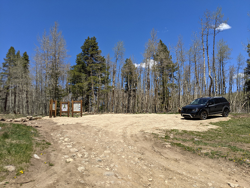
My goal was to be on the trail by 7am.  It was 6:45 when I took this pic at the upper trailhead sign, without another car in sight.

upper trailhead

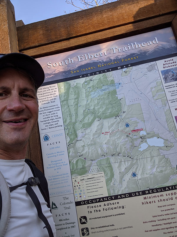
Keep in mind, Google Maps calls this the East Ridge Trailhead and so does 14ers.com… but the official sign here reads South Elbert.  They ought to fix that since this route clearly comes in from the East!

google map overview

The lower part of trail #1481 was clear of snow and dry on this first weekend in June.

elbert trail 1481

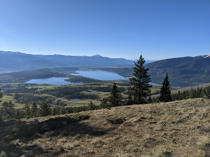
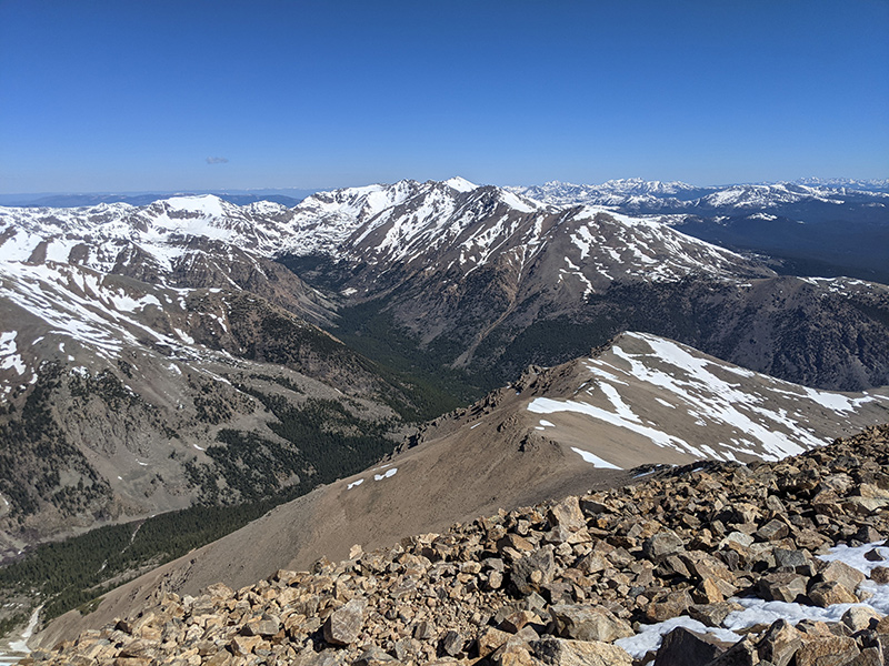
About two miles in, as I climbed above treeline, the view of Twin Lakes behind me was just incredible.

twin lakes view

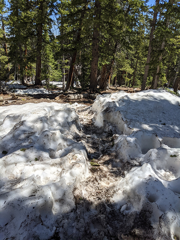
Soon after, the trail turned to snow, confirming what worried me about trying this 14er so early.

snow covered trail

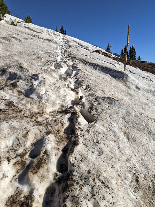
It wasn’t as bad as I’d thought, so I continued on, following tracks that unexpectedly looked fresh.

fresh tracks

Sure enough, someone else was heading up from this side as well — a younger guy I ended up passing.

another hiker

Mt. Elbert Summit

I was moving along quite nicely and soon reached the junction where this Southeast Ridge route meets the Northeast route — the summit now only yards away.

southeast route meets northeast

By 10am, three hours into my hike, I’d already covered five miles and gained 4,000 feet of elevation.

summit stats

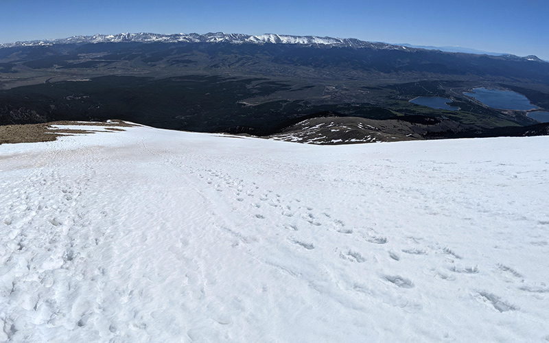
I talked to a few people that had just come up the Northeast Ridge route and snapped a few pics — this one of Mount Massive to the north, another 14er on my list.

view of mt massive

Northeast Ridge Route Down

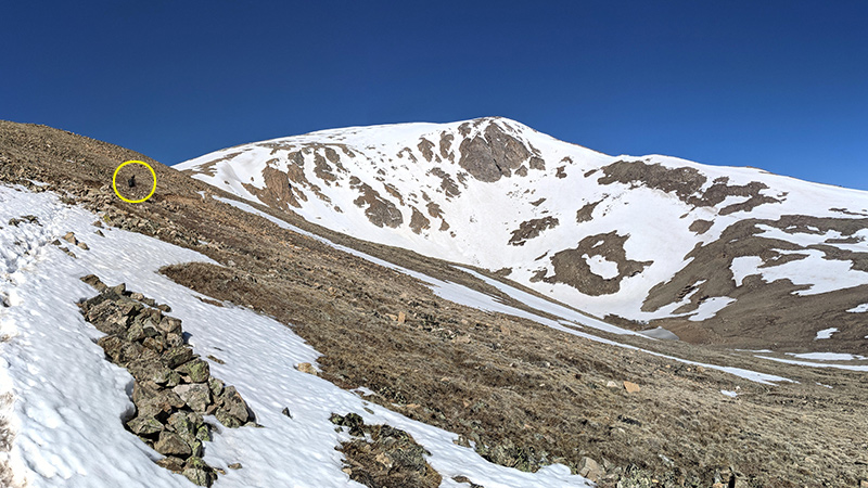
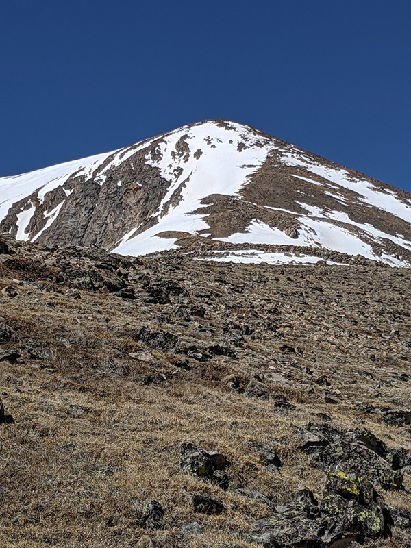
My loop hike continued down along the Northeast Ridge.

northeast ridge down

Here’s looking back at this route from about 12,500 feet.

northeast ridge from 12,000 ft

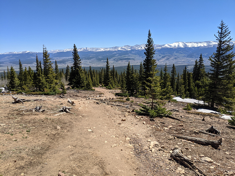
Trail conditions continued clear and dry to the tree line.

clear and dry trail condition

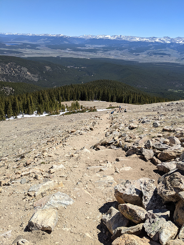
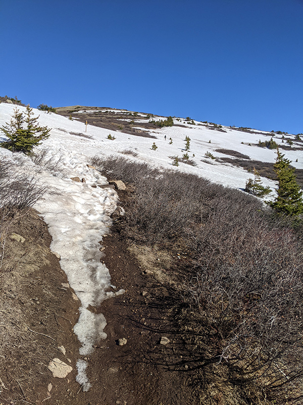
Then it got interesting again with snow drifts through the forest…

snow drifts through the forest

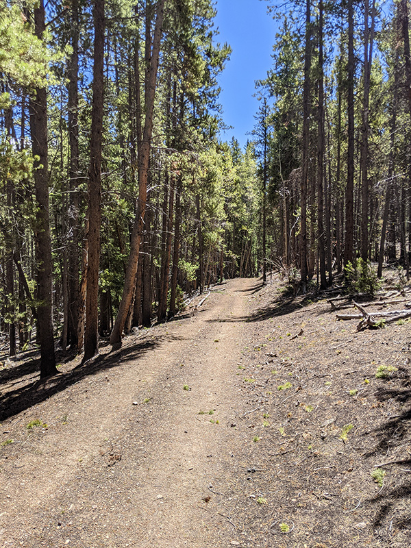
…before turning to bone-dry dirt again.

trail bone dry

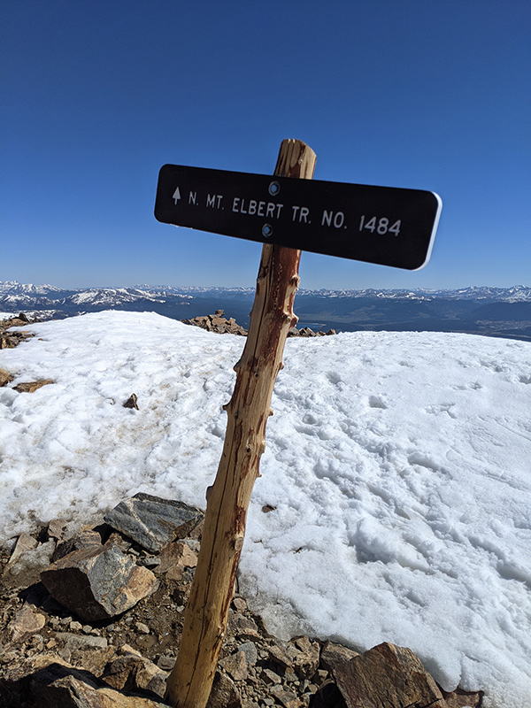
3.5 miles down from the summit, I made it to the intersection of North Mount Elbert Trail #1484 and the Colorado Trail #1776.

north cdt intersection

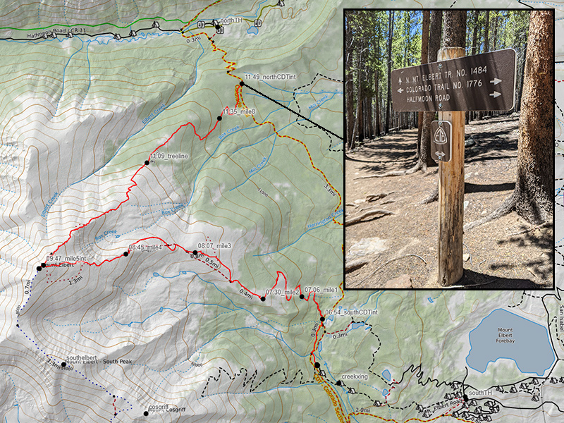
Continental Divide Trail Across

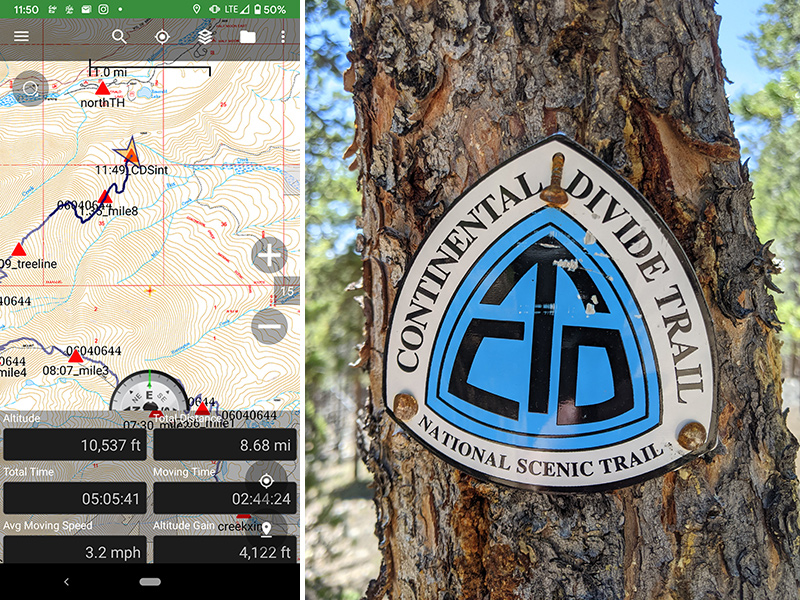
This last stretch back to the car followed the Continental Divide Trail for the next four miles.

last stretch along cdt

More dry trail to finish off this super fun day.

cdt back to car

Still no other cars where I had parked only six hours ago.

upper parking area

Final stats for the day: 12.6 miles in a little over 6 hours with 4,800′ of elevation.

After returning to Leadville, my wife and I enjoyed a late lunch and then took some time to explore this charming little mountain town its the surrounding area.

← I tagged Wheeeeeeeler, New Mexico’s tallest peak!
From One Extreme to the Other in the Lower 48 →

Leave a Reply Cancel reply

Your email address will not be published. Required fields are marked *

On this day last year—February 18—my team and I reached the summit of Aconcagua, the tallest peak in Argentina and the highest mountain in the Western Hemisphere at 22,837 feet.

I’ve enjoyed looking back on that expedition by rereading my day-by-day trip report from our climb.

👉 Link in bio: an 18-part guide covering the entire climb, plus pre-trip planning tips and post-expedition things to see and do around Mendoza.

Whether this is your first high-altitude objective or you’re adding Aconcagua to your mountaineering résumé, the guide will help you see why I chose the 360° Traverse, how to plan for your expedition, and what to expect each day on the mountain.

#aconcagua #aconcagua360 #aconcaguaexpedition #highaltitudemountaineering #mountaineering

33 3
Open post by backcountryfever with ID 18055701743428917
On this day last year—February 18—my team and I reached the summit of Aconcagua, the tallest peak in Argentina and the highest mountain in the Western Hemisphere at 22,837 feet.

I’ve enjoyed looking back on that expedition by rereading my day-by-day trip report from our climb.

👉 Link in bio: an 18-part guide covering the entire climb, plus pre-trip planning tips and post-expedition things to see and do around Mendoza.

Whether this is your first high-altitude objective or you’re adding Aconcagua to your mountaineering résumé, the guide will help you see why I chose the 360° Traverse, how to plan for your expedition, and what to expect each day on the mountain.

#aconcagua #aconcagua360 #aconcaguaexpedition #highaltitudemountaineering #mountaineering

Winter is my favorite season, and cold weather camping is one of my favorite winter activities.

#coldweathercamping #wintercamping #tenting #lovewinter #lovecamping

19 0
Open post by backcountryfever with ID 18088708565160118
Winter is my favorite season, and cold weather camping is one of my favorite winter activities.

#coldweathercamping #wintercamping #tenting #lovewinter #lovecamping

Scoping out snow levels for my annual winter campout this weekend. Yep, there`s enough to still make it fun!

#wintercamping #coldweathercamping #winterhike #sunset #weekendwarrior

19 2
Open post by backcountryfever with ID 18093303244798082
Scoping out snow levels for my annual winter campout this weekend.  Yep, there's enough to still make it fun!

#wintercamping #coldweathercamping #winterhike #sunset #weekendwarrior

Speaking of my multi-millioner friends (see link in the bio), I got to hike with them last weekend.

I had my mind set on doing a Grandeur Peak Yo-Yo for my first hike of the year. Thankfully, @gwhatco and @andeethatch were OK with slowing down for the day.

Not sure what I was thinking though, my thighs were so sore for the next two days. Hockey sure doesn`t use those same muscles like I thought it did.

Recovery definitely called for a few infrared sauna sessions afterwards!

#grandeurpeak #yoyo #doublesummit #legday #goatworthy

35 0
Open post by backcountryfever with ID 18093050872988089
Speaking of my multi-millioner friends (see link in the bio), I got to hike with them last weekend.

I had my mind set on doing a Grandeur Peak Yo-Yo for my first hike of the year. Thankfully, @gwhatco and @andeethatch were OK with slowing down for the day.

Not sure what I was thinking though, my thighs were so sore for the next two days. Hockey sure doesn't use those same muscles like I thought it did. 

Recovery definitely called for a few infrared sauna sessions afterwards!

#grandeurpeak #yoyo #doublesummit #legday #goatworthy

Yeah, you read that right — 5,000,000 vertical feet. That’s a million feet of vert every year for five straight years. Who does that? Well… these two average hikers from Utah have been stacking numbers like this since 2021 — quietly, but well beyond “average”.

The numbers speak for themselves. Get a summary and breakdown by month from the link in the bio ☝️

Think about that: we’re talking about an average of 50 miles and 20,000 feet of gain every single week.

It’s hard to wrap my head around that level of commitment. What they’re doing every month is roughly what I log in a year, all while holding down full-time jobs. That’s one serious fitness program.

In talking with Andee about what comes next, they took the week off after Christmas, then jumped right into the new year on a local favorite—Mount Olympus—with plans to log another million in 2026.

#goatworthy #biggoals #millionverticalfeet #hikerlife #hikemoreworryless

24 5
Open post by backcountryfever with ID 17966367422867268
Yeah, you read that right — 5,000,000 vertical feet.  That’s a million feet of vert every year for five straight years.  Who does that?  Well… these two average hikers from Utah have been stacking numbers like this since 2021 — quietly, but well beyond “average”. 

The numbers speak for themselves.  Get a summary and breakdown by month from the link in the bio ☝️

Think about that: we’re talking about an average of 50 miles and 20,000 feet of gain every single week.

It’s hard to wrap my head around that level of commitment.  What they’re doing every month is roughly what I log in a year, all while holding down full-time jobs.  That’s one serious fitness program.

In talking with Andee about what comes next, they took the week off after Christmas, then jumped right into the new year on a local favorite—Mount Olympus—with plans to log another million in 2026.

#goatworthy #biggoals #millionverticalfeet #hikerlife #hikemoreworryless

With the encouragement from my youngest daughter, I bought a small fleet of kid carriers to get these youngsters started early! We`ve enjoyed a few days out in this unseasonably warm November, but still need to get them ALL out together. Fun times ahead for sure!!

#osprey #ospreypacks #hikingwithkids #familyfun #getemstartedearly

20 1
Open post by backcountryfever with ID 18064990223634047
With the encouragement from my youngest daughter, I bought a small fleet of kid carriers to get these youngsters started early!  We've enjoyed a few days out in this unseasonably warm November, but still need to get them ALL out together.  Fun times ahead for sure!!

#osprey #ospreypacks #hikingwithkids #familyfun #getemstartedearly

My first time up Mt. Ogden unintentionally turned into a full-on-loop-de-doo: up Beus, down Malan`s.

Beus Canyon was pretty boring above treeline, so I decided not to head back the way I came. After tagging the summit, I figured Malan`s would be way more interesting — and it sure was!

Malan`s Basin is surprisingly sketch up high, through a steep and narrow gully, then hard to follow in the middle where an already faint trail disappeared under leaves. I lost the trail a few times and had to backtrack a bit to find my way.

Finally, the Bonneville Shoreline Trail came in clutch once again, making this a nice long loop-de-doo.

Mt. Ogden Loop-de-doo mileage breakdown 👇
- Beus Canyon trailhead to summit, 6 miles
- Mt. Ogden to Malan`s Peak, 3 miles
- Malan`s Peak to Bonneville Shoreline Trail, 3 miles
- BST across and back to Beus trailhead, 3 miles

For a total of 15 miles and 5,300 feet of elevation gain.

#mtogden #mountogden #ogdenpeak #beuscanyon #beuscanyontrail #malansbasin #malanspeak #bonnevilleshorelinetrail #bonnevilleshoreline #bst #loophike #loopdedoo #wasatchfront #hikeogden #fallhike #fallhikingfallhiking

24 0
Open post by backcountryfever with ID 17906240730272550
My first time up Mt. Ogden unintentionally turned into a full-on-loop-de-doo: up Beus, down Malan's. 

Beus Canyon was pretty boring above treeline, so I decided not to head back the way I came. After tagging the summit, I figured Malan's would be way more interesting — and it sure was!

Malan's Basin is surprisingly sketch up high, through a steep and narrow gully, then hard to follow in the middle where an already faint trail disappeared under leaves.  I lost the trail a few times and had to backtrack a bit to find my way.

Finally, the Bonneville Shoreline Trail came in clutch once again, making this a nice long loop-de-doo.

Mt. Ogden Loop-de-doo mileage breakdown 👇
- Beus Canyon trailhead to summit, 6 miles
- Mt. Ogden to Malan's Peak, 3 miles
- Malan's Peak to Bonneville Shoreline Trail, 3 miles
- BST across and back to Beus trailhead, 3 miles

For a total of 15 miles and 5,300 feet of elevation gain.

#mtogden #mountogden #ogdenpeak #beuscanyon #beuscanyontrail #malansbasin #malanspeak #bonnevilleshorelinetrail #bonnevilleshoreline #bst #loophike #loopdedoo #wasatchfront #hikeogden #fallhike #fallhikingfallhiking

Awesome views from the top of Y Mountain. Looking north into Rock Canyon, where I started, and across towards the old Squaw Peak, Cascade Mountain, and Mount Timpanogos further off in the distance.

Pretty fun loop hike 👇

- Up 1.8 miles from the Rock Canyon trailhead
- Up 1.8 miles on First Right Fork to Slide Canyon
- Down Slide Canyon Trail .5 miles to Y Mountain Trail
- Up 1 mile to Y Mountain West Peak
- Down .25 and over .25 miles to Y Mountain East Peak
- Down 1 mile back to Slide Canyon Trail
- Down 1.5 miles to Y Trail (top of the BYU Y)
- Down 1 mile to the Y Trail trailhead
- Across 1.75 miles on the Bonneville Shoreline Trail

For a total of 10.75 miles with 4,137 feet of elevation gain.

#ymountain #rockcanyon #rockcanyontrail #firstrightfork #slidecanyon #ytrail #ytrailhead #bst #bonnevilleshorelinetrail #bonnevilleshoreline #connector #loophike #wasatchfront #hikethewasatch #wasatchmountains #wasatch #hike #hikemore

32 1
Open post by backcountryfever with ID 17900152413305912
Awesome views from the top of Y Mountain.  Looking north into Rock Canyon, where I started, and across towards the old Squaw Peak, Cascade Mountain, and Mount Timpanogos further off in the distance. 

Pretty fun loop hike 👇

- Up 1.8 miles from the Rock Canyon trailhead
- Up 1.8 miles on First Right Fork to Slide Canyon
- Down Slide Canyon Trail .5 miles to Y Mountain Trail
- Up 1 mile to Y Mountain West Peak 
- Down .25 and over .25 miles to Y Mountain East Peak
- Down 1 mile back to Slide Canyon Trail
- Down 1.5 miles to Y Trail (top of the BYU Y)
- Down 1 mile to the Y Trail trailhead
- Across 1.75 miles on the Bonneville Shoreline Trail

For a total of 10.75 miles with 4,137 feet of elevation gain.

#ymountain #rockcanyon #rockcanyontrail #firstrightfork #slidecanyon #ytrail #ytrailhead #bst #bonnevilleshorelinetrail #bonnevilleshoreline #connector #loophike #wasatchfront #hikethewasatch #wasatchmountains #wasatch #hike #hikemore

As the seasons change, each quiet mile through these trees feels like an invitation to let go of what was and move toward all that`s yet to come...

#seasonschange #lettinggo #movingon #pressingforward #lookingahead #newbeginnings #natureishealing #healingenergy #goodvibes #autumnvibes #autumnmountains #hiking #hikerlife #mountainlife #mountains

27 0
Open post by backcountryfever with ID 17902202193279047
As the seasons change, each quiet mile through these trees feels like an invitation to let go of what was and move toward all that's yet to come...

#seasonschange #lettinggo #movingon #pressingforward #lookingahead #newbeginnings #natureishealing #healingenergy #goodvibes #autumnvibes #autumnmountains #hiking #hikerlife #mountainlife #mountains
Follow on Instagram

Recent Posts

  • 5 Million Vertical Feet Gained Over 5 Years
  • 2025 Year in Review
  • From Waikīkī to Makapuʻu: A Casual Tour of Honolulu Stops
  • High Hopes for Hiking Hawaii — Hobbled by Hockey
  • It’s Mountaineering Season in Utah!

Recent Comments

  • Backcountry Fever on Solo Summit of Shasta
  • Michelle Tirhi on Solo Summit of Shasta
  • Matt on How I Would Do Kings Peak in 1 Day
  • Rich Meziere on Bummed Out By A Broken BOA Binding
  • Backcountry Fever on Bummed Out By A Broken BOA Binding

RECOMMENDED READING

Categories

  • 14ers
  • Adventure Plans
  • Avalanche Awareness
  • Backpacking
  • Epic Treks
  • Grand Canyon
  • Health & Wellness
  • International Expeditions
  • Mountaineering
  • Pacific Northwest
  • Peak Bagging
  • Product Feedback
  • Reading References
  • Road Trip
  • Scrambling
  • Season Summary
  • Seven Summits
  • Six-Pack Challenge
  • Snowshoeing
  • Social Media
  • State Highpoints
  • Technology
  • Uinta Mountains
  • Uncategorized
  • Uphill Training
  • Wasatch Front
  • Zion
©2026 Backcountry Fever